|
Zavadka, Skole Raion
Zavadka ( uk, Зава́дка, pl, Zawadka) is a small village ( selo) in Stryi Raion, Lviv Oblast, of Western Ukraine. It belongs to Kozova rural hromada, one of the hromadas of Ukraine. The population of village is just about 648 persons and local government is administered by Zavadkivska village council. Geography The village is located in the mountains, that is far from the central road. It is in the Ukrainian Carpathians within the limits of the Eastern Beskids on the northern slopes of the ridge Dovzhky. The village is small and has an area of 2,46 km2. It is situated at an altitude of above sea level. Distance from the regional center Lviv is , from the district center Skole, and from the village Oriava. History and attractions The village was founded in 1538 and was known as Ilnychok. Until 18 July 2020, Zavadka belonged to Skole Raion Skole Raion ( uk, Сколівський район) was a raion in Lviv Oblast in western Ukraine. Its administrative ... [...More Info...] [...Related Items...] OR: [Wikipedia] [Google] [Baidu] |
Village
A village is a clustered human settlement or community, larger than a hamlet but smaller than a town (although the word is often used to describe both hamlets and smaller towns), with a population typically ranging from a few hundred to a few thousand. Though villages are often located in rural areas, the term urban village is also applied to certain urban neighborhoods. Villages are normally permanent, with fixed dwellings; however, transient villages can occur. Further, the dwellings of a village are fairly close to one another, not scattered broadly over the landscape, as a dispersed settlement. In the past, villages were a usual form of community for societies that practice subsistence agriculture, and also for some non-agricultural societies. In Great Britain, a hamlet earned the right to be called a village when it built a church. [...More Info...] [...Related Items...] OR: [Wikipedia] [Google] [Baidu] |
Hromada
A hromada ( uk, територіальна громада, lit=territorial community, translit=terytorialna hromada) is a basic unit of administrative division in Ukraine, similar to a municipality. It was established by the Government of Ukraine on 12 June 2020. Similar terms exist in Poland (''gromada'') and in Belarus (''hramada''). The literal translation of this term is "community", similarly to the terms used in western European states, such as Germany ('' Gemeinde''), France (''commune'') and Italy (''comune''). History In history of Ukraine and Belarus, hromadas appeared first as village communities, which gathered their meetings for discussing and resolving current issues. In the 19th century, there were a number of political organizations of the same name, particularly in Belarus. Prior to 2020, the basic units of administrative division in Ukraine were rural councils, settlement councils and city councils, which were often referred to by the generic term ''hromada ... [...More Info...] [...Related Items...] OR: [Wikipedia] [Google] [Baidu] |
Skole Raion
Skole Raion ( uk, Сколівський район) was a raion in Lviv Oblast in western Ukraine. Its administrative center was Skole. The raion was abolished on 18 July 2020 as part of the administrative reform of Ukraine, which reduced the number of raions of Lviv Oblast to seven. The area of Skole Raion was merged into Stryi Raion. The last estimate of the raion population was . It was established in 1940. At the time of disestablishment, the raion consisted of three hromadas: * Kozova rural hromada with the administration in the selo of Kozova; * Skole urban hromada with the administration in Skole; * Slavske settlement hromada with the administration in the urban-type settlement of Slavske. People from Skole Raion * Petro Jacyk, born in Verkhnie Synovydne Verkhnie Synovydne ( uk, Ве́рхнє Синьови́дне, former name, to 1946 uk, Синьовидсько Вижнє, translit=Synovydsko Vyzhnie, label=none, pl, Synowódzko Wyżne) is an urban-type s ... [...More Info...] [...Related Items...] OR: [Wikipedia] [Google] [Baidu] |
Oriava
Oriava ( uk, Оря́ва, pl, Orawa) is a village (''selo'') in Stryi Raion, Lviv Oblast, of Western Ukraine. Village Oriava is located in the Ukrainian Carpathians, within the limits of the Eastern Beskids ( Skole Beskids ) in southern Lviv Oblast. It belongs to Kozova rural hromada, one of the hromadas of Ukraine. The village is located along the river with the same name Oriava. It is from the city of Lviv, from Stryi, and from Skole. Local government– Oriavska village council. The first mention of Oriava dates from 1574. Until 18 July 2020, Oriava belonged to Skole Raion Skole Raion ( uk, Сколівський район) was a raion in Lviv Oblast in western Ukraine. Its administrative center was Skole. The raion was abolished on 18 July 2020 as part of the administrative reform of Ukraine, which reduced the nu .... The raion was abolished in July 2020 as part of the administrative reform of Ukraine, which reduced the number of raions of Lviv Oblast to seven. ... [...More Info...] [...Related Items...] OR: [Wikipedia] [Google] [Baidu] |
Skole
Skole ( uk, Ско́ле) is a town in Stryi Raion, Lviv Oblast (region) of Ukraine. It hosts the administration of Skole urban hromada, one of the hromadas of Ukraine. Population: . History The first official date recorded for Skole was in 1397. A very important route from Kyiv to Hungary ran through Skole; as a result, it was frequently fought over by other nations. When the Skole region was under Polish rule, the Polish king parceled out the land among the Polish nobility. German colonists, particularly craftspeople, who settled in the Skole region promoted the development of its economy. A great influence on the economy and cultural development of the region was Baron Groedl and his family. In Skole, the coins of Baron Groedl were used. They were minted at Vien, a mint which continued to be in use until 1930. Skole received its Magdeburg rights in 1397, by a decree of King Wladyslaw Jagiello. Until 1772, the town belonged to the Lviv Land, Ruthenian Voivodeship of t ... [...More Info...] [...Related Items...] OR: [Wikipedia] [Google] [Baidu] |
Lviv
Lviv ( uk, Львів) is the largest city in western Ukraine, and the seventh-largest in Ukraine, with a population of . It serves as the administrative centre of Lviv Oblast and Lviv Raion, and is one of the main cultural centres of Ukraine. It was named in honour of Leo, the eldest son of Daniel, King of Ruthenia. Lviv emerged as the centre of the historical regions of Red Ruthenia and Galicia in the 14th century, superseding Halych, Chełm, Belz and Przemyśl. It was the capital of the Kingdom of Galicia–Volhynia from 1272 to 1349, when it was conquered by King Casimir III the Great of Poland. From 1434, it was the regional capital of the Ruthenian Voivodeship in the Kingdom of Poland. In 1772, after the First Partition of Poland, the city became the capital of the Habsburg Kingdom of Galicia and Lodomeria. In 1918, for a short time, it was the capital of the West Ukrainian People's Republic. Between the wars, the city was the centre of the Lwów Voivodeship in th ... [...More Info...] [...Related Items...] OR: [Wikipedia] [Google] [Baidu] |
Eastern Beskids Of The Outer Eastern Carpathians
The Eastern Beskids or Eastern Beskyds ( uk, Східні Бескиди; pl, Beskidy Wschodnie; rue, Выходны Бескиды; ro, Beskizii Orientali; russian: Восточные Бескиды) are a geological group of mountain ranges of the Beskids, within the Outer Eastern Carpathians. As a continuation of the Central Beskids, this mountain range includes the far southeastern corner of Poland, the far eastern corner of Slovakia, and stretches southward through western parts of Ukraine, up to the border of Romania. In Polish and Ukrainian terminology, the range is commonly called the "Eastern Beskids" ( uk, Східні Бескиди; pl, Beskidy Wschodnie), while in Slovakia, the term ''Meadowed Mountains'' ( sk, Poloniny) is also used. The scope of those terms varies in accordance to different traditions and classifications. At the three-way border, portions of the Slovak Bukovec Mountains ( sk, Bukovské vrchy), the Polish Bieszczady Mountains ( pl, Bieszczady Za ... [...More Info...] [...Related Items...] OR: [Wikipedia] [Google] [Baidu] |
Ukrainian Carpathians
The Ukrainian Carpathians ( uk, Українські Карпати) are a section of the Eastern Carpathians, within the borders of modern Ukraine. They are located in the southwestern corner of Western Ukraine, within administrative territories of four Ukrainian regions (oblasts), covering northeastern part of Zakarpattia Oblast, southwestern part of Lviv Oblast, southern half of Ivano-Frankivsk Oblast and western half of Chernivtsi Oblast. They are stretching in general northwest–southeast direction, starting at the tripartite border point of Ukraine with Poland and Slovakia, and continuing towards Ukrainian border with Romania. In terms of geological classification, Ukrainian Carpathians belong to two distinctive categories, with major part belonging to the Outer Eastern Carpathians and minor part to the Inner Eastern Carpathians. Within different regional and national traditions, there are several overlapping variants of divisions and designations for various E ... [...More Info...] [...Related Items...] OR: [Wikipedia] [Google] [Baidu] |
Kozova Rural Hromada
Kozova (Ukrainian: Козова; Polish: ''Kozowa''; Russian: Козо́ва) is an urban-type settlement in Ternopil Raion, Ternopil Oblast (province) of western Ukraine, in the area historically known as Galicia, east of Berezhany, some west of Ternopil and c. southeast of Lviv. It hosts the administration of Kozova settlement hromada, one of the hromadas of Ukraine. The settlement is situated beside a lake on the Koropets River (“little carp”). There is presumption that the name Kozova comes from the Ukrainian word ''koza'' (goat), though other possible sources exist. Population: History From 1350 to 1772 and again from 1919 to 1939, it was part of Poland. The first partition of Poland in 1772 attributed Galicia to the Habsburg monarchy. See more details in the article Kingdom of Galicia and Lodomeria. The Polish name ''Kozowa'' was used until 1939. During the Kerensky Offensive the Armoured Car Expeditionary Force of the British Royal Navy Air Service establ ... [...More Info...] [...Related Items...] OR: [Wikipedia] [Google] [Baidu] |
Oblasts Of Ukraine
An oblast ( uk, о́бласть; ) in Ukraine, often called a region or province, is the main type of first-level administrative division of the country. Ukraine's territory is divided into 24 oblasts, as well as one autonomous republic, Crimea, and two cities with special status, Kyiv and Sevastopol. Ukraine is a unitary state, thus the oblasts do not have much legal scope of competence other than that which is established in the Ukrainian Constitution and by law. Articles 140–146 of Chapter XI of the constitution deal directly with local authorities and their competency. Oblasts are subdivided into raions (districts), each oblast having from 3 to 10 raions following the July 2020 reform. General characteristics In Ukraine, the term ''oblast'' denotes a primary administrative division. Under the Russian Empire and into the 1920s, Ukraine was divided between several governorates. The term ''oblast'' was introduced in 1932 by Soviet authorities when the Ukrainian SSR was ... [...More Info...] [...Related Items...] OR: [Wikipedia] [Google] [Baidu] |
Western Ukraine
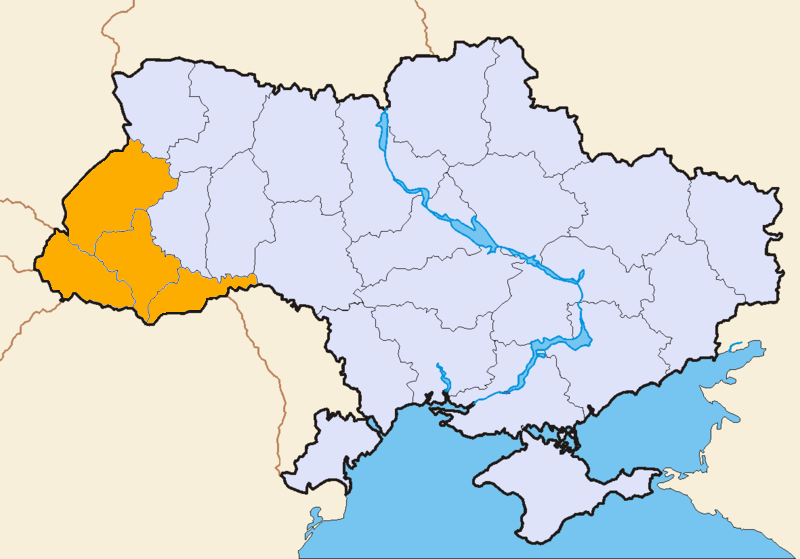
Western Ukraine or West Ukraine ( uk, Західна Україна, Zakhidna Ukraina or , ) is the territory of Ukraine linked to the former Kingdom of Galicia–Volhynia, which was part of the Polish–Lithuanian Commonwealth, the Austrian Empire, Austria-Hungary and the Second Polish Republic, and came fully under the control of the Soviet Union (via the Ukrainian Soviet Socialist Republic) only in 1939, following the Molotov–Ribbentrop Pact. There is no universally accepted definition of the territory's boundaries (see the map, right), but the contemporary Ukrainian administrative regions or Oblasts of Chernivtsi, Ivano-Frankovsk, Lviv, Ternopil and Transcarpathia (which were part of the former Austro-Hungarian Empire) are nearly always included and the Lutsk and Rivne Oblasts (parts of the annexed from Poland during its Third Partition) are usually included. It is less common to include the Khmelnytski and, especially, the Vinnytsia and Zhytomyr Oblasts in this c ... [...More Info...] [...Related Items...] OR: [Wikipedia] [Google] [Baidu] |


