|
Ziarat
Ziarat (Urdu and ps, ) is a city in the Ziarat District situated in the Balochistan. It is from the capital city of Eastern Balochistan Quetta. It was established as a district on 1st July 1986, before then it was part of Sibi district. The Quaid-e-Azam Residency is in the valley, where Quaid-e-Azam (the founder of Pakistan) spent a few of his most memorable days. History On 29 October 2008, at around 4 am, Ziarat and surrounding areas were struck by an earthquake doublet. The first tremor, 6.2 magnitude, lasted a couple of seconds, and was followed by a magnitude-6.4 tremor that lasted almost 30 seconds, destroying many mud houses and several government buildings. Neighbouring villages were also badly affected by the earthquake. More than 200 people were killed, and over 50,000 were left homeless. Landslides cut off many roads, making the area less accessible to emergency responders. Pakistani military helicopters were used to reach mountainous and remote locations. Geog ... [...More Info...] [...Related Items...] OR: [Wikipedia] [Google] [Baidu] |
Ziarat District
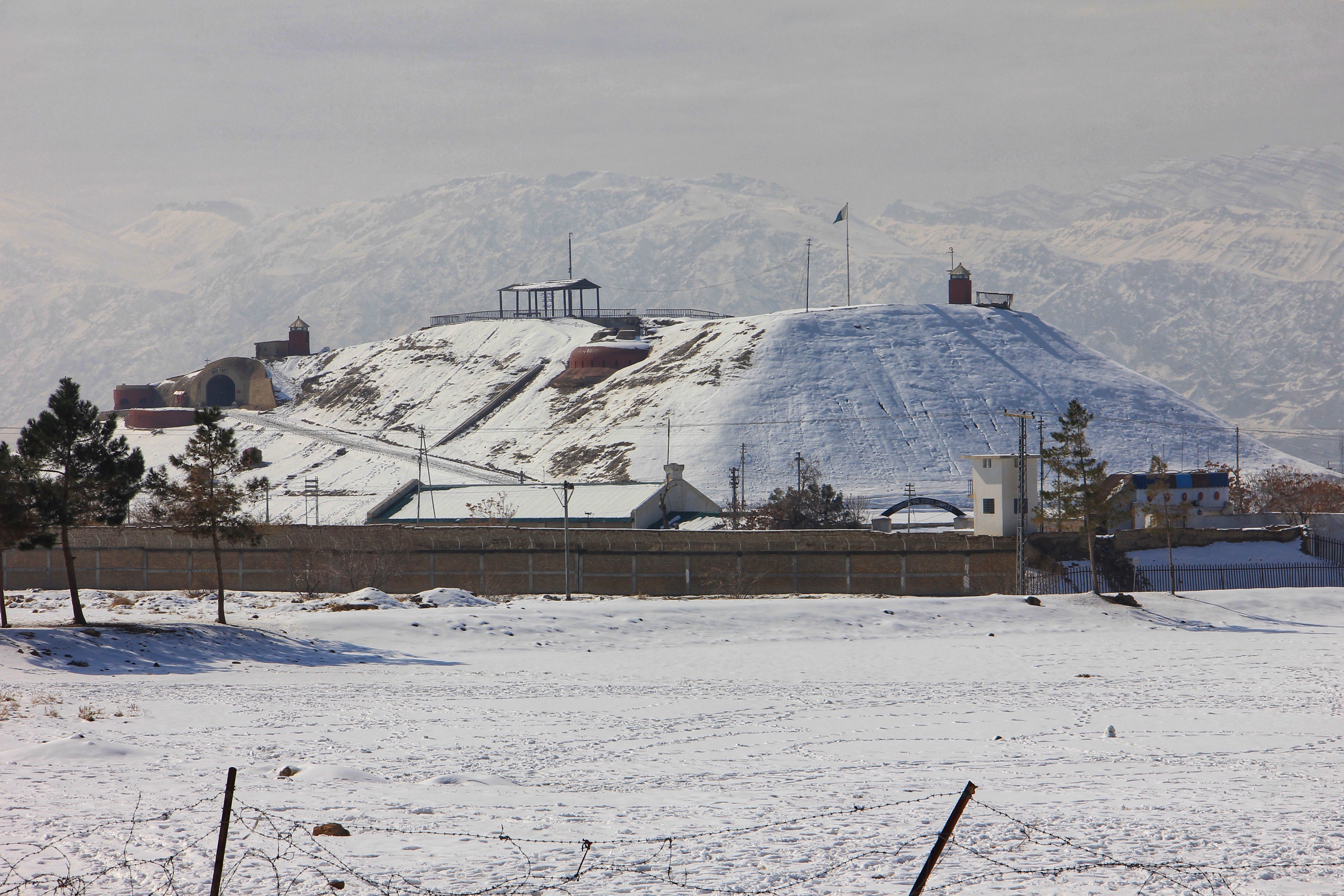
Ziarat ( ur, ) is a district in the north of Balochistan province of Pakistan. Ziarat town (situated at an altitude of about 2,400 meters) is headquarters of the district of the Sub division, and also of the tehsil. Khalifat Hills have the highest peak with an altitude of in Ziarat district. Administration Ziarat District was established in July 1986, previously being part of Sibi District. The district, with a population of 52855, is subdivided into two tehsils ''Ziarat'' and ''Sanjawi'' the latter is the most densely populated having a population of 32,456, while Ziarat Tehsil has a population of 18,000. The district contain a total of ten Union Councils. Demography At the time of the 2017 census the district had a population of 160,095, of which 82,161 were males and 77,912 females. Rural population was 156,703 (97.88%) while the urban population was 3,392 (2.12%). The literacy rate was 45.36% - the male literacy rate was 58.84% while the female literacy rate was 31.43%. 417 ... [...More Info...] [...Related Items...] OR: [Wikipedia] [Google] [Baidu] |
Ziarat Juniper Forest
The Ziarat Juniper Forest is a juniper forest in Ziarat, Balochistan, Pakistan. Geography These forests are spread around mountainous area of Ziarat and Mount Zarghoon. The mountains range from 1,181 to 3,488 meters elevation. The forests cover an area of about 110,000 hectares, and it is the largest juniper forest in Pakistan. The climate is temperate and semi-arid, with mild summers and cold winters. Average annual rainfall (measured in Ziarat) is 269 mm, with a maximum of 74 mm in July and a minimum of 3 mm in January. July is the hottest month (27.4 °C), and January the coldest (7.9 °C). Relative humidity ranges from 35% in January to 60% in September. Snow falls between November and April, with a maximum (68 cm) in February."Flora of Ziarat; Ethnobotanic and Medicinal Importance". IUCN. Accessed 9 December 2020/ref> Ecology The characteristic tree is the Pashtun juniper (''Juniperus seravschanica''). Juniper forest occurs between 2000 and 3, ... [...More Info...] [...Related Items...] OR: [Wikipedia] [Google] [Baidu] |
Quaid-e-Azam Residency
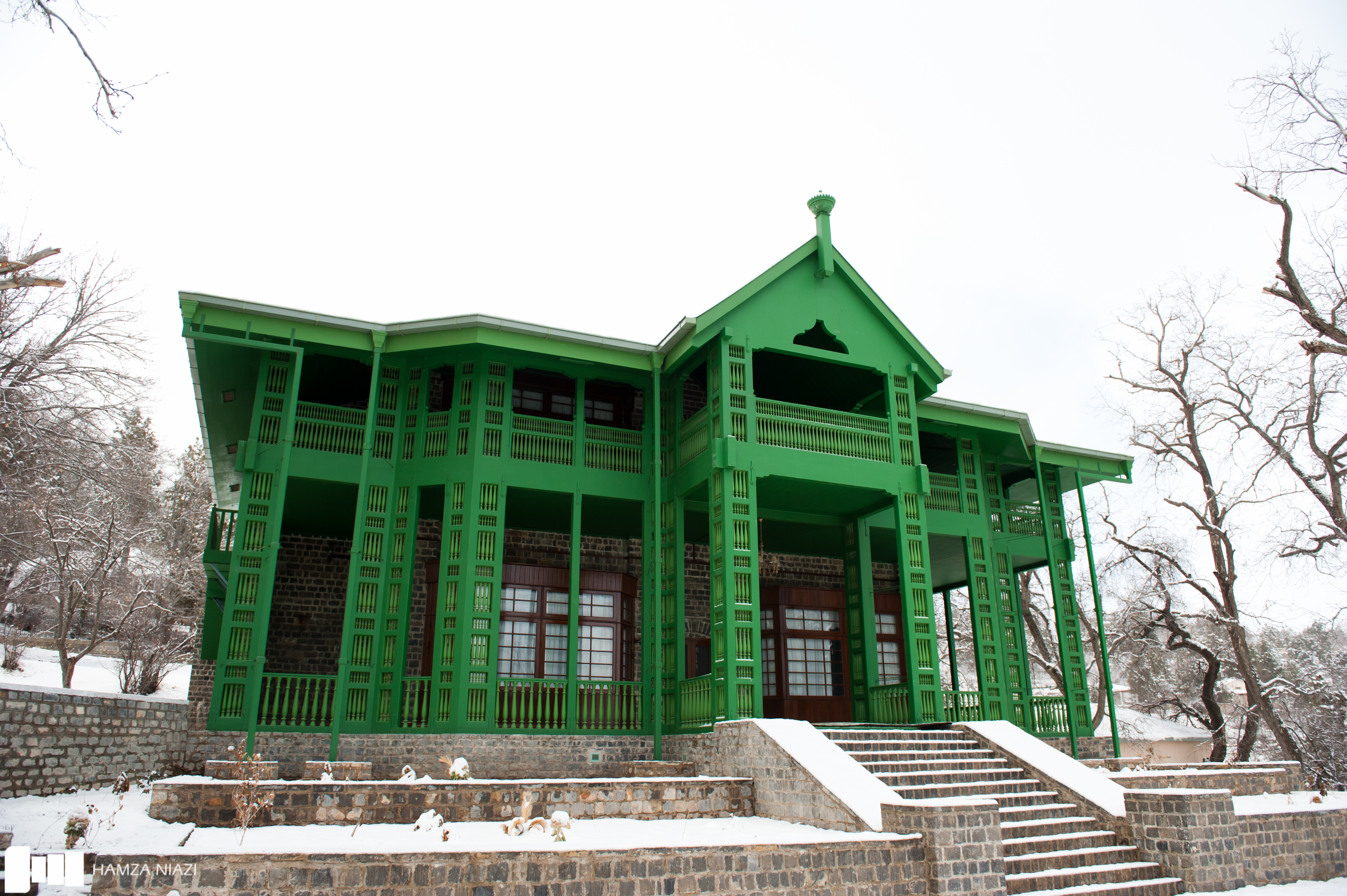
Quaid-e-Azam Residency ( ur, ), also known as Ziarat Residency, is located in Ziarat, Balochistan, Pakistan. It is where Muhammad Ali Jinnah spent the last two months and ten days of his life, nursed by A. S. Nathaniel. It is the most famous landmark of the city, constructed in 1892 during the British Raj. The building is a wooden structure, originally designed as a sanatorium before being converted into the summer residence of the agent of the Governor General. It is declared a heritage site and is of great architectural importance. 2013 terrorist attack On 15 June 2013, the Residency was targeted with rockets. The wooden parts of the building were badly affected as a result of the attack. Militants belonging to BLA claimed responsibility. It was badly damaged as a result of the intense attack. However, the government of Pakistan vowed to restore the site. The residency was also damaged during the 2008 earthquake. However, despite the wooden structure being badly damaged in ... [...More Info...] [...Related Items...] OR: [Wikipedia] [Google] [Baidu] |
2008 Ziarat Earthquake
The 2008 Ziarat earthquakes hit the Pakistani province of Balochistan on October 29 with a moment magnitude of 6.4. The US Geological Survey reported that the first earthquake occurred north of Quetta and southeast of the Afghanistan city of Kandahar at 04:09 local time (28 October, 23:09 UTC) at a depth of , at 30.653°N, 67.323°E. It was followed by another shallower magnitude 6.4 earthquake at a depth of approximately 12 hours after the initial shock, at 30.546°N, 67.447°E. 215 people were confirmed dead. More than 200 were injured (according to Mohammed Zaman, assistant to the Balochistan chief secretary, Nasir Khosa), and 120,000 were homeless (according to Dilawar Khan Kakar, Ziarat, Balochistan mayor and chief administrator). Qamar Zaman Chaudhry, director general of Pakistan Meteorological Department, stated the quake epicenter was north of Quetta, and about southwest of Islamabad. Tectonic summary Western and northern Pakistan lie across the complex plate boundary ... [...More Info...] [...Related Items...] OR: [Wikipedia] [Google] [Baidu] |
Balochistan (Pakistan)
Balochistan (; bal, بلۏچستان; ) is one of the four provinces of Pakistan. Located in the southwestern region of the country, Balochistan is the largest province of Pakistan by land area but is the least populated one. It shares land borders with the Pakistani provinces of Khyber Pakhtunkhwa and Punjab to the north-east and Sindh to the south-east. It shares International borders with Iran to the west and Afghanistan to the north; It is also bound by the Arabian Sea to the south. Balochistan is an extensive plateau of rough terrain divided into basins by ranges of sufficient heights and ruggedness. It has the world's largest deep sea port, The Port of Gwadar lying in the Arabian Sea. Balochistan shares borders with Punjab and the Khyber Pakhtunkhwa to the northeast, Sindh to the east and southeast, the Arabian Sea to the south, Iran ( Sistan and Baluchestan) to the west and Afghanistan (Helmand, Nimruz, Kandahar, Paktika and Zabul Provinces) to the north and northwe ... [...More Info...] [...Related Items...] OR: [Wikipedia] [Google] [Baidu] |
List Of Dialling Codes Of Pakistan
Fixed telephony The area codes in Pakistan consists of two to five digits; generally smaller the city, longer the prefix. All large cities have two-digit codes. The smaller towns might have six digital whereas big cities have seven digit numbers. Azad Kashmir telephone lines contain five digits. On 1 July 2009, telephone numbers in Karachi and Lahore were changed from seven digits to eight digits. This was accomplished by adding 9 to the beginning of all phone numbers that started with a 9 i.e. government and semi-government lines and adding 3 to all other lines. The following is the list of dialling codes for various cities and districts in Pakistan. See also *Telephone numbers in Pakistan References ITU allocations list External links PTCL - Official site {{DEFAULTSORT:List Of Dialing Codes Of Pakistan Pakistan Pakistan ( ur, ), officially the Islamic Republic of Pakistan ( ur, , label=none), is a country in South Asia. It is the world's List of countries and ... [...More Info...] [...Related Items...] OR: [Wikipedia] [Google] [Baidu] |
Juniperus Seravschanica
''Juniperus seravschanica'' is a species of juniper. Common names include Pashtun juniper ( ps, اوبښته ''ōbəx̌ta'', " specieswhich sucks water"; Pashto: پښتني صنوبر). It ranges from southernmost Kazakhstan through Kyrgyzstan, Tajikistan, eastern Uzbekistan and Turkmenistan, to northern and eastern Afghanistan, northern Pakistan, and Kashmir. Outlying populations are found in the mountains of southeastern Iran – near Kuhbanan, Rabor, and on Kuh-e Khabr in the Hazaran range – and the Al Hajar Mountains of Oman."Juniperus seravschanica". ''Plants of the World Online''. Accessed 5 December 2020/ref>Adams, R.P., Al-Farsi, A. & Schwarzbach, A.E. (2014). Confirmation of the southern-most population of Juniperus seravschanica in Oman by DNA sequencing of nrDNA and four cpDNA regions Phytologia 96: 218-224. ''Juniperus seravschanica'' is sometimes classified as a subspecies of '' Juniperus polycarpos, J. polycarpos'' or '' J. excelsa''. Distribution ''Juniperus ... [...More Info...] [...Related Items...] OR: [Wikipedia] [Google] [Baidu] |
Districts Of Pakistan
The Districts of Pakistan ( ur, ); are the third-order administrative divisions of Pakistan, below provinces and divisions, but forming the first-tier of local government. In total, there are 169 districts in Pakistan including the Capital Territory and the districts of Azad Kashmir and Gilgit Baltistan. These districts are further divided into ''Tehsils, Union Councils''. History In 1947, when Pakistan gained independence there were 124 districts. In 1969, 2 new districts (Tangail and Patuakhali) in East Pakistan were formed totalling to 126. After the Independence of Bangladesh, Pakistan lost 20 of its districts and so there were 106 districts. In 2001, the number was reduced to 102 by the merger of the 5 districts of Karachi Central, Karachi East, Karachi South, Karachi West and Malir to form Karachi District. The number of districts rose to 106 again in December 2004, when four new districts were created in the province of Sindh of which one (Umerkot) had existed until ... [...More Info...] [...Related Items...] OR: [Wikipedia] [Google] [Baidu] |
Quaid-e-Azam
Muhammad Ali Jinnah (, ; born Mahomedali Jinnahbhai; 25 December 1876 – 11 September 1948) was a barrister, politician, and the founder of Pakistan. Jinnah served as the leader of the All-India Muslim League from 1913 until the inception of Pakistan on 14 August 1947, and then as the Dominion of Pakistan's first Governor-General of Pakistan, governor-general until his death. Born at Wazir Mansion in Karachi, Jinnah was trained as a barrister at Lincoln's Inn in London. Upon his return to British Raj, India, he enrolled at the Bombay High Court, and took an interest in national politics, which eventually replaced his legal practice. Jinnah rose to prominence in the Indian National Congress in the first two decades of the 20th century. In these early years of his political career, Jinnah advocated Hindu–Muslim unity, helping to shape the 1916 Lucknow Pact between the Congress and the All-India Muslim League, in which Jinnah had also become prominent. Jinnah beca ... [...More Info...] [...Related Items...] OR: [Wikipedia] [Google] [Baidu] |
Raisani
Raisarri رئیساڑی is one of many tribes that reside in Balochistan-former Brahui Ranges Kalat state. They speak the Brahui language, Brahui language in Mastung and Bolan and Brahui and Pashto language, Brahui and Pashto language in Ziarat and Thal-Chotiali. The Raisarri-رئیساڑی tribal chief is called the Chief of Sarawan from the princely state of Kalat-Brahui Ranges. The present Chief of Sarawan is Nawab Muhammad Aslam Khan Raisarri-رئیساڑی. During the rivalry war in 1987 between Raisarri and Rind tribe, both sides faced hundreds of casualties. Shaheed Nawabzada Mir Ismail Raisarti, Siraj Raisani, Shaheed Nawabzada Mir Siraj Khan Raisarri, and their father Nawab Ghous Bakhsh Raisarri are recalled as martyrs of Raisarri رئیساڑی tribe. Few of the most recognized personalities from Raisarri tribe are Nawabzada Aminullah Khan Raisarri the Eldest Son of Nawab Ghaus Bakhsh Raisani (Former Ambassador of Pakistan to Lebanon, Syria and Oman, High Commissioner ... [...More Info...] [...Related Items...] OR: [Wikipedia] [Google] [Baidu] |
Quetta
Quetta (; ur, ; ; ps, کوټه) is the tenth List of cities in Pakistan by population, most populous city in Pakistan with a population of over 1.1 million. It is situated in Geography of Pakistan, south-west of the country close to the Durand line, International border with Afghanistan. It is the capital of the Administrative units of Pakistan, province of Balochistan, Pakistan, Balochistan where it is the largest city. Quetta is at an average elevation of above sea level, making it Pakistan's only high-altitude major city. The city is known as the ''"Fruit Garden of Pakistan"'' due to the numerous fruit orchards in and around it, and the large variety of fruits and dried fruit products produced there. Located in northern Balochistan near the Durand line, Pakistan-Afghanistan border and the road across to Kandahar, Quetta is a trade and communication centre between the two countries. The city is near the Bolan Pass route which was once one of the major gateways from Ce ... [...More Info...] [...Related Items...] OR: [Wikipedia] [Google] [Baidu] |
Sibi
Sibi ( Sindhi: سيوي ur, ) is a city situated in the Balochistan province of Pakistan. The city is the headquarters of the district and tehsil of the same name. Etymology The origin of the town's name is attributed to Rani Sewi, a Hindu lady of the Sewa Dynasty who ruled Balochistan before the 7th century.The tribal Baluchistan by Syed Abdul Quddus page 49 History The history of the Sibi region dates back to the 7th century at the earliest, when it was ruled by the Sewa dynasty. In the early 13th century, Sibi was a dependency of Multan under Nasiruddin Qabacha of the Ghurid Empire. The area was then variously subject to Multan or Sindh throughout much of its history. The Arghun dynasty of Kandahar invaded in the late 15th century and seized Sibi from the Samma dynasty of Sindh, but it was returned to Sindh during the Mughal period. Sibi was governed by the Kalhora dynasty during the early 18th century, which in turn paid tribute to the Afsharids after Nader Shah's invas ... [...More Info...] [...Related Items...] OR: [Wikipedia] [Google] [Baidu] |


