|
Yarim Tepe
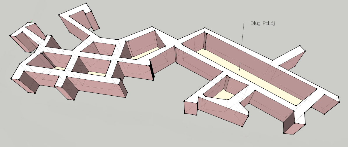
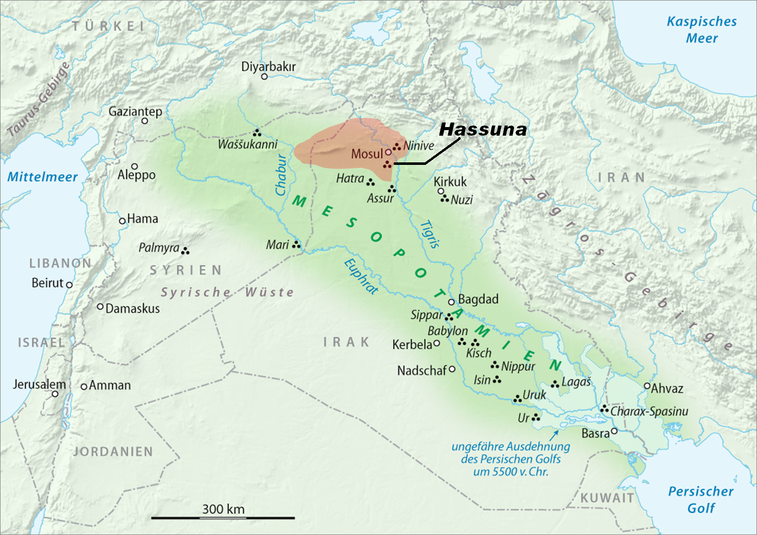
Yarim Tepe is an archaeological site of an early farming settlement that goes back to about 6000 BC. It is located in the Sinjar valley some 7km southwest from the town of Tal Afar in northern Iraq. The site consists of several hills reflecting the development of the Hassuna culture, and then of the Halaf and Ubaid cultures. The settlement was investigated between 1969 and 1976, and later by the Soviet archaeological expedition under the leadership of Rauf Munchaev and Nikolai Merpert. Yarim Tepe excavations Yarim Tepe I The hill known as Yarim-Tepe I belongs to Hassuna culture. The high central, oval-shaped core is 80 meters long and 30 meters wide. Some objects found here are reminiscent of those of Tureng Tepe in Iran. 13 building layers are found here, reflecting the main stages of this culture. The cultural level is 6.5 m deep. There are more than 1500 rectangular furnaces and ceramic ovens used for cooking. The earliest known kiln, dating to around 6000 BC, was found he ... [...More Info...] [...Related Items...] OR: [Wikipedia] [Google] [Baidu] |
Arpachiyah
Tell Arpachiyah (outside modern Mosul in Ninawa Governorate Iraq) is a prehistoric archaeological site in Nineveh Province (Iraq). It takes its name from a more recent village located about from Nineveh. The proper name of the mound on which the site is located is Tepe Reshwa. Tepe Gawra is also a contemporary Neolithic site located in the Mosul region. History of archaeological research After being scouted by Reginald Campbell Thompson in 1928, it was excavated by Max Mallowan and John Cruikshank Rose of the British School of Archaeology in Iraq, along with Agatha Christie, in 1933. Additional soundings were conducted in 1976 by a team led by Ismail Hijara.Ismail Hijara, Three New Graves at Arpachiyah, World Archaeology, vol. 10, no. 2, pp. 125-128, 1978 Several Halaf structures were uncovered, including tholoi and the "Burnt House". An array of Halaf pottery and sealings were also found, along with some Ubaid burials. Tell Arpachiyah and its environment Tell Arpachiyah is a s ... [...More Info...] [...Related Items...] OR: [Wikipedia] [Google] [Baidu] |
Archaeological Sites In Iraq
Archaeology or archeology is the scientific study of human activity through the recovery and analysis of material culture. The archaeological record consists of artifacts, architecture, biofacts or ecofacts, sites, and cultural landscapes. Archaeology can be considered both a social science and a branch of the humanities. It is usually considered an independent academic discipline, but may also be classified as part of anthropology (in North America – the four-field approach), history or geography. Archaeologists study human prehistory and history, from the development of the first stone tools at Lomekwi in East Africa 3.3 million years ago up until recent decades. Archaeology is distinct from palaeontology, which is the study of fossil remains. Archaeology is particularly important for learning about prehistoric societies, for which, by definition, there are no written records. Prehistory includes over 99% of the human past, from the Paleolithic until the advent of ... [...More Info...] [...Related Items...] OR: [Wikipedia] [Google] [Baidu] |
Jarmo
Jarmo (Qal'at Jarmo) ( ku, Çermo) is a prehistoric archeological site located in modern Iraq on the foothills of the Zagros Mountains. It lies at an altitude of 800 m above sea-level in a belt of oak and pistachio woodlands in the Adhaim River watershed. Excavations revealed that Jarmo was an agricultural community dating back to 7090 BC. It was broadly contemporary with such other important Neolithic sites such as Jericho in the Southern Levant and Çatalhöyük in Anatolia. Discovery and excavation The site was originally discovered by the Iraqi Directorate of Antiquities in 1940, and later became known to archaeologist Robert Braidwood from the University of Chicago Oriental Institute. At the time, he was looking for suitable places to research the origins of the Neolithic Revolution.Robert J. Braidwood, The Iraq-Jarmo Project of the Oriental Institute of the University of Chicago, Season 1954–1955, Verlag nicht ermittelbar, 1954 Braidwood worked as part of th ... [...More Info...] [...Related Items...] OR: [Wikipedia] [Google] [Baidu] |
Tell Arpachiyah
Tell Arpachiyah (outside modern Mosul in Ninawa Governorate Iraq) is a prehistoric archaeological site in Nineveh Province (Iraq). It takes its name from a more recent village located about from Nineveh. The proper name of the mound on which the site is located is Tepe Reshwa. Tepe Gawra is also a contemporary Neolithic site located in the Mosul region. History of archaeological research After being scouted by Reginald Campbell Thompson in 1928, it was excavated by Max Mallowan and John Cruikshank Rose of the British School of Archaeology in Iraq, along with Agatha Christie, in 1933. Additional soundings were conducted in 1976 by a team led by Ismail Hijara.Ismail Hijara, Three New Graves at Arpachiyah, World Archaeology, vol. 10, no. 2, pp. 125-128, 1978 Several Halaf structures were uncovered, including tholoi and the "Burnt House". An array of Halaf pottery and sealings were also found, along with some Ubaid burials. Tell Arpachiyah and its environment Tell Arpachiyah is ... [...More Info...] [...Related Items...] OR: [Wikipedia] [Google] [Baidu] |
Tell Maghzaliyah
Tell Maghzaliyah (Tell Maghzalia), in Nineveh Governorate, Iraq, is a prehistoric fortified aceramic Mesolithic and Neolithic site located approximately 7.5 km northwest of Yarim Tepe, with which it shows some similarities. It is situated near the Abra River, a tributary of the Habur River, which eventually drains into the Euphrates River. Tell Maghzaliyah shows the development of pre-Hassuna culture. There are also numerous connections to the Jarmo culture going back to 7000 BCE. Archaeology The site is approximately 4500 square meters in area, and the depth of deposit is approximately 8 meters. It was excavated during 12 seasons between 1969 and 1980 on the Sinjar Plain, by a Soviet team from the Institute of Archaeology, Academy of Sciences led by R. M. Munchaev and N. Ya. Merpert with N.O. Bader. The original village housed approximately 150 people. It was more suited to hunting and gathering, than to long-standing agriculture. Archeological evidence includes flint flak ... [...More Info...] [...Related Items...] OR: [Wikipedia] [Google] [Baidu] |
Tell Es-Sawwan
Tell es-Sawwan is an important Samarran period archaeological site in Saladin Province, Iraq. It is located north of Baghdad, and south of Samarra. The site is a primarily Ubaid, Hassuna, and Samarra culture occupation with some later Babylonian graves. It is considered the type site for the Samarran culture. Tell es-Sawwan and its environment Tell es-Sawwan is an oval mound long by wide with a maximum height of . The main mound was surrounded by a three-metre defensive ditch and a strong mudbrick wall. The village consisted of large houses and other buildings thought to be granaries. The inhabitants of Tell es-Sawwan were farmers who used irrigation from the Tigris to support their crops, as rainfall was unreliable. They used stone and flint tools similar to those of the Hassuna culture. Their prosperity, probably based on the dependability of irrigated crops, is evidenced by the presence of fine Samarran ware and beautiful, translucent marble vessels Underfloor graves of a ... [...More Info...] [...Related Items...] OR: [Wikipedia] [Google] [Baidu] |
Kul Tepe (Iraq)
Kul Tepe may refer to: *Kültəpə, Azerbaijan *Kültepe, Turkey *Kul Tepe Jolfa Kul Tepe Jolfa (Gargar Tepesi) (Kul Tapeh) is an ancient archaeological site in the Jolfa County of Iran, located in the city of Hadishahr, about 10 km south from the Araxes River. It dates to Chalcolithic period (5000–4500 BC), and was discov ..., Iran * Gol Tappeh (other), places in Iran {{geodis ... [...More Info...] [...Related Items...] OR: [Wikipedia] [Google] [Baidu] |
Tepe Gawra
Tepe Gawra (Kurdish for "Great Mound") is an ancient Mesopotamian settlement 15 miles NNE of Mosul in northwest Iraq that was occupied between 5000 and 1500 BC. It is roughly a mile from the site of Nineveh and 2 miles E of the site of Khorsabad. It contains remains from the Halaf period, the Ubaid period, and the Uruk period (4000–3100 BC). Tepe Gawra contains material relating to the Halaf-Ubaid Transitional period c. 5,500–5,000 BC. Archaeology The tell or settlement mound at Tepe Gawra is in diameter and high. A brief exploratory dig was performed by Austen Layard before 1850. The site was formally excavated in 1927, 1931, 1932 and 1934-35 by archaeologists from a joint expedition of the University of Pennsylvania and the American Schools of Oriental Research, led by Ephraim Avigdor Speiser. At the same time, these scholars explored the related nearby ancient site of Tell Billa, which is located about southwest of Gawra. In 2001, Mitchell Rothman reanalyzed ... [...More Info...] [...Related Items...] OR: [Wikipedia] [Google] [Baidu] |
Kiln
A kiln is a thermally insulated chamber, a type of oven, that produces temperatures sufficient to complete some process, such as hardening, drying, or chemical changes. Kilns have been used for millennia to turn objects made from clay into pottery, tiles and bricks. Various industries use rotary kilns for pyroprocessing—to calcinate ores, to calcinate limestone to lime for cement, and to transform many other materials. Pronunciation and etymology According to the Oxford English Dictionary, kiln was derived from the words cyline, cylene, cyln(e) in Old English, in turn derived from Latin ''culina'' ("kitchen"). In Middle English the word is attested as kulne, kyllne, kilne, kiln, kylle, kyll, kil, kill, keele, kiele. For over 600 years, the final "n" in kiln was silent. It wasn't until the late 20th century where the "n" began to be pronounced. This is due to a phenomenon known as spelling pronunciation, where the pronunciation of a word is surmised from its spelling an ... [...More Info...] [...Related Items...] OR: [Wikipedia] [Google] [Baidu] |
Sinjar
Sinjar ( ar, سنجار, Sinjār; ku, شنگال, translit=Şingal, syr, ܫܝܓܪ, Shingar) is a town in the Sinjar District of the Nineveh Governorate in northern Iraq. It is located about five kilometers south of the Sinjar Mountains. Its population in 2013 was estimated at 88,023, and is predominantly Yazidi. History Antiquity In the 2nd century AD, Sinjar became a military base called Singara and part of the Roman ''Limes (Roman Empire), limes''. It remained part of the Roman Empire until it was sacked by the Sasanian Empire, Sasanians in 360. Starting in the late 5th century, the Sinjar Mountains, mountains around Sinjar became an abode of the Banu Taghlib, an Arab tribe. At the beginning of 6th century, a tribe called Qadišaiē (Kαδίσηνοι), who were of either Kurdish or Arab origin, dwelt there. The Qadišaye practiced idolatry. According to the early Islamic literary sources, Singara had long been a bone of contention between the Sasanian and Byzantine Empire ... [...More Info...] [...Related Items...] OR: [Wikipedia] [Google] [Baidu] |
Tureng Tepe
Tureng Tepe ( fa, تورنگ تپه, "Hill of the Pheasants"; alternatively spelled in English as Turang Tappe/Tape/Tappa/Tappeh) is a Neolithic and Chalcolithic archaeological site in northeastern Iran, in the Gorgan plain, approximately 17 km northeast of the town of Gorgan. Nearby is a village of Turang Tappeh. Description Tureng Tepe consists of a group of mounds interspersed with ponds and water courses. The whole archaeological pattern is about 800 – 900 m in diameter. Most of the mounds rise between 11 and 15 m above the level of the surrounding plan, but the steep central mound, marked A on the Wulsin's plan, is over 30 m high and dominated the entire site. The oldest remains on the site date to the Neolithic and Chalcolithic periods. The Bronze Age settlement portion of the site dates from approximately 3100-2900 BC through 1900 BC.Moreau, KathyTureng Tepe, Iran expedition records (finding aid)(University of Pennsylvania, Penn Museum Archives, 2010), Retrieved J ... [...More Info...] [...Related Items...] OR: [Wikipedia] [Google] [Baidu] |

.jpg)
