|
Ythanwells
Ythanwells () is a village in the Marr area of Aberdeenshire, Scotland, lying east of Huntly. The village is sometimes known as Wells of Ythan, although this name strictly refers to the nearby source of the River Ythan. Ythanwells Church, now semi-derelict and in use as an agricultural barn, was built in 1864. The village also formerly had a school, which serves today as a community centre. Ythanwells now comes under the catchment area for Drumblade Primary School. , Aberdeenshire Council The Roman Camp site known as Glenmailen
Ythan Wells, also known as Glenmailen, is the site of a Roman military camp, near the farm of Glenmellan, east of the villa ...
[...More Info...] [...Related Items...] OR: [Wikipedia] [Google] [Baidu] |
Glenmailen
Ythan Wells, also known as Glenmailen, is the site of a Roman military camp, near the farm of Glenmellan, east of the village of Ythanwells in Aberdeenshire, Scotland. The site is a designated scheduled monument. Traces of two marching camps have been found at the site. The larger camp, covering some was discovered in 1785 by Col. Alex Shand. A smaller camp, extending to and partially overlapping the area of the first, was discovered by J. K. St Joseph in 1968. This smaller camp predates the larger and has been dated to the campaigns of Agricola. The site is situated at the headwaters of the River Ythan, where a series of natural springs supplies potable water, that was convenient for the large marching camp installed here by the Romans in the first few centuries AD. The Roman legions established a chain of very large forts at Ardoch, Strageath, Inchtuthil, Battledykes, Stracathro and Raedykes, taking the Elsick Mounth on the way to Normandykes, then ... [...More Info...] [...Related Items...] OR: [Wikipedia] [Google] [Baidu] |
River Ythan
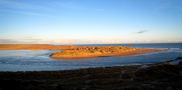
The Ythan is a river in the north-east of Scotland rising at Wells of Ythan near the village of Ythanwells and flowing south-eastwards through the towns of Fyvie, Methlick and Ellon before flowing into the North Sea near Newburgh, in Formartine. The lower reach of the river is known as the Ythan Estuary, is a part of the River Ythan, Sands of Forvie and Meikle Loch Special Protection Area for conservation, particularly the breeding ground of three tern species (common tern, little tern and Sandwich tern) (Lumina, 2004). The River Ythan has a length of and a catchment area of . As figures of the discharge, /s are given or /s. Nitrate Vulnerable Zone The Scottish Government has designated the River Ythan catchment as a Nitrate Vulnerable Zone following concerns about the spread of algal mats in the river during the 1990s. The resulting restrictions on the use of fertilisers in the catchment were criticised by many farmers, 90% of the land in the catchment area is used for agric ... [...More Info...] [...Related Items...] OR: [Wikipedia] [Google] [Baidu] |
Aberdeenshire
Aberdeenshire ( sco, Aiberdeenshire; gd, Siorrachd Obar Dheathain) is one of the 32 Subdivisions of Scotland#council areas of Scotland, council areas of Scotland. It takes its name from the County of Aberdeen which has substantially different boundaries. The Aberdeenshire Council area includes all of the area of the Counties of Scotland, historic counties of Aberdeenshire and Kincardineshire (except the area making up the City of Aberdeen), as well as part of Banffshire. The county boundaries are officially used for a few purposes, namely land registration and Lieutenancy areas of Scotland, lieutenancy. Aberdeenshire Council is headquartered at Woodhill House, in Aberdeen, making it the only Scottish council whose headquarters are located outside its jurisdiction. Aberdeen itself forms a different council area (Aberdeen City). Aberdeenshire borders onto Angus, Scotland, Angus and Perth and Kinross to the south, Highland (council area), Highland and Moray to the west and Aber ... [...More Info...] [...Related Items...] OR: [Wikipedia] [Google] [Baidu] |
Gordon (UK Parliament Constituency)
Gordon is a county constituency of the House of Commons of the Parliament of the United Kingdom (Westminster), which elects one member of Parliament (MP) by the first past the post system of election. The constituency first returned a member in the 1983 general election, but has undergone boundary changes since that date. The constituency has been represented since 12 December 2019 by Richard Thomson of the Scottish National Party. Boundaries 1983–1997: Gordon District, and the City of Aberdeen District electoral divisions of East Don and West Don. 1997–2005: The Gordon District electoral divisions of East Gordon, Formartine, Garioch, Inverurie, Kintore and Newmachar, and West Gordon, the Banff and Buchan District electoral division of Lower Deveron and Upper Ythan, and the Moray District electoral division of Keith-Strathisla. 2005–present: The Aberdeenshire Council wards of Tarves, Ythan, Ellon Town, Logie Buchan, Meldrum, Udny-Slains, Belhelvie, Insch, Chapel a ... [...More Info...] [...Related Items...] OR: [Wikipedia] [Google] [Baidu] |
Aberdeenshire West (Scottish Parliament Constituency)
Aberdeenshire West (Gaelic: ''Siorrachd Obar Dheathain an Iar'') is a constituency of the Scottish Parliament ( Holyrood) covering part of the council area of Aberdeenshire. It elects one Member of the Scottish Parliament (MSP) by the first past the post method of election. Also, however, it is one of ten constituencies in the North East Scotland electoral region, which elects seven additional members, in addition to ten constituency MSPs, to produce a form of proportional representation for the region as a whole. The seat has been held by Alexander Burnett of the Scottish Conservatives since the 2016 Scottish Parliament election. Electoral region The other nine constituencies of the North East Scotland region are Aberdeen Central, Aberdeen Donside, Aberdeen South and North Kincardine, Aberdeenshire East, Angus North and Mearns, Angus South, Banffshire and Buchan Coast, Dundee City East and Dundee City West. The region covers all of the Aberdeen City council ... [...More Info...] [...Related Items...] OR: [Wikipedia] [Google] [Baidu] |
Marr
Marr (Scottish Gaelic: ''Màrr'') is one of six committee areas in Aberdeenshire, Scotland. It has a population of 34,038 (2001 Census). Someone from Marr is called a ''Màrnach'' in Scottish Gaelic. Etymology The genesis of the name ''Marr'' is uncertain. ''Mar'', a Brittonic personal name, may be involved. Further possibilities include a connection with the ethnic names ''Marsi'' and ''Marsigni'' of Italy and Bohemia, or a derivation from Old Norse ''marr'' meaning "sea, marsh, fen". American academic Thomas Clancy has noted cautiously the similarity between the territory names ''Buchan'' and ''Marr'' to those of the Welsh commotes ''Cantref Bychan'' and ''Cantref Mawr'', meaning "large-" and "small-commote", respectively. Linguist Guto Rhys adjudged the proposal "appealing" but "questionable", on the basis that the form ''Marr'' conflicts with the expected development of ''mawr''. Features To the west, the mountain environment of the Cairngorms National Park sustains ... [...More Info...] [...Related Items...] OR: [Wikipedia] [Google] [Baidu] |
Huntly
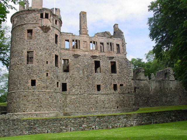
Huntly ( gd, Srath Bhalgaidh or ''Hunndaidh'') is a town in Aberdeenshire, Scotland, formerly known as Milton of Strathbogie or simply Strathbogie. It had a population of 4,460 in 2004 and is the site of Huntly Castle. Its neighbouring settlements include Keith and Rothiemay. Both Huntly and the surrounding district of Gordon are named for a town and family that originated in the Border country. Huntly is the historic home of the Gordon Highlanders regiment which traditionally recruited throughout the North-East of Scotland. Huntly has a primary school (Gordon Primary) and a secondary school (The Gordon Schools) beside Huntly Castle. It is the home of the Deans bakers, which produce shortbread biscuits. In November 2007, Deans of Huntly opened their new visitor centre. Four of the owls from the local falconry centre starred in the Harry Potter films. History Settlement around the confluence of the Bogie and Deveron rivers dates back to the Neolithic period. Settlement rem ... [...More Info...] [...Related Items...] OR: [Wikipedia] [Google] [Baidu] |


