|
Yomou
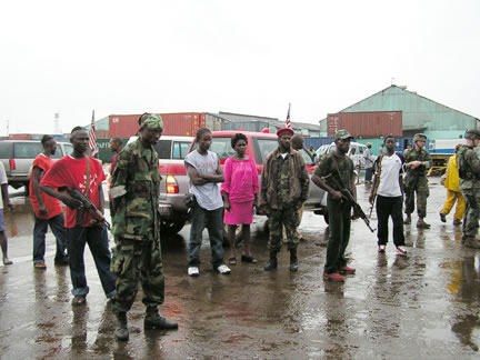
Yomou ( N’ko: ߦߏ߭ߡߎ߲߬) is a town located in southeastern Guinea. It is the capital of Yomou Prefecture. It has an estimated population of 29,138 (2008) growing from 9,661 (1996). , Retrieved on June 18, 2008 The town is inhabited mainly inhabited by the Guerze ( Kpelle) and (or Manon) peoples. The surrounding area borders Liberia to the east. A number of refugees crossed the border to Yomou during the |
Yomou Prefecture
Yomou is a prefecture located in the Nzérékoré Region of Guinea. The capital and principal town of the prefecture is Yomou. The prefecture covers an area of 3,920 km.² and has an estimated population of 114,371. As of 2005, Yomou town is estimated to have a population of around 12,000. The town is an important trading centre for the Guinea Highlands area. Sub-prefectures The prefecture is divided administratively into 7 sub-prefectures: # Yomou-Centre # Banié # Bheeta # Bignamou # Bowé Bowé is a town and sub-prefecture in the Yomou Prefecture in the Nzérékoré Region of south-eastern Guinea Guinea ( ),, fuf, 𞤘𞤭𞤲𞤫, italic=no, Gine, wo, Gine, nqo, ߖߌ߬ߣߍ߫, bm, Gine officially the Republic of Gui ... # Djécké # Péla Prefectures of Guinea Nzérékoré Region {{Guinea-geo-stub ... [...More Info...] [...Related Items...] OR: [Wikipedia] [Google] [Baidu] |
Nzérékoré Region
The Nzérékoré Region ( nqo, ߒߛߙߍߜߍ߬ߘߍ߫ ߕߌ߲߬ߞߎߘߎ߲) is a region in the southern part of Guinea. Its capital and largest city is Nzérékoré. It is one of the eight regions of Guinea. It is bordered by the countries of Sierra Leone, Liberia, and Ivory Coast, and the Guinean regions of Kankan and Faranah. Administrative divisions Nzérékoré Region is divided into six prefectures; which are further sub-divided into 66 sub-prefectures: * Beyla Prefecture * Guéckédou Prefecture * Lola Prefecture * Macenta Prefecture * Nzérékoré Prefecture * Yomou Prefecture Geography Nzérékoré Region is traversed by the northwesterly line of equal latitude and longitude. The region includes several forested highlands, including the Nimba Range, Simandou Massif, and Ziama Massif. The region contains the headwaters of several rivers. The Milo, Sankarani, and Dion rivers flow northward to become tributaries the Niger River. The Moa, Lofa, St. Paul, St. John, Cav ... [...More Info...] [...Related Items...] OR: [Wikipedia] [Google] [Baidu] |
Regions Of Guinea
Guinea is divided into 8 administrative regions. 7 regions other than Conakry Region are further subdivided into 33 prefectures. See also * Administrative divisions of Guinea * Prefectures of Guinea * Sub-prefectures of Guinea The sub-prefectures (known in French as ''sous-prefectures'') are the third-level administrative divisions in Guinea. As of 2009 there were 303 rural sub-prefectures of Guinea and 38 urban sub-prefectures, 5 of which compose the Conakry greater urb ... * ISO 3166-2:GN References Subdivisions of Guinea Guinea, Regions Guinea 1 Regions, Guinea Guinea geography-related lists {{Guinea-geo-stub ... [...More Info...] [...Related Items...] OR: [Wikipedia] [Google] [Baidu] |
N'Ko Script
N'Ko () is a script devised by Solomana Kante in 1949, as a modern writing system for the Mandé languages of West Africa. The term ''N'Ko'', which means ''I say'' in all Mandé languages, is also used for the Mandé literary standard written in N'Ko script. The script has a few similarities to the Arabic script, notably its direction (right-to-left) and the letters which are connected at the base. Unlike Arabic, it is obligatory to mark both tone and vowels. N'Ko tones are marked as diacritics, in a similar manner to the marking of some vowels in Arabic. History Kante created N'Ko in response to erroneous beliefs that no indigenous African writing system existed, as well as to provide a better way to write Mandé languages, which had for centuries been written in predominately in Ajami script, which was not perfectly suited to the tones unique to Mandé and common to many West African languages. A widely told story among N'Ko proponents is that Kante was particularly chall ... [...More Info...] [...Related Items...] OR: [Wikipedia] [Google] [Baidu] |
Guinea
Guinea ( ),, fuf, 𞤘𞤭𞤲𞤫, italic=no, Gine, wo, Gine, nqo, ߖߌ߬ߣߍ߫, bm, Gine officially the Republic of Guinea (french: République de Guinée), is a coastal country in West Africa. It borders the Atlantic Ocean to the west, Guinea-Bissau to the northwest, Senegal to the north, Mali to the northeast, Cote d'Ivoire to the southeast, and Sierra Leone and Liberia to the south. It is sometimes referred to as Guinea-Conakry after its capital Conakry, to distinguish it from other territories in the eponymous region such as Guinea-Bissau and Equatorial Guinea. It has a population of million and an area of . Formerly French Guinea, it achieved independence in 1958. It has a history of military coups d'état.Nicholas Bariyo & Benoit FauconMilitary Faction Stages Coup in Mineral-Rich Guinea ''Wall Street Journal'' (September 5, 2021).Krista LarsonEXPLAINER: Why is history repeating itself in Guinea's coup? Associated Press (September 7, 2021).Danielle PaquettH ... [...More Info...] [...Related Items...] OR: [Wikipedia] [Google] [Baidu] |
Kpelle People
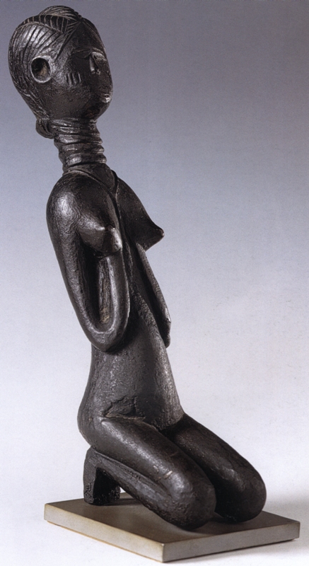
The Kpelle people (also known as the ''Guerze, Kpwesi, Kpessi, Sprd, Mpessi, Berlu, Gbelle, Bere, Gizima,'' or ''Buni'') are the largest ethnic group in Liberia. They are located primarily in an area of central Liberia extending into Guinea. They speak the Kpelle language, which belongs to the Mande language family. Despite their yearly heavy rainfalls and rough land, Kpelle survive mostly on their staple crop of rice. Traditionally organized under several paramount chiefs who serve as mediators for the public, preserve order and settle disputes, the Kpelle are arguably the most rural and conservative of the major ethnic groups in Liberia. The Kpelle people are also referred to as Gberese, Gbese, Gbeze, Gerse, Gerze, Kpelli, Kpese, Kpwele, Ngere, and Nguere. History The Kpelle or Guerze lived in North Sudan during the sixteenth-century, before fleeing to other parts of Northwest Africa into what is now Mali. Their flight was due to internal conflicts between the tribes from ... [...More Info...] [...Related Items...] OR: [Wikipedia] [Google] [Baidu] |
Mano People
Mano is an ethnic group of Liberia. The group speaks the Mano language The Mano language, also known as Maa, Mah, and Mawe, is a significant Mande language of Liberia and Guinea. It is spoken primarily in Nimba County in north-central Liberia and in Nzérékoré, Lola Lola may refer to: Places * Lolá, a or ..., which belongs to the Mande language family. Mano people in Liberia The Mano ethnic group occupy the northeastern part of Liberia known as Nimba County and some parts of modern day Guinea , in the forest section of that republic. According to John Gbatu, (1919-2010), a prominent Mano tribal leader, the name Nimba originates with the Mano dialect which in Mano is Niemba Tun. The meaning is "hills on which young maidens will slip and fall". This is so because the Mano used to worship their god up what is today known as Mt. Nimba in Liberia. They occupied major cities and towns in Niemba such as Ganta, Yekepa, Sanniquellie, and Scalepea amongst others. Accordi ... [...More Info...] [...Related Items...] OR: [Wikipedia] [Google] [Baidu] |
Liberia
Liberia (), officially the Republic of Liberia, is a country on the West African coast. It is bordered by Sierra Leone to Liberia–Sierra Leone border, its northwest, Guinea to its north, Ivory Coast to its east, and the Atlantic Ocean to its south and southwest. It has a population of around 5 million and covers an area of . English is the official language, but over 20 indigenous languages are spoken, reflecting the country's ethnic and cultural diversity. The country's capital and largest city is Monrovia. Liberia began in the early 19th century as a project of the American Colonization Society (ACS), which believed black people would face better chances for freedom and prosperity in Africa than in the United States. Between 1822 and the outbreak of the American Civil War in 1861, more than 15,000 freed and free-born black people who faced social and legal oppression in the U.S., along with 3,198 Afro-Caribbeans, relocated to Liberia. Gradually developing an Americo- ... [...More Info...] [...Related Items...] OR: [Wikipedia] [Google] [Baidu] |
First Liberian Civil War
The First Liberian Civil War lasted from 1989 to 1997. President Samuel Doe had established a regime in 1980 but totalitarianism and corruption led to unpopularity and the withdrawal of support from the United States by the late 1980s. The National Patriotic Front of Liberia (NPFL) led by Charles Taylor invaded Liberia from the Ivory Coast to overthrow Doe in December 1989 and gained control over most of the country within a year. Doe was captured and executed by the Independent National Patriotic Front of Liberia (INPFL), a splinter faction of the NPFL led by Prince Johnson, in September 1990. The NPFL and INPFL fought each other for control of the capital Monrovia and against the Armed Forces of Liberia and pro-Doe United Liberation Movement of Liberia for Democracy. Peace negotiations and foreign involvement led to a ceasefire in 1995 but fighting continued until a peace agreement between the main factions in August 1996. Taylor was elected President of Liberia following the ... [...More Info...] [...Related Items...] OR: [Wikipedia] [Google] [Baidu] |
Second Liberian Civil War
The Second Liberian Civil War was a conflict in the West African nation of Liberia lasted from 1999 to 2003. It was preceded by the First Liberian Civil War, which ended in 1996. President Charles Taylor came to power in 1997 after victory in the First Liberian Civil War which led to two years of peace. The Liberians United for Reconciliation and Democracy (LURD), an anti-Taylor rebel group backed by the government of Guinea, invaded northern Liberia in April 1999. LURD made gradual gains against Taylor in the north and began approaching the capital Monrovia by early 2002. The Movement for Democracy in Liberia (MODEL), a second anti-Taylor rebel group, invaded southern Liberia in early 2003 and quickly conquered most of the south. Taylor, controlling only a third of Liberia and under pressure from the Siege of Monrovia, resigned in August 2003 and fled to Nigeria. The Accra Comprehensive Peace Agreement was signed by the warring parties a week later, marking the political end of ... [...More Info...] [...Related Items...] OR: [Wikipedia] [Google] [Baidu] |


