|
Yarraville
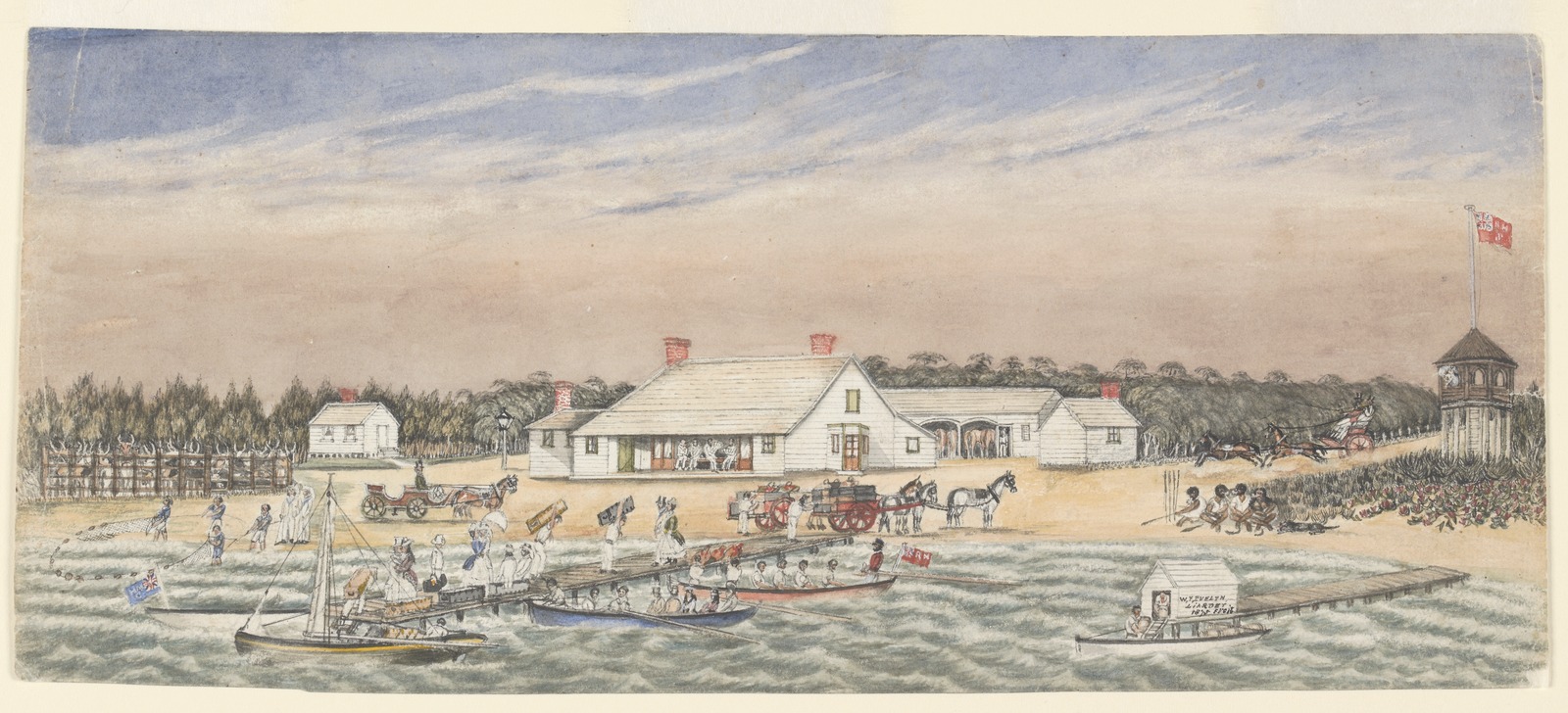
Yarraville is an inner-city suburb in Melbourne, Victoria, Australia, west of Melbourne's Central Business District, located within the City of Maribyrnong local government area. Yarraville recorded a population of 15,636 at the . Yarraville is bordered on the east by the junction of the Maribyrnong and the Yarra Rivers, and its southern boundary is the West Gate Freeway. In 2020, Yarraville was named Australia's best suburb and fifth in the world. The suburb lies immediately north of the West Gate Bridge, and immediately west of its namesake, the Yarra River. Features of Yarraville include C.J. Cruickshank Park, Yarraville Oval, Beaton Reserve, Yarraville Gardens, Stony Creek and the Yarraville Village Shopping Strip. History Yarraville was named due to its proximity to the Yarra River. It was subdivided in 1859, and the residential development of the area commenced. In 1859 a railway line from Footscray to Williamstown was opened, which prompted land sales in the area. ... [...More Info...] [...Related Items...] OR: [Wikipedia] [Google] [Baidu] |
Yarraville Railway Station
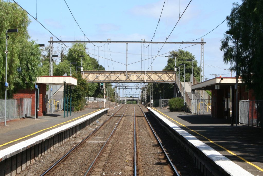
Yarraville railway station is located on the Werribee and Williamstown lines in Victoria, Australia. It serves the inner-western Melbourne suburb of Yarraville, and it opened on 20 November 1871 as South Footscray. History Yarraville station opened on 20 November 1871, twelve years after the line from Footscray was extended to Newport. Like the suburb itself, the station was named after the ''Yarraville'' estate, which was developed by Biers, Henningham & Co. Land sales began in 1859. In 1892, the present station buildings were provided, replacing timber station buildings that were destroyed by fire in 1890. The station opened to goods traffic in 1883 and, in 1893, a goods shed that was originally at South Morang was relocated to Yarraville. In 1912, an extension of the yard was provided at the up end. By July 1969, the station was closed to goods traffic, with the goods shed demolished shortly after. In 1970, an overpass replaced a level crossing at nearby Somerville Roa ... [...More Info...] [...Related Items...] OR: [Wikipedia] [Google] [Baidu] |
Seddon, Victoria
Seddon is an inner-city suburb in Melbourne, Victoria, Australia, west of Melbourne's Central Business District, located within the City of Maribyrnong local government area. Seddon recorded a population of 5,143 at the . Located south of Footscray and north of Yarraville, Seddon was formerly a semi-industrial, working-class suburb. In recent years Seddon has experienced rapid gentrification due to its close proximity to the Melbourne City Centre. History Originally known as ''Belgravia'', Seddon was officially declared a suburb in 1906, named after Richard Seddon, the New Zealand Prime Minister from 1893 to 1906, who resided there before he moved to Bendigo and later to New Zealand. Seddon was, on occasion, considered part of neighbouring Footscray. The original State Bank of Victoria in Charles Street, Seddon used to stamp its Bank Account passbooks as Footscray South Vic. Not unusual, considering Seddon is south of Footscray. However, while central Footscray is one of th ... [...More Info...] [...Related Items...] OR: [Wikipedia] [Google] [Baidu] |
Kingsville, Victoria
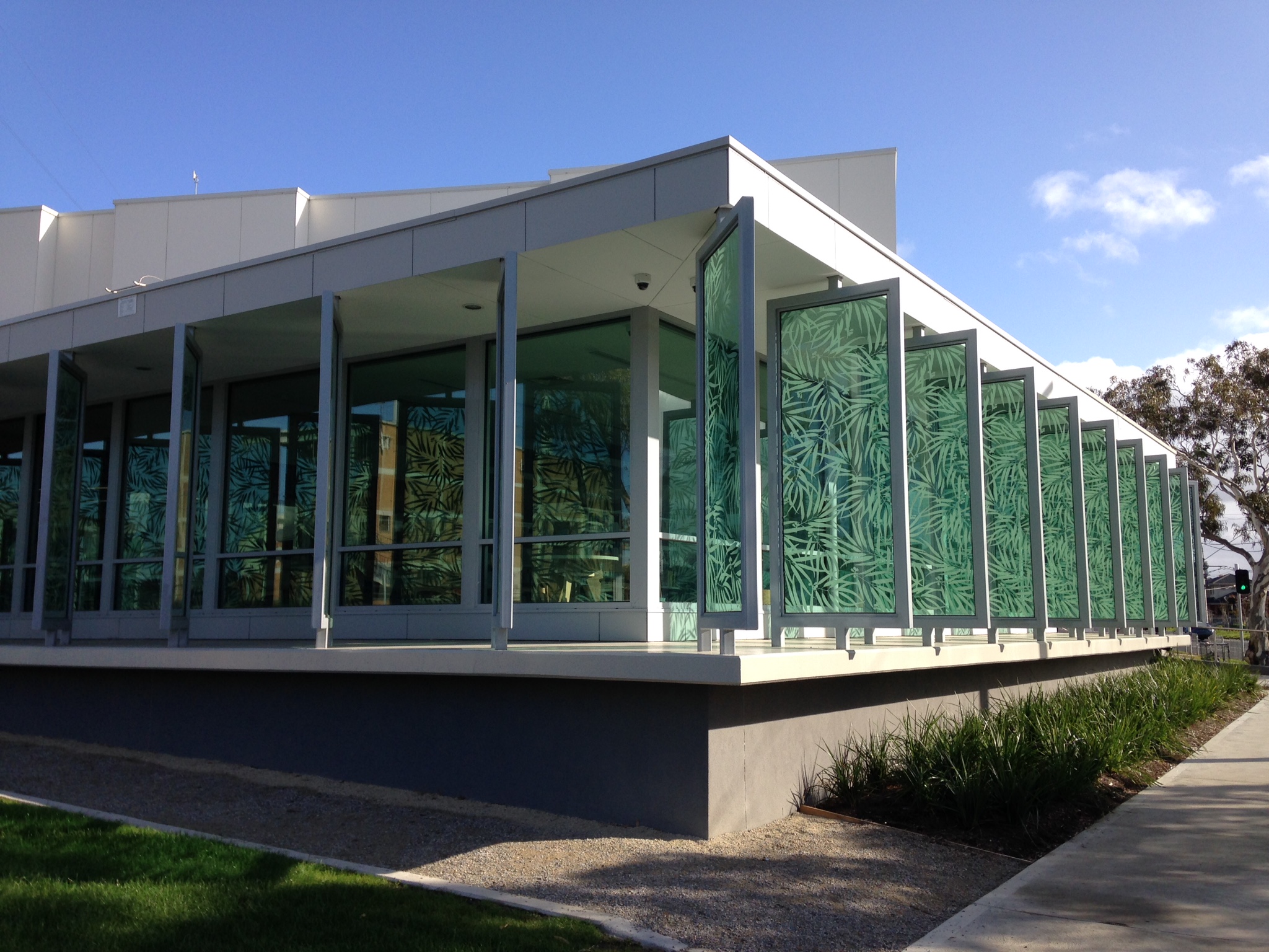
Kingsville is an inner-city suburb in Melbourne, Victoria, Australia, west of Melbourne's Central Business District, located within the City of Maribyrnong local government area. Kingsville recorded a population of 3,920 at the . Kingsville is a small suburb nestled primarily between West Footscray and Yarraville, and is often considered to be a part of one or the other. The suburb forms a right-angled triangle, bounded in the east by Williamstown Road, in the south by Somerville Road, with Geelong Road as the hypotenuse. History Kingsville was the original name for the entire West Yarraville region. This region was later renamed either Yarraville (south of Somerville Road) or West Footscray (north of Somerville Road), with South Kingsville retaining its original name. In the late 1990s the original name of Kingsville returned to the "wedge" of West Footscray with its present boundaries. Kingsville Post Office opened on 1 January 1915. Education Kingsville Primary School ... [...More Info...] [...Related Items...] OR: [Wikipedia] [Google] [Baidu] |
Sun Theatre
The Sun Theatre is an eight-screened Movie theater, cinema located in Melbourne, Australia, in the inner-west suburb of Yarraville. History The Sun Theatre originally opened in 1938 as a single-screen cinema seating 1,050 patrons. The Theatre was very popular in the area; it was noted for being the most luxurious cinema in the area and drew large crowds each week. Ticket counters and a booking office were used to handle the crowds. The Sun's original candy location is today known as the Sun Bookshop. A unique feature to the cinema was the pram room, where babies in their prams were placed and given a number. If a baby started crying, its number was flashed on the screen to alert the parents. The Sun's popularity began to dwindle during the 1950s and 60s, largely due to the introduction of television in Australia. In the late 1960s, the Sun was transformed into a Greek theatre to satisfy the growing Greek population of Yarraville. However, the new Greek Theatre was eventually sh ... [...More Info...] [...Related Items...] OR: [Wikipedia] [Google] [Baidu] |
City Of Maribyrnong
The City of Maribyrnong is a local government area within the metropolitan area of Melbourne, Australia. It comprises the inner western suburbs between 5 and 10 kilometres from Melbourne city centre. It was formed in 1994 from the merger of the City of Footscray and parts of the City of Sunshine. In June 2018, Maribyrnong had a population of 91,387. According to Local Government Victoria, Maribyrnong has the second most ethnically diverse population in Victoria, with 40% of residents born outside Australia. Many of Maribyrnong's former industrial sites have been replaced by residential developments. New residents are generally more educated and higher income. Maribyrnong attracted new cultural groups. Its name comes from the nearby Maribyrnong River. Wards and councillors Suburbs * Braybrook * Footscray * Kingsville * Maidstone * Maribyrnong * Seddon * Tottenham * West Footscray * Yarraville Community snapshot Figures below are drawn from the 2011 Census un ... [...More Info...] [...Related Items...] OR: [Wikipedia] [Google] [Baidu] |
Altona North, Victoria
Altona North is a suburb in Melbourne, Victoria, Australia, south-west of Melbourne's Central Business District, located within the City of Hobsons Bay local government area. Altona North recorded a population of 12,962 at the . Bordering suburbs include Altona, Brooklyn, Laverton North, Newport, South Kingsville, Williamstown North and Yarraville. In addition to the Paisley Park sporting complex, Altona North is home to three parks; S J Clement Reserve – Gilligan Rd, W L J Crofts Reserve – Blackshaws Rd and Urban Forest Reserve – Grieve Pde. History The Altona area was home to Kurung-Jang-Balluk Aboriginal people, of the Woiwurrung clan. Altona North Post Office first opened on 11 April 1960 as suburban development took place. In 1966 it was renamed Beevers when a new Altona North office opened in Duke Street to the south. In 1986 Altona Gate Office replaced Beevers. The Prince and Princess of Wales officially opened the Mason Street Housing Commission Estate in t ... [...More Info...] [...Related Items...] OR: [Wikipedia] [Google] [Baidu] |
Spotswood, Victoria
Spotswood is an inner-city suburb in Melbourne, Victoria, Australia, south-west of Melbourne's Central Business District, located within the City of Hobsons Bay local government area. Spotswood recorded a population of 2,820 at the . The suburb is bounded by the Newport–Sunshine freight railway line in the west, the West Gate Freeway in the north, the Yarra River in the east and by Burleigh Street in the south. Spotswood was named after John Stewart Spottiswoode (shortened to Spotswood), one of the first farmers who owned much of the area in the 1840s. History Spottiswoode Post Office opened on 1 February 1882 and was renamed Spottiswood around 1903 and Spotswood around 1906. Locality Spotswood is known for the Victorian Science Museum, known as Scienceworks. Scienceworks is near the old sewage pumping station of Spotswood, constructed in 1897. This location was also used as the police headquarters in ''Mad Max'' and for the Academy Award-winning short film '' Harvie ... [...More Info...] [...Related Items...] OR: [Wikipedia] [Google] [Baidu] |
Maribyrnong River
The Maribyrnong River is a perennial river of the Port Phillip catchment, located in the northwestern suburbs of Melbourne, in the Australian state of Victoria (Australia), Victoria. Course The Maribyrnong River draws its headwaters from near Mount Macedon, Victoria, Mount Macedon within the Macedon Ranges, part of the Great Dividing Range. Formed by the confluence of the Jackson Creek (Victoria), Jackson Creek and the Deep Creek (Victoria), Deep Creek below , the river flows generally southward, joined by two minor Tributary, tributaries before reaching its confluence with the Yarra River at , to eventually empty into Port Phillip. The river descends over its Watercourse, course. Headwaters The head of the Maribyrnong catchment is situated in the Macedon Ranges region of central Victoria around northwest of Melbourne City Centre. Various creeks beginning in the southern Mount Macedon area flow into Riddells Creek which in turn flows into the Jackson Creek. The Jackson Cr ... [...More Info...] [...Related Items...] OR: [Wikipedia] [Google] [Baidu] |
Footscray Railway Station
Footscray railway station is the junction for the Sunbury, Werribee and Williamstown lines in Victoria, Australia. It serves the western Melbourne suburb of Footscray, and it opened on 17 January 1859.Footscray Vicsig It is also serviced by , and ... [...More Info...] [...Related Items...] OR: [Wikipedia] [Google] [Baidu] |
Williamstown Railway Line
The Williamstown railway line is a 16.2 km commuter rail passenger train service in Melbourne, Australia, operating between Williamstown in the western suburbs to Flinders Street in the central business district. It runs across flat coastal land and therefore has no significant earthworks. From the junction at Newport to the next station of North Williamstown, it runs beside the Newport Workshops, and from there through mainly old residential areas. The line used to continue a short distance to Williamstown Pier, around which there is heavy industrial areas including shipbuilding. Infrastructure The Williamstown Line shares tracks with the Werribee line between Flinders Street and Newport. The line is double track throughout, except for Williamstown station, and provided with automatic block signalling. There are no intermediate terminating facilities. Stabling facilities are provided within the grounds of the Newport workshops. Services Trains on the Williamsto ... [...More Info...] [...Related Items...] OR: [Wikipedia] [Google] [Baidu] |
Port Melbourne, Victoria
Port Melbourne is an inner-city suburb in Melbourne, Victoria, Australia, south-west of Melbourne's Central Business District, located within the Cities of Melbourne and Port Phillip local government areas. Port Melbourne recorded a population of 17,633 at the 2021 census. The area to the north of the West Gate Freeway is located within the City of Melbourne, with The area to the south located within the City of Port Phillip. The suburb is bordered by the shores of Hobsons Bay and the lower reaches of the Yarra River. Port Melbourne covers a large area, which includes the distinct localities of Fishermans Bend, Garden City and Beacon Cove. Historically it was known as Sandridge and developed as the city's second port, linked to the nearby Melbourne CBD. The formerly industrial Port Melbourne has been subject to intense urban renewal over the past three decades. As a result, Port Melbourne is a diverse and historic area, featuring industrial and port areas along the Yarra, ... [...More Info...] [...Related Items...] OR: [Wikipedia] [Google] [Baidu] |
Stony Creek, Melbourne
Stony Creek is located in the western suburbs of Melbourne, Victoria, Australia. It runs through the suburbs of St Albans, Albion, Sunshine, Braybrook, Tottenham, Brooklyn, Kingsville and Yarraville. in its upper reaches Stony Creek's environmental state is very poor; it is best characterised as a concrete stormwater drain for these sections of its course. Through most of Sunshine it has been directed underground coming out at Matthews Hill Reserve. It then becomes a pleasantly treelined creek before passing through heavily industrialised areas. Stony Creek joins the Yarra River under the Westgate Bridge at thStony Creek Backwashwhere it is fringed with mangroves A mangrove is a shrub or tree that grows in coastal saline or brackish water. The term is also used for tropical coastal vegetation consisting of such species. Mangroves are taxonomically diverse, as a result of convergent evolution in several .... The ''Friends of Stony Creek'' is a group that works to re ... [...More Info...] [...Related Items...] OR: [Wikipedia] [Google] [Baidu] |


