|
Yangambi INERA
Yangambi is a town in Isangi territory of Tshopo province, Democratic Republic of the Congo. Location Yangambi is on the north side of the Congo River and lies on the R408 road which connects it to Kisangani 100 kilometers to the east. This road is unpaved, rarely used in the rainy season and difficult to use at all times of the year. The roads linking Yangambi to Weko and Isangi are also very poor. The river provides an alternative transport route. The town was once served by the small Yangambi Airport. Weather Mean annual rainfall is . August is the wettest month and February the driest. The skies tend to be partly cloudy even during the drier seasons. Yangambi Biosphere Reserve 235,000 hectares of forest around Yangambi were declared a Biosphere Reserve in 1976, part of UNESCO’s Man and the Biosphere Programme (MAB). The Yangambi Biosphere Reserve comprises secondary forests with ''Pycnanthus angolensis'' and '' Fagara macrophylla'', semi deciduous secondary rain forest ... [...More Info...] [...Related Items...] OR: [Wikipedia] [Google] [Baidu] |
National Institute For Agronomic Study Of The Belgian Congo
The National Institute for Agronomic Study of the Belgian Congo (french: link=no, Institut national pour l'étude agronomique du Congo belge (INÉAC), nl, Nationaal Instituut voor de Landbouwkunde in Belgisch-Congo (NILCO) ) was a research facility established in Yangambi in the Belgian Congo, operating from 1933 to 1962. INEAC was established as a successor to the ''Régie des Plantations de la Colonie'' (REPCO). The INEAC experimental fields and research facilities were built along the north bank of the Congo River, and along a road stretching northward from the river for about . The goal of this institute was to follow a more scientific approach with regards to agricultural policies and innovations, and to promote the diffusion of agricultural innovations and know-how under the Congolese farmers. The creation of this institute was part of a larger 'indigenous peasantry programme'. This policy aimed to modernize indigenous agriculture by assigning plots of land to individual ... [...More Info...] [...Related Items...] OR: [Wikipedia] [Google] [Baidu] |
National Institute For Agronomy In Belgian Congo
The National Institute for Agronomic Study of the Belgian Congo (french: link=no, Institut national pour l'étude agronomique du Congo belge (INÉAC), nl, Nationaal Instituut voor de Landbouwkunde in Belgisch-Congo (NILCO) ) was a research facility established in Yangambi in the Belgian Congo, operating from 1933 to 1962. INEAC was established as a successor to the ''Régie des Plantations de la Colonie'' (REPCO). The INEAC experimental fields and research facilities were built along the north bank of the Congo River, and along a road stretching northward from the river for about . The goal of this institute was to follow a more scientific approach with regards to agricultural policies and innovations, and to promote the diffusion of agricultural innovations and know-how under the Congolese farmers. The creation of this institute was part of a larger 'indigenous peasantry programme'. This policy aimed to modernize indigenous agriculture by assigning plots of land to individual ... [...More Info...] [...Related Items...] OR: [Wikipedia] [Google] [Baidu] |
Provinces Of The Democratic Republic Of The Congo
Article 2 of the Constitution of the Democratic Republic of the Congo divides the country into the capital city of Kinshasa and 25 named provinces. It also gives the capital the status of a province. Therefore, in many contexts Kinshasa is regarded as the 26th province. List History When Belgium annexed the Belgian Congo as a colony in November 1908, it was initially organised into 22 districts. Ten western districts were administered directly by the main colonial government, while the eastern part of the colony was administered under two vice-governments: eight northeastern districts formed Orientale Province, and four southeastern districts formed Katanga. In 1919, the colony was organised into four provinces: * Congo-Kasaï (five southwestern districts), * Équateur (five northwestern districts), * Orientale Province and Katanga (previous vice-governments). [...More Info...] [...Related Items...] OR: [Wikipedia] [Google] [Baidu] |
Pycnanthus Angolensis
''Pycnanthus angolensis'' is a species of tree in the nutmeg family, Myristicaceae. It is native to Tropical Africa. Its English language common names include African nutmeg, false nutmeg, boxboard, and cardboard.''Pycnanthus angolensis''. AgroForestryTree Database. World Agroforestry Centre. In Africa it is widely known as ''ilomba''.Richter, H. G. and M. J. Dallwitz. 2000 onwards Commercial timbers: descriptions, illustrations, identification, and information retrieval. DELTA – DEscription Language for TAxonomy. June, 2009. Description This |
Center For International Forestry Research
The Center for International Forestry Research (CIFOR) is a non-profit scientific research organization that conducts research on the use and management of forests with a focus on tropical forests in developing countries. CIFOR, which merged with World Agroforestry (known by the acronym ICRAF) on Jan. 1, 2019, is the forestry and agroforestry research center of the Consultative Group on International Agricultural Research (CGIAR), a network of 15 research centers around the world that focus on agricultural research for sustainable development, working closely with governments and other partners to help develop evidence-based solutions to problems related to sustainable agriculture and natural resource management. CIFOR-ICRAF research is intended to "deliver actionable evidence and solutions to transform how land is used and how food is produced: conserving and restoring ecosystems, responding to the global climate, malnutrition, biodiversity and desertification crises." It also c ... [...More Info...] [...Related Items...] OR: [Wikipedia] [Google] [Baidu] |
European Union
The European Union (EU) is a supranational political and economic union of member states that are located primarily in Europe. The union has a total area of and an estimated total population of about 447million. The EU has often been described as a '' sui generis'' political entity (without precedent or comparison) combining the characteristics of both a federation and a confederation. Containing 5.8per cent of the world population in 2020, the EU generated a nominal gross domestic product (GDP) of around trillion in 2021, constituting approximately 18per cent of global nominal GDP. Additionally, all EU states but Bulgaria have a very high Human Development Index according to the United Nations Development Programme. Its cornerstone, the Customs Union, paved the way to establishing an internal single market based on standardised legal framework and legislation that applies in all member states in those matters, and only those matters, where the states have agreed to act ... [...More Info...] [...Related Items...] OR: [Wikipedia] [Google] [Baidu] |
World War II
World War II or the Second World War, often abbreviated as WWII or WW2, was a world war that lasted from 1939 to 1945. It involved the vast majority of the world's countries—including all of the great powers—forming two opposing military alliances: the Allies and the Axis powers. World War II was a total war that directly involved more than 100 million personnel from more than 30 countries. The major participants in the war threw their entire economic, industrial, and scientific capabilities behind the war effort, blurring the distinction between civilian and military resources. Aircraft played a major role in the conflict, enabling the strategic bombing of population centres and deploying the only two nuclear weapons ever used in war. World War II was by far the deadliest conflict in human history; it resulted in 70 to 85 million fatalities, mostly among civilians. Tens of millions died due to genocides (including the Holocaust), starvation, ma ... [...More Info...] [...Related Items...] OR: [Wikipedia] [Google] [Baidu] |
Kilo-Moto
Kilo-Moto is a region in the far northeast corner of the Democratic Republic of the Congo (DRC) where gold was discovered in the Ituri River by government prospectors in 1903. Moto is in the Haut-Uélé Province and Kilo in the Ituri Province. Location Kilo Moto is a semi-continuous greenstone belt in the northeast of the DRC. In the northern part, the Moto Goldmines project has an aggregate lease area of , with most activity centered on a area around the old Durba gold mine. It is possible that as much as 25.7m ounces of gold are present. In the center is the Zani-Kodo area. To the south is the Mongbwalu field, a concession to the north and east of Bunia that is mainly owned by AngloGold Ashanti with the DRC parastatal ''Office des Mines de Kilo Moto'' (OKIMO) holding a 13.78% interest. Colonial period The Kilo mine was opened in 1905 and the Moto mine in 1911. Gold was also extracted by panning the river gravels. In 1919 the government created the ''Régie Industrielle des ... [...More Info...] [...Related Items...] OR: [Wikipedia] [Google] [Baidu] |
Yangambi INERA
Yangambi is a town in Isangi territory of Tshopo province, Democratic Republic of the Congo. Location Yangambi is on the north side of the Congo River and lies on the R408 road which connects it to Kisangani 100 kilometers to the east. This road is unpaved, rarely used in the rainy season and difficult to use at all times of the year. The roads linking Yangambi to Weko and Isangi are also very poor. The river provides an alternative transport route. The town was once served by the small Yangambi Airport. Weather Mean annual rainfall is . August is the wettest month and February the driest. The skies tend to be partly cloudy even during the drier seasons. Yangambi Biosphere Reserve 235,000 hectares of forest around Yangambi were declared a Biosphere Reserve in 1976, part of UNESCO’s Man and the Biosphere Programme (MAB). The Yangambi Biosphere Reserve comprises secondary forests with ''Pycnanthus angolensis'' and '' Fagara macrophylla'', semi deciduous secondary rain forest ... [...More Info...] [...Related Items...] OR: [Wikipedia] [Google] [Baidu] |
Chimpanzee
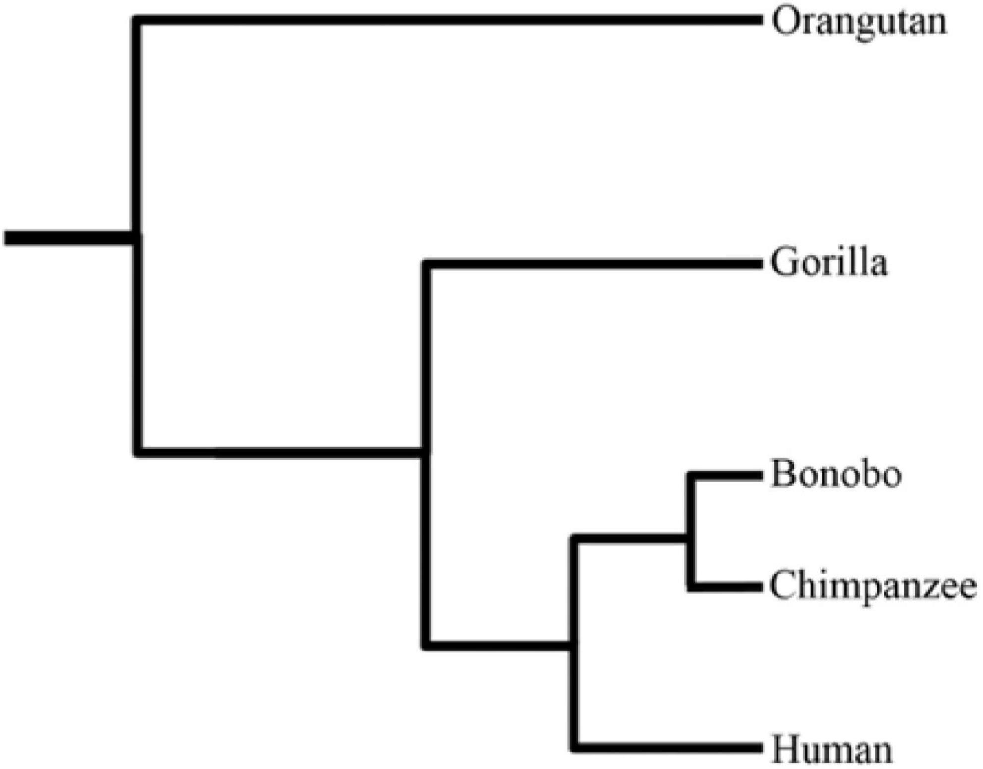
The chimpanzee (''Pan troglodytes''), also known as simply the chimp, is a species of great ape native to the forest and savannah of tropical Africa. It has four confirmed subspecies and a fifth proposed subspecies. When its close relative the bonobo was more commonly known as the pygmy chimpanzee, this species was often called the common chimpanzee or the robust chimpanzee. The chimpanzee and the bonobo are the only species in the genus ''Pan''. Evidence from fossils and DNA sequencing shows that ''Pan'' is a sister taxon to the human lineage and is humans' closest living relative. The chimpanzee is covered in coarse black hair, but has a bare face, fingers, toes, palms of the hands, and soles of the feet. It is larger and more robust than the bonobo, weighing for males and for females and standing . The chimpanzee lives in groups that range in size from 15 to 150 members, although individuals travel and forage in much smaller groups during the day. The species lives in ... [...More Info...] [...Related Items...] OR: [Wikipedia] [Google] [Baidu] |
African Forest Elephant
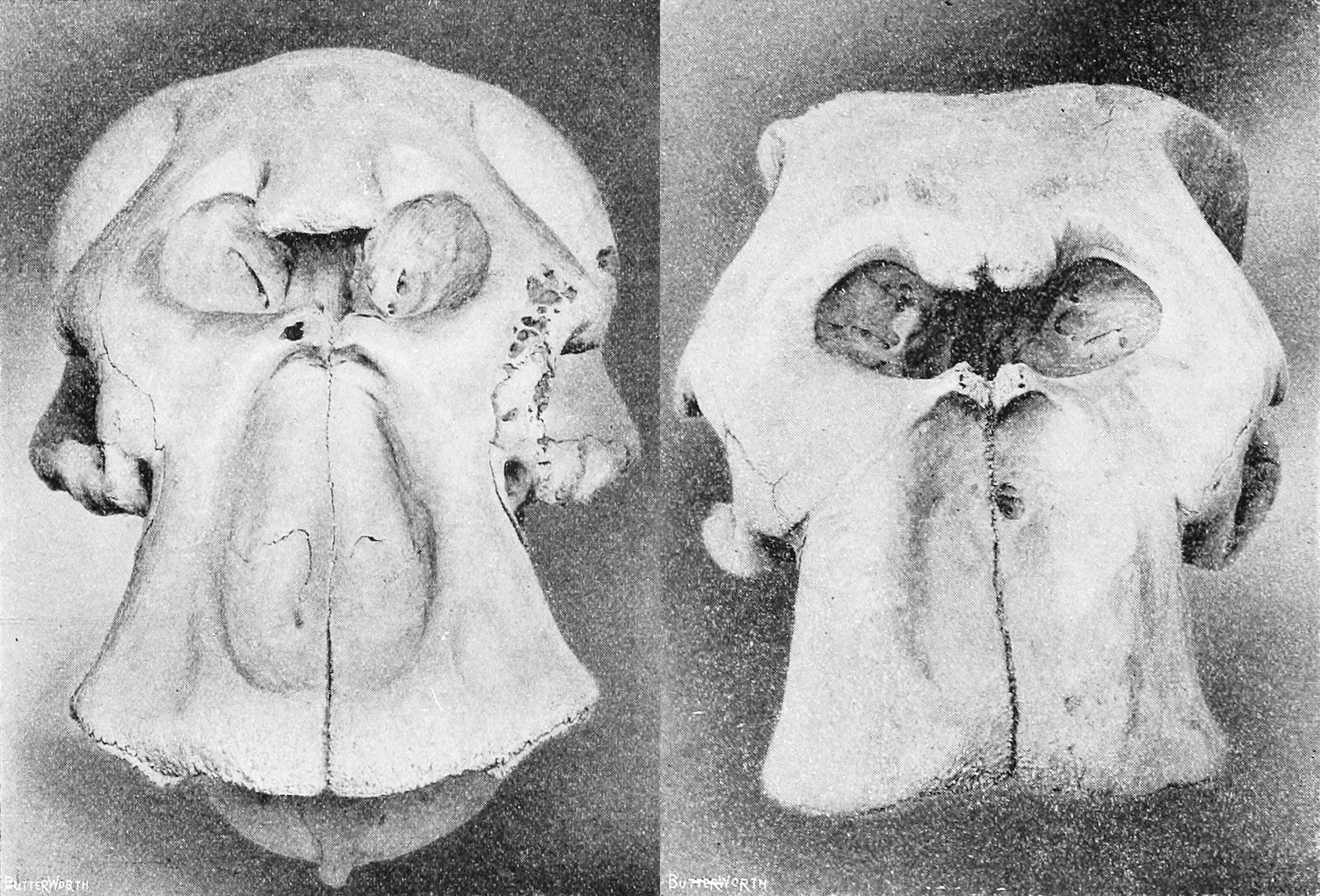
The African forest elephant (''Loxodonta cyclotis'') is one of the two living African elephant species. It is native to humid forests in West Africa and the Congo Basin. It is the smallest of the three living elephant species, reaching a shoulder height of . Both sexes have straight, down-pointing tusks, which erupt when they are 1–3 years old. It lives in family groups of up to 20 individuals. Since it forages on leaves, seeds, fruit, and tree bark, it has been referred to as the 'megagardener of the forest'. It contributes significantly to maintain the composition and structure of the Guinean Forests of West Africa and the Congolese rainforests. The first scientific description of the species was published in 1900. During the 20th century, overhunting caused a sharp decline in population, and by 2013 it was estimated that less than 30,000 individuals remained. It is threatened by habitat loss, fragmentation, and poaching. The conservation status of populations varies across ... [...More Info...] [...Related Items...] OR: [Wikipedia] [Google] [Baidu] |
Pericopsis Elata
''Pericopsis elata'' is a species of flowering plant in the family ''Fabaceae'' and is known by the common names African teak, afromosia, afrormosia, kokrodua and assamela. Description The species grows to 30-45m tall with a trunk of 1–1.8m in diameter. Annual diameter increases between unlogged and logged areas have been shown to be similar. It is a deciduous species that flowers at the end of the main dry season. The minimum trunk diameter for reproduction is given as 32 cm, while that for effective flowering is 37 cm. The fruit take 7 months to mature. Despite its relatively small diameter, trees can live to be over 400 years old. Range The species is native to moist, semi-deciduous forests in Cameroon, Republic of the Congo, DRC, Ivory Coast, Ghana, and Nigeria. Up until the mid 20th century, the tree was commonly found in its native range. However, after its wood was introduced to world markets in 1948, its range quickly diminished. It can no longer be found in ... [...More Info...] [...Related Items...] OR: [Wikipedia] [Google] [Baidu] |


