|
Xinshan Dam
The Xinshan Dam () is a dam located in Anle District, Keelung, Taiwan. The dam supplies water to Keelung and New Taipei districts of Jinshan, Ruifang, Wanli and Xizhi Districts. History The dam was completed in 1980. The reservoir underwent expansion capacity in 1998 from to . Transportation The dam is accessible west of Keelung Station of Taiwan Railways. See also * List of dams and reservoirs in Taiwan This is a partial listing of dams and reservoirs in Taiwan (Republic of China). List of dams and reservoirs See also * List of power stations in Taiwan References * Reservoirs, dams and weirs of Taiwan(Taiwan Water Resources Agency ... References 1980 establishments in Taiwan Buildings and structures in Keelung Dams completed in 1980 Dams in Taiwan {{taiwan-dam-stub ... [...More Info...] [...Related Items...] OR: [Wikipedia] [Google] [Baidu] |
Anle District
Anle District () is a district of the city of Keelung, Taiwan. With 80,521 inhabitants, it is the largest settlement in Keelung. History In March 1988, the Keelung city government reassigned administration of several urban villages between districts. Sih-wha, Sih-rong, Sih-ding, Sih-kong, Deh-ho, Deh-ann, and Chung-ho, originally part of Anle District, became part of Zhongshan District (Chung-shan). Ying-geh, Chi-sien, She-wei, San-min, Wu-fu and Liu-ho, originally part of Qidu District (Chi-du) became part of Anle District. Geography * Area: 18.025 km2 * Population: 80,623 (March 2023) Administrative divisions Anle District includes 25 urban villages: Siwei/Sihwei (), Qixian/Cisian (), Jiaren (), Yongkang (), Gancheng (), Xinxi/Sinsi (), Xichuan/Sichuan (), Dingguo (), Dingbang (), Leyi (), Anhe (), Ciren/Cihren (), Xinlun/Sinlun (), Neiliao (), Zhonglun/Jhonglun (), Wulun (), Wailiao (), Xingliao/Singliao (), Changle (), Wufu (), Liuhe/Liouhe (), Sanmin (), Ying'an/Y ... [...More Info...] [...Related Items...] OR: [Wikipedia] [Google] [Baidu] |
Keelung
Keelung () or Jilong () (; Hokkien POJ: '), officially known as Keelung City, is a major port city situated in the northeastern part of Taiwan. The city is a part of the Taipei–Keelung metropolitan area, along with its neighbors, New Taipei City and Taipei, respectively. Nicknamed the ''Rainy Port'' for its frequent rain and maritime role, the city is Taiwan's second largest seaport (after Kaohsiung). The city was founded by the Spanish Empire in 1626, then called La Santisima Trinidad. Name According to early Chinese accounts, this northern coastal area was originally called ''Pak-kang'' (). By the early 20th century, the city was known to the Western world as Kelung, as well as the variants ''Kiloung'', ''Kilang'' and ''Keelung''. In his 1903 general history of Taiwan, US Consul to Formosa (1898–1904) James W. Davidson related that "Kelung" was among the few well-known names, thus warranting no alternate Japanese romanization. However, the Taiwanese people have ... [...More Info...] [...Related Items...] OR: [Wikipedia] [Google] [Baidu] |
Taiwan
Taiwan, officially the Republic of China (ROC), is a country in East Asia, at the junction of the East and South China Seas in the northwestern Pacific Ocean, with the People's Republic of China (PRC) to the northwest, Japan to the northeast, and the Philippines to the south. The territories controlled by the ROC consist of 168 islands, with a combined area of . The main island of Taiwan, also known as ''Formosa'', has an area of , with mountain ranges dominating the eastern two-thirds and plains in the western third, where its highly urbanised population is concentrated. The capital, Taipei, forms along with New Taipei City and Keelung the largest metropolitan area of Taiwan. Other major cities include Taoyuan, Taichung, Tainan, and Kaohsiung. With around 23.9 million inhabitants, Taiwan is among the most densely populated countries in the world. Taiwan has been settled for at least 25,000 years. Ancestors of Taiwanese indigenous peoples settled the isla ... [...More Info...] [...Related Items...] OR: [Wikipedia] [Google] [Baidu] |
Embankment Dam
An embankment dam is a large artificial dam. It is typically created by the placement and compaction of a complex semi-plastic mound of various compositions of soil or rock. It has a semi-pervious waterproof natural covering for its surface and a dense, impervious core. This makes the dam impervious to surface or seepage erosion. Such a dam is composed of fragmented independent material particles. The friction and interaction of particles binds the particles together into a stable mass rather than by the use of a cementing substance. Types Embankment dams come in two types: the earth-filled dam (also called an earthen dam or terrain dam) made of compacted earth, and the rock-filled dam. A cross-section of an embankment dam shows a shape like a bank, or hill. Most have a central section or core composed of an impermeable material to stop water from seeping through the dam. The core can be of clay, concrete, or asphalt concrete. This type of dam is a good choice for sites wit ... [...More Info...] [...Related Items...] OR: [Wikipedia] [Google] [Baidu] |
New Taipei
New Taipei City is a Special municipality (Taiwan), special municipality located in northern Taiwan. The city is home to an estimated population of 3,974,683 as of 2022, making it the most populous city of Taiwan, and also the second largest special municipality by area, behind Kaohsiung. New Taipei City neighbours Keelung to the northeast, Yilan County, Taiwan, Yilan County to the southeast, and Taoyuan City, Taoyuan to the southwest, and completely encloses the city of Taipei. Banqiao District is its municipal seat and biggest commercial area. Before the Spanish Formosa, Spanish and Dutch Formosa, Dutch started arriving in Taiwan and set up small outposts in Tamsui in 1626, the area of present-day New Taipei City was mostly inhabited by Taiwanese indigenous peoples, mainly the Ketagalan people. From the Taiwan under Qing rule, late Qing era, the Tamsui Customs Wharf, port of Tamsui was opened up to foreign traders as one of the treaty ports after the Qing dynasty of China si ... [...More Info...] [...Related Items...] OR: [Wikipedia] [Google] [Baidu] |
District (Taiwan)
Districts are administrative subdivisions of the Taiwan, Republic of China (Taiwan)'s special municipality (Taiwan), special municipalities of the second level and provincial city (Taiwan), provincial cities of the third level formerly under its Provinces of China, provinces. There are two types of district in the administrative scheme. Ordinary districts are governed directly by the municipality/city government with district administrators appointed by the mayors to four-year terms. The mountain indigenous district is a local government body with elected district chiefs as well as district council serving four-year terms. History The first administrative divisions entitled "districts" were established in the 1900s when Taiwan was Taiwan under Japanese rule, under Japanese rule. After the World War II, nine (9) out of eleven (11) Cities of Japan, prefectural cities established by the Japanese government were reform into provincial cities. These cities are Changhua, Chiayi, Hsin ... [...More Info...] [...Related Items...] OR: [Wikipedia] [Google] [Baidu] |
Jinshan District, New Taipei
Jinshan District () is a rural district on the coast in northern New Taipei, Taiwan. The district draws many visitors each year because of its hot springs and its proximity to Chin Pao San and the Ju Ming Museum. The district is home to the Dharma Drum Buddhist College, an institution of higher learning founded by Dharma Drum Mountain monastics devoted to the principles of Zen Buddhism. Name Origin This area was originally a Ketagalan people, Ketagalan settlement, called "Ki-ppare" (Basay language, Basay: Quimourije), meaning "bumper harvest". This was later adapted as ''Kimpauli'' (金包里; ), the choice of characters perhaps influenced by the discovery of golden dust in the Sulfur creeks. In 1920 during Taiwan under Japanese rule, Japanese rule, the area was renamed Kanayama Village (金山庄), Kīrun District (基隆郡), Taihoku Prefecture. Qingshui Wetland Adjacent to Jinshan town at the north-west is a lowland wetland formed by alluvial deposits from Sulphur Creek ... [...More Info...] [...Related Items...] OR: [Wikipedia] [Google] [Baidu] |
Ruifang District
Ruifang District () is a suburban district in eastern New Taipei City, Taiwan. History During Japanese rule, Ruifang was called , and was administered as part of of Taihoku Prefecture. Mining was an important industry in Ruifang (then known as ''Sui-hong'') in the early 20th century. Gold was mined in Kyūfun and Kinkaseki while coal was mined in ''Kau-tong'' ( 猴硐; ''Houtong''). After the handover of Taiwan from Japan to the Republic of China in 1945, Ruifang was organized as an urban township of Taipei County. The mining sites became popular tourist destinations after 1990. On 25 December 2010, Taipei County was upgraded into a municipality named New Taipei City and Ruifang became a district of the municipality. In March 2012, it was named one of the ''Top 10 Small Tourist Towns'' by the Tourism Bureau. Administrative divisions There are thirty-four urban villages in the district which are divided between four election districts: *Election District One **Longtan ( ... [...More Info...] [...Related Items...] OR: [Wikipedia] [Google] [Baidu] |
Wanli District, New Taipei
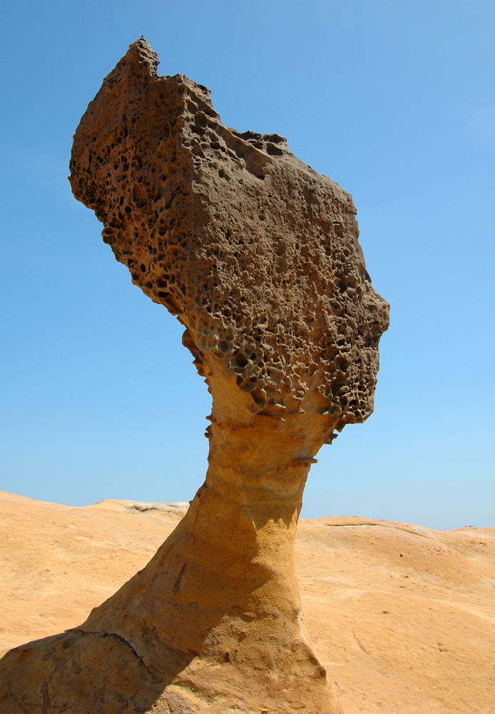
Wanli District (), known in Basay as Masu, is a rural district on the rocky seacoast in northeastern New Taipei City in northern Taiwan. Wanli is a popular tourist destination and the site of the Cape Yeliu Miocene Formation which features distinctive hoodoo outcrops. The "Queen's Head" outcrop is a Taiwanese icon and serves as an informal trademark for the township. Kataw in the adjacent Jinshan District features the Wanli Taiwanese hot springs area, which is connected with the Jinshan Hot Springs (金山溫泉). History The village of Masu (瑪鋉) was inhabited by Taiwanese aborigines before the era of European colonization. The area first came under the control of the Spanish, who were then ousted by the Dutch. The area began to develop when Hoklo people came to set up fishing operations. The Ming dynasty loyalist Koxinga landed his troops at Wanli in 1661 to expel the Dutch from their northern strongholds while their principal fortress in Tainan was under siege. In 168 ... [...More Info...] [...Related Items...] OR: [Wikipedia] [Google] [Baidu] |
Xizhi District
Xizhi () is an inner city district in eastern New Taipei City in northern Taiwan, and is located between Taipei City and Keelung City. Compared to most districts in eastern New Taipei, which are very sparsely populated, Xizhi is one of the more populated districts in New Taipei, with a population of 204,691 people as of August 2022. Xizhi grew quickly during the 1980s and 1990s, and is home to many of Taiwan's major electronics companies, such as Acer, Garmin (Asia), Coiler, Lanner Electronics and DFI. Name origin The district's old name ''Tsui-tng-ka'' () refers to the fact that the tide from the Keelung River stops at Xizhi and goes back to the sea. During Japanese rule, the place name was changed to and was under Shichisei District, Taihoku Prefecture. This is the source of the current name. History The area was originally called Kypanas ( Basay: ''Kippanas'') () by the indigenous Ketagalan people. In 1758, Han immigrants built a settlement () near the area. In ... [...More Info...] [...Related Items...] OR: [Wikipedia] [Google] [Baidu] |
Keelung Railway Station
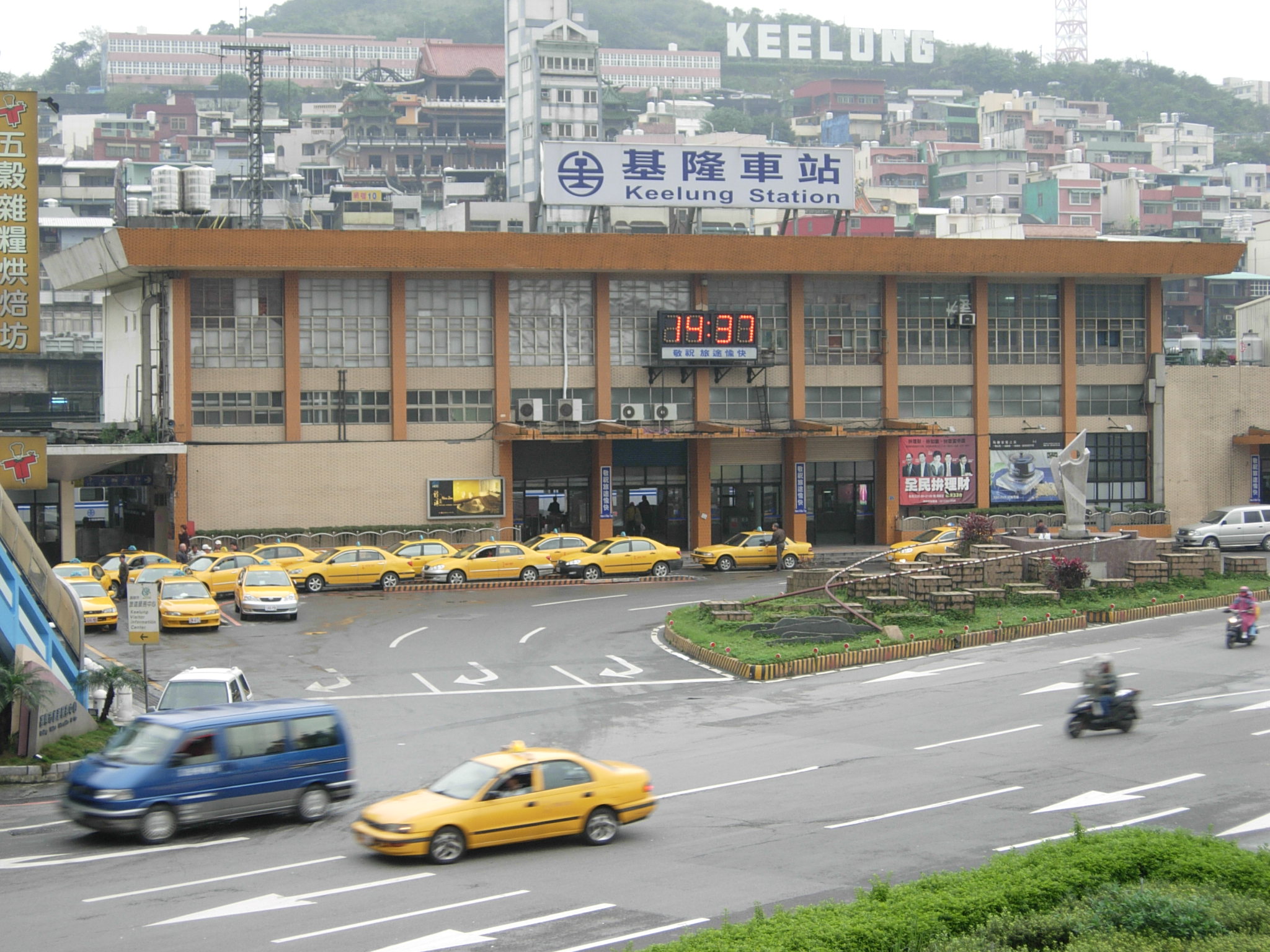
Keelung Station () is a railway station in Ren'ai District, Keelung, Taiwan served by Taiwan Railways. The station was built in 1891, and has gone through several renovations. Overview The station has three stories (two aboveground, one underground). Platform layout History *1891-10-20: A station to the north of the current station was opened (Keelung Train Pier, ) when the railroad segment from Keelung to Tsui-tng-ka Pier was completed. *1893-10-20: The rail line from Keelung to Taipeh (Taipei) was completed. *1908-10-30: The third-generation station (with clock tower) was opened for service. The style is similar to Hsinchu and Taichung stations, which opened at around the same time. *April 1914: The rail line from Keelung to '' Haccho'' was completed. *1967-01-23: The fourth-generation station was completed. *1968: Station underpass was completed. *1968-04-05: The Keelung Railway Restaurant was added to the station. *1985-06-06: The aforementioned restaurant closed. *201 ... [...More Info...] [...Related Items...] OR: [Wikipedia] [Google] [Baidu] |
Taiwan Railways Administration
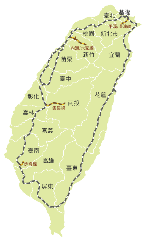
Taiwan Railways Administration (TRA) is a railway operator in Taiwan. It is an agency of the Ministry of Transportation and Communications, responsible for managing, maintaining, and running conventional passenger and freight railway services on 1097 km of track in Taiwan. Since Taiwan is heavily urbanised with a high population density, railways have played an important part in domestic transportation since the late 19th century. Passenger traffic in 2018 was 231,267,955. The agency's headquarters are in Zhongzheng District, Taipei. Overview Railway services between Keelung and Hsinchu began in 1891 under China's Qing dynasty. Because the railway was completely rebuilt and substantially expanded under the operated by Formosa's Japanese colonial government (1895–1945), the network's Japanese influence and heritage persists. Similarities between the TRA and the Japan Railways (JR) companies can be noted in signal aspects, signage, track layout, fare controls, sta ... [...More Info...] [...Related Items...] OR: [Wikipedia] [Google] [Baidu] |


.jpg)


