|
Wisconsin River
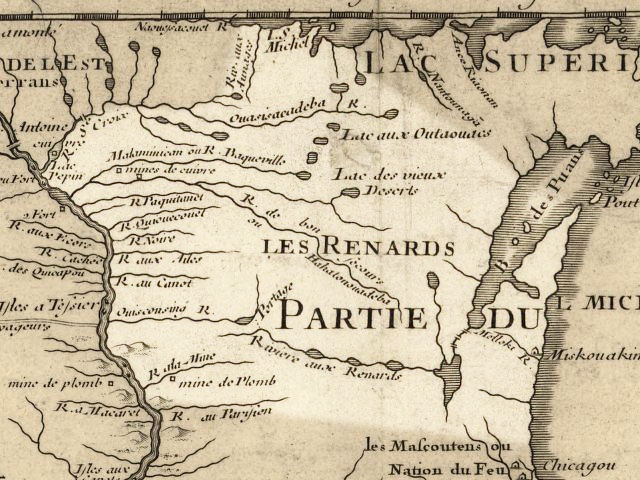
The Wisconsin River is a tributary of the Mississippi River in the U.S. state of Wisconsin. At approximately 430 miles (692 km) long, it is the state's longest river. The river's name, first recorded in 1673 by Jacques Marquette as "Meskousing", is rooted in the Algonquian languages used by the area's American Indian tribes, but its original meaning is obscure. French explorers who followed in the wake of Marquette later modified the name to "Ouisconsin", and so it appears on Guillaume de L'Isle's map (Paris, 1718). This was simplified to "Wisconsin" in the early 19th century before being applied to Wisconsin Territory and finally the state of Wisconsin. The Wisconsin River originates in the forests of the North Woods Lake District of northern Wisconsin, in Lac Vieux Desert near the border of the Upper Peninsula of Michigan. It flows south across the glacial plain of central Wisconsin, passing through Wausau, Stevens Point, and Wisconsin Rapids. In southern Wisconsi ... [...More Info...] [...Related Items...] OR: [Wikipedia] [Google] [Baidu] |
Lac Vieux Desert
Lac Vieux Desert is a lake in the United States divided between Gogebic County, Michigan, and Vilas County, Wisconsin. Fed primarily by springs in the surrounding swamps, it is the source of the Wisconsin River, which flows out of its southwest corner. The lake contains a number of small islands, especially in its northeastern lobe, including Draper Island in Michigan and Duck Island, in Wisconsin. Lac Vieux Desert has a surface elevation above sea level, and a maximum depth of about . The surface area is , of which approximately two-thirds is in Wisconsin and one third in Michigan. Located in the Lake District of northern Wisconsin, the lake is a popular boating and fishing resort. The lake was named by French fur trappers, who were some of the first Europeans in the region. They translated the name into French from the term used by the Ojibwe of the area: ''Gete-gitigaani-zaaga'igan,'' meaning "Lake of the Old Clearing", or "Old Garden." At the time of European colonization, ... [...More Info...] [...Related Items...] OR: [Wikipedia] [Google] [Baidu] |
Stevens Point, Wisconsin
Stevens Point is the county seat of Portage County, Wisconsin, United States. The city was incorporated in 1858. Its 2020 population of 25,666 makes it the largest city in the county. Stevens Point forms the core of the United States Census Bureau's Stevens Point Micropolitan Statistical Area, which had a 2020 population of 70,377 Stevens Point is home to the University of WisconsinŌĆōStevens Point and a campus of Mid-State Technical College. History Historically part of the Menominee homelands, a three-mile strip along the Wisconsin River was ceded to the United States in an 1836 treaty. In 1854 the Menominee made its last treaty with the U.S., gathering on a reservation on the Wolf River. In the Menominee language it is called ''Pas─½pahk─½hnen'' which means "It juts out as land" or "point of land". Stevens Point was named after George Stevens, who operated a grocery and supply business on the Wisconsin River during the extensive logging of interior Wisconsin. The river w ... [...More Info...] [...Related Items...] OR: [Wikipedia] [Google] [Baidu] |
Wisconsin Glaciation
The Wisconsin Glacial Episode, also called the Wisconsin glaciation, was the most recent glacial period of the North American ice sheet complex. This advance included the Cordilleran Ice Sheet, which nucleated in the northern North American Cordillera; the Innuitian ice sheet, which extended across the Canadian Arctic Archipelago; the Greenland ice sheet; and the massive Laurentide Ice Sheet, which covered the high latitudes of central and eastern North America. This advance was synchronous with global glaciation during the last glacial period, including the North American alpine glacier advance, known as the Pinedale glaciation. The Wisconsin glaciation extended from approximately 75,000 to 11,000 years ago, between the Sangamonian Stage and the current interglacial, the Holocene. The maximum ice extent occurred approximately 25,000ŌĆō21,000 years ago during the last glacial maximum, also known as the ''Late Wisconsin'' in North America. This glaciation radically altered the ... [...More Info...] [...Related Items...] OR: [Wikipedia] [Google] [Baidu] |
Merrill, Wisconsin
Merrill is a city in and the county seat of Lincoln County, Wisconsin, United States. It is located to the south of and adjacent to the Town of Merrill. The population was 9,347, according to the 2020 census. Merrill is part of the United States Census Bureau's Merrill MSA, which includes all of Lincoln County. Together with the Wausau MSA, which includes all of Marathon County, it forms the Wausau-Merrill CSA. History Merrill was first inhabited by the Chippewa Native Americans. The first European settlement there was a logging town named Jenny Bull Falls. By 1843, a trading post was constructed near the town; John Faely was the first settler. Within four years a dam, started by Andrew Warren, was constructed over the Wisconsin River. Warren then established the first mill powered by the dam, and other saw mills in the area. In 1870, T. B. Scott succeeded Warren, and the mill soon became increasingly successful. In 1899 the mill burned down. During that time the name of t ... [...More Info...] [...Related Items...] OR: [Wikipedia] [Google] [Baidu] |
Pleistocene
The Pleistocene ( , often referred to as the '' Ice age'') is the geological epoch that lasted from about 2,580,000 to 11,700 years ago, spanning the Earth's most recent period of repeated glaciations. Before a change was finally confirmed in 2009 by the International Union of Geological Sciences, the cutoff of the Pleistocene and the preceding Pliocene was regarded as being 1.806 million years Before Present (BP). Publications from earlier years may use either definition of the period. The end of the Pleistocene corresponds with the end of the last glacial period and also with the end of the Paleolithic age used in archaeology. The name is a combination of Ancient Greek grc, label=none, ŽĆ╬╗╬Ąß┐¢ŽāŽä╬┐Žé, ple─½stos, most and grc, label=none, ╬║╬▒╬╣╬ĮŽīŽé, kain├│s (latinized as ), 'new'. At the end of the preceding Pliocene, the previously isolated North and South American continents were joined by the Isthmus of Panama, causing a faunal interchange between the t ... [...More Info...] [...Related Items...] OR: [Wikipedia] [Google] [Baidu] |
Driftless Area
The Driftless Area, a topographical and cultural region in the American Midwest, comprises southwestern Wisconsin, southeastern Minnesota, northeastern Iowa, and the extreme northwestern corner of Illinois. Never covered by ice during the last ice age, the area lacks the characteristic glacial deposits known as drift. Its landscape is characterized by steep hills, forested ridges, deeply carved river valleys, and karst geology with spring-fed waterfalls and cold-water trout streams. Ecologically, the Driftless Area's flora and fauna are more closely related to those of the Great Lakes region and New England than those of the broader Midwest and central Plains regions. The steep riverine landscape of both the Driftless Area proper and the surrounding Driftless-like region are the result of early glacial advances that forced preglacial rivers that flowed into the Great Lakes southward, causing them to carve a gorge across bedrock cuestas, thereby forming the modern incised upp ... [...More Info...] [...Related Items...] OR: [Wikipedia] [Google] [Baidu] |
Lincoln County, Wisconsin
Lincoln County is a county located in the U.S. state of Wisconsin. As of the 2020 census, the population was 28,415. Its county seat is Merrill. The county was created in 1875 and named after President Abraham Lincoln. Lincoln County comprises the Merrill, WI Micropolitan Statistical Area, which is also included in the Wausau- Stevens Point- Wisconsin Rapids, WI Combined Statistical Area. Geography According to the U.S. Census Bureau, the county has a total area of , of which is land and (3.1%) is water. Adjacent counties * Oneida County - north * Langlade County - east * Marathon County - south * Taylor County - west * Price County - northwest Major highways * U.S. Highway 8 * U.S. Highway 51 * Highway 17 (Wisconsin) * Highway 64 (Wisconsin) * Highway 86 (Wisconsin) * Highway 107 (Wisconsin) Railroads * Tomahawk Railway * Watco Buses * List of intercity bus stops in Wisconsin Airports * KRRL - Merrill Municipal Airport * KTKV - Tomahawk Regional Airp ... [...More Info...] [...Related Items...] OR: [Wikipedia] [Google] [Baidu] |
Grandfather Falls
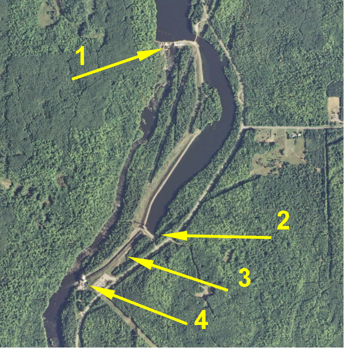
Grandfather Falls is the highest waterfall on the Wisconsin River. The total drop is 89 feet, spread out in a series of cascades over about one mile. The upper third of the falls and most of the flow, except in the spring, is diverted through a canal and a series of penstocks to feed hydroelectric generators. Grandfather Falls dam and power generating facility is owned and operated by Wisconsin Public Service Corporation. The cascade has been known historically as Grandfather Bull Falls and as Boileaux Rapids. Other phonetic variations on Boileaux such as Beauleaux and Brearbeaux are also sometimes seen in older accounts and maps. The Ojibwe name for the cascade was "Konajewun" which means "long falls". Many of the falls and rapids on the Wisconsin River had the word "Bull" inserted in the name, such as Big Bull Falls at what is now Wausau and Jenny Bull Falls at what is now Merrill. These derive from ''voyageurs'' working for John Baptiste DuBay, who ran a trading post for ... [...More Info...] [...Related Items...] OR: [Wikipedia] [Google] [Baidu] |
Western Upland
The Western Upland is a geographical region covering much of the western half of the U.S. state of Wisconsin. It stretches from southern Polk County, Wisconsin in the north to the state border with Illinois in the south, and from Rock County in the east to the Mississippi River in the west. Wisconsin's Western Upland is a rugged, hilly region deeply dissected by rivers and streams. The area is characterized by rocky outcroppings and numerous small caves, as well as sharp and frequent changes in altitude. The elevation in the region ranges from about 600 feet above sea level in the Mississippi River Valley to more than 1,700 feet above sea level at Blue Mound State Park, in Iowa County. The Mississippi, Wisconsin, Kickapoo, Black, and Chippewa rivers all carve deep gorges through the upland. Even most small creeks and streams have coulees penetrating some two to three hundred feet deeper than the surrounding land. Meanwhile, highlands like Military Ridge, the Baraboo Range, an ... [...More Info...] [...Related Items...] OR: [Wikipedia] [Google] [Baidu] |
Portage, Wisconsin
Portage is a city in and the county seat of Columbia County, Wisconsin, United States. The population was 10,581 at the 2020 census making it the largest city in Columbia County. The city is part of the Madison Metropolitan Statistical Area. Portage was named for the Fox-Wisconsin Waterway, a portage between the Fox River and the Wisconsin River, which was recognized by Jacques Marquette and Louis Joliet during their discovery of a route to the Mississippi River in 1673. The city's slogan is "Where the North Begins." History The Native American tribes that once lived here, and later the European traders and settlers, took advantage of the lowlands between the Fox and Wisconsin Rivers as a natural "portage". This is reflected in indigenous names for the town, such as the Menominee name ''Kahk─ümohnakaneh'', which means "at the short cut". In May 1673, Jacques Marquette joined the expedition of Louis Jolliet, a French-Canadian explorer, to find the Mississippi River. ... [...More Info...] [...Related Items...] OR: [Wikipedia] [Google] [Baidu] |
Madison, Wisconsin
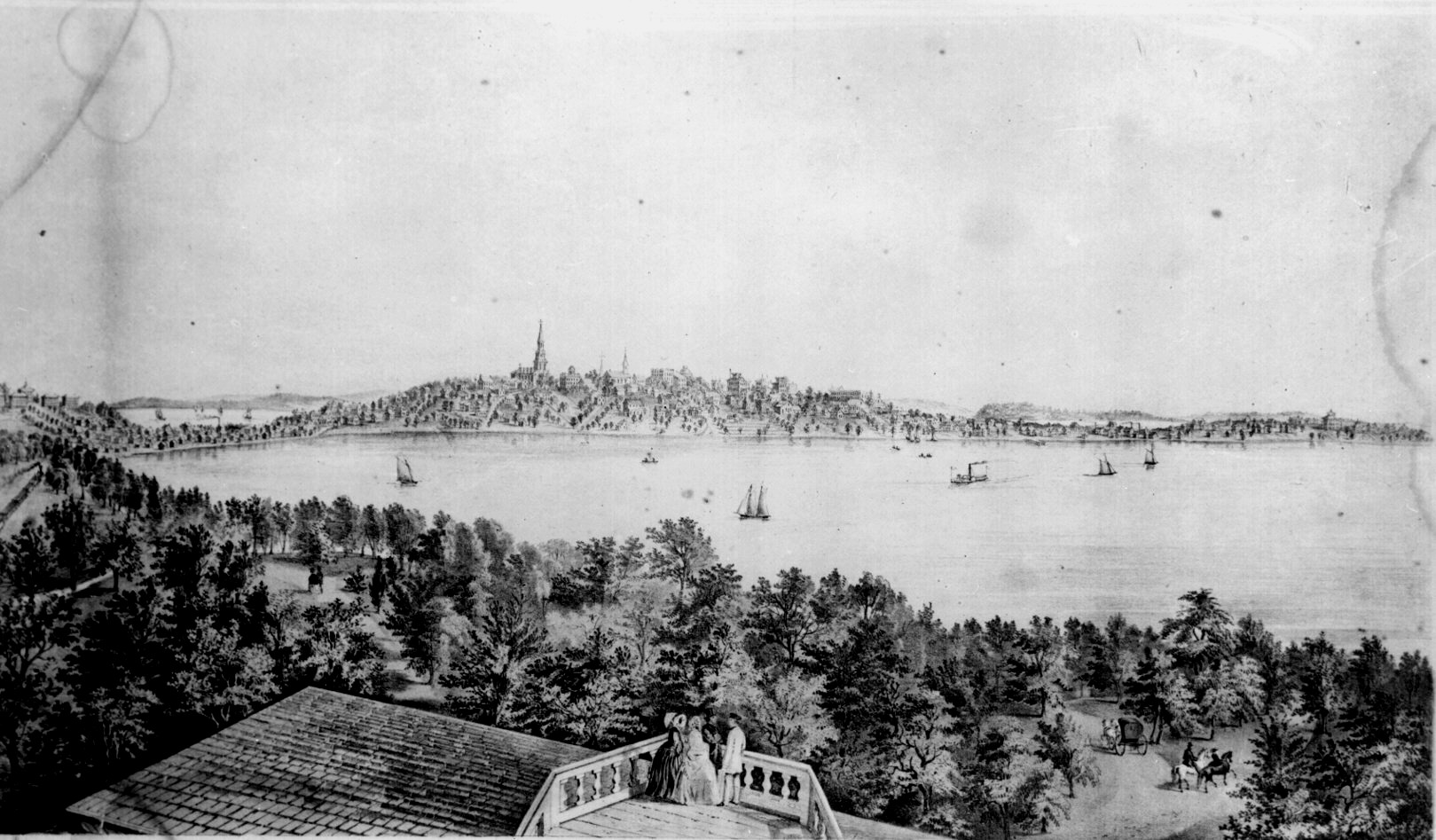
Madison is the county seat of Dane County, Wisconsin, Dane County and the capital city of the U.S. state of Wisconsin. As of the 2020 United States Census, 2020 census the population was 269,840, making it the second-largest city in Wisconsin by population, after Milwaukee, and the List of United States cities by population, 80th-largest in the U.S. The city forms the core of the Madison, Wisconsin, metropolitan statistical area, Madison Metropolitan Area which includes Dane County and neighboring Iowa County, Wisconsin, Iowa, Green County, Wisconsin, Green, and Columbia County, Wisconsin, Columbia counties for a population of 680,796. Madison is named for American Founding Fathers of the United States, Founding Father and President James Madison. The city is located on the traditional land of the Ho-Chunk, and the Madison area is known as ''Dejope'', meaning "four lakes", or ''Taychopera'', meaning "land of the four lakes", in the Ho-Chunk language. Located on an isthmus and la ... [...More Info...] [...Related Items...] OR: [Wikipedia] [Google] [Baidu] |
Dells Of The Wisconsin River
The Dells of the Wisconsin River, also called the Wisconsin Dells (from Old English Ōd├”leĆØ, modern English ŌĆ£daleŌĆØ), meaning ŌĆ£valleyŌĆØ, is a 5-mile (8-km) gorge on the Wisconsin River in south-central Wisconsin, USA. It is noted for its scenic beauty, in particular for its unique Cambrian sandstone rock formations and tributary canyons. The formations are divided into the "Upper Dells" and the "Lower Dells" by the Kilbourn Dam. The cliffs, some over 100 feet (30 m) high, and side canyons are closed to the public to protect sensitive ecological features. The viewing of the rock formations by water is a popular tourist attraction in the area. The nearby city of Wisconsin Dells is the center of summer tourist activity, much of it in the form of the theme parks unrelated to the river features. The Dells of the Wisconsin River is owned by the Wisconsin Department of Natural Resources. It was established as a State Natural Area in 1994. Description and formatio ... [...More Info...] [...Related Items...] OR: [Wikipedia] [Google] [Baidu] |


.jpg)


