|
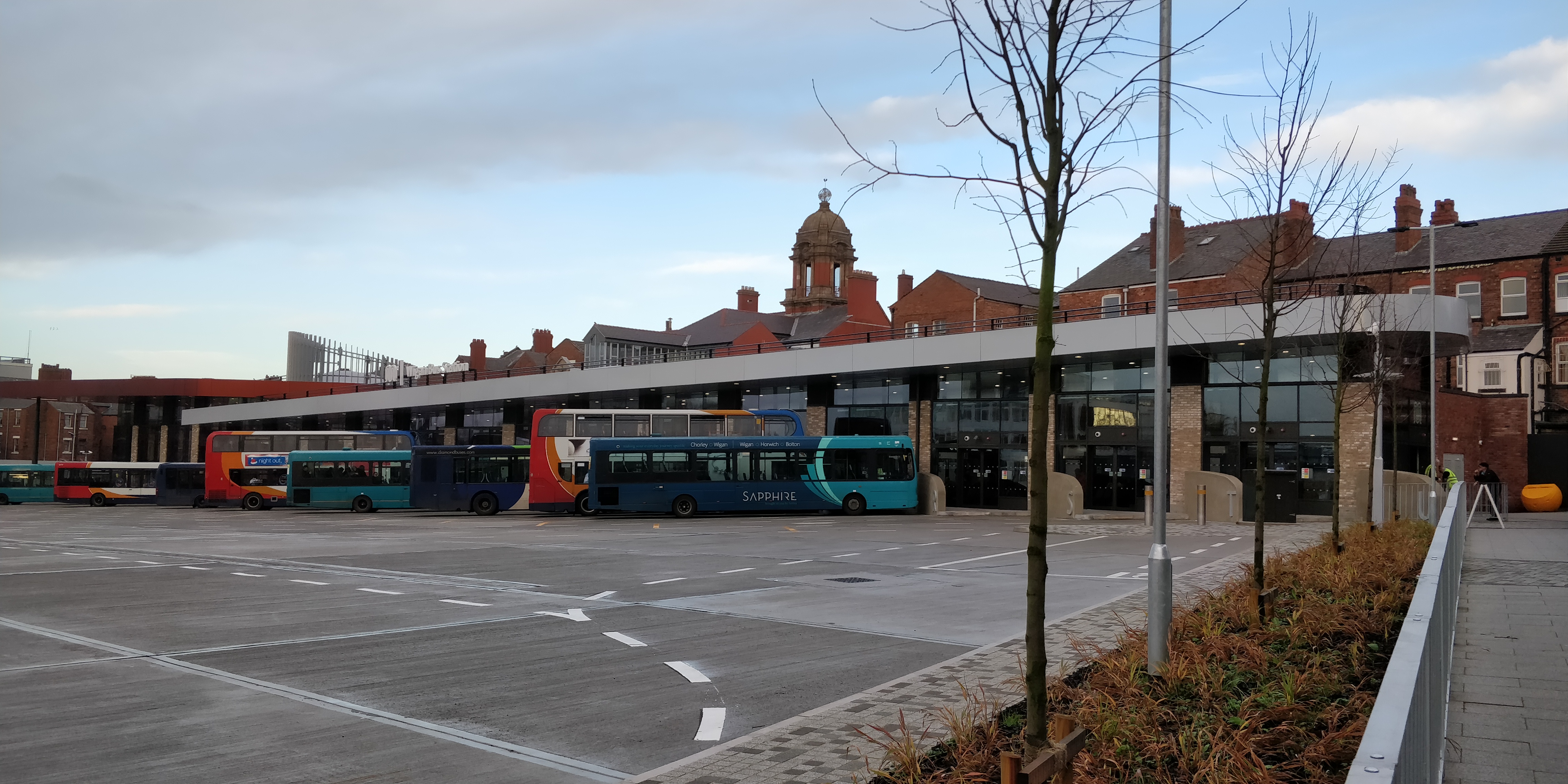
Wigan Bus Station
Wigan bus station is a bus station located in the town of Wigan, in Greater Manchester, England. It is run by Transport for Greater Manchester. Services The majority of services that serve Wigan Bus Station are run by Stagecoach Manchester, following their takeover of First Greater Manchester's Wigan depot in December 2012. Other operators that serve the bus station include Arriva North West, Preston Bus, Diamond Bus North West, and Stagecoach Merseyside & South Lancashire. There are frequent buses running to Bolton, Chorley, Ormskirk, St Helens and Skelmersdale plus several parts of the Wigan area, such as Ashton-in-Makerfield, Hindley, Shevington, Leigh, Pemberton, Golborne, Appley Bridge and Standish. Buses also run to Manchester, Preston, Southport, the Trafford Centre and Warrington. Although there are several Nightbus services, which operate to areas around the town and to Leigh, these services do not serve the bus station and depart from outside Wigan North Weste ... [...More Info...] [...Related Items...] OR: [Wikipedia] [Google] [Baidu] |
Wigan
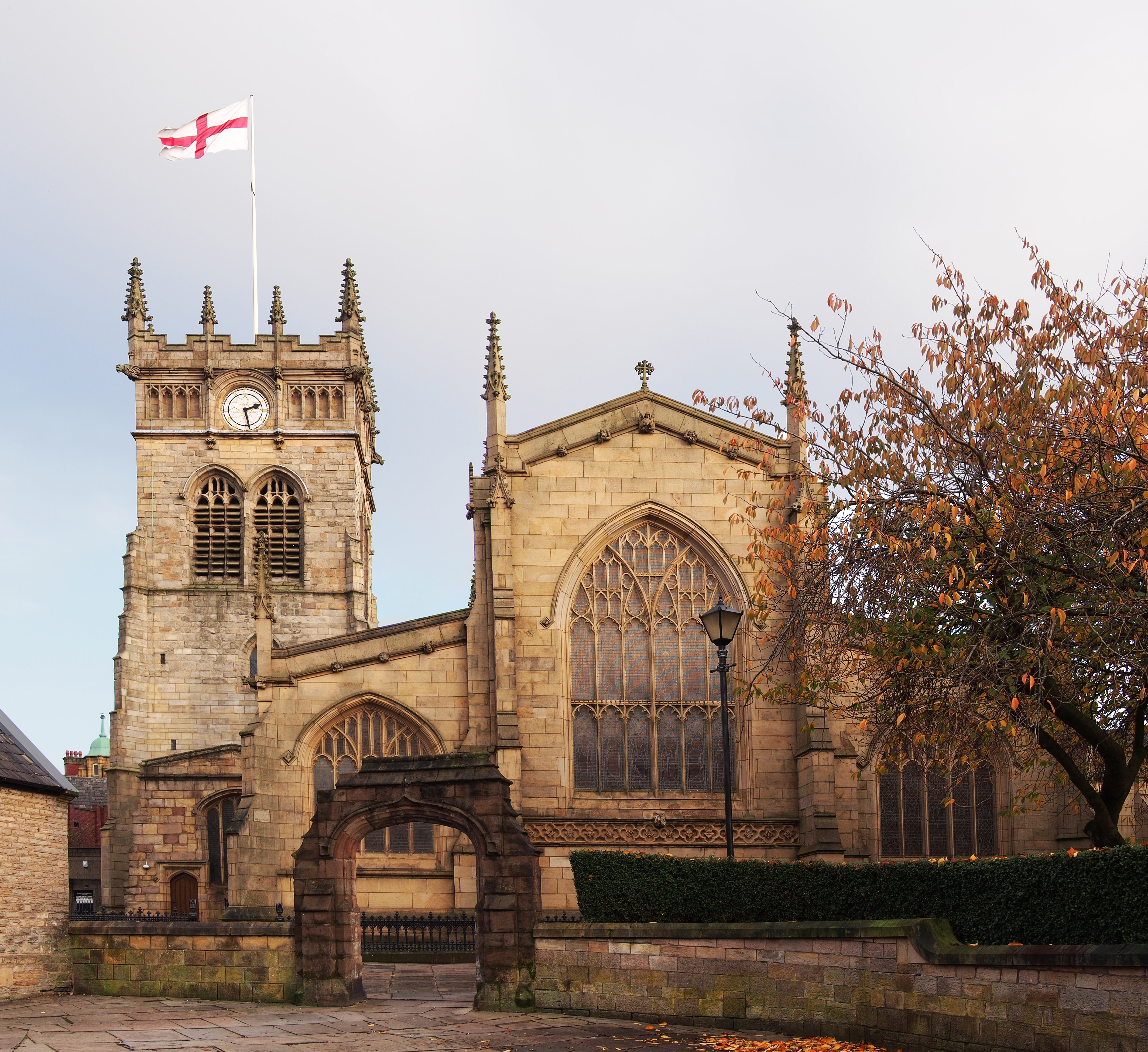
Wigan ( ) is a large town in Greater Manchester, England, on the River Douglas, Lancashire, River Douglas. The town is midway between the two cities of Manchester, to the south-east, and Liverpool, to the south-west. Bolton lies to the north-east and Warrington to the south. It is the largest settlement in the Metropolitan Borough of Wigan and is its administrative centre. The town has a population of 107,732 and the wider borough of 330,713. Wigan was formerly within the Historic counties of England, historic county of Lancashire. Wigan was in the territory of the Brigantes, an ancient Celtic tribe that ruled much of what is now northern England. The Brigantes were subjugated in the Roman conquest of Britain and the Roman settlement of ''Coccium'' was established where Wigan lies. Wigan was incorporated as a Borough status in the United Kingdom, borough in 1246, following the issue of a charter by Henry III of England, King Henry III of England. At the end of the Middle ... [...More Info...] [...Related Items...] OR: [Wikipedia] [Google] [Baidu] |
Skelmersdale
Skelmersdale is a town in Lancashire, England, on the River Tawd, west of Wigan, northeast of Liverpool and southwest of Preston. In 2006, it had a population of 38,813. The town is known locally as Skem . While the first record of the town is in the ''Domesday Book'' of 1086, much of the town, including the current town centre, was developed as a second wave new town in the 1960s. The town's initial development as a coal town coincided with the Industrial Revolution in the 19th century; the town lies on the Lancashire Coalfield. Geography Skelmersdale is situated in a small valley on the River Tawd. The town was designed to accommodate both nature and compact housing estates, and the town centre contains a large amount of forestation. The Beacon Country Park lies to the east of Skelmersdale, where the Beacon Point lies, along with a golf club. Furthermore, the Tawd Valley Park runs through the centre of the town, where improvement efforts from the council are currently o ... [...More Info...] [...Related Items...] OR: [Wikipedia] [Google] [Baidu] |
Warrington
Warrington () is a town and unparished area in the borough of the same name in the ceremonial county of Cheshire, England, on the banks of the River Mersey. It is east of Liverpool, and west of Manchester. The population in 2019 was estimated at 165,456 for the town's urban area, and just over 210,014 for the entire borough, the latter being more than double that of 1968 when it became a new town. Warrington is the largest town in the ceremonial county of Cheshire. In 2011 the unparished area had a population of 58,871. Warrington was founded by the Romans at an important crossing place on the River Mersey. A new settlement was established by the Saxon Wærings. By the Middle Ages, Warrington had emerged as a market town at the lowest bridging point of the river. A local tradition of textile and tool production dates from this time. The town of Warrington (north of the Mersey) is within the boundaries of the historic county of Lancashire and the expansion and urbanisation ... [...More Info...] [...Related Items...] OR: [Wikipedia] [Google] [Baidu] |
Trafford Centre
The Trafford Centre is a large indoor shopping centre and entertainment complex in Greater Manchester, England. It opened in 1998 and is third largest in the United Kingdom by retail space. Originally developed by the Peel Group, the Trafford Centre was sold to Capital Shopping Centres, later to become Intu, in 2011 for £1.65 billion setting a record as the costliest single property sale in British history. The battle to obtain permission to build the centre was amongst the longest and most expensive in United Kingdom planning history. the Trafford Centre had Europe's largest food court and the UK's busiest cinema. History Genesis The site was owned by the Manchester Ship Canal Company which John Whittaker's Peel Holdings had been acquiring shares in since 1971 Manchester City Council also had a stake, but by the mid 1980s Whittaker had a majority control and proposed building an out-of-town shopping centre, and other schemes. The council faced a conflict of interes ... [...More Info...] [...Related Items...] OR: [Wikipedia] [Google] [Baidu] |
Southport
Southport is a seaside town in the Metropolitan Borough of Sefton in Merseyside, England. At the 2001 census, it had a population of 90,336, making it the eleventh most populous settlement in North West England. Southport lies on the Irish Sea coast and is fringed to the north by the Ribble estuary. The town is north of Liverpool and southwest of Preston. Within the boundaries of the historic county of Lancashire, the town was founded in 1792 when William Sutton, an innkeeper from Churchtown, built a bathing house at what is now the south end of Lord Street.''North Meols and Southport – a History'', Chapter 9, Peter Aughton (1988) At that time, the area, known as South Hawes, was sparsely populated and dominated by sand dunes. At the turn of the 19th century, the area became popular with tourists due to the easy access from the nearby Leeds and Liverpool Canal. The rapid growth of Southport largely coincided with the Industrial Revolution and the Victorian er ... [...More Info...] [...Related Items...] OR: [Wikipedia] [Google] [Baidu] |
Preston, Lancashire
Preston () is a city on the north bank of the River Ribble in Lancashire, England. The city is the administrative centre of the county of Lancashire and the wider City of Preston local government district. Preston and its surrounding district obtained city status in 2002, becoming England's 50th city in the 50th year of Queen Elizabeth II's reign. Preston has a population of 114,300, the City of Preston district 132,000 and the Preston Built-up Area 313,322. The Preston Travel To Work Area, in 2011, had a population of 420,661, compared with 354,000 in the previous census. Preston and its surrounding area have provided evidence of ancient Roman activity, largely in the form of a Roman road that led to a camp at Walton-le-Dale. The Angles established Preston; its name is derived from the Old English meaning "priest's settlement" and in the ''Domesday Book'' is recorded as "Prestune". In the Middle Ages, Preston was a parish and township in the hundred of Amounderness an ... [...More Info...] [...Related Items...] OR: [Wikipedia] [Google] [Baidu] |
Manchester
Manchester () is a city in Greater Manchester, England. It had a population of 552,000 in 2021. It is bordered by the Cheshire Plain to the south, the Pennines to the north and east, and the neighbouring city of Salford to the west. The two cities and the surrounding towns form one of the United Kingdom's most populous conurbations, the Greater Manchester Built-up Area, which has a population of 2.87 million. The history of Manchester began with the civilian settlement associated with the Roman fort ('' castra'') of ''Mamucium'' or ''Mancunium'', established in about AD 79 on a sandstone bluff near the confluence of the rivers Medlock and Irwell. Historically part of Lancashire, areas of Cheshire south of the River Mersey were incorporated into Manchester in the 20th century, including Wythenshawe in 1931. Throughout the Middle Ages Manchester remained a manorial township, but began to expand "at an astonishing rate" around the turn of the 19th century. Manchest ... [...More Info...] [...Related Items...] OR: [Wikipedia] [Google] [Baidu] |
Standish, Greater Manchester
Standish is a small town in the Metropolitan Borough of Wigan, Greater Manchester, England. Within the boundaries of the historic county of Lancashire, it is on the A49 road between Chorley and Wigan, near Junction 27 of the M6 motorway. The population of the town was 13,278 in the 2011 census. Formed around a crossroads, the village has grown into a small town as urban expansion between Manchester and Liverpool extends outwards. St Wilfrid's Church is a Grade I listed parish church. History The name Standish is derived from the Old English ''stan'', meaning stone, and ''edisc'', a park or enclosure. It has been variously recorded as Stanedis in 1206, Stanediss in 1219, Standissh, Stanedich and Stanedissh in 1292 and Standisch in 1330. The adjoining village of Langtree was recorded as Langetre in 1206 and Longetre in 1330. A Roman road passed through the township. Standish and Langtree were part of the Penwortham barony in the 12th century, and between 1150 and 1164, Richa ... [...More Info...] [...Related Items...] OR: [Wikipedia] [Google] [Baidu] |
Appley Bridge
Appley Bridge is a small, affluent village crossing the borders of Greater Manchester and West Lancashire, England. It is located off Junction 27 of the M6 motorway and is nestled in the Douglas Valley alongside the Leeds and Liverpool Canal. Toponymy Appley comes from ''Apple lea'' (on the River Douglas), from (''boscus de'' "Woodland") ''Appelae'', ''Appeleie'', or ''Appeleye'', found in 13th-century Chartulary of Cockersand Abbey; also "Appley Moor"; within the township of Wrightington in the ancient parish of Eccleston. Community Once a busy industrial village with a paint and linoleum works, several quarries, and clay pits for the Wigan brick company, today the village still has several factories including a weighbridge manufacturer and a caravan factory. Today it is not as busy, with its main purpose being providing housing for the many commuters who work along the M6 corridor. Appley Bridge has two churches, (Methodist and Church of England), and is in the Dean ... [...More Info...] [...Related Items...] OR: [Wikipedia] [Google] [Baidu] |
Golborne
Golborne (pronounced or ) is a town in the Metropolitan Borough of Wigan, in Greater Manchester, England. It lies south-southeast of Wigan, northeast of Warrington and to the west of the city of Manchester. Combined with the village of Lowton, it has a population of 24,041. Within the boundaries of the Historic counties of England, historic county of Lancashire, Golborne owes most of its growth to the mining and textile industries. There was also significant agricultural activity, and many farms still belong to the families who originally owned them. History Toponymy The name Golborne derives from the Old English ''golde'' and ''burna'', and means "stream where Caltha palustris, marsh marigolds grow". The earliest settlements in the present-day town were on banks of the Millingford Brook, hence its name being derived from a water course where calendula grew. Golborne has been recorded in ancient documents as Goldeburn in 1187, Goldburc in 1201, Goseburn and Goldburn in 1212 ... [...More Info...] [...Related Items...] OR: [Wikipedia] [Google] [Baidu] |
Pemberton, Greater Manchester
Pemberton is a town and an electoral ward of the Metropolitan Borough of Wigan, in Greater Manchester, England. It lies on the southwestern bank of the River Douglas,. which separates it from the town of Wigan, and east of the M6 motorway. The area today serves as a predominantly residential suburb along with the adjoining area of Orrell and as a ward has a population of 13,638,Pemberton 2001 United Kingdom Census, neighbourhood.statistics.gov.uk. URLs accessed 11 November 2008. increasing to 13,982 at the 2011 Census. a part of |
Leigh Bus Station
Leigh is a town in the Metropolitan Borough of Wigan, Greater Manchester, England, on low-lying land northwest of Chat Moss. Within the boundaries of the historic county of Lancashire, Leigh was originally the centre of a large ecclesiastical parish covering six vills or townships. When the three townships of Pennington, Westleigh and Bedford merged in 1875, forming the Leigh Local Board District, Leigh became the official name for the town, although it had been applied to the area of Pennington and Westleigh around the parish church for many centuries. The town became an urban district in 1894 when part of Atherton was added. In 1899 Leigh became a municipal borough. The first town hall was built on King Street and replaced by the present building in 1907. Originally an agricultural area (noted for dairy farming), domestic spinning and weaving led to a considerable silk industry and, in the 20th century, the cotton industry. Leigh also exploited the underlying coal measure ... [...More Info...] [...Related Items...] OR: [Wikipedia] [Google] [Baidu] |


_-_geograph.org.uk_-_1072207.jpg)
