|
Waverbridge
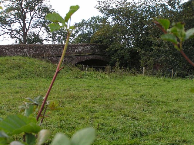
Waverbridge is a hamlet in the civil parish of Dundraw, right on the boundary with the civil parish of Waverton in Cumbria, United Kingdom. It is located approximately two-and-three-quarter miles north-west of Wigton, three-and-three-quarter miles south-east of Abbeytown, and seven-and-a-half miles north-east of Aspatria. Carlisle, Cumbria's county town, is situated fourteen-and-a-quarter miles to the north-east. The B5302 road runs through the settlement, between Silloth-on-Solway in the west and Wigton in the east. The hamlet is named for its bridge over the River Waver The River Waver is a river in Cumbria, England. The river rises at Wavergillhead (as Townthwaite Beck). It is fed by the northwards flowing Thornthwaite Beck and Pow Gill either side of Bolton Wood Lane. The "Little Waver", rising at Catlands Hi .... Historically there was a mill in Waverbridge, as well as a school, both are now used for residential purposes. References Hamlets in Cumbria Allerdale [...More Info...] [...Related Items...] OR: [Wikipedia] [Google] [Baidu] |
Waverbridge - Geograph
Waverbridge is a hamlet in the Civil parishes in England, civil parish of Dundraw, right on the boundary with the civil parish of Waverton, Cumbria, Waverton in Cumbria, United Kingdom. It is located approximately two-and-three-quarter miles north-west of Wigton, three-and-three-quarter miles south-east of Abbeytown, and seven-and-a-half miles north-east of Aspatria. Carlisle, Cumbria, Carlisle, Cumbria's county town, is situated fourteen-and-a-quarter miles to the north-east. The B5302 road runs through the settlement, between Silloth-on-Solway in the west and Wigton in the east. The hamlet is named for its bridge over the River Waver. Historically there was a mill in Waverbridge, as well as a school, both are now used for residential purposes. References Hamlets in Cumbria Allerdale {{Cumbria-geo-stub ... [...More Info...] [...Related Items...] OR: [Wikipedia] [Google] [Baidu] |
B5302 Road
The B5302 is a B roads in Great Britain, B road which runs for approximately twelve-and-a-quarter miles between the towns of Silloth-on-Solway and Wigton in Cumbria, United Kingdom. From west to east, it passes through the villages of Causewayhead, Calvo, Cumbria, Calvo, Abbeytown, Wheyrigg, and Waverbridge, and also passes near to Blackdyke and Blencogo. At its eastern end, it comes very close to the Solway Coast Area of Outstanding Natural Beauty, and passes by Silloth Airfield, left over from the Second World War. Several of the villages that the road passes through were formerly served by trains on the single-track Carlisle and Silloth Bay Railway, which closed with the Beeching axe in the 1960s. It is the main road connecting Silloth-on-Solway and surrounding settlements with the A596 road, A596, and by extension, the city of Carlisle, Cumbria, Carlisle. The route Silloth-on-Solway to Calvo The B5302's western terminus is in the coastal town of Silloth-on-Solway, at the junc ... [...More Info...] [...Related Items...] OR: [Wikipedia] [Google] [Baidu] |
Dundraw
Dundraw is a hamlet and a civil parish near Abbeytown, in the Allerdale borough of Cumbria, United Kingdom. It is in the North West of England and Cumbria County Council, based in Carlisle, is the local county council. The hamlet is approximately three-and-a-half miles east of Abbeytown, nine-and-a-quarter miles south-east of Silloth-on-Solway, three-and-a-quarter miles north-west of Wigton, and fourteen miles south-west of Carlisle. Etymology The first part of the name is Brittonic ''drum-'', which in etymological terms means "a ridge" (Welsh ''drum''). The second element is ''*draɣïn'', meaning "thorns" (Welsh ''draen''). Alternatively, the name may be derived from Gaelic equivalents of the aforementioned words. The loss of the final syllable is attributed to Old Norse speakers substituting the first element, which Middle English speakers 'translated' as ''dræġ'', meaning "a drag, a steep slope", omitting ''*–ïn'' as this was taken to be the Scandinavian suffixed definit ... [...More Info...] [...Related Items...] OR: [Wikipedia] [Google] [Baidu] |
River Waver
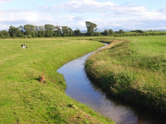
The River Waver is a river in Cumbria, England. The river rises at Wavergillhead (as Townthwaite Beck). It is fed by the northwards flowing Thornthwaite Beck and Pow Gill either side of Bolton Wood Lane. The "Little Waver", rising at Catlands Hill, joins at Waterside near Woodrow. The river then takes a northward course via Waverton and Waverbridge, both of which are named for the river, before turning sharply westward at Abbeytown. The river then goes north, running into Moricambe Bay, an inlet of the Solway Firth The Solway Firth ( gd, Tràchd Romhra) is a firth that forms part of the border between England and Scotland, between Cumbria (including the Solway Plain) and Dumfries and Galloway. It stretches from St Bees Head, just south of Whitehaven .... Waver, River {{England-river-stub ... [...More Info...] [...Related Items...] OR: [Wikipedia] [Google] [Baidu] |
Workington (UK Parliament Constituency)
Workington is a Constituencies of the Parliament of the United Kingdom, constituency in Cumbria represented in the House of Commons of the United Kingdom, House of Commons of the Parliament of the United Kingdom, UK Parliament since 2019 United Kingdom general election, 2019 by Mark Jenkinson, a Conservative Party (UK), Conservative. Boundaries The constituency covers much of the north-west of Cumbria, corresponding largely to the Allerdale borough, except for the areas around Wigton and Keswick, Cumbria, Keswick. As well as Workington itself, the constituency contains the towns of Cockermouth, Maryport, Aspatria and Silloth. Boundary review 1918–1950: The Municipal Borough of Workington, the Urban Districts of Arlecdon and Frizington, Aspatria, Harrington, and Maryport, and parts of the Rural Districts of Cockermouth, Whitehaven, and Wigton. 1950–1983: The Municipal Borough of Workington, the Urban Districts of Cockermouth, Keswick, and Maryport, and the Rural District of ... [...More Info...] [...Related Items...] OR: [Wikipedia] [Google] [Baidu] |
Allerdale
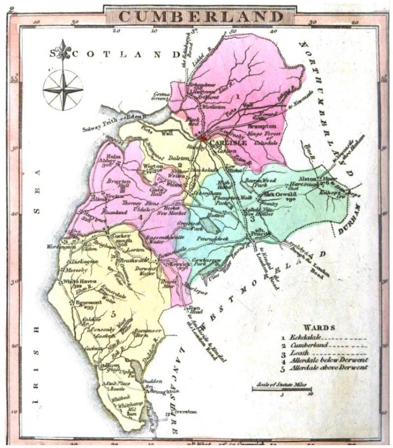
Allerdale is a non-metropolitan district of Cumbria, England, with borough status. Its council is based in Workington and the borough has a population of 93,492 according to the 2001 census, increasing to 96,422 at the 2011 Census. The Borough of Allerdale was formed under the Local Government Act 1972, on 1 April 1974 by the merger of the municipal borough of Workington, the urban districts of Maryport, Cockermouth and Keswick; and the rural districts of Cockermouth and Wigton, all of which were within the administrative county of Cumberland. In 1995 Allerdale was granted borough status. The name derives from the ancient region of Allerdale, represented latterly by the two wards of Cumberland, called Allerdale-above-Derwent and Allerdale-below-Derwent, the present borough corresponding largely to the latter with parts of the former. Much of the area during the medieval period was a royal forest subject to forest law. In July 2021 the Ministry of Housing, Communities an ... [...More Info...] [...Related Items...] OR: [Wikipedia] [Google] [Baidu] |
Cumbria
Cumbria ( ) is a ceremonial and non-metropolitan county in North West England, bordering Scotland. The county and Cumbria County Council, its local government, came into existence in 1974 after the passage of the Local Government Act 1972. Cumbria's county town is Carlisle, in the north of the county. Other major settlements include Barrow-in-Furness, Kendal, Whitehaven and Workington. The administrative county of Cumbria consists of six districts ( Allerdale, Barrow-in-Furness, Carlisle, Copeland, Eden and South Lakeland) and, in 2019, had a population of 500,012. Cumbria is one of the most sparsely populated counties in England, with 73.4 people per km2 (190/sq mi). On 1 April 2023, the administrative county of Cumbria will be abolished and replaced with two new unitary authorities: Westmorland and Furness (Barrow-in-Furness, Eden, South Lakeland) and Cumberland ( Allerdale, Carlisle, Copeland). Cumbria is the third largest ceremonial county in England by area. It i ... [...More Info...] [...Related Items...] OR: [Wikipedia] [Google] [Baidu] |
Civil Parishes In England
In England, a civil parish is a type of Parish (administrative division), administrative parish used for Local government in England, local government. It is a territorial designation which is the lowest tier of local government below districts of England, districts and metropolitan and non-metropolitan counties of England, counties, or their combined form, the Unitary authorities of England, unitary authority. Civil parishes can trace their origin to the ancient system of Parish (Church of England), ecclesiastical parishes, which historically played a role in both secular and religious administration. Civil and religious parishes were formally differentiated in the 19th century and are now entirely separate. Civil parishes in their modern form came into being through the Local Government Act 1894, which established elected Parish councils in England, parish councils to take on the secular functions of the vestry, parish vestry. A civil parish can range in size from a sparsely ... [...More Info...] [...Related Items...] OR: [Wikipedia] [Google] [Baidu] |
Waverton, Cumbria
Waverton is a linear village and civil parish in the Allerdale borough of Cumbria, England. Waverton lies on the main A596 road east of a bridge over the River Waver, 2.2 miles south west from Wigton and 14.2 miles from the nearest city, Carlisle. The river is the reason for Waverton's name as well as it coming from the old English word tuǹ, this meaning "An enclosure; a farmstead; a village; an estate". Population There were no major changes in the population of Waverton in the nineteenth century, when population first began to be collected in the Census. The population was slowly increasing each year, but only by a maximum of 30 people a year up till 1871. After 1871 the Census records show that there was a decrease in the population. This fluctuation was repeated as from 1910 there was a sharp increase, however this was followed by another population depletion just after the 1920. The population of Waverton began steadily increasing even through World War II and the contin ... [...More Info...] [...Related Items...] OR: [Wikipedia] [Google] [Baidu] |
Wigton
Wigton is a market town in the Allerdale borough of Cumbria, England. Historically in Cumberland, it lies just outside the Lake District in the borough of Allerdale. Wigton is at the centre of the Solway Plain, between the Caldbeck Fells and the Solway coast. It is served by Wigton railway station on the Cumbrian Coast Line, and the A596 road to Workington. The town of Silloth-on-Solway lies to the west, beyond Abbeytown. Etymology Wigton is "Wicga's tūn". "Wicga" is an Old English pre-7th-century personal name meaning "a beetle" (as in "earwig"), while "tūn" is Old English for a demarcated plot, a "homestead" or "village", so Wigton is "the hamlet belonging to Wicga". History On the River Wampool and Wiza Beck ( beck being a dialect word meaning "brook" or "stream" – from the Old Norse ''bekkr''), the market town of Wigton is an ancient settlement and evolved from a pre-medieval street plan, which can still be traced today. The Romans had a cavalry station, Maglo ... [...More Info...] [...Related Items...] OR: [Wikipedia] [Google] [Baidu] |
Abbeytown
Abbeytown, also known as Holme Abbey, is a village and civil parish in the Allerdale borough of Cumbria, England. The name Abbeytown dates to the mid-17th century (''The Towne of the Abbey'', ''Abbey Towne''; ''Abbeytown'' from mid-18th century) and is named after the Holmcultram Abbey founded in the 12th century. The population of the civil parish as of the 2011 census was 819. It is located five-and-a-half miles south-east of Silloth, and six-and-a-half miles north-west of Wigton. The civil parish borders Holme Low to the north, Holme East Waver and Dundraw to the east, Bromfield to the south, and Holme St Cuthbert to the west. The county town of Carlisle is eighteen miles to the north-east. Other nearby settlements include Foulsyke, Highlaws, Kelsick, Mawbray, Pelutho, and Wheyrigg. The B5302 road runs through the village. Historically a part of Cumberland, Abbeytown was built around the former Cistercian Holmcultram Abbey, the nave of the church of which now serves th ... [...More Info...] [...Related Items...] OR: [Wikipedia] [Google] [Baidu] |
Aspatria
Aspatria is a town and civil parish in the non-metropolitan district of Allerdale, and is currently embraced in the Parliamentary constituency of Workington, Cumbria, England. Historically within Cumberland the town rests on the north side of the Ellen Valley, overlooking a panoramic view of the countryside, with Skiddaw to the South and the Solway Firth to the North. Its developments are aligned approximately east-west along the A596 Carlisle to Workington road and these extend to approximately 2 miles (3 km) in length. It lies about 8 miles (12 km) northeast of Maryport, a similar distance to the Southwest of Wigton, about 9 miles (14 km) north of Cockermouth and 5 miles (8 km) from the coast and Allonby. It comprises the townships of Aspatria and Brayton, Hayton and Mealo, and Oughterside and Allerby, the united area being ; while the township takes up an area of . In earlier days a Roman road leading from "Old Carlisle" to Ellenborough passed through the ... [...More Info...] [...Related Items...] OR: [Wikipedia] [Google] [Baidu] |


