|
Water Supply And Sanitation In Senegal
Water supply and sanitation in Senegal is characterized by a relatively high level of access compared to the average of Sub-Saharan Africa. One of the interesting features is a public-private partnership (PPP) that has been operating in Senegal since 1996, with Senegalaise des Eaux (SDE), a subsidiary of Saur International, as the private partner. It does not own the water system but manages it on a 10-year lease contract with the Senegalese government. Between 1996 and 2014, water sales doubled to 131 million cubic meters per year and the number of household connections increased by 165% to more than 638,000. According to the World Bank, "the Senegal case is regarded as a model of public-private partnership in sub-Saharan Africa". [...More Info...] [...Related Items...] OR: [Wikipedia] [Google] [Baidu] |
Senegal
Senegal,; Wolof: ''Senegaal''; Pulaar: 𞤅𞤫𞤲𞤫𞤺𞤢𞥄𞤤𞤭 (Senegaali); Arabic: السنغال ''As-Sinighal'') officially the Republic of Senegal,; Wolof: ''Réewum Senegaal''; Pulaar : 𞤈𞤫𞤲𞤣𞤢𞥄𞤲𞤣𞤭 𞤅𞤫𞤲𞤫𞤺𞤢𞥄𞤤𞤭 (Renndaandi Senegaali); Arabic: جمهورية السنغال ''Jumhuriat As-Sinighal'') is a country in West Africa, on the Atlantic Ocean coastline. Senegal is bordered by Mauritania to the north, Mali to the east, Guinea to the southeast and Guinea-Bissau to the southwest. Senegal nearly surrounds the Gambia, a country occupying a narrow sliver of land along the banks of the Gambia River, which separates Senegal's southern region of Casamance from the rest of the country. Senegal also shares a maritime border with Cape Verde. Senegal's economic and political capital is Dakar. Senegal is notably the westernmost country in the mainland of the Old World, or Afro-Eurasia. It owes its name to the ... [...More Info...] [...Related Items...] OR: [Wikipedia] [Google] [Baidu] |
Tropical Climate
Tropical climate is the first of the five major climate groups in the Köppen climate classification identified with the letter A. Tropical climates are defined by a monthly average temperature of 18 °C (64.4 °F) or higher in the coolest month, and feature hot temperatures all year-round. Annual precipitation is often abundant in tropical climates, and shows a seasonal rhythm but may have seasonal dryness to varying degrees. There are normally only two seasons in tropical climates, a wet (rainy / monsoon) season and a dry season. The annual temperature range in tropical climates is normally very small. Sunlight is intense in these climates. There are three basic types of tropical climates within the tropical climate group: tropical rainforest climate (Af), tropical monsoon climate (Am) and tropical wet and dry climate or tropical savannah (Aw for dry winters, and As for dry summers), which are classified and distinguished by the precipitation and the precipitation lev ... [...More Info...] [...Related Items...] OR: [Wikipedia] [Google] [Baidu] |
Overdrafting
Overdrafting is the process of extracting groundwater beyond the equilibrium yield of an aquifer. Groundwater is one of the largest sources of fresh water and is found underground. Groundwater depletion is comparable to a bank account in which more money is withdrawn than deposited. The primary cause of groundwater depletion is the excessive pumping of groundwater up from underground aquifers. There are two sets of yields: safe yield and sustainable yield. Safe yield is the amount of groundwater that can be withdrawn over a period of time without exceeding the long-term recharge rate or affecting the aquifer integrity. Sustainable yield is the amount of water extraction that can be sustained indefinitely without negative hydrological impacts, taking into account both recharge rate and surface water impacts. There are two types of aquifers: confined and unconfined. In confined aquifers, there is an overbearing layer called aquitard, which contains impermeable materials through wh ... [...More Info...] [...Related Items...] OR: [Wikipedia] [Google] [Baidu] |
Overexploitation
Overexploitation, also called overharvesting, refers to harvesting a renewable resource to the point of diminishing returns. Continued overexploitation can lead to the destruction of the resource, as it will be unable to replenish. The term applies to natural resources such as water aquifers, grazing pastures and forests, wild medicinal plants, fish stocks and other wildlife. In ecology, overexploitation describes one of the five main activities threatening global biodiversity. Ecologists use the term to describe populations that are harvested at an unsustainable rate, given their natural rates of mortality and capacities for reproduction. This can result in extinction at the population level and even extinction of whole species. In conservation biology, the term is usually used in the context of human economic activity that involves the taking of biological resources, or organisms, in larger numbers than their populations can withstand. The term is also used and defined some ... [...More Info...] [...Related Items...] OR: [Wikipedia] [Google] [Baidu] |
Kaolack
Kaolack ( ar, كاولاك; wo, Kawlax) is a town of 172,305 people (2002 census) on the north bank of the Saloum River and the N1 road in Senegal. It is the capital of the Kaolack Region, which borders The Gambia to the south. Kaolack is an important regional market town and is Senegal's main peanut trading and processing center. As the center of the Ibrahimiyya branch of the Tijaniyyah Sufi order founded by Ibrayima Ñas, it is also a major center of Islamic education. The Leona Niassene mosque (right) in Kaolack is one of the largest and best known in Senegal. History Kaolack is situated on the Saloum River about from its mouth. It is the successor city to Kahone, historic capital of the kingdom of Saloum. Kahone, originally a place marked by a sacred tree on the right bank of the Saloum River facing the island of Kouyong, became capital of the mostly Serer kingdom of Saloum in the early 16th century. In the 17th and 18th centuries it consisted of a number of distinc ... [...More Info...] [...Related Items...] OR: [Wikipedia] [Google] [Baidu] |
Casamance
, settlement_type = Geographical region , image_skyline = Senegal Casamance.png , image_caption = Casamance in Senegal , image_flag = Flag of Casamance.svg , image_shield = , motto = , nickname = , etymology = , subdivision_type = Country , subdivision_name = Senegal , subdivision_type1 = , subdivision_name1 = , subdivision_type2 = , subdivision_name2 = , subdivision_type3 = , subdivision_name3 = , subdivision_type4 = , subdivision_name4 = , parts_type = Parts , parts_style = para , p1 = Kolda Region, Sédhiou Region and Ziguinchor Region , image_map = , map_caption = , pushpin_map = , pushpin_relief = , pushpin_map_caption = , coordinates = , coordinates_footnotes ... [...More Info...] [...Related Items...] OR: [Wikipedia] [Google] [Baidu] |
Aquifer
An aquifer is an underground layer of water-bearing, permeable rock, rock fractures, or unconsolidated materials (gravel, sand, or silt). Groundwater from aquifers can be extracted using a water well. Aquifers vary greatly in their characteristics. The study of water flow in aquifers and the characterization of aquifers is called hydrogeology. Related terms include aquitard, which is a bed of low permeability along an aquifer, and aquiclude (or ''aquifuge''), which is a solid, impermeable area underlying or overlying an aquifer, the pressure of which could create a confined aquifer. The classification of aquifers is as follows: Saturated versus unsaturated; aquifers versus aquitards; confined versus unconfined; isotropic versus anisotropic; porous, karst, or fractured; transboundary aquifer. Challenges for using groundwater include: overdrafting (extracting groundwater beyond the Dynamic equilibrium, equilibrium yield of the aquifer), groundwater-related subsidence of land, gro ... [...More Info...] [...Related Items...] OR: [Wikipedia] [Google] [Baidu] |
Thiès
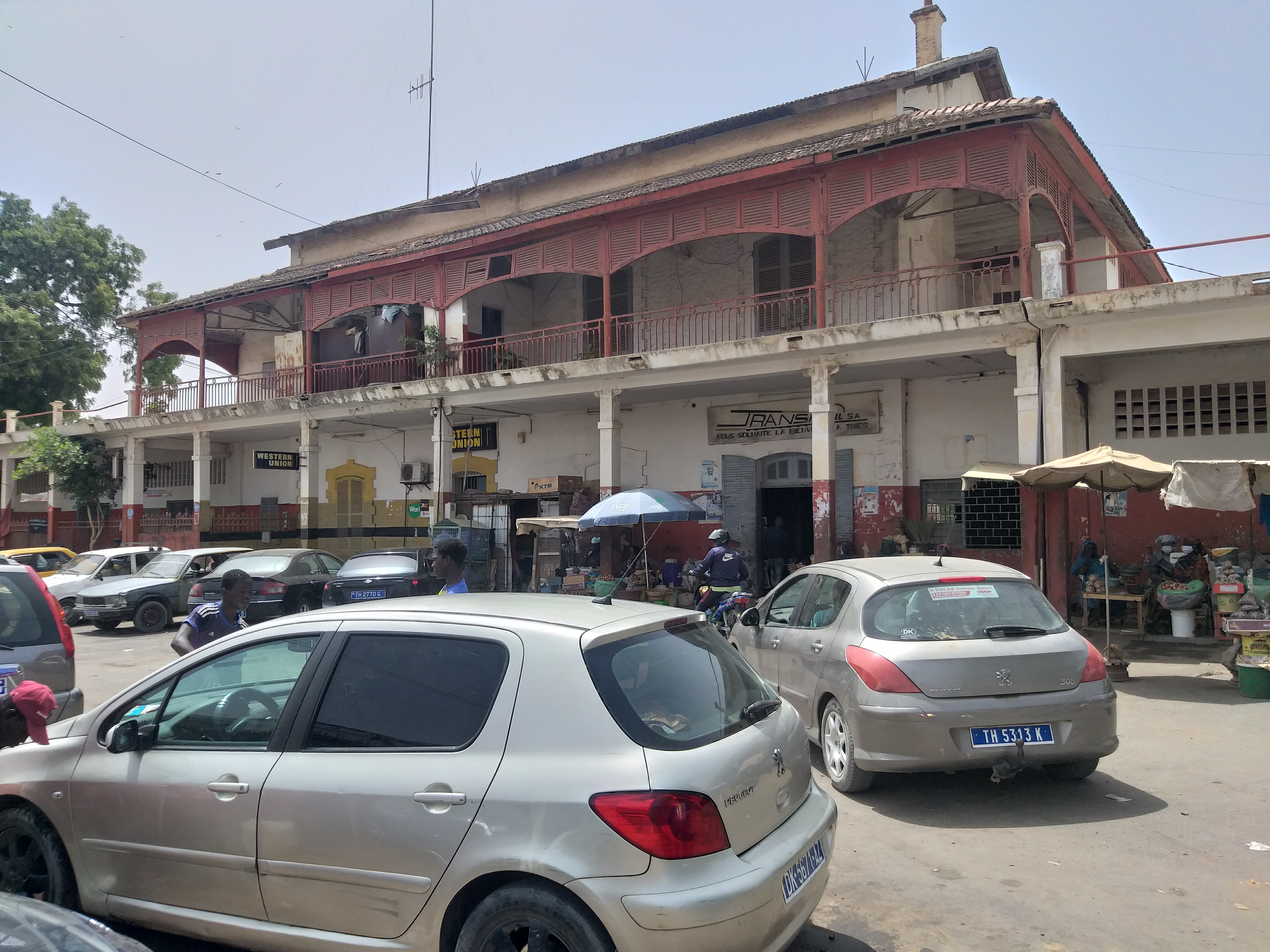
Thiès (; ar, ثيس, Ṯyass; Noon: ''Chess'') is the third largest city in Senegal with a population officially estimated at 320,000 in 2005. It lies east of Dakar on the N2 road and at the junction of railway lines to Dakar, Bamako and St-Louis. It is the capital of Thiès Region and is a major industrial city. History Before colonization, the Thiès Plateau was a wooded frontier between the kingdoms of Cayor and Baol inhabited by the Serer-Noon, an ethnic sub-group of the Serer people. The Serer-Noon still inhabit the Thiès-Nones neighborhood of the south-west city today. They speak the Noon language, one of the Cangin languages. The village of Dianxene, belonging to the kingdom of Cayor, was founded on the strategically important plateau in the 17th century. In 1860, it had only 75 inhabitants. The French founded a military post there in 1864, becoming an important force in the city's development ever since. The Spiritans founded a mission there in the late 19th cen ... [...More Info...] [...Related Items...] OR: [Wikipedia] [Google] [Baidu] |
Falémé River
The Falémé River is a river in West Africa. The Falémé arises in northern Guinea and flows in a north-northeast direction to Mali, forming a short portion of the border between Guinea and Senegal. It turns north and then forms a portion of the border between Mali and Senegal, before joining the Sénégal River 50 km upstream of the town of Bakel in Senegal. Description The Falémé River is around 650 km in length and drains a basin of 28,900 km2. Its source is in the northern part of the Fouta Djallon highlands at an altitude of 800 m. Most of the rainfall on the highlands occurs between May and October as a result of the West African Monsoon. August is normally the wettest month. The flow of the river is highly seasonal with the maximum occurring during September and very little flow between December and June. The average annual discharge of the river over the period 1904-1984 was 6.59 km3. Mining There are iron ore deposits in Senegal near th ... [...More Info...] [...Related Items...] OR: [Wikipedia] [Google] [Baidu] |
Geba River
The Geba is a river of West Africa that rises in the northernmost area of Guinea in the Fouta Djallon highlands, passes through southern Senegal, and reaches the Atlantic Ocean in Guinea-Bissau. It is about in total length. In Senegal, the river is locally known as the Kayanga. Its tributary the Colufe River joins the Geba at Bafatá. After passing by Geba town and Bambadinca, the river broadens into a wide estuary below Xime (where it is joined by the Corubal River), with a total width of about at Bissau. The estuary widens further as the river flows into the Atlantic, forming the Bissagos Islands archipelago. The Geba River, along with the Corubal River, drains the Bafatá Plateau. It also drains the Gabú Plain, along with the Farim River The Cacheu is a river of Guinea-Bissau also known as the Farim along its upper course. Its total length is about 257 km. One of its major tributaries is the Canjambari River. Course Its headwaters are near the northern border ... [...More Info...] [...Related Items...] OR: [Wikipedia] [Google] [Baidu] |
Saloum River
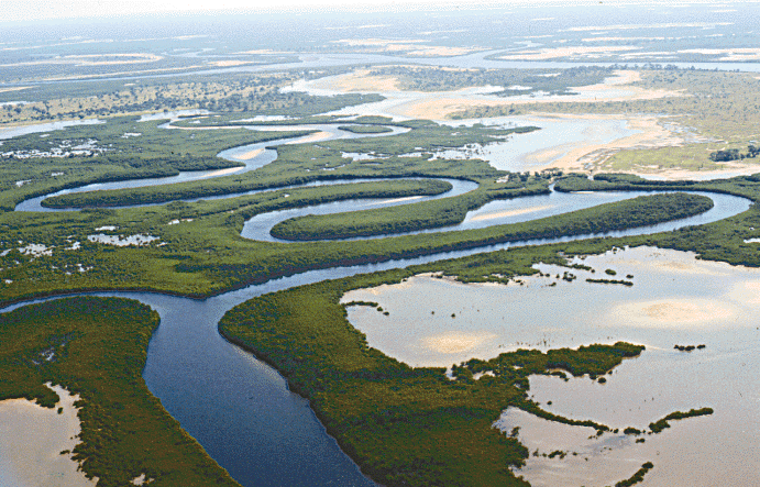
The Saloum River rises about 105 kilometers east of Kaolack, Senegal, and flows into the Atlantic Ocean. The significant Saloum Delta is located at its mouth, which is protected as Saloum Delta National Park. The river basin lies within the Serer people, Serer pre-colonial Saloum, Kingdom of Saloum. Mangrove forests occupy a 5-kilometer belt on either side of the river almost 70 kilometers upstream. See also *Sine River *Sine-Saloum *Kingdom of Saloum References A Directory of African Wetlands Robert Mepham, R. H. Hughes, G. M. Bernacsek, International Union for Conservation of Nature and Natural Resources, United Nations Environment Programme, World Conservation Monitoring Centre, 1992. Rivers of Senegal Serer country {{Senegal-river-stub ... [...More Info...] [...Related Items...] OR: [Wikipedia] [Google] [Baidu] |


