|
Wassenaar
Wassenaar (; population: in ) is a municipality and town located in the province of South Holland, on the western coast of the Netherlands. An affluent suburb of The Hague, Wassenaar lies north of that city on the N44/A44 highway near the North Sea coast. It is part of the Haaglanden region and the Rotterdam–The Hague metropolitan area. The municipality covers an area of , of which is covered by water. Wassenaar is home to some of the Netherlands' richest residential neighborhoods as well as the country's most expensive street, the ''Groot Haesebroekseweg''. History There are rumours that the 12th-century Romanesque church in Wassenaar lies on the spot where the Northumbrian missionary Willibrord once landed in the Netherlands; the high dunes to the west were not formed until later. Wassenaar long remained an unremarkable little town, known only as the home of the House of Wassenaer. It only began to gain notoriety in the 19th century when Louis Bonaparte ordered the co ... [...More Info...] [...Related Items...] OR: [Wikipedia] [Google] [Baidu] |
Huize Ivicke
Huize Ivicke is a monumental building in Wassenaar, the Netherlands. Constructed in 1913 for A. F. J. van Hattum, it is a replica of the Eremitageslottet hunting lodge in the Jaegersborg Dyrehave in Denmark. It was inhabited until the mid-1980s, when it became offices. Since 2000, it has been owned by speculator Ronnie van de Putte, known as the "Slum King of the Netherlands" (Krottenkoning van Nederland). He refuses to renovate the building, despite its monumental status. Heritage groups warned the local municipality in the late 2010s that the villa was severely dilapidated and it was placed on a list of the fourteen most threatened monuments in Europe. It is currently the subject of an intense dispute over emergency renovations and was squatted in 2018, by people wanting to carry out essential repairs. The house, the formal garden, the gate and the playhouse are all national monuments. History Huize Ivicke stands at Rust en Vreugdlaan 2, adjacent to the Rijksstraatweg (N44) ... [...More Info...] [...Related Items...] OR: [Wikipedia] [Google] [Baidu] |
Prince Frederik Of The Netherlands
Prince Frederick of the Netherlands, Prince of Orange-Nassau (full names: Willem Frederik Karel; 28 February 1797, in Berlin – 8 September 1881, in Wassenaar), was the second son of William I of the Netherlands and his wife, Wilhelmine of Prussia (1774–1837), Wilhelmine of Prussia. Early life The prince grew up at the court of his grandfather Frederick William II of Prussia and uncle Frederick William III of Prussia. One of his tutors was Carl von Clausewitz. Aged 16, the prince fought in the Battle of Leipzig. The prince first entered the Netherlands in December 1813. As he spoke no Dutch, the prince was sent to Leiden University to get a further education. He was also educated by Karl Ludwig von Phull in The Hague. When Napoleon I of France, Napoleon returned from Elba, during the Hundred Days the prince was given command of a detachment of Arthur Wellesley, 1st Duke of Wellington, Wellington's army which was posted in a fall back position near Braine-le-Comte should the b ... [...More Info...] [...Related Items...] OR: [Wikipedia] [Google] [Baidu] |
House Of Wassenaer
Van Wassenaer is the name of an old Dutch noble family. It was first mentioned in the county of Holland on November 3, 1200. They are one of the few original noble families from Holland that has survived to this day. Members of the family carry the title of count or baron. Origin of the name The family was already noble from earliest times ("Uradel"). According to family legend, the name may be taken from the crescent (''wassende'') moon on the family coat of arms, borrowed from an Arabian banner that a member of the van Wassenaer family obtained while on a crusade. According to some family archives, Wassenaar means Wasser Herren, Sea Lords/Kings, which had been a traditional title that the invading Romans (under Caligula) had recognized while destituting the kings of Batavia. History of the family The founding father of the Wassenaer family was Philip, who lived in the early 13th century, and owned lands in Wassenaar. He was a vassal of William I, Count of Holland who took par ... [...More Info...] [...Related Items...] OR: [Wikipedia] [Google] [Baidu] |
Leiden
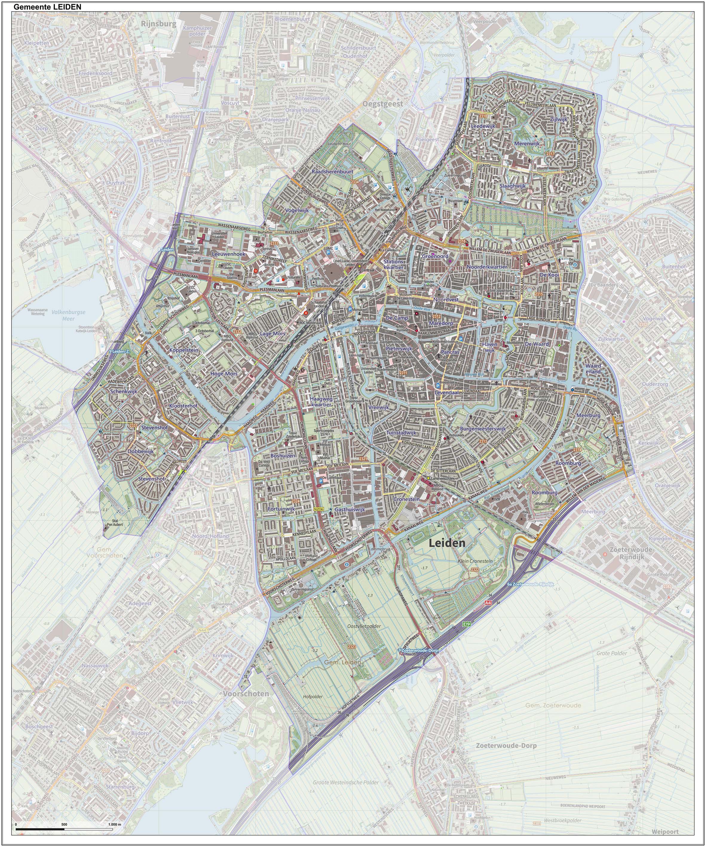
Leiden (; in English and archaic Dutch also Leyden) is a city and municipality in the province of South Holland, Netherlands. The municipality of Leiden has a population of 119,713, but the city forms one densely connected agglomeration with its suburbs Oegstgeest, Leiderdorp, Voorschoten and Zoeterwoude with 206,647 inhabitants. The Netherlands Central Bureau of Statistics (CBS) further includes Katwijk in the agglomeration which makes the total population of the Leiden urban agglomeration 270,879, and in the larger Leiden urban area also Teylingen, Noordwijk, and Noordwijkerhout are included with in total 348,868 inhabitants. Leiden is located on the Oude Rijn, at a distance of some from The Hague to its south and some from Amsterdam to its north. The recreational area of the Kaag Lakes (Kagerplassen) lies just to the northeast of Leiden. A university city since 1575, Leiden has been one of Europe's most prominent scientific centres for more than four centuries. Leide ... [...More Info...] [...Related Items...] OR: [Wikipedia] [Google] [Baidu] |
Rotterdam–The Hague Metropolitan Area
The Rotterdam–The Hague metropolitan area ( nl, Metropoolregio Rotterdam Den Haag) is a metropolitan area encompassing the cities of Rotterdam and The Hague as well as 21 other municipalities. It was founded in 2014. The area has a population of approximately 2.7 million across . It is the largest European port, with many international organizations residing within its borders. The area is also part of the larger urban area called Randstad. Air traffic is supported by Rotterdam-The Hague Airport offering services to a number of European cities, however the majority of air travelers use Amsterdam Airport Schiphol, which is about 45 kilometers from The Hague. RandstadRail offers light rail public transport in the area and also Rotterdam metro, The Hague tram, Rotterdam tram and the frequent trains of the Dutch railways are popular modes for public transportation within the region. Goal The main reason for the cooperation is economic, to keep and make the area more attractive ... [...More Info...] [...Related Items...] OR: [Wikipedia] [Google] [Baidu] |
Municipalities Of The Netherlands
As of 24 March 2022, there are 344 municipalities ( nl, gemeenten) and three special municipalities () in the Netherlands. The latter is the status of three of the six island territories that make up the Dutch Caribbean. Municipalities are the second-level administrative division, or public bodies (), in the Netherlands and are subdivisions of their respective provinces. Their duties are delegated to them by the central government and they are ruled by a municipal council that is elected every four years. Municipal mergers have reduced the total number of municipalities by two-thirds since the first official boundaries were created in the mid 19th century. Municipalities themselves are informally subdivided into districts and neighbourhoods for administrative and statistical purposes. These municipalities come in a wide range of sizes, Westervoort is the smallest with a land area of and Súdwest-Fryslân the largest with a land area of . Schiermonnikoog is both the least pop ... [...More Info...] [...Related Items...] OR: [Wikipedia] [Google] [Baidu] |
The Hague
The Hague ( ; nl, Den Haag or ) is a city and municipality of the Netherlands, situated on the west coast facing the North Sea. The Hague is the country's administrative centre and its seat of government, and while the official capital of the Netherlands is Amsterdam, The Hague has been described as the country's de facto capital. The Hague is also the capital of the province of South Holland, and the city hosts both the International Court of Justice and the International Criminal Court. With a population of over half a million, it is the third-largest city in the Netherlands, after Amsterdam and Rotterdam. The Hague is the core municipality of the Greater The Hague urban area, which comprises the city itself and its suburban municipalities, containing over 800,000 people, making it the third-largest urban area in the Netherlands, again after the urban areas of Amsterdam and Rotterdam. The Rotterdam–The Hague metropolitan area, with a population of approximately 2.6&n ... [...More Info...] [...Related Items...] OR: [Wikipedia] [Google] [Baidu] |
Haaglanden
:''Parts of this article have been translated from the Dutch version of this page'' Haaglanden (, literally ''Haguelands'') was a conurbation surrounding The Hague in the Netherlands from 1992 until 2015. The city's position as the country's seat of government made the region prominent in the Netherlands. Located on the west coast of the province of South Holland, the region had a population of 1,050,543 in September 2013, and covered an area of 405 km². ''Haaglanden'' was an official term referring to an urban region"Urban region" referring to the Dutch terms ''stadsgewest'', ''stadsregio'' and ''plusregio'', which were more or less used interchangeably. literally called ''Haaglanden Urban Region'' (''Stadsgewest Haaglanden''). The official website of Haaglanden used the English translation ''The Hague Region''. Another translation would have been the ''Greater Hague Area''. The term was also sometimes used to refer to the conurbation of The Hague in a general, informal sense; ... [...More Info...] [...Related Items...] OR: [Wikipedia] [Google] [Baidu] |
South Holland
South Holland ( nl, Zuid-Holland ) is a province of the Netherlands with a population of over 3.7 million as of October 2021 and a population density of about , making it the country's most populous province and one of the world's most densely populated areas. Situated on the North Sea in the west of the Netherlands, South Holland covers an area of , of which is water. It borders North Holland to the north, Utrecht and Gelderland to the east, and North Brabant and Zeeland to the south. The provincial capital is the Dutch seat of government The Hague, while its largest city is Rotterdam. The Rhine-Meuse-Scheldt delta drains through South Holland into the North Sea. Europe's busiest seaport, the Port of Rotterdam, is located in South Holland. History Early history Archaeological discoveries in Hardinxveld-Giessendam indicate that the area of South Holland has been inhabited since at least c. 7,500 years before present, probably by nomadic hunter-gatherers. Agriculture and perman ... [...More Info...] [...Related Items...] OR: [Wikipedia] [Google] [Baidu] |
Scheveningen
Scheveningen is one of the eight districts of The Hague, Netherlands, as well as a subdistrict (''wijk'') of that city. Scheveningen is a modern seaside resort with a long, sandy beach, an esplanade, a pier, and a lighthouse. The beach is popular for water sports such as windsurfing and Kitesurfing, kiteboarding. The harbour is used for both fishing and tourism. History The earliest reference to the name ''Sceveninghe'' goes back to around 1280. The first inhabitants may have been Anglo-Saxons. Other historians favour a Norsemen, Scandinavian origin. Fishing was the main source of food and income. The Battle of Scheveningen was fought between English and Dutch fleets off the coast of the village on 10 August 1653. Thousands of people gathered on the shore to watch. Edward Montagu, 1st Earl of Sandwich, Montagu's flagship picked up the English king at Scheveningen in order to accomplish the Restoration (England), Restoration. A road to neighbouring The Hague was const ... [...More Info...] [...Related Items...] OR: [Wikipedia] [Google] [Baidu] |
Frank Koen
Frank or Franks may refer to: People * Frank (given name) * Frank (surname) * Franks (surname) * Franks, a medieval Germanic people * Frank, a term in the Muslim world for all western Europeans, particularly during the Crusades - see Farang Currency * Liechtenstein franc or frank, the currency of Liechtenstein since 1920 * Swiss franc or frank, the currency of Switzerland since 1850 * Westphalian frank, currency of the Kingdom of Westphalia between 1808 and 1813 * The currencies of the German-speaking cantons of Switzerland (1803–1814): ** Appenzell frank ** Argovia frank ** Basel frank ** Berne frank ** Fribourg frank ** Glarus frank ** Graubünden frank ** Luzern frank ** Schaffhausen frank ** Schwyz frank ** Solothurn frank ** St. Gallen frank ** Thurgau frank ** Unterwalden frank ** Uri frank ** Zürich frank Places * Frank, Alberta, Canada, an urban community, formerly a village * Franks, Illinois, United States, an unincorporated community * Franks, Missouri, United Stat ... [...More Info...] [...Related Items...] OR: [Wikipedia] [Google] [Baidu] |
Dunes
A dune is a landform composed of wind- or water-driven sand. It typically takes the form of a mound, ridge, or hill. An area with dunes is called a dune system or a dune complex. A large dune complex is called a dune field, while broad, flat regions covered with wind-swept sand or dunes with little or no vegetation are called ''ergs'' or ''sand seas''. Dunes occur in different shapes and sizes, but most kinds of dunes are longer on the stoss (upflow) side, where the sand is pushed up the dune, and have a shorter ''slip face'' in the lee side. The valley or trough between dunes is called a ''dune slack''. Dunes are most common in desert environments, where the lack of moisture hinders the growth of vegetation that would otherwise interfere with the development of dunes. However, sand deposits are not restricted to deserts, and dunes are also found along sea shores, along streams in semiarid climates, in areas of glacial outwash, and in other areas where poorly cemented san ... [...More Info...] [...Related Items...] OR: [Wikipedia] [Google] [Baidu] |


