|
Warmwell
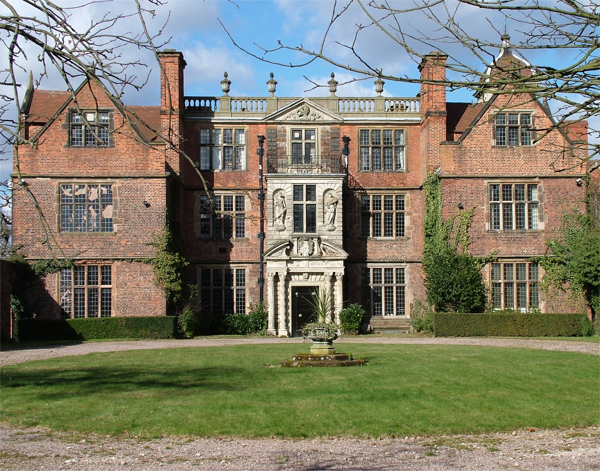
Warmwell is a small village and civil parish in south west Dorset, England, situated on the B3390 road about southeast of Dorchester. In 2013 the estimated population of the parish was 80. Warmwell contains several historic buildings, including a Jacobean manor house, and from May 1937 was the home of RAF Station Woodsford airfield (later renamed RAF Warmwell Royal Air Force Warmwell or more simply RAF Warmwell is a former Royal Air Force station near Warmwell in Dorset, England from 1937 to 1946, located about 5 miles east-southeast of Dorchester; 100 miles southwest of London. During the Second W ...), which is now a popular holiday site and contains a caravan park and several other small businesses. References External links Villages in Dorset {{Dorset-geo-stub ... [...More Info...] [...Related Items...] OR: [Wikipedia] [Google] [Baidu] |
RAF Warmwell
Royal Air Force Warmwell or more simply RAF Warmwell is a former Royal Air Force station near Warmwell in Dorset, England from 1937 to 1946, located about 5 miles east-southeast of Dorchester; 100 miles southwest of London. During the Second World War it was used by the Royal Air Force and the United States Army Air Forces Ninth Air Force. History RAF use At above sea level RAF Warmwell originally opened in May 1937 as a landing ground named RAF Woodsford, for units carrying out air-to-ground firing and bombing on ranges set up off the south coast of Dorset at Chesil Bank. With the airfield code of 'XW' it was renamed RAF Warmwell in July 1938 due to possible confusion with Woodford, near Manchester, which was an airfield where Avro was producing the Lancaster bomber. After the use by squadrons using the ranges diminished, and as the Second World War started more and more units were based here to act as fighter defence for the important naval facilities at Portland and Portsmo ... [...More Info...] [...Related Items...] OR: [Wikipedia] [Google] [Baidu] |
South Dorset (UK Parliament Constituency)
South Dorset is a constituency represented in the House of Commons of the UK Parliament since 2010 by Richard Drax, a Conservative. The constituency was created as a consequence of the Redistribution of Seats Act 1885, although the area covered has changed since then. History Formation The constituency was created as a consequence of the Redistribution of Seats Act 1885. The Act reduced the number of MPs.in Dorset from 10 to 4 (see Redistribution of Seats Act 1885#Redistributed seats: England). It was initially proposed to name the new constituencies after existing boroughs (Shaftesbury, Dorchester, Poole and Bridport) but, following an amendment in the Commons on 14 April 1885, the names were changed to the points of the compass (North Dorset, South Dorset, East Dorset, West Dorset). The South Dorset constituency was divided into 7 polling districts. Dorchester was chosen as the place where the nomination of candidates would take place and the result would be declared. Th ... [...More Info...] [...Related Items...] OR: [Wikipedia] [Google] [Baidu] |
Dorset (unitary Authority)
Dorset is a unitary authority area in the ceremonial county of Dorset, England, which came into existence on 1 April 2019. It covers all of the ceremonial county except for Bournemouth, Christchurch and Poole. The council of the district is Dorset Council (UK), Dorset Council, which was in effect Dorset County Council re-constituted so as to be vested with the powers and duties of five district councils which were also abolished, and shedding its partial responsibility for and powers in Christchurch. History and statutory process Statutory instruments for re-organisation of Dorset (as to local government) were made in May 2018. These implemented the Future Dorset plan to see all councils then existing within the county abolished and replaced by two new unitary authorities on 1 April 2019. *The unitary authorities of Bournemouth Borough Council, Bournemouth and Poole Borough Council, Poole merged with the non-metropolitan district of Christchurch, Dorset, Christchurch to create a ... [...More Info...] [...Related Items...] OR: [Wikipedia] [Google] [Baidu] |
Dorset
Dorset ( ; archaically: Dorsetshire , ) is a county in South West England on the English Channel coast. The ceremonial county comprises the unitary authority areas of Bournemouth, Christchurch and Poole and Dorset (unitary authority), Dorset. Covering an area of , Dorset borders Devon to the west, Somerset to the north-west, Wiltshire to the north-east, and Hampshire to the east. The county town is Dorchester, Dorset, Dorchester, in the south. After the Local Government Act 1972, reorganisation of local government in 1974, the county border was extended eastward to incorporate the Hampshire towns of Bournemouth and Christchurch. Around half of the population lives in the South East Dorset conurbation, while the rest of the county is largely rural with a low population density. The county has a long history of human settlement stretching back to the Neolithic era. The Roman conquest of Britain, Romans conquered Dorset's indigenous Durotriges, Celtic tribe, and during the Ear ... [...More Info...] [...Related Items...] OR: [Wikipedia] [Google] [Baidu] |
Civil Parishes In England
In England, a civil parish is a type of Parish (administrative division), administrative parish used for Local government in England, local government. It is a territorial designation which is the lowest tier of local government below districts of England, districts and metropolitan and non-metropolitan counties of England, counties, or their combined form, the Unitary authorities of England, unitary authority. Civil parishes can trace their origin to the ancient system of Parish (Church of England), ecclesiastical parishes, which historically played a role in both secular and religious administration. Civil and religious parishes were formally differentiated in the 19th century and are now entirely separate. Civil parishes in their modern form came into being through the Local Government Act 1894, which established elected Parish councils in England, parish councils to take on the secular functions of the vestry, parish vestry. A civil parish can range in size from a sparsely ... [...More Info...] [...Related Items...] OR: [Wikipedia] [Google] [Baidu] |
England
England is a country that is part of the United Kingdom. It shares land borders with Wales to its west and Scotland to its north. The Irish Sea lies northwest and the Celtic Sea to the southwest. It is separated from continental Europe by the North Sea to the east and the English Channel to the south. The country covers five-eighths of the island of Great Britain, which lies in the North Atlantic, and includes over 100 smaller islands, such as the Isles of Scilly and the Isle of Wight. The area now called England was first inhabited by modern humans during the Upper Paleolithic period, but takes its name from the Angles, a Germanic tribe deriving its name from the Anglia peninsula, who settled during the 5th and 6th centuries. England became a unified state in the 10th century and has had a significant cultural and legal impact on the wider world since the Age of Discovery, which began during the 15th century. The English language, the Anglican Church, and Engli ... [...More Info...] [...Related Items...] OR: [Wikipedia] [Google] [Baidu] |
Dorchester, Dorset
Dorchester ( ) is the county town of Dorset, England. It is situated between Poole and Bridport on the A35 trunk route. A historic market town, Dorchester is on the banks of the River Frome to the south of the Dorset Downs and north of the South Dorset Ridgeway that separates the area from Weymouth, to the south. The civil parish includes the experimental community of Poundbury and the suburb of Fordington. The area around the town was first settled in prehistoric times. The Romans established a garrison there after defeating the Durotriges tribe, calling the settlement that grew up nearby Durnovaria; they built an aqueduct to supply water and an amphitheatre on an ancient British earthwork. After the departure of the Romans, the town diminished in significance, but during the medieval period became an important commercial and political centre. It was the site of the "Bloody Assizes" presided over by Judge Jeffreys after the Monmouth Rebellion, and later the trial of t ... [...More Info...] [...Related Items...] OR: [Wikipedia] [Google] [Baidu] |
Jacobean Architecture
The Jacobean style is the second phase of Renaissance architecture in England, following the Elizabethan style. It is named after King James VI and I, with whose reign (1603–1625 in England) it is associated. At the start of James' reign there was little stylistic break in architecture, as Elizabethan trends continued their development. However, his death in 1625 came as a decisive change towards more classical architecture, with Italian influence, was in progress, led by Inigo Jones; the style this began is sometimes called Stuart architecture, or English Baroque (though the latter term may be regarded as starting later). Courtiers continued to build large prodigy houses, even though James spent less time on summer progresses round his realm than Elizabeth had. The influence of Flemish and German Northern Mannerism increased, now often executed by immigrant craftsmen and artists, rather than obtained from books as in the previous reign. There continued to be very little build ... [...More Info...] [...Related Items...] OR: [Wikipedia] [Google] [Baidu] |

.jpg)

