|
Worton (civil Parish), Oxfordshire
Worton is a civil parish in the West Oxfordshire district about south of Banbury, England. It was formed in 1932 by the merger of the parishes of Nether Worton and Over Worton, each of which is a small village. The main road between Deddington and Swerford Swerford is a village and Civil parishes in England, civil parish on the River Swere in the Cotswold Hills in Oxfordshire, England. It is about northeast of Chipping Norton, Oxfordshire, Chipping Norton. Swerford has two main neighbourhoods: Ch ... is the parish's northern boundary. It was a turnpike road and is now the B4031. From there the parish extends to Worton Wood on its southern boundary. East–west the parish is nowhere more than wide. The 2011 Census recorded the population of Worton parish as 624. References External links * Civil parishes in Oxfordshire West Oxfordshire District {{Oxfordshire-geo-stub ... [...More Info...] [...Related Items...] OR: [Wikipedia] [Google] [Baidu] |
Civil Parishes In England
In England, a civil parish is a type of Parish (administrative division), administrative parish used for Local government in England, local government. It is a territorial designation which is the lowest tier of local government below districts of England, districts and metropolitan and non-metropolitan counties of England, counties, or their combined form, the Unitary authorities of England, unitary authority. Civil parishes can trace their origin to the ancient system of Parish (Church of England), ecclesiastical parishes, which historically played a role in both secular and religious administration. Civil and religious parishes were formally differentiated in the 19th century and are now entirely separate. Civil parishes in their modern form came into being through the Local Government Act 1894, which established elected Parish councils in England, parish councils to take on the secular functions of the vestry, parish vestry. A civil parish can range in size from a sparsely ... [...More Info...] [...Related Items...] OR: [Wikipedia] [Google] [Baidu] |
West Oxfordshire
West Oxfordshire is a local government district in northwest Oxfordshire, England, including towns such as Woodstock, Burford, Chipping Norton, Charlbury, Carterton and Witney, where the council is based. Area The area is mainly rural downland and forest, the main activities being farming and associated trades. The district was created on 1 April 1974, under the Local Government Act 1972, by the merger of Chipping Norton Municipal Borough, Woodstock Municipal Borough, Witney Urban District, Chipping Norton Rural District and Witney Rural District. West Oxfordshire lies within the River Thames catchment area, with the Thames itself and its tributaries including the River Evenlode and River Windrush running through the area. Parts of the district suffered severe flooding during the 2007 floods in the UK. Governance Elections to West Oxfordshire District Council are held in three out of every four years, with one third of the seats on the council being elected at each electio ... [...More Info...] [...Related Items...] OR: [Wikipedia] [Google] [Baidu] |
Banbury
Banbury is a historic market town on the River Cherwell in Oxfordshire, South East England. It had a population of 54,335 at the 2021 Census. Banbury is a significant commercial and retail centre for the surrounding area of north Oxfordshire and southern parts of Warwickshire and Northamptonshire which are predominantly rural. Banbury's main industries are motorsport, car components, electrical goods, plastics, food processing and printing. Banbury is home to the world's largest coffee-processing facility (Jacobs Douwe Egberts), built in 1964. The town is famed for Banbury cakes, a spiced sweet pastry dish. Banbury is located north-west of London, south-east of Birmingham, south-east of Coventry and north-west of Oxford. History Toponymy The name Banbury may derive from "Banna", a Saxon chieftain said to have built a stockade there in the 6th century (or possibly a byname from ang, bana meaning ''felon'', ''murderer''), and / meaning ''settlement''. In Anglo Saxon i ... [...More Info...] [...Related Items...] OR: [Wikipedia] [Google] [Baidu] |
Nether Worton
Nether Worton is a hamlet in Oxfordshire, about south of Banbury and east of Chipping Norton. Nether Worton was a separate civil parish until 1932, when it was merged with Over Worton to form the current civil parish of Worton.. Archaeology Earthworks on Hawk Hill indicate a prehistoric settlement of unknown date, possibly Iron Age. Manor The Domesday Book records that until 1066 one Leofgeat held the manor of ''Ortune'', probably at what is now Nether Worton. After the Norman Conquest of England an estate of three hides and half a yardland at Worton passed to William the Conqueror's half-brother Odo of Bayeux. By 1086 there were 15 households consisting of 10 smallholders and five villagers. Nether Worton House is the former manor house. It has a datestone inscribed 1653 but parts of the house may be earlier. The house was extended about 1920. It is a Grade II* listed building. The principal landowners in Nether Worton at the time were the Draper family. The best known of ... [...More Info...] [...Related Items...] OR: [Wikipedia] [Google] [Baidu] |
Over Worton
Over Worton is a hamlet in Oxfordshire, about south of Banbury and east of Chipping Norton. Over Worton was a separate civil parish until 1932, when it was merged with Nether Worton to form the current civil parish of Worton. Archaeology Just north of Holy Trinity parish churchyard is an Anglo-Saxon ''hlaew'' ( barrow), about in diameter and high. It is a Scheduled Ancient Monument. Worton has the remains of a medieval village cross. In the 20th century it was restored as the parish war memorial. Manor The Domesday Book records that until 1066 one Leofgeat held the manor of ''Ortune'', probably at what is now Nether Worton. After the Norman Conquest of England an estate of three hides and half a yardland at Worton passed to William the Conqueror's half-brother Odo of Bayeux. By 1086 there were 15 households consisting of 10 smallholders and five villagers. Parish church Over Worton has had a parish church since at least the 13th century. The earliest known record of it ... [...More Info...] [...Related Items...] OR: [Wikipedia] [Google] [Baidu] |
Deddington
Deddington is a civil parish and small town in Oxfordshire about south of Banbury. The parish includes two hamlets: Clifton and Hempton. The 2011 Census recorded the parish's population as 2,146. Deddington is a small settlement but has a commercial centre including a market place, which hosts a popular monthly farmer’s market. It has been a market town probably since the 12th century. One of the Hundred Rolls of King Edward I from 1275–76 records Deddington as a borough. It has a deli, coffee shop, restaurant, three pubs and a town hall (see below). Its football team is called Deddington Town FC. Geography The parish is about wide east–west, about wide north–south and has an area of about . Watercourses bound it on three sides: The River Cherwell to the east, its tributary the River Swere to the north and the Sowbrook (''i.e.'' "South Brook") to the south. Here the Cherwell also forms the county boundary with Northamptonshire. To the west the parish is bounded by f ... [...More Info...] [...Related Items...] OR: [Wikipedia] [Google] [Baidu] |
Swerford
Swerford is a village and civil parish on the River Swere in the Cotswold Hills in Oxfordshire, England. It is about northeast of Chipping Norton. Swerford has two main neighbourhoods: Church End and East End. The area between them contains very few houses and is called Between Towns. The 2011 census recorded the parish's population as 132. Manor The Domesday Book records that in 1086 Swerford was part of the royal manor of Hook Norton, which was held by Robert D'Oyly. The village has a motte-and-bailey castle which is believed to have been built early in the 12th century during the civil war between Empress Matilda and King Stephen. In 1783 Henry Scott, 3rd Duke of Buccleuch commissioned the building of the country house of Swerford Park as a hunting lodge. In 1820 General Sir R. Bolton bought the house. Bolton commissioned the artist and architect Joseph Gandy, who remodelled the house between 1824 and 1829 in the style of Sir John Soane. Church and chapel The Church o ... [...More Info...] [...Related Items...] OR: [Wikipedia] [Google] [Baidu] |
Toll Roads In Great Britain
Toll roads in Great Britain, used to raise fees for the management of roads in the United Kingdom, were common in the era of the turnpike trusts. Currently there is a single major road, the M6 Toll and a small number of bridges and tunnels where tolls are collected. In addition, there are also two UK road pricing schemes, the London congestion charge and the Durham congestion charge. History Medieval period In the 14th century, pavage grants, which had previously been made for paving the market place or streets of towns, began also to be used for maintaining some roads between towns. These grants were made by letters patent, almost invariably for a limited term, presumably the time likely to be required to pay for the required works. Responsibility for the upkeep of most roads seems to have rested with landowners, however. This was probably not easily enforced against them. The Parliament of England placed the upkeep of bridges to local settlements or the containing count ... [...More Info...] [...Related Items...] OR: [Wikipedia] [Google] [Baidu] |
United Kingdom Census 2011
A Census in the United Kingdom, census of the population of the United Kingdom is taken every ten years. The 2011 census was held in all countries of the UK on 27 March 2011. It was the first UK census which could be completed online via the Internet. The Office for National Statistics (ONS) is responsible for the census in England and Wales, the General Register Office for Scotland (GROS) is responsible for the census in Scotland, and the Northern Ireland Statistics and Research Agency (NISRA) is responsible for the census in Northern Ireland. The Office for National Statistics is the executive office of the UK Statistics Authority, a non-ministerial department formed in 2008 and which reports directly to Parliament. ONS is the UK Government's single largest statistical producer of independent statistics on the UK's economy and society, used to assist the planning and allocation of resources, policy-making and decision-making. ONS designs, manages and runs the census in England an ... [...More Info...] [...Related Items...] OR: [Wikipedia] [Google] [Baidu] |
Neighbourhood Statistics
The Neighbourhood Statistics Service (NeSS) was established in 2001 by the UK's Office for National Statistics (ONS) and the Neighbourhood Renewal Unit (NRU) - then part of the Office of the Deputy Prime Minister (ODPM), now Communities and Local Government (CLG) - to provide good quality small area data to support the Government's ''Neighbourhood Renewal'' agenda. This cross-Government initiative also involved the co-operation and partnership of data suppliers across departments, agencies and other organisations. The ONS closed the Neighbourhood Statistics website for England and Wales on the 12 May 2017. To offset this, the ONS is aiming to meet the needs of users via the ONS website, although direct postcode searches are no longer available to users. The Scottish Government continues to provide local statistics via Statistics.Gov.Scot and Census area profiles. Neighbourhood statistics for Northern Ireland continue to be made available from the Northern Ireland Neighbourho ... [...More Info...] [...Related Items...] OR: [Wikipedia] [Google] [Baidu] |
Office For National Statistics
The Office for National Statistics (ONS; cy, Swyddfa Ystadegau Gwladol) is the executive office of the UK Statistics Authority, a non-ministerial department which reports directly to the UK Parliament. Overview The ONS is responsible for the collection and publication of statistics related to the economy, population and society of the UK; responsibility for some areas of statistics in Scotland, Northern Ireland and Wales is devolved to the devolved governments for those areas. The ONS functions as the executive office of the National Statistician, who is also the UK Statistics Authority's Chief Executive and principal statistical adviser to the UK's National Statistics Institute, and the 'Head Office' of the Government Statistical Service (GSS). Its main office is in Newport near the United Kingdom Intellectual Property Office and Tredegar House, but another significant office is in Titchfield in Hampshire, and a small office is in London. ONS co-ordinates data collection wi ... [...More Info...] [...Related Items...] OR: [Wikipedia] [Google] [Baidu] |
Oxfordshire County Council
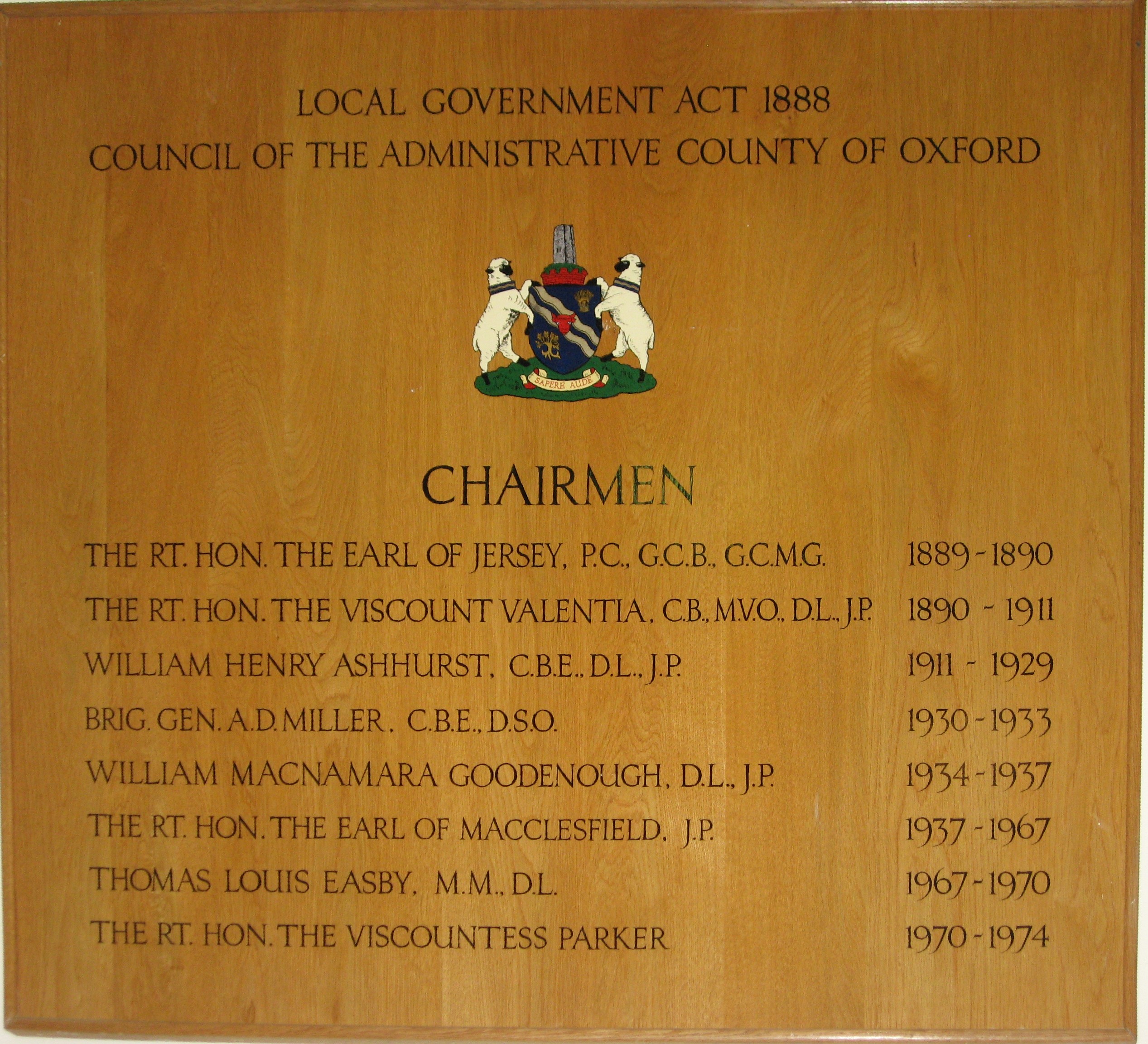
Oxfordshire County Council is the county council (upper-tier local authority) for the non-metropolitan county of Oxfordshire in the South East of England. It is an elected body responsible for some local government services in the county, including education (schools, libraries and youth services), social services, public health, highway maintenance, waste disposal, emergency planning, consumer protection and town and country planning for matters to do with minerals, waste, highways and education. It is one of the largest employers in Oxfordshire and has a gross expenditure budget of £856.2 million for the 2021–22 financial year. History County councils were first introduced in England and Wales with full powers from 22 September 1889 as a result of the Local Government Act 1888, taking over administrative functions until then carried out by the unelected quarter sessions. The areas they covered were termed administrative counties and were not in all cases identical to the tr ... [...More Info...] [...Related Items...] OR: [Wikipedia] [Google] [Baidu] |


.jpg)


