|
Worting
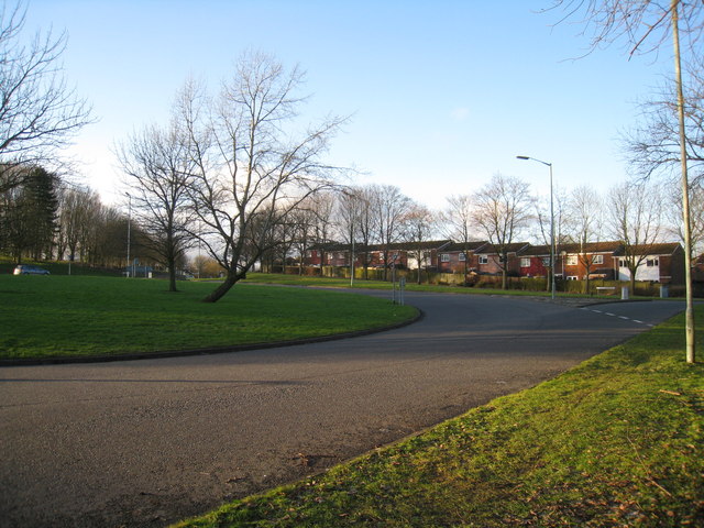
Worting is a former village and now a district of Basingstoke, Hampshire, that was formed around 1970 as part of the Basingstoke Town Centre Development Plan. The area is bounded to the south by Hatch Warren and the Worting Junction. To the east is the district of Brighton Hill Brighton Hill is a district of Basingstoke, England, that was formed around 1970 as part of the Town Centre Development Plan. The area is bounded to the west by the newer housing estate of Hatch Warren and by the A30. To the east of Brighton ... and the Cranbourne area. Villages in Hampshire Areas of Basingstoke {{Hampshire-geo-stub ... [...More Info...] [...Related Items...] OR: [Wikipedia] [Google] [Baidu] |
Worting Junction
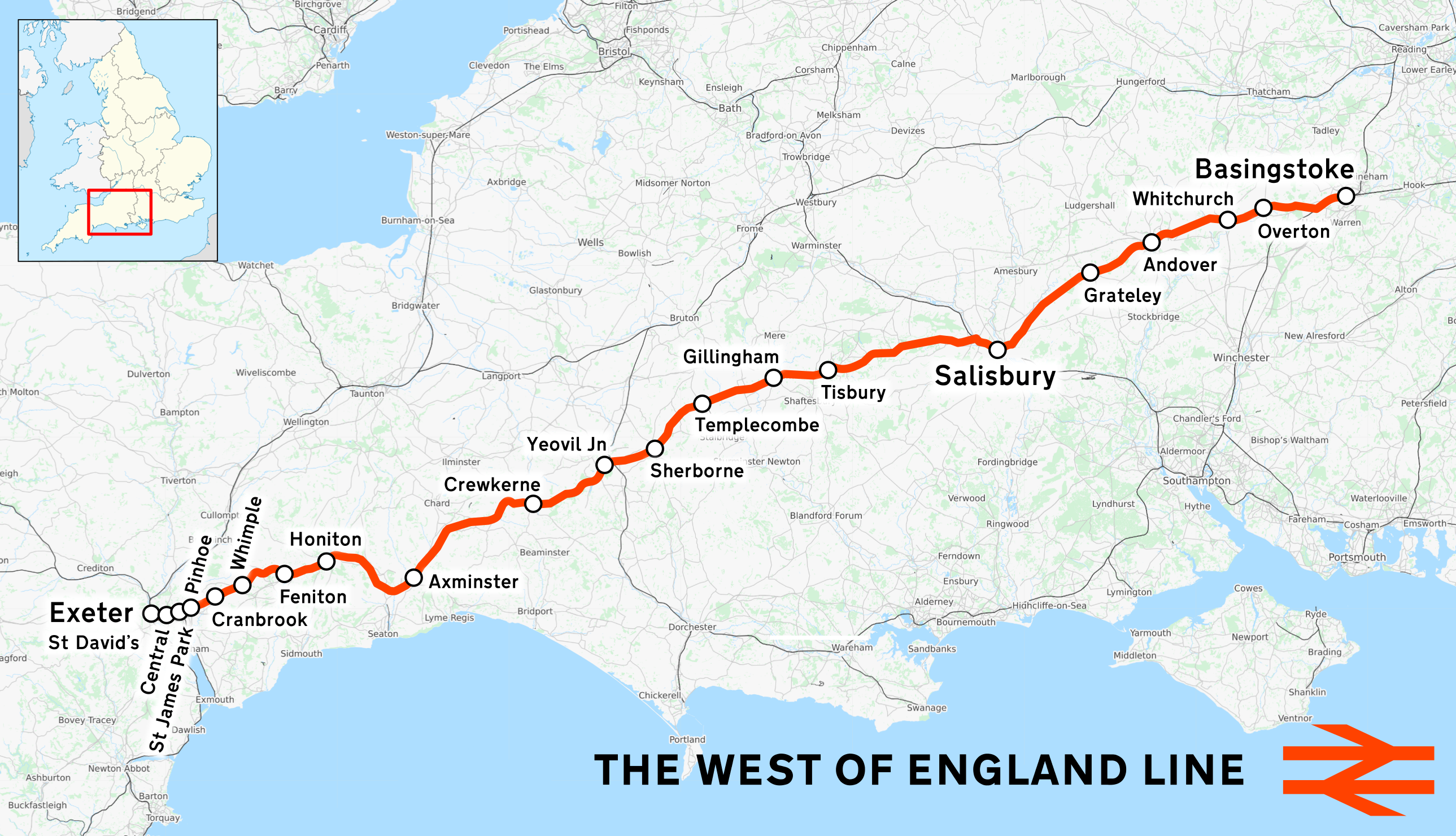
The West of England line (also known as the West of England Main Line) is a British railway line from , Hampshire, to in Devon, England. Passenger services run between London Waterloo station and Exeter; the line intersects with the Wessex Main Line at . Despite its historic title, it is not today's principal route from London to the West of England: Exeter and everywhere further west are reached more quickly from London Paddington via the Reading–Taunton line. History Once all sections had been incorporated into the London and South Western Railway, the sections and branches were: * Basingstoke to Salisbury ** Basingstoke to Andover, opened 3 July 1854 ** Andover to Salisbury, opened 1 May 1857 ** Branches: ***''Basingstoke and Alton Light Railway'' opened June 1901, closed 30 May 1936 *** From Hurstbourne and Andover to Romsey and on to Eastleigh and Southampton: both closed. Link via Longparish opened 1 June 1885; closed 6 July 1931. *** At Andover, junction with the ... [...More Info...] [...Related Items...] OR: [Wikipedia] [Google] [Baidu] |
Basingstoke
Basingstoke ( ) is the largest town in the county of Hampshire. It is situated in south-central England and lies across a valley at the source of the River Loddon, at the far western edge of The North Downs. It is located north-east of Southampton, south-west of London, 27 miles (43 km) west of Guildford, south of Reading and north-east of the county town and former capital Winchester. According to the 2016 population estimate, the town had a population of 113,776. It is part of the borough of Basingstoke and Deane and part of the parliamentary constituency of Basingstoke. Basingstoke is an old market town expanded in the mid-1960s, as a result of an agreement between London County Council and Hampshire County Council. It was developed rapidly after the Second World War, along with various other towns in the United Kingdom, in order to accommodate part of the London 'overspill' as perceived under the Greater London Plan in 1944. Basingstoke market was mentioned ... [...More Info...] [...Related Items...] OR: [Wikipedia] [Google] [Baidu] |
Basingstoke And Deane
Basingstoke and Deane is a local government district and borough in Hampshire, England. Its primary settlement is Basingstoke. Other settlements include Bramley, Tadley, Kingsclere, Overton, Oakley, Whitchurch and the village of Deane, some from Basingstoke. It is the northernmost borough of Hampshire, bordered by Berkshire to the north. The first Basingstoke Mayor, George Baynard, was appointed in 1641. The district was formed as the District of Basingstoke on 1 April 1974 by the merger of the borough of Basingstoke, Basingstoke Rural District and Kingsclere and Whitchurch Rural District. On 20 January 1978, following the grant of borough status, the district became the Borough of Basingstoke and Deane. The council claims that the new title included the names of the largest town and smallest village in the borough, although there are eight civil parishes with populations smaller than Deane. Basingstoke and Deane has over 430 local neighbourhood watch schemes i ... [...More Info...] [...Related Items...] OR: [Wikipedia] [Google] [Baidu] |
Hampshire
Hampshire (, ; abbreviated to Hants) is a ceremonial county, ceremonial and non-metropolitan county, non-metropolitan counties of England, county in western South East England on the coast of the English Channel. Home to two major English cities on its south coast, Southampton and Portsmouth, Hampshire is the 9th-most populous county in England. The county town of Hampshire is Winchester, located in the north of the county. The county is bordered by Dorset to the south-west, Wiltshire to the north-west, Berkshire to the north, Surrey to the north-east, and West Sussex to the south east. The county is geographically diverse, with upland rising to and mostly south-flowing rivers. There are areas of downland and marsh, and two national parks: the New Forest National Park, New Forest and part of the South Downs National Park, South Downs, which together cover 45 per cent of Hampshire. Settled about 14,000 years ago, Hampshire's recorded history dates to Roman Britain, when its chi ... [...More Info...] [...Related Items...] OR: [Wikipedia] [Google] [Baidu] |
Basingstoke (UK Parliament Constituency)
Basingstoke () is a constituency in Hampshire represented in the House of Commons of the UK Parliament since 2005 by Maria Miller, a member of the Conservative Party who served as Culture Secretary and Minister for Women and Equalities from 2012 to 2014 under Prime Minister David Cameron. Constituency profile The constituency is based around the town of Basingstoke, and the surrounding countryside, in Hampshire. Basingstoke is both a commuter town with frequent trains to London and a regional economic centre, making this a prosperous area. History Political history With the exception of a 1923-1924 Liberal MP, since broadening in 1885 it has elected Conservative MPs, and thus meets the longevity indicator, if not majority indicator, as a Conservative safe seat. The closest it came to a non-Conservative victory was in 2001, when its incumbent since 1983, Hunter, in his final election, was returned by 880 votes. In June 2016, an estimated 53.6% of local adults voting in the ... [...More Info...] [...Related Items...] OR: [Wikipedia] [Google] [Baidu] |
Hatch Warren
Hatch Warren is a district and ward of Basingstoke in Hampshire, England. The population of the appropriate ward called Hatch Warren and Beggarwood was 9,284 at the 2011 Census. It is situated west of the town centre and neighbouring housing estates include Kempshott and Brighton Hill. It is primarily served by Brighton Hill Community School (a secondary school), one Primary school, St Marks and a junior school, Hatch Warren. It lies within the Hatch Warren & Beggarwood ward of Basingstoke and Deane Borough Council. Hatch Warren shares a Newsletter, the Rabbiter, with Beggarwood and Kempshott Park, and has a small retail park, which includes a Sainsbury's supermarket and petrol station, as well as Argos, Lidl, American Golf, Pets at Home, Dreams and B&M. It also has a pub named The Portsmouth Arms. The pub was due to open in 1996, but was destroyed by arson; the Portsmouth Arms did however open a year later. There is a Community Centre in Hatch Warren, It is used by a Youth ... [...More Info...] [...Related Items...] OR: [Wikipedia] [Google] [Baidu] |
Brighton Hill
Brighton Hill is a district of Basingstoke, England, that was formed around 1970 as part of the Town Centre Development Plan. The area is bounded to the west by the newer housing estate of Hatch Warren and by the A30. To the east of Brighton Hill, the Viables Industrial Estate and Cranbourne area. The area to the east is a lot older than Brighton Hill itself. The M3 motorway runs in a straight line to the south of the area, directly next to the southern ebb of Brighton Hill, which sometimes is referred to as Old Hatchwarren. Origin of the name The earliest mention of the Brighton Hill name found so far was on a map dated 1877. However, this seems to relate to a cottage or some other building, situated just over halfway between Hatch Warren Farm (at the rear of the 'Portsmouth Arms' public house) and where the then Hatch Warren Lane and Winchester Road (now the A30) joined at a crossroads. An excerpt of map is shown here: http://www.british-history.ac.uk/mapsheet.aspx?comp ... [...More Info...] [...Related Items...] OR: [Wikipedia] [Google] [Baidu] |
Villages In Hampshire
A village is a clustered human settlement or community A community is a social unit (a group of living things) with commonality such as place, norms, religion, values, customs, or identity. Communities may share a sense of place situated in a given geographical area (e.g. a country, villag ..., larger than a hamlet (place), hamlet but smaller than a town (although the word is often used to describe both hamlets and smaller towns), with a population typically ranging from a few hundred to a few thousand. Though villages are often located in rural areas, the term urban village is also applied to certain urban neighborhoods. Villages are normally permanent, with fixed dwellings; however, transient villages can occur. Further, the dwellings of a village are fairly close to one another, not scattered broadly over the landscape, as a dispersed settlement. In the past, villages were a usual form of community for societies that practice subsistence agriculture, and a ... [...More Info...] [...Related Items...] OR: [Wikipedia] [Google] [Baidu] |


