|
Woodlesford
Woodlesford () is a suburban village in the City of Leeds, West Yorkshire, England, south-east of Leeds city centre. Formerly part of the Rothwell Urban District, it is now within the Rothwell ward of Leeds City Council. The village sits on the banks of the Aire and Calder Navigation and river system. History The name was first recorded between 1188 and 1202, in the form ''Widlesford'', with other medieval forms including ''Wryd(e)lesford(e)''. These other forms are closer to the likely origin: Old English *''wrīdels'' 'thicket' + ''ford'' 'ford'. The ford was on a bend in the River Aire close to the present day Woodlesford lock on the Aire and Calder Navigation. Much of Woodlesford's expansion took place in the nineteenth century as a mining and stone quarrying village. The closest pit to the centre of the village was sunk to the Beeston seam in the 1870s but was only operational for a few years. Many of the miners employed there then moved to work at pits owned by T & ... [...More Info...] [...Related Items...] OR: [Wikipedia] [Google] [Baidu] |
Woodlesford Railway Station
Woodlesford railway station serves Woodlesford and Rothwell in West Yorkshire, England. It lies on the Hallam Line and the Pontefract Line, south of . Facilities The station is unstaffed, but a self-service ticket machine is provided to allow passengers to buy before travelling or collect advance purchase tickets. The platforms are staggered either side of the (now disused) foot crossing, with the Leeds-bound platform the more northerly of the two. Waiting shelters, timetable posters and digital CIS displays are provided on each platform, with automated announcements also offered to give train running information. Step-free access is available to both platforms (via the ramps on the footbridge for platform 2). Service Monday to Saturdays there is a half-hourly service to Leeds and an hourly service to Sheffield on the Hallam Line and hourly towards Knottingley on the Pontefract Line. A single through train to runs in the evening. Sundays, there is an hourly service t ... [...More Info...] [...Related Items...] OR: [Wikipedia] [Google] [Baidu] |
Rothwell Urban District, Yorkshire
Rothwell is a town in the south-east of the City of Leeds metropolitan borough in West Yorkshire, England. It is situated between Leeds and Wakefield. It is in the Rothwell ward of Leeds City Council and Elmet and Rothwell parliamentary constituency. Rothwell is part of the West Yorkshire Urban Area. Rothwell had a population of 21,010 in the 2001 census, and the Rothwell ward has an estimated population of 32,365. At the 2011 census the ward had a population of 20,354. The town is close to the A1/ M1 link road and the Stourton park and ride. The nearest railway station is Woodlesford. History Rothwell was mentioned in the Domesday Book as ''"Rodewelle"''. One of the royal lodge's documented owners was John of Gaunt, 1st Duke of Lancaster, who is supposed to have killed the last wild boar in England while hunting nearby; hence a boar's head formed part of the arms of the former Rothwell Urban District Council. The parish church (Church Street) is dedicated to Holy Trini ... [...More Info...] [...Related Items...] OR: [Wikipedia] [Google] [Baidu] |
Oulton, West Yorkshire
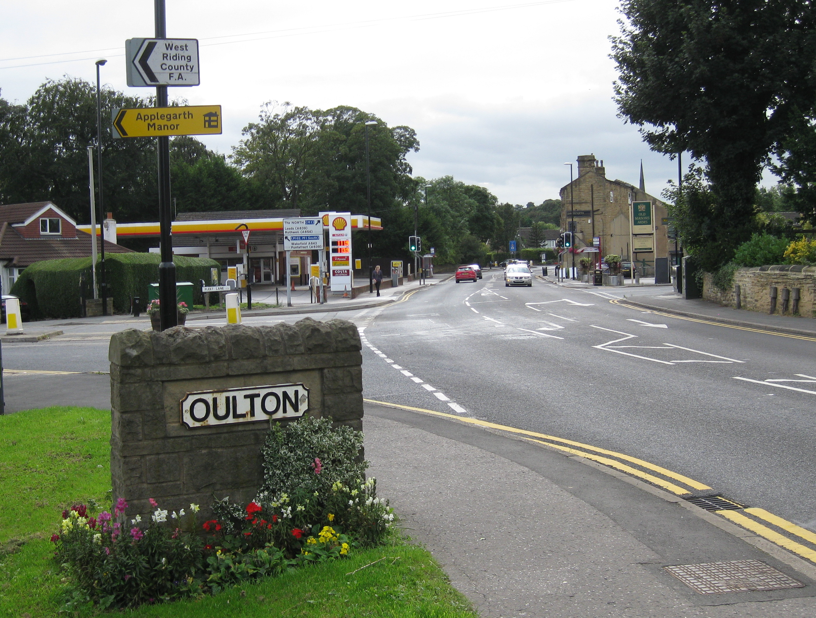
Oulton is a village in the City of Leeds metropolitan borough, West Yorkshire, England, between Leeds and Wakefield. It is at the junction of the A639 and A642 roads. Though now adjoining the village of Woodlesford, it was once quite separate. The village formed part of the Rothwell Urban District until its merger into the City of Leeds Metropolitan District in 1974 and today sits in the Rothwell ward of Leeds City Council. It is also in the Elmet and Rothwell parliamentary constituency. Oulton Hall was built in 1850 and is now a hotel and conference centre. Notable and former residents * Richard Bentley theologian, critic and scholar, who became Master of Trinity College, Cambridge. * The cricketer and Anglican clergyman Henry Bell was born in Oulton. * Francis Ingram slave trader and privateer. File:Oulton Edrus Tailor 2016.jpg, Half-Timbered house on the Leeds Road, Oulton File:Oulton The Three Horseshoes 2016.jpg, Three Horseshoes inn, Oulton File:Oulton M ... [...More Info...] [...Related Items...] OR: [Wikipedia] [Google] [Baidu] |
Leeds Railway Station
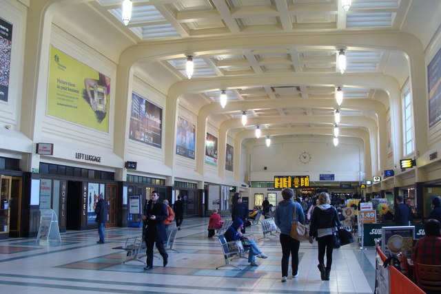
Leeds railway station (also known as Leeds City railway station) is the mainline railway station serving the city centre of Leeds in West Yorkshire, England. It is the fourth-busiest railway station in the UK outside London (as of March 2020). It is located on New Station Street to the south of City Square, at the foot of Park Row, behind the landmark Queens Hotel. It is one of 20 stations managed by Network Rail. Leeds is an important hub on the British rail network. The station is the terminus of the Leeds branch of the East Coast Main Line (on which London North Eastern Railway provides high speed inter-city services to every half hour from the station) and is an important stop on the Cross Country Route between Scotland, the Midlands and South West England connecting to major cities such as Birmingham, Glasgow, Edinburgh, Derby, Bristol, Exeter, Plymouth and Penzance. There are also regular inter-city services to major destinations throughout Northern England including Manc ... [...More Info...] [...Related Items...] OR: [Wikipedia] [Google] [Baidu] |
Aire And Calder Navigation
The Aire and Calder Navigation is the canalised section of the Rivers Aire and Calder in West Yorkshire, England. The first improvements to the rivers above Knottingley were completed in 1704 when the Aire was made navigable to Leeds and the Calder to Wakefield, by the construction of 16 locks. Lock sizes were increased several times, as was the depth of water, to enable larger boats to use the system. The Aire below Haddlesey was bypassed by the opening of the Selby Canal in 1778. A canal from Knottingley to the new docks and new town at Goole provided a much shorter route to the River Ouse from 1826. The New Junction Canal was constructed in 1905, to link the system to the River Don Navigation, by then part of the Sheffield and South Yorkshire Navigation. Steam tugs were introduced in 1831. In the 1860s, compartment boats were introduced, later called Tom Puddings, from which coal was unloaded into ships by large hydraulic hoists. This system enabled the canal to carry at ... [...More Info...] [...Related Items...] OR: [Wikipedia] [Google] [Baidu] |
Castleford Railway Station
Castleford railway station serves the town of Castleford in West Yorkshire. It lies on the Hallam and Pontefract lines, south-east of Leeds. Although it was built originally as a through station, regular passenger services beyond Castleford towards York were discontinued in January 1970. Today, all trains calling at the station reverse here, arriving and departing from the former northbound platform 1. Platform 2 is currently out of use and inaccessible, though it was brought back into use temporarily during the Leeds First project in 2002; Transpennine services between York and Huddersfield were diverted to avoid engineering work in Leeds, routed via Church Fenton, Castleford and Wakefield Kirkgate. It may also be brought back into use on a more permanent basis to help accommodate extra peak hour services, if Network Rail proceed with plans mooted in the recent Yorkshire & Humberside RUS. The route from Church Fenton continues to be used for freight traffic, empty sto ... [...More Info...] [...Related Items...] OR: [Wikipedia] [Google] [Baidu] |
Rothwell (ward)
Rothwell is an electoral ward of Leeds City Council in south east Leeds, West Yorkshire, including the town of the same name and the villages of Carlton, Oulton and Woodlesford. Councillors indicates seat up for re-election. indicates councillor vacancy. ''*'' indicates incumbent councillor. Elections since 2010 May 2022 May 2021 May 2019 May 2018 May 2016 May 2015 May 2014 May 2012 May 2011 May 2010 See also *Listed buildings in Rothwell, West Yorkshire Rothwell is a ward in the metropolitan borough of the City of Leeds, West Yorkshire, England. It contains 40 listed buildings that are recorded in the National Heritage List for England. Of these, four are listed at Grade II*, the middl ... Notes References {{notelist Places in Leeds Wards of Leeds Rothwell, West Yorkshire ... [...More Info...] [...Related Items...] OR: [Wikipedia] [Google] [Baidu] |
City Of Leeds
The City of Leeds is a city and metropolitan borough in West Yorkshire, England. The metropolitan borough includes the administrative centre of Leeds and the towns of Farsley, Garforth, Guiseley, Horsforth, Morley, Otley, Pudsey, Rothwell, Wetherby and Yeadon. It has a population of (), making it technically the second largest city in England by population behind Birmingham, since London is not a single local government entity. It is governed by Leeds City Council. The current city boundaries were set on 1 April 1974 by the provisions of the Local Government Act 1972, as part a reform of local government in England. The city is a merger of eleven former local government districts; the unitary City and County Borough of Leeds combined with the municipal boroughs of Morley and Pudsey, the urban districts of Aireborough, Garforth, Horsforth, Otley and Rothwell, and parts of the rural districts of Tadcaster, Wharfedale and Wetherby from the West Riding of Yorkshire. ... [...More Info...] [...Related Items...] OR: [Wikipedia] [Google] [Baidu] |
Barnsley Interchange
Barnsley Interchange is a combined rail and bus station in the centre of Barnsley, South Yorkshire. It was first opened in 1850 as ''Barnsley Exchange'' railway station and is north of Sheffield. It is on the Hallam and Penistone Lines, both operated by Northern Trains. On 20 May 2007, the new bus station and refurbished railway station were officially opened by Travel South Yorkshire, with the combined facility renamed to ''Barnsley Interchange''. Earlier history The Sheffield, Rotherham, Barnsley, Wakefield, Huddersfield & Goole Railway was formed in 1846 with the aim of providing access to the South Yorkshire coalfield. It was to link the Manchester and Leeds Railway (M&LR) near Horbury, with the Sheffield and Rotherham Railway near , by way of Barnsley. Whilst the railway was still at the planning stage, it was split in two at Barnsley, the northern portion being leased to the M&LR and the southern to the South Yorkshire, Doncaster & Goole Railway (SYD&G). The northern ... [...More Info...] [...Related Items...] OR: [Wikipedia] [Google] [Baidu] |
Wakefield
Wakefield is a cathedral city in West Yorkshire, England located on the River Calder. The city had a population of 99,251 in the 2011 census.https://www.nomisweb.co.uk/census/2011/ks101ew Census 2011 table KS101EW Usual resident population, West Yorkshire – Wakefield BUASD, code E35000474 The city is the administrative centre of the wider City of Wakefield metropolitan district, which had a population of , the most populous district in England. It is part of the West Yorkshire Built-up Area and the Yorkshire and The Humber region. In 1888, it was one of the last group of towns to gain city status due to having a cathedral. The city has a town hall and county hall, as the former administrative centre of the city's county borough and metropolitan borough as well as county town to both the West Riding of Yorkshire and West Yorkshire, respectively. The Battle of Wakefield took place in the Wars of the Roses, and the city was a Royalist stronghold in the Civil War. Wake ... [...More Info...] [...Related Items...] OR: [Wikipedia] [Google] [Baidu] |
Goole Railway Station
Goole railway station is a railway station in town of Goole on the Hull and Doncaster Branch in the East Riding of Yorkshire, England. The station and its passenger services are managed and provided by Northern. Lines from Goole run north to the Hull and Selby Line at Gilberdyke (formerly Staddlethorpe); south to the South Humberside Main Line near Thorne; there is also a westward line to Knottingley mostly used by freight, with an infrequent passenger service. The station opened in 1869 replacing a terminus station in the Goole docks. Facilities The station has a ticket office on platform 2 (southbound), which is staffed part-time (07:00 - 13:30) on weekdays and Saturdays only. A self-service ticket machine is available for use outside of these times and for collecting pre-paid tickets. A waiting room and vending machine are provided on platform 2 and a shelter on platform 1, along with extensive canopies on each side. Digital display screens, timetable posters and automat ... [...More Info...] [...Related Items...] OR: [Wikipedia] [Google] [Baidu] |
Sheffield Railway Station
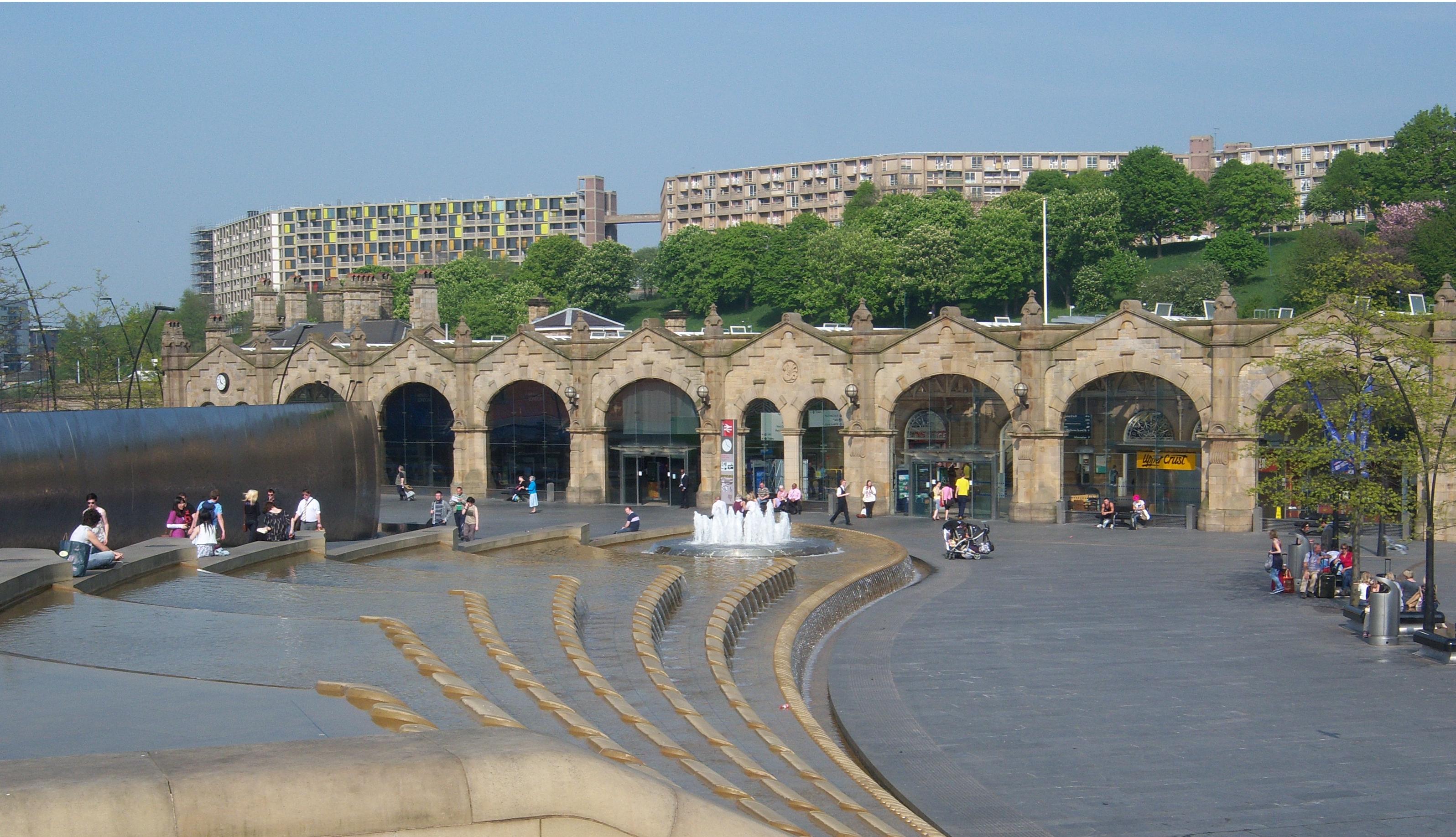
Sheffield station, formerly ''Pond Street'' and later ''Sheffield Midland'', is a combined railway station and tram stop in Sheffield, England; it is the busiest station in South Yorkshire. Adjacent is Sheffield station/Sheffield Hallam University Sheffield Supertram stop. In 2017–18, the station was the 43rd-busiest in the UK and the 15th-busiest outside London. History 1870 - 1960 The station was opened in 1870 by the Midland Railway to the designs of the company architect John Holloway Sanders. It was the fifth and last station to be built in Sheffield city centre. The station was built on the 'New Line', which ran between Grimesthorpe Junction, on the former Sheffield and Rotherham Railway, and Tapton Junction, just north of Chesterfield. This line replaced the Midland Railway's previous route, the 'old road', to London, which ran from Sheffield Wicker via Rotherham. The new line and station were built despite some controversy and opposition locally. The Duke of Norf ... [...More Info...] [...Related Items...] OR: [Wikipedia] [Google] [Baidu] |


