|
Wisconsin Central Railroad (1871–1899)
The original Wisconsin Central Railroad Company was a major early railroad that operated throughout northern Wisconsin. It built lines up through the forested wilderness, and opened large tracts to logging and settlement. It established stations which would grow into a string of cities and towns between Stevens Point and Ashland, including Marshfield and Medford, and it connected these places to Chicago and St. Paul. It also played a major role in building Chicago's Grand Central Station. Despite these successes, it struggled financially from the start and was bankrupt by 1879. It was leased to the Northern Pacific Railway from 1889 to 1893, and was finally reorganized from bankruptcy in 1897 as the Wisconsin Central Railway. Background By the time of the Civil War, the southern half of Wisconsin was somewhat settled. Much of the north, however, remained wilderness, including swaths of virgin timber and deposits of iron ore. Treaties with Native Americans had placed most ... [...More Info...] [...Related Items...] OR: [Wikipedia] [Google] [Baidu] |
Wisconsin
Wisconsin () is a state in the upper Midwestern United States. Wisconsin is the 25th-largest state by total area and the 20th-most populous. It is bordered by Minnesota to the west, Iowa to the southwest, Illinois to the south, Lake Michigan to the east, Michigan to the northeast, and Lake Superior to the north. The bulk of Wisconsin's population live in areas situated along the shores of Lake Michigan. The largest city, Milwaukee, anchors its largest metropolitan area, followed by Green Bay and Kenosha, the third- and fourth-most-populated Wisconsin cities respectively. The state capital, Madison, is currently the second-most-populated and fastest-growing city in the state. Wisconsin is divided into 72 counties and as of the 2020 census had a population of nearly 5.9 million. Wisconsin's geography is diverse, having been greatly impacted by glaciers during the Ice Age with the exception of the Driftless Area. The Northern Highland and Western Upland along wi ... [...More Info...] [...Related Items...] OR: [Wikipedia] [Google] [Baidu] |
Wisconsin River
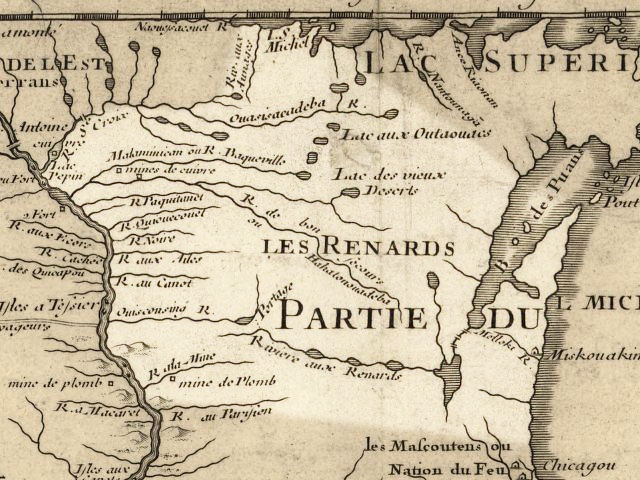
The Wisconsin River is a tributary of the Mississippi River in the U.S. state of Wisconsin. At approximately 430 miles (692 km) long, it is the state's longest river. The river's name, first recorded in 1673 by Jacques Marquette as "Meskousing", is rooted in the Algonquian languages used by the area's American Indian tribes, but its original meaning is obscure. French explorers who followed in the wake of Marquette later modified the name to "Ouisconsin", and so it appears on Guillaume de L'Isle's map (Paris, 1718). This was simplified to "Wisconsin" in the early 19th century before being applied to Wisconsin Territory and finally the state of Wisconsin. The Wisconsin River originates in the forests of the North Woods Lake District of northern Wisconsin, in Lac Vieux Desert near the border of the Upper Peninsula of Michigan. It flows south across the glacial plain of central Wisconsin, passing through Wausau, Stevens Point, and Wisconsin Rapids. In southern Wisconsin it en ... [...More Info...] [...Related Items...] OR: [Wikipedia] [Google] [Baidu] |
Section (United States Land Surveying)
In U.S. land surveying under the Public Land Survey System (PLSS), a section is an area nominally , containing , with 36 sections making up one survey township on a rectangular grid. The legal description of a tract of land under the PLSS includes the name of the state, name of the county, township number, range number, section number, and portion of a section. Sections are customarily surveyed into smaller squares by repeated halving and quartering. A quarter section is and a "quarter-quarter section" is . In 1832 the smallest area of land that could be acquired was reduced to the quarter-quarter section, and this size parcel became entrenched in American mythology. After the Civil War, freedmen (freed slaves) were reckoned to be self-sufficient with " 40 acres and a mule." In the 20th century real estate developers preferred working with parcels. The phrases "front 40" and " back 40," referring to farm fields, indicate the front and back quarter-quarter sections of land. ... [...More Info...] [...Related Items...] OR: [Wikipedia] [Google] [Baidu] |
Superior, Wisconsin
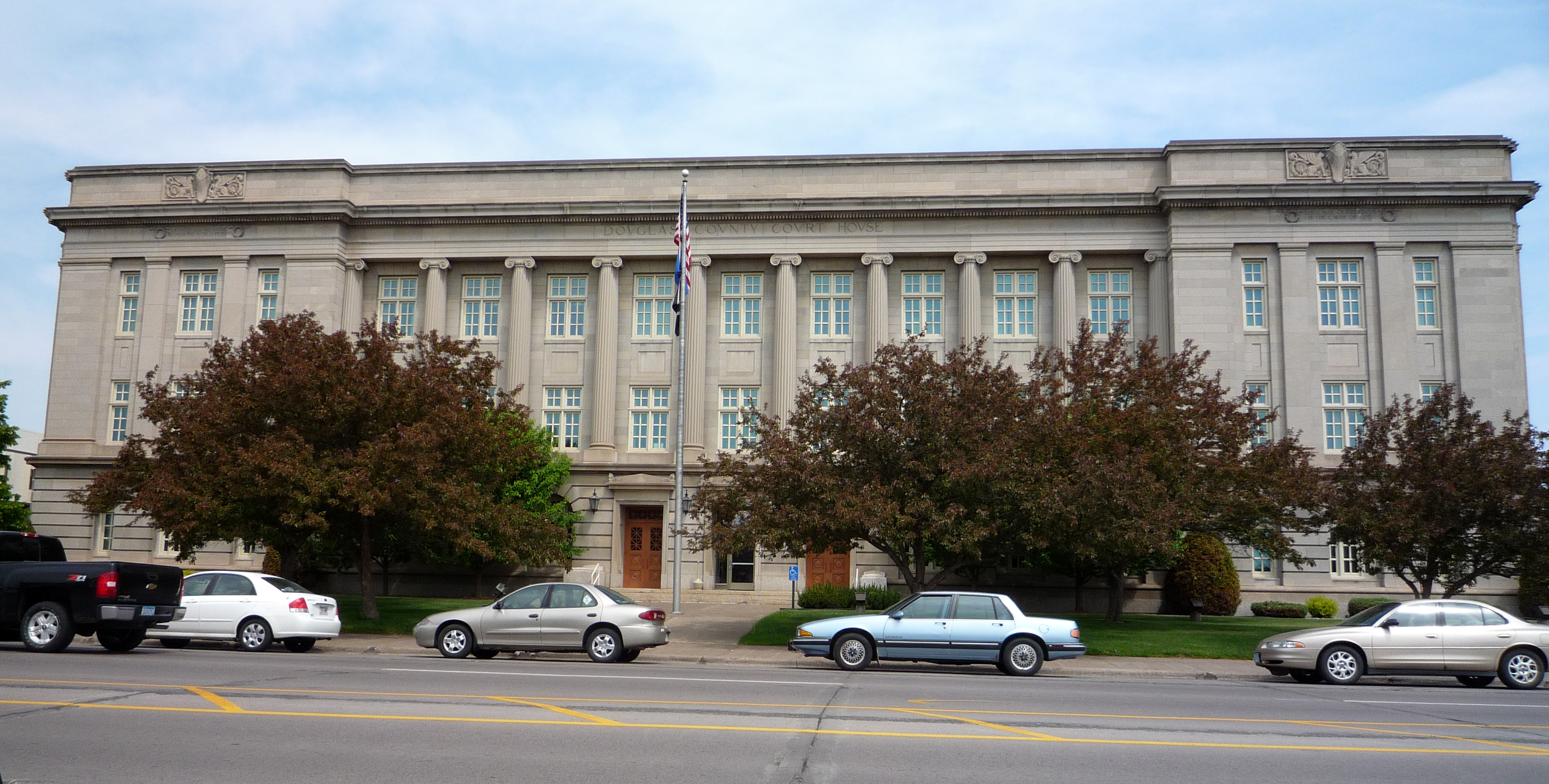
, native_name_lang = oj , nickname = , total_type = , motto = , image_skyline = Tower Avenue.jpg , imagesize = , image_caption = Downtown Superior , image_flag = , flag_size = , image_seal = , seal_size = , image_shield = , shield_size = , image_blank_emblem = , blank_emblem_type = , blank_emblem_size = , pushpin_map = Wisconsin , pushpin_label_position = , pushpin_map_caption = Location of the city of Superiorin Douglas County, Wisconsin , pushpin_mapsize = , subdivision_type = Country , subdivision_name = United States , subdivision_type1 = U.S. state, State , subdivision_name1 = Wisconsin , subdivision_type2 = List of counties in Wisconsin, County , subdivision_name2 = Douglas County, Wisconsin, Douglas , seat_ty ... [...More Info...] [...Related Items...] OR: [Wikipedia] [Google] [Baidu] |
Portage, Wisconsin
Portage is a city in and the county seat of Columbia County, Wisconsin, Columbia County, Wisconsin, United States. The population was 10,581 at the 2020 census making it the largest city in Columbia County. The city is part of the Madison, Wisconsin, metropolitan statistical area, Madison Metropolitan Statistical Area. Portage was named for the Fox-Wisconsin Waterway, a portage between the Fox River (Green Bay tributary), Fox River and the Wisconsin River, which was recognized by Jacques Marquette and Louis Joliet during their discovery of a route to the Mississippi River in 1673. The city's slogan is "Where the North Begins." History The Native Americans in the United States, Native American tribes that once lived here, and later the European traders and settlers, took advantage of the lowlands between the Fox and Wisconsin Rivers as a natural "portage". This is reflected in indigenous names for the town, such as the Menominee name ''Kahkāmohnakaneh'', which means "at the ... [...More Info...] [...Related Items...] OR: [Wikipedia] [Google] [Baidu] |
Land Grant
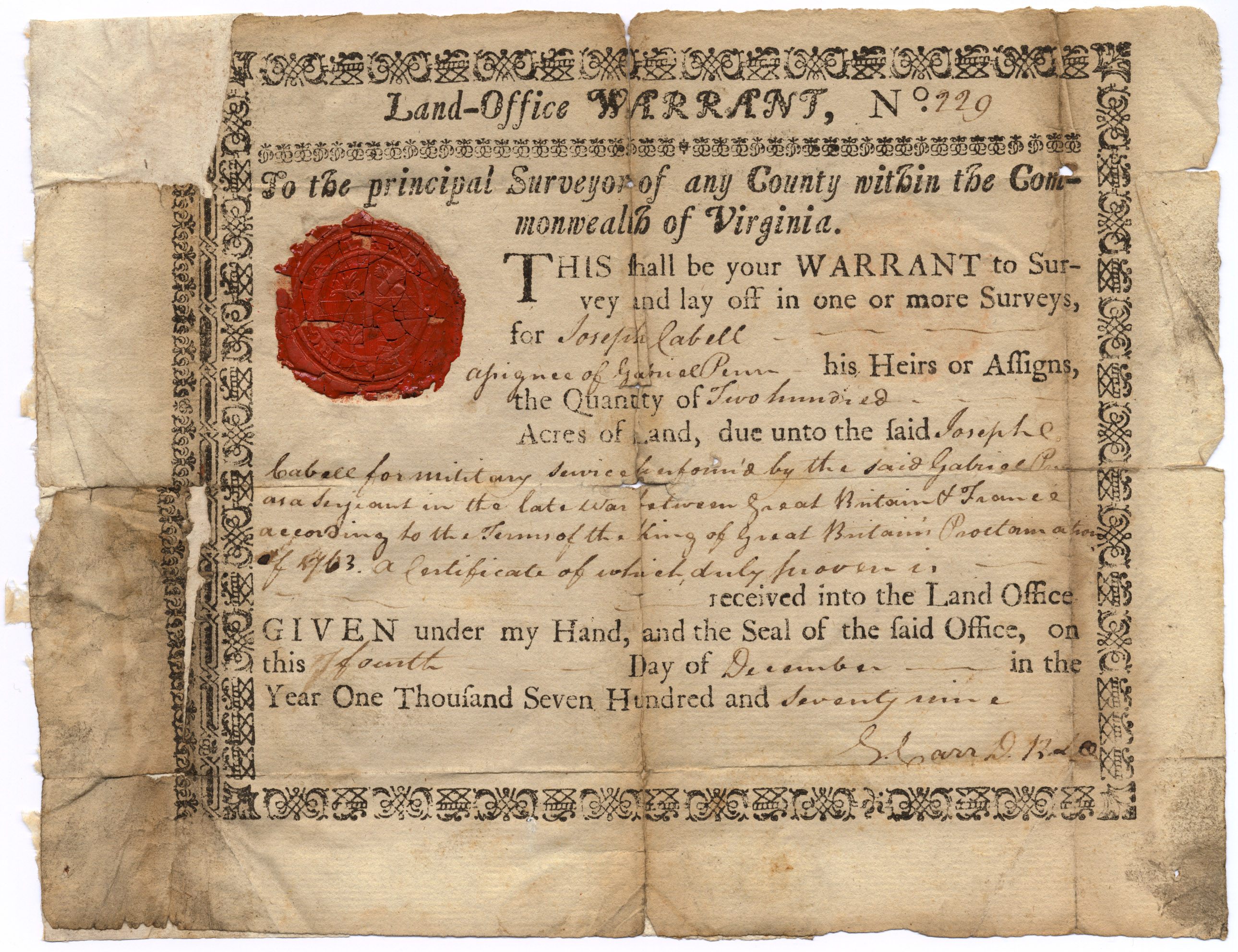
A land grant is a gift of real estate—land or its use privileges—made by a government or other authority as an incentive, means of enabling works, or as a reward for services to an individual, especially in return for military service. Grants of land are also awarded to individuals and companies as incentives to develop unused land in relatively unpopulated countries; the process of awarding land grants are not limited to the countries named below. The United States historically gave out numerous land grants as Homesteads to individuals desiring to prove a farm. The American Industrial Revolution was guided by many supportive acts of legislatures (for example, the Main Line of Public Works legislation of 1826) promoting commerce or transportation infrastructure development by private companies, such as the Cumberland Road turnpike, the Lehigh Canal, the Schuylkill Canal and the many railroads that tied the young United States together. Ancient Rome Roman soldiers were given pe ... [...More Info...] [...Related Items...] OR: [Wikipedia] [Google] [Baidu] |
United States Department Of War
The United States Department of War, also called the War Department (and occasionally War Office in the early years), was the United States Cabinet department originally responsible for the operation and maintenance of the United States Army, also bearing responsibility for naval affairs until the establishment of the Navy Department in 1798, and for most land-based air forces until the creation of the Department of the Air Force on September 18, 1947. The Secretary of War, a civilian with such responsibilities as finance and purchases and a minor role in directing military affairs, headed the War Department throughout its existence. The War Department existed from August 7, 1789 until September 18, 1947, when it split into the Department of the Army and the Department of the Air Force. The Department of the Army and Department of the Air Force later joined the Department of the Navy under the United States Department of Defense in 1949. History 18th century The Departme ... [...More Info...] [...Related Items...] OR: [Wikipedia] [Google] [Baidu] |
Lake Superior
Lake Superior in central North America is the largest freshwater lake in the world by surface areaThe Caspian Sea is the largest lake, but is saline, not freshwater. and the third-largest by volume, holding 10% of the world's surface fresh water. The northern and westernmost of the Great Lakes of North America, it straddles the Canada–United States border with the province of Ontario to the north and east, and the states of Minnesota to the northwest and Wisconsin and Michigan to the south. It drains into Lake Huron via St. Marys River, then through the lower Great Lakes to the St. Lawrence River and the Atlantic Ocean. Name The Ojibwe name for the lake is ''gichi-gami'' (in syllabics: , pronounced ''gitchi-gami'' or ''kitchi-gami'' in different dialects), meaning "great sea". Henry Wadsworth Longfellow wrote this name as "Gitche Gumee" in the poem ''The Song of Hiawatha'', as did Gordon Lightfoot in his song " The Wreck of the ''Edmund Fitzgerald''". According to oth ... [...More Info...] [...Related Items...] OR: [Wikipedia] [Google] [Baidu] |
Province Of Canada
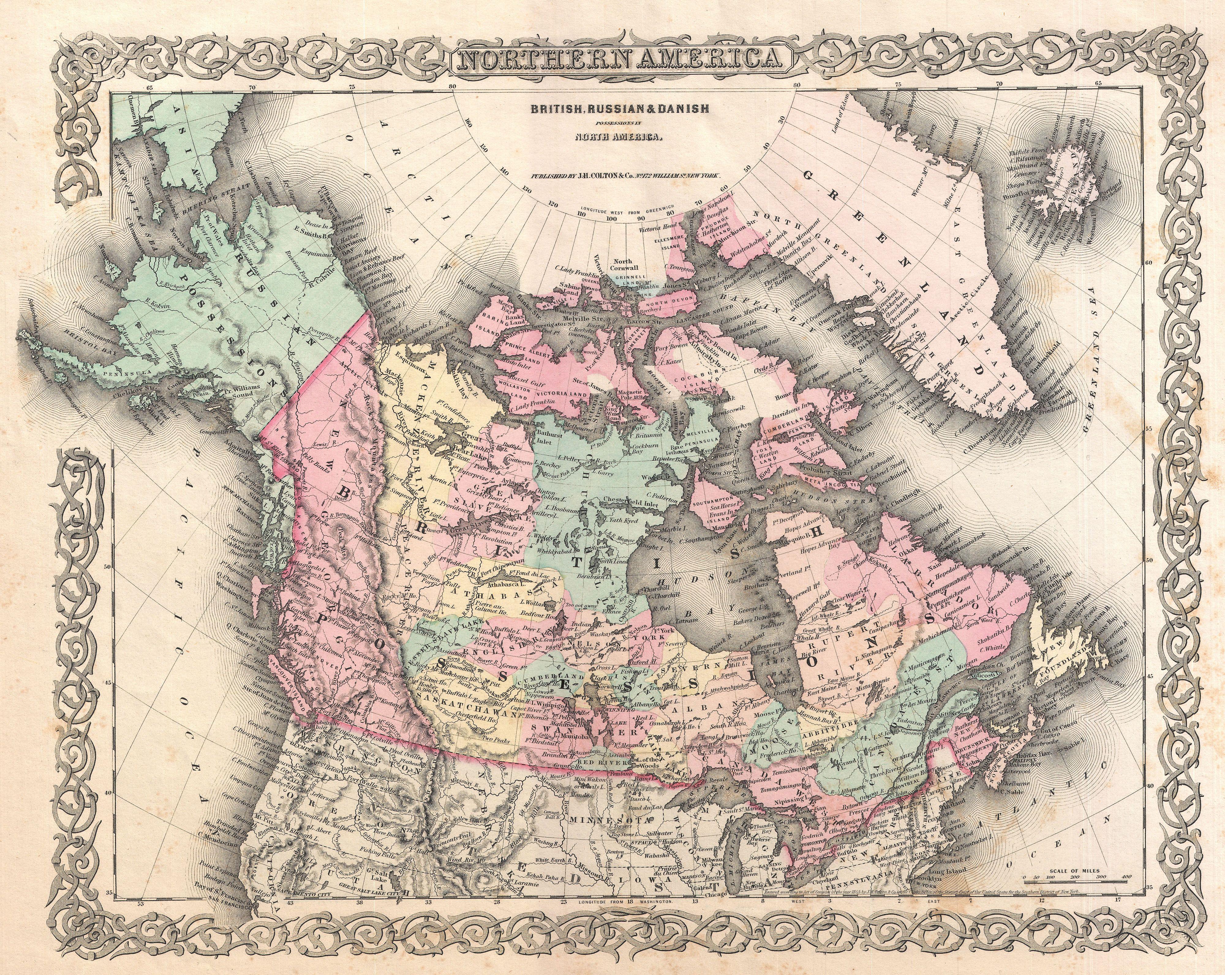
The Province of Canada (or the United Province of Canada or the United Canadas) was a British North America, British colony in North America from 1841 to 1867. Its formation reflected recommendations made by John Lambton, 1st Earl of Durham, in the Report on the Affairs of British North America following the Rebellions of 1837–1838. The Act of Union 1840, passed on 23 July 1840 by the British Parliament and proclaimed by the Monarchy of Great Britain, Crown on 10 February 1841, merged the Colonies of Upper Canada and Lower Canada by abolishing their separate parliaments and replacing them with a Parliament of the Province of Canada, single one with two houses, a Legislative Council of the Province of Canada, Legislative Council as the upper chamber and the Legislative Assembly of the Province of Canada, Legislative Assembly as the lower chamber. In the aftermath of the Rebellions of 1837–1838, unification of the two Canadas was driven by two factors. Firstly, Upper Canad ... [...More Info...] [...Related Items...] OR: [Wikipedia] [Google] [Baidu] |
American Revolution
The American Revolution was an ideological and political revolution that occurred in British America between 1765 and 1791. The Americans in the Thirteen Colonies formed independent states that defeated the British in the American Revolutionary War (1775–1783), gaining independence from the British Crown and establishing the United States of America as the first nation-state founded on Enlightenment principles of liberal democracy. American colonists objected to being taxed by the Parliament of Great Britain, a body in which they had no direct representation. Before the 1760s, Britain's American colonies had enjoyed a high level of autonomy in their internal affairs, which were locally governed by colonial legislatures. During the 1760s, however, the British Parliament passed a number of acts that were intended to bring the American colonies under more direct rule from the British metropole and increasingly intertwine the economies of the colonies with those of Brit ... [...More Info...] [...Related Items...] OR: [Wikipedia] [Google] [Baidu] |
Prairie Du Chien, Wisconsin
Prairie du Chien () is a city in and the county seat of Crawford County, Wisconsin, United States. The population was 5,506 at the 2020 census. Its ZIP Code is 53821. Often referred to as Wisconsin's second oldest city, Prairie du Chien was established as a European settlement by French voyageurs in the late seventeenth century. Its settlement date of June 17, 1673, makes it the fourth colonial settlement by European settlers in the Midwestern United States, following Green Bay, Wisconsin, Sault Ste. Marie, Michigan, and St. Ignace, Michigan. The city offers many sites showing its rich and important history in the region. The city is located near the confluence of the Wisconsin and Mississippi rivers, a strategic point along the Fox-Wisconsin Waterway that connects the Great Lakes with the Mississippi. This location offered early French missionaries and explorers their first access and entrance to the Mississippi River. Early French visitors to the site found it occupied by ... [...More Info...] [...Related Items...] OR: [Wikipedia] [Google] [Baidu] |
War Of 1812
The War of 1812 (18 June 1812 – 17 February 1815) was fought by the United States of America and its indigenous allies against the United Kingdom and its allies in British North America, with limited participation by Spain in Florida. It began when the United States declared war on 18 June 1812 and, although peace terms were agreed upon in the December 1814 Treaty of Ghent, did not officially end until the peace treaty was ratified by Congress on 17 February 1815. Tensions originated in long-standing differences over territorial expansion in North America and British support for Native American tribes who opposed US colonial settlement in the Northwest Territory. These escalated in 1807 after the Royal Navy began enforcing tighter restrictions on American trade with France and press-ganged men they claimed as British subjects, even those with American citizenship certificates. Opinion in the US was split on how to respond, and although majorities in both the House and ... [...More Info...] [...Related Items...] OR: [Wikipedia] [Google] [Baidu] |


