|
Willowcreek, Oregon
Willowcreek is an unincorporated village in Malheur County, Oregon, United States. It is about northwest of Vale on U.S. Route 26. The village has a combined store and café, and the region's elementary school. Willowcreek is located at . Today Willowcreek has a Vale mailing address, although the nearest post office is in nearby Jamieson. The village took its name from Willow Creek, a prominent stream of the county that is a tributary of the Malheur River. The Union Pacific (UP) station here was named Lancaster (or Lancaster Station) after Lancaster, Pennsylvania. The station was on UP's Brogan Line, which was removed by UP. It was named by Brogan namesake D. M. Brogan, who was born in the Pennsylvania city. Willowcreek post office had been established in 1937 but was discontinued by 1980. Education Willowcreek Elementary School is part of the Vale School District. The same district operates Vale High School Vale High School is a public high school in Vale, Oregon, United Stat ... [...More Info...] [...Related Items...] OR: [Wikipedia] [Google] [Baidu] |
Unincorporated Area
An unincorporated area is a region that is not governed by a local municipal corporation. Widespread unincorporated communities and areas are a distinguishing feature of the United States and Canada. Most other countries of the world either have no unincorporated areas at all or these are very rare: typically remote, outlying, sparsely populated or List of uninhabited regions, uninhabited areas. By country Argentina In Argentina, the provinces of Chubut Province, Chubut, Córdoba Province (Argentina), Córdoba, Entre Ríos Province, Entre Ríos, Formosa Province, Formosa, Neuquén Province, Neuquén, Río Negro Province, Río Negro, San Luis Province, San Luis, Santa Cruz Province, Argentina, Santa Cruz, Santiago del Estero Province, Santiago del Estero, Tierra del Fuego Province, Argentina, Tierra del Fuego, and Tucumán Province, Tucumán have areas that are outside any municipality or commune. Australia Unlike many other countries, Australia has only local government in Aus ... [...More Info...] [...Related Items...] OR: [Wikipedia] [Google] [Baidu] |
Malheur County, Oregon
Malheur County () is one of the 36 counties in the U.S. state of Oregon. As of the 2020 census, the population was 31,571. Its county seat is Vale, and its largest city is Ontario. The county was named after the Malheur River, which runs through the county. The word "malheur" is French for misfortune or tragedy. Malheur County is included in the Ontario, Oregon Micropolitan Statistical Area, which is also included in the Boise Combined Statistical Area. It is included in the eight-county definition of Eastern Oregon. History Malheur County was created February 17, 1887, from the southern territory of Baker County. It was first settled by miners and stockmen in the early 1860s. The discovery of gold in 1863 attracted further development, including settlements and ranches. Basques settled in the region in the 1890s and were mainly engaged in sheep raising. Geography According to the United States Census Bureau, the county has a total area of , of which is land and (0.4%) ... [...More Info...] [...Related Items...] OR: [Wikipedia] [Google] [Baidu] |
Oregon
Oregon () is a U.S. state, state in the Pacific Northwest region of the Western United States. The Columbia River delineates much of Oregon's northern boundary with Washington (state), Washington, while the Snake River delineates much of its eastern boundary with Idaho. The 42nd parallel north, 42° north parallel delineates the southern boundary with California and Nevada. Oregon has been home to many Indigenous peoples of the Americas, indigenous nations for thousands of years. The first European traders, explorers, and settlers began exploring what is now Oregon's Pacific coast in the early-mid 16th century. As early as 1564, the Spanish expeditions to the Pacific Northwest, Spanish began sending vessels northeast from the Philippines, riding the Kuroshio Current in a sweeping circular route across the northern part of the Pacific. In 1592, Juan de Fuca undertook detailed mapping and studies of ocean currents in the Pacific Northwest, including the Oregon coast as well as ... [...More Info...] [...Related Items...] OR: [Wikipedia] [Google] [Baidu] |
Vale, Oregon
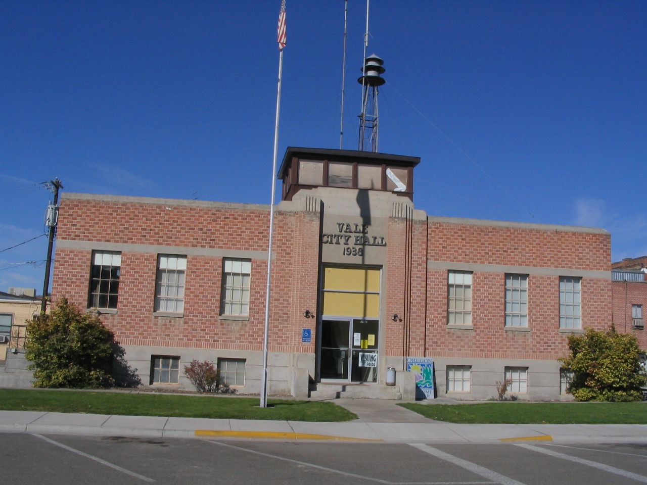
Vale is a city in and the county seat of Malheur County, Oregon, United States, about west of the Idaho border. It is at the intersection of U.S. Routes 20 and 26, on the Malheur River at its confluence with Bully Creek. Vale was selected as Malheur's county seat in 1888 in a vote where other candidate communities were Ontario and Jordan Valley. As of the 2010 census, the city had a total population of 1,874, down from 1,976 in 2000. Vale is part of the Ontario, OR–ID Micropolitan Statistical Area. History The area where present-day Vale sits was historically home to small groups of Native Americans. The area was also a central gathering place for Paiutes during salmon run season. The community was the first stop in Oregon along the Oregon Trail. Journals of those who traveled the trail note a trading post in the area as early as 1853, and by 1864, Johnathan Keeney had built a cabin and a barn that he offered for lodging for passing travelers. This cabin was replace ... [...More Info...] [...Related Items...] OR: [Wikipedia] [Google] [Baidu] |
DeLorme
DeLorme is the producer of personal satellite tracking, messaging, and navigation technology. The company’s main product, ''inReach'', integrates GPS and satellite technologies. ''inReach'' provides the ability to send and receive text messages anywhere in the world (including when beyond cell phone range) by using the Iridium satellite constellation. By pairing with a smart phone, navigation is possible with access to free downloadable topographic maps and NOAA charts. On February 11, 2016, the company announced that it had been purchased by Garmin, a multinational producer of GPS products and services.Garmin® Signs Purchase Agreement to Acquire DeLorme® 11 February 2016 DeLorme also produces printed atlas and topographic software prod ... [...More Info...] [...Related Items...] OR: [Wikipedia] [Google] [Baidu] |
Yarmouth, Maine
Yarmouth is a town in Cumberland County, Maine, United States, twelve miles north of the state's largest city, Portland. When originally settled in 1636, as North Yarmouth, it was part of Massachusetts, and remained as such for 213 years. In 1849, twenty-nine years after Maine's admittance to the Union as the twenty-third state, it was incorporated as the Town of Yarmouth. Yarmouth is part of the Portland– South Portland-Biddeford Metropolitan Statistical Area. The town's population was 8,990 in the 2020 census. The town's proximity to the Atlantic Ocean, and its location on the banks of the Royal River (formerly ''Yarmouth River''), which empties into Casco Bay less than one mile away, means it is a prime location as a harbor. Ships were built in Yarmouth's harbor mainly between 1818 and the 1870s, at which point demand declined dramatically. Meanwhile, the Royal River's four waterfalls within Yarmouth, whose Main Street sits about above sea level, resulted in the foun ... [...More Info...] [...Related Items...] OR: [Wikipedia] [Google] [Baidu] |
Jamieson, Oregon
Jamieson is an unincorporated community in Malheur County, Oregon, United States. The community is northwest of Vale along U.S. Route 26. Jamieson's only business or service is a post office A post office is a public facility and a retailer that provides mail services, such as accepting letters and parcels, providing post office boxes, and selling postage stamps, packaging, and stationery. Post offices may offer additional serv ... with ZIP code 97909. U.S. P ... [...More Info...] [...Related Items...] OR: [Wikipedia] [Google] [Baidu] |
Willow Creek (Malheur River)
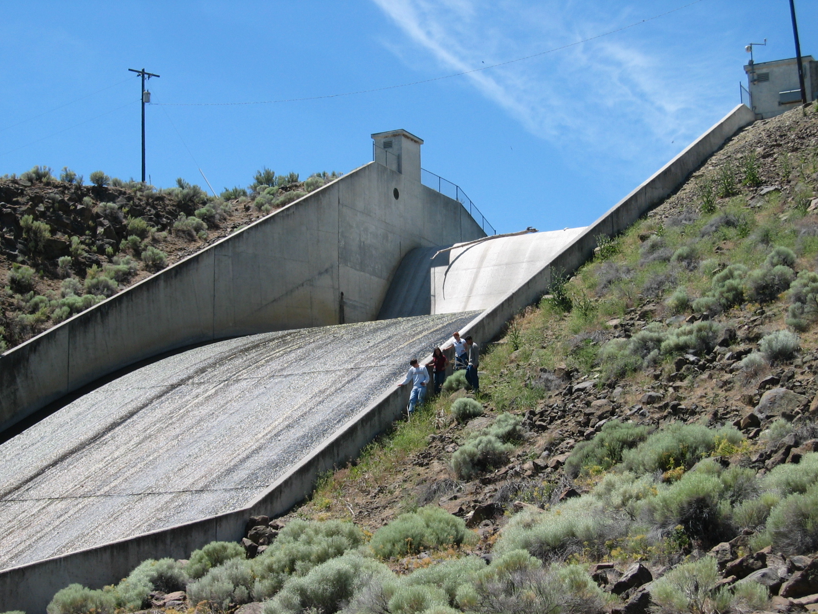
Willow Creek is a tributary of the Malheur River in Malheur County in the U.S. state of Oregon. Reference states that Willow Creek is dammed from its mouth. The remaining distance is an estimate based on map scale and ruler. The creek, which forms at above sea level and ends at , flows generally southeast between Ironside and Vale. Willow Creek's watershed covers of relatively arid land. Willow Creek begins at the confluence of its Middle and South forks, slightly north of Ironside and U.S. Route 26. It flows northeast away from Route 26 to Malheur Reservoir, then turns southeast by Huntington Junction before reaching Route 26 again at Brogan. The creek continues southeast, roughly parallel to the highway, through Jamieson and Willowcreek before reaching Vale. It enters the Malheur River about from the larger stream's confluence with the Snake River. Irrigated farming in the basin produces sugar beets, onions, potatoes, corn, mint, grain, alfalfa seed, vegetable seed, a ... [...More Info...] [...Related Items...] OR: [Wikipedia] [Google] [Baidu] |
Malheur River
The Malheur River (local pronunciation: "MAL-hyure") is a tributary of the Snake River in eastern Oregon in the United States. It drains a Great Basin Desert, high desert area, between the Harney Basin and the Blue Mountains (Oregon), Blue Mountains and the Snake. Despite the similarity of name, the river does not flow into nearby Malheur Lake, which is located in the enclosed Harney Basin southwest of the watershed of the river. When water levels were higher, Malheur Lake would drain into the Malheur River. Course The Malheur River rises in the southern Blue Mountains (Pacific Northwest), Blue Mountains of southern Grant County, Oregon, Grant County, south of Strawberry Mountain (Oregon), Strawberry Mountain in the Strawberry Mountain Wilderness. It flows south through Malheur National Forest, then southeast past Drewsey, Oregon, Drewsey and through Warm Springs Reservoir. At Riverside, Malheur County, Oregon, Riverside in western Malheur County, Oregon, Malheur County it rec ... [...More Info...] [...Related Items...] OR: [Wikipedia] [Google] [Baidu] |
Union Pacific
The Union Pacific Railroad , legally Union Pacific Railroad Company and often called simply Union Pacific, is a freight-hauling railroad that operates 8,300 locomotives over routes in 23 U.S. states west of Chicago and New Orleans. Union Pacific is the second largest railroad in the United States after BNSF, with which it shares a duopoly on transcontinental freight rail lines in the Western, Midwestern and Southern United States. Founded in 1862, the original Union Pacific Rail Road was part of the first transcontinental railroad project, later known as the Overland Route. Over the next century, UP absorbed the Missouri Pacific Railroad, the Chicago and North Western Transportation Company, the Western Pacific Railroad, the Missouri–Kansas–Texas Railroad and the Chicago, Rock Island and Pacific Railroad. In 1996, the Union Pacific merged with Southern Pacific Transportation Company, itself a giant system that was absorbed by the Denver and Rio Grande Western Railroad. ... [...More Info...] [...Related Items...] OR: [Wikipedia] [Google] [Baidu] |
Lancaster, Pennsylvania
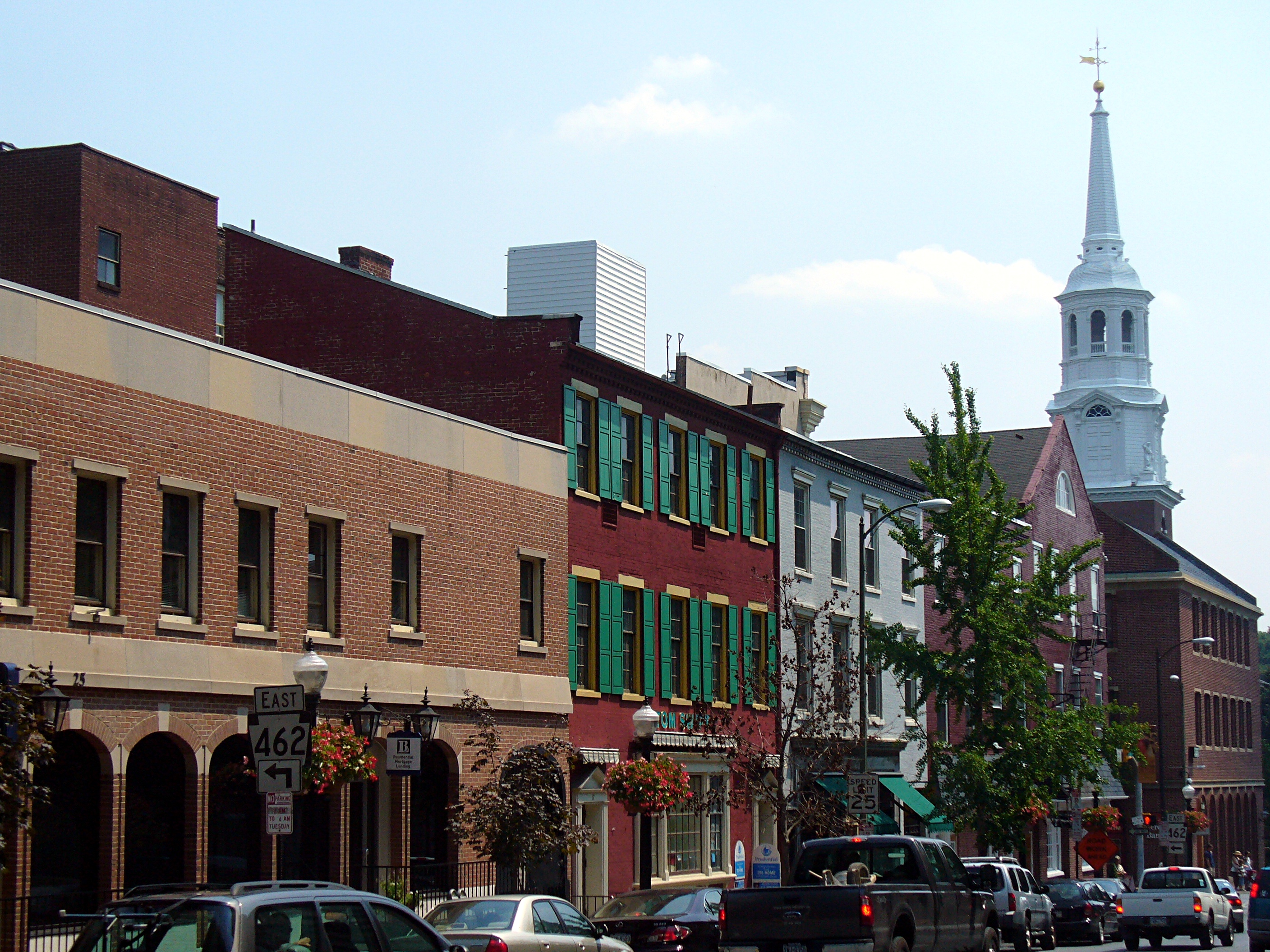
Lancaster, ( ; pdc, Lengeschder) is a city in and the county seat of Lancaster County, Pennsylvania. It is one of the oldest inland cities in the United States. With a population at the 2020 census of 58,039, it ranks 11th in population among Pennsylvania's municipalities. The Lancaster metropolitan area population is 507,766, making it the 104th-largest metropolitan area in the U.S. and second-largest in the South Central Pennsylvania area. The city's primary industries include healthcare, tourism, public administration, manufacturing, and both professional and semi-professional services. Lancaster is a hub of Pennsylvania's Dutch Country. Lancaster is located southwest of Allentown and west of Philadelphia. History Originally called Hickory Town, the city was renamed after the English city of Lancaster by native John Wright. Its symbol, the red rose, is from the House of Lancaster. Lancaster was part of the 1681 Penn's Woods Charter of William Penn, and was laid ... [...More Info...] [...Related Items...] OR: [Wikipedia] [Google] [Baidu] |
Brogan, Oregon
Brogan is an unincorporated community and Census-designated place (CDP) in Malheur County, Oregon, United States, on U.S. Route 26. Brogan was founded by D. M. Brogan in 1909, and when a post office was established in the locality on April 23 that year, it was named for him. Brogan is located on the north end of the now-abandoned Union Pacific Railroad branch line from Vale. Demographics Brogan is part of the Ontario, OR– ID Micropolitan Statistical Area. At the 2010 census, the population was 90 (47 female and 43 male). The median age was 50.5 years. There were 41 households, five of which included children under age 18. Education Brogan is within the Vale School District 84. This district has grades K-12 and operates Vale High School Vale High School is a public high school in Vale, Oregon, United States. It is a part of Vale School District 84. The Vale School District takes students from Vale and Brogan, as well as the unincorporated community of Willowcreek. Ad ... [...More Info...] [...Related Items...] OR: [Wikipedia] [Google] [Baidu] |


.jpg)


