|
White River Junction, VT
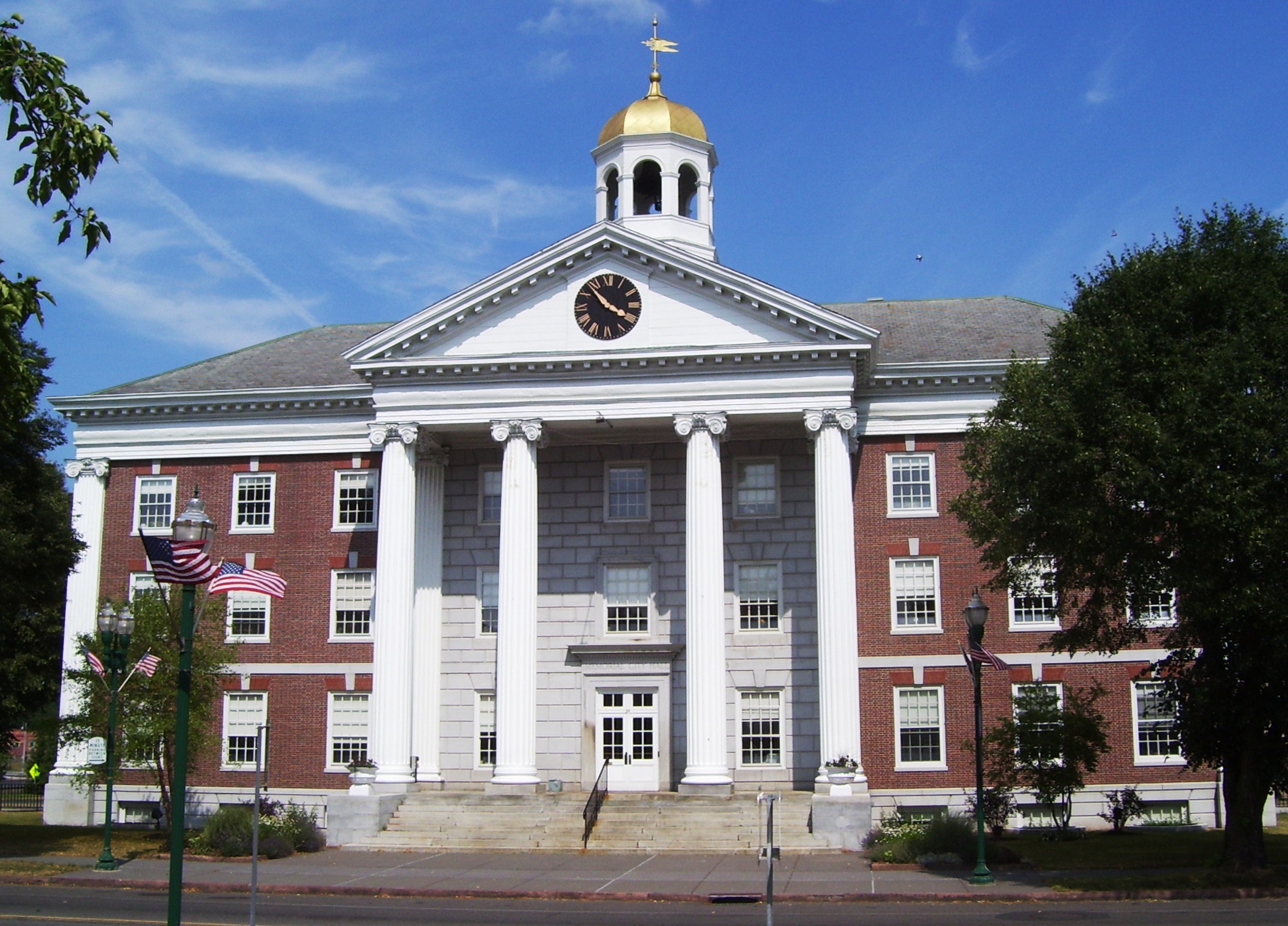
White River Junction is an unincorporated village and census-designated place (CDP) in the town of Hartford in Windsor County, Vermont, United States. The population was 2,528 at the 2020 census, up from 2,286 in 2010, making it the largest community within the town of Hartford. The village includes the White River Junction Historic District, a historic district listed on the National Register of Historic Places in 1980 and whose boundaries increased in 2002. The historic district reflects the urban architecture of the area from the late 19th century and early 20th century. The district is bounded by the Central Vermont railroad tracks, Gates Street, and South Main Street. It includes at least 29 contributing and non-contributing buildings. Notable buildings include the Coolidge Hotel, the First National Bank building, a U.S. Post Office building, and the White River Junction Fire House, showing examples of Greek Revival, Colonial Revival, Richardsonian Romanesque, Italianate ... [...More Info...] [...Related Items...] OR: [Wikipedia] [Google] [Baidu] |
Census-designated Place
A census-designated place (CDP) is a concentration of population defined by the United States Census Bureau for statistical purposes only. CDPs have been used in each decennial census since 1980 as the counterparts of incorporated places, such as self-governing cities, towns, and villages, for the purposes of gathering and correlating statistical data. CDPs are populated areas that generally include one officially designated but currently unincorporated community, for which the CDP is named, plus surrounding inhabited countryside of varying dimensions and, occasionally, other, smaller unincorporated communities as well. CDPs include small rural communities, edge cities, colonias located along the Mexico–United States border, and unincorporated resort and retirement communities and their environs. The boundaries of any CDP may change from decade to decade, and the Census Bureau may de-establish a CDP after a period of study, then re-establish it some decades later. Most unin ... [...More Info...] [...Related Items...] OR: [Wikipedia] [Google] [Baidu] |
2010 United States Census
The United States census of 2010 was the twenty-third United States national census. National Census Day, the reference day used for the census, was April 1, 2010. The census was taken via mail-in citizen self-reporting, with enumerators serving to spot-check randomly selected neighborhoods and communities. As part of a drive to increase the count's accuracy, 635,000 temporary enumerators were hired. The population of the United States was counted as 308,745,538, a 9.7% increase from the 2000 census. This was the first census in which all states recorded a population of over half a million people as well as the first in which all 100 largest cities recorded populations of over 200,000. Introduction As required by the United States Constitution, the U.S. census has been conducted every 10 years since 1790. The 2000 U.S. census was the previous census completed. Participation in the U.S. census is required by law of persons living in the United States in Title 13 of the United ... [...More Info...] [...Related Items...] OR: [Wikipedia] [Google] [Baidu] |
Vermont Central Railway
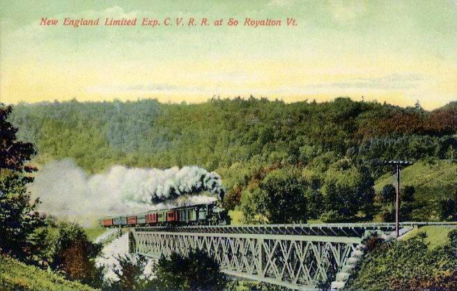
The Central Vermont Railway was a railroad that operated in the U.S. states of Connecticut, Massachusetts, New Hampshire, New York, and Vermont, as well as the Canadian province of Quebec. It connected Montreal, Quebec, with New London, Connecticut, using a route along the shores of Lake Champlain, through the Green Mountains and along the Connecticut River valley, as well as Montreal to Boston, Massachusetts, through a connection with the Boston and Maine Railroad at White River Junction, Vermont. History The Vermont Central Railroad was chartered October 31, 1843, to build a line across the center of Vermont, running from Burlington on Lake Champlain east to Montpelier, and then southeast and south to Windsor on the Connecticut River. Initial plans had the main line running through Montpelier. However, due to the difficulty of building through the Williamstown Gulf, a narrow valley south of Barre, Vermont, and to land interests of Charles Paine in Northfield, Vermont, a cour ... [...More Info...] [...Related Items...] OR: [Wikipedia] [Google] [Baidu] |
West Lebanon, New Hampshire
West Lebanon is a section (pop. approx 4,100) of the city of Lebanon, New Hampshire, on the Connecticut River. The area contains a major shopping plaza strip along New Hampshire Route 12A, serving the Upper Valley The Connecticut River is the longest river in the New England region of the United States, flowing roughly southward for through four states. It rises 300 yards (270 m) south of the U.S. border with Quebec, Canada, and discharges at Long Islan ... communities along Interstates Interstate 89, 89 and Interstate 91, 91. West Lebanon also hosts the Lebanon Municipal Airport (New Hampshire), Lebanon Municipal Airport, a number of small software and tech businesses, and a regional daily newspaper, the ''Valley News''. The village serves as a bedroom community for nearby Dartmouth College. West Lebanon was the site of Lebanon's first settlement in 1761. The village later developed into a regional hub for rail transport, although at that time it was better known to travelers ... [...More Info...] [...Related Items...] OR: [Wikipedia] [Google] [Baidu] |
Connecticut River
The Connecticut River is the longest river in the New England region of the United States, flowing roughly southward for through four states. It rises 300 yards (270 m) south of the U.S. border with Quebec, Canada, and discharges at Long Island Sound. Its watershed encompasses , covering parts of five U.S. states and one Canadian province, via 148 tributaries, 38 of which are major rivers. It produces 70% of Long Island Sound's fresh water, discharging at per second. The Connecticut River Valley is home to some of the northeastern United States' most productive farmland, as well as the Hartford–Springfield Knowledge Corridor, a metropolitan region of approximately two million people surrounding Springfield, Massachusetts, and Hartford, Connecticut. History The word "Connecticut" is a corruption of the Mohegan word ''quinetucket'', which means "beside the long, tidal river". The word came into English during the early 1600s to name the river, which was also called simply "Th ... [...More Info...] [...Related Items...] OR: [Wikipedia] [Google] [Baidu] |
White River (Vermont)
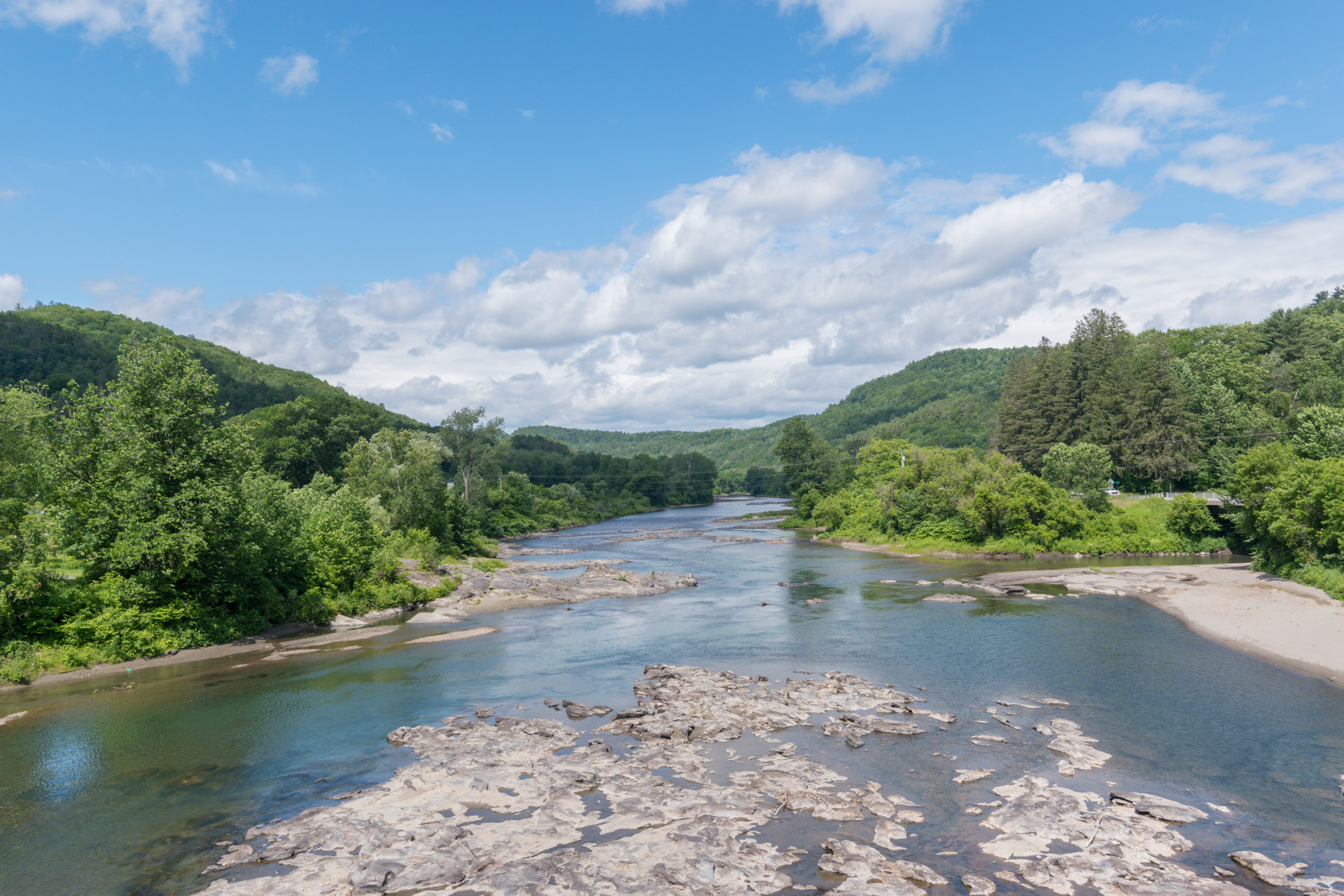
The White River is a U.S. Geological Survey. National Hydrography Dataset high-resolution flowline dataThe National Map accessed April 1, 2011 river in the U.S. state of Vermont. It is a tributary of the Connecticut River, and is the namesake of the White River Valley. The White River rises at Skylight Pond south of Bread Loaf Mountain near the crest of the Green Mountains. The river flows east to the town of Granville, where it receives the outflow from the southern portion of Granville Notch. The river turns south and, followed by Vermont Route 100, flows through the towns of Hancock and Rochester. Entering Stockbridge, the river turns northeast and, followed by Vermont Route 107, flows to the town of Bethel, where the Third Branch of the White River enters from the north. The Second Branch and the First Branch of the White River also enter from the north as the river flows through Royalton. From Royalton to the river's mouth, the valley is occupied by Interstate 89 and ... [...More Info...] [...Related Items...] OR: [Wikipedia] [Google] [Baidu] |
Preserve America
Preserve America is a United States government program, established under President George W. Bush, intended to encourage and support community efforts to preserve and enjoy the country's cultural and natural heritage. As of 2017, more than 900 communities, representing all 50 states, Washington, D.C., American Samoa, and the U.S. Virgin Islands, have been designated as "Preserve America Communities".Overview Preserve America website, accessed August 17, 2008 Designated communities become eligible to apply for Preserve America grants to enhance and the use of community historic and cultural sites. Federal budget allocations for Preserve America grants totaled approximately $5 million in |
Interstate Highway System
The Dwight D. Eisenhower National System of Interstate and Defense Highways, commonly known as the Interstate Highway System, is a network of controlled-access highways that forms part of the National Highway System in the United States. The system extends throughout the contiguous United States and has routes in Hawaii, Alaska, and Puerto Rico. The U.S. federal government first funded roadways through the Federal Aid Road Act of 1916, and began an effort to construct a national road grid with the passage of the Federal Aid Highway Act of 1921. In 1926, the United States Numbered Highway System was established, creating the first national road numbering system for cross-country travel. The roads were still state-funded and maintained, however, and there was little in the way of national standards for road design. U.S. Highways could be anything from a two-lane country road to a major multi-lane freeway. After Dwight D. Eisenhower became president in 1953, his administration ... [...More Info...] [...Related Items...] OR: [Wikipedia] [Google] [Baidu] |
Romanesque Revival Architecture
Romanesque Revival (or Neo-Romanesque) is a style of building employed beginning in the mid-19th century inspired by the 11th- and 12th-century Romanesque architecture. Unlike the historic Romanesque style, Romanesque Revival buildings tended to feature more simplified arches and windows than their historic counterparts. An early variety of Romanesque Revival style known as Rundbogenstil ("Round-arched style") was popular in German lands and in the German diaspora beginning in the 1830s. By far the most prominent and influential American architect working in a free "Romanesque" manner was Henry Hobson Richardson. In the United States, the style derived from examples set by him are termed Richardsonian Romanesque, of which not all are Romanesque Revival. Romanesque Revival is also sometimes referred to as the " Norman style" or " Lombard style", particularly in works published during the 19th century after variations of historic Romanesque that were developed by the Normans in En ... [...More Info...] [...Related Items...] OR: [Wikipedia] [Google] [Baidu] |
Italianate
The Italianate style was a distinct 19th-century phase in the history of Classical architecture. Like Palladianism and Neoclassicism, the Italianate style drew its inspiration from the models and architectural vocabulary of 16th-century Italian Renaissance architecture, synthesising these with picturesque aesthetics. The style of architecture that was thus created, though also characterised as "Neo-Renaissance", was essentially of its own time. "The backward look transforms its object," Siegfried Giedion wrote of historicist architectural styles; "every spectator at every period—at every moment, indeed—inevitably transforms the past according to his own nature." The Italianate style was first developed in Britain in about 1802 by John Nash, with the construction of Cronkhill in Shropshire. This small country house is generally accepted to be the first Italianate villa in England, from which is derived the Italianate architecture of the late Regency and early Victorian eras. ... [...More Info...] [...Related Items...] OR: [Wikipedia] [Google] [Baidu] |
Richardsonian Romanesque
Richardsonian Romanesque is a style of Romanesque Revival architecture named after the American architect Henry Hobson Richardson (1838–1886). The revival style incorporates 11th and 12th century southern French, Spanish, and Italian Romanesque characteristics. Richardson first used elements of the style in his Richardson Olmsted Complex in Buffalo, New York, designed in 1870. Multiple architects followed in this style in the late 19th century; Richardsonian Romanesque later influenced modern styles of architecture as well. History and development This very free revival style incorporates 11th and 12th century southern French, Spanish and Italian Romanesque characteristics. It emphasizes clear, strong picturesque massing, round-headed "Romanesque" arches, often springing from clusters of short squat columns, recessed entrances, richly varied rustication, blank stretches of walling contrasting with bands of windows, and cylindrical towers with conical caps embedded in the wall ... [...More Info...] [...Related Items...] OR: [Wikipedia] [Google] [Baidu] |
Colonial Revival
The Colonial Revival architectural style seeks to revive elements of American colonial architecture. The beginnings of the Colonial Revival style are often attributed to the Centennial Exhibition of 1876, which reawakened Americans to the architectural traditions of their colonial past. Fairly small numbers of Colonial Revival homes were built c. 1880–1910, a period when Queen Anne-style architecture was dominant in the United States. From 1910–1930, the Colonial Revival movement was ascendant, with about 40% of U.S. homes built during this period in the Colonial Revival style. In the immediate post-war period (c. 1950s–early 1960s), Colonial Revival homes continued to be constructed, but in simplified form. In the present-day, many New Traditional homes draw from Colonial Revival styles. While the dominant influences in Colonial Revival style are Georgian and Federal architecture, Colonial Revival homes also draw, to a lesser extent, from the Dutch Colonial ... [...More Info...] [...Related Items...] OR: [Wikipedia] [Google] [Baidu] |
.jpg)


.jpg)


