|
Whenby
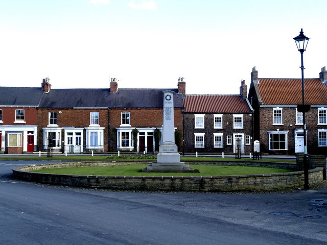
Whenby is a civil parish, and small village, in Hambleton district of North Yorkshire, England. Whenby lies between Sheriff Hutton and Brandsby, on Main Street, and a little to the east of the Howardian Hills. It has an area of , and is situated approximately north of York and east of Easingwold Easingwold is a market town, electoral ward and civil parish in the Hambleton District in North Yorkshire, England. Historically, part of the North Riding of Yorkshire, it had a population of 4,233 at the 2001 census, increasing to 4,627 at t .... There is a track that leads from Main Street to St Martin's Church. This track has the village's telephone box (old, red and falling down!), post box, and village notice board on it. The village has nothing else but houses and farms. Whenby has approximately 14 houses, most of these are old cottages, and all but 3 are on the north and east side of Main Street. All surrounding land is farmland, and strict planning permissions preven ... [...More Info...] [...Related Items...] OR: [Wikipedia] [Google] [Baidu] |
St Martin's Church, Whenby
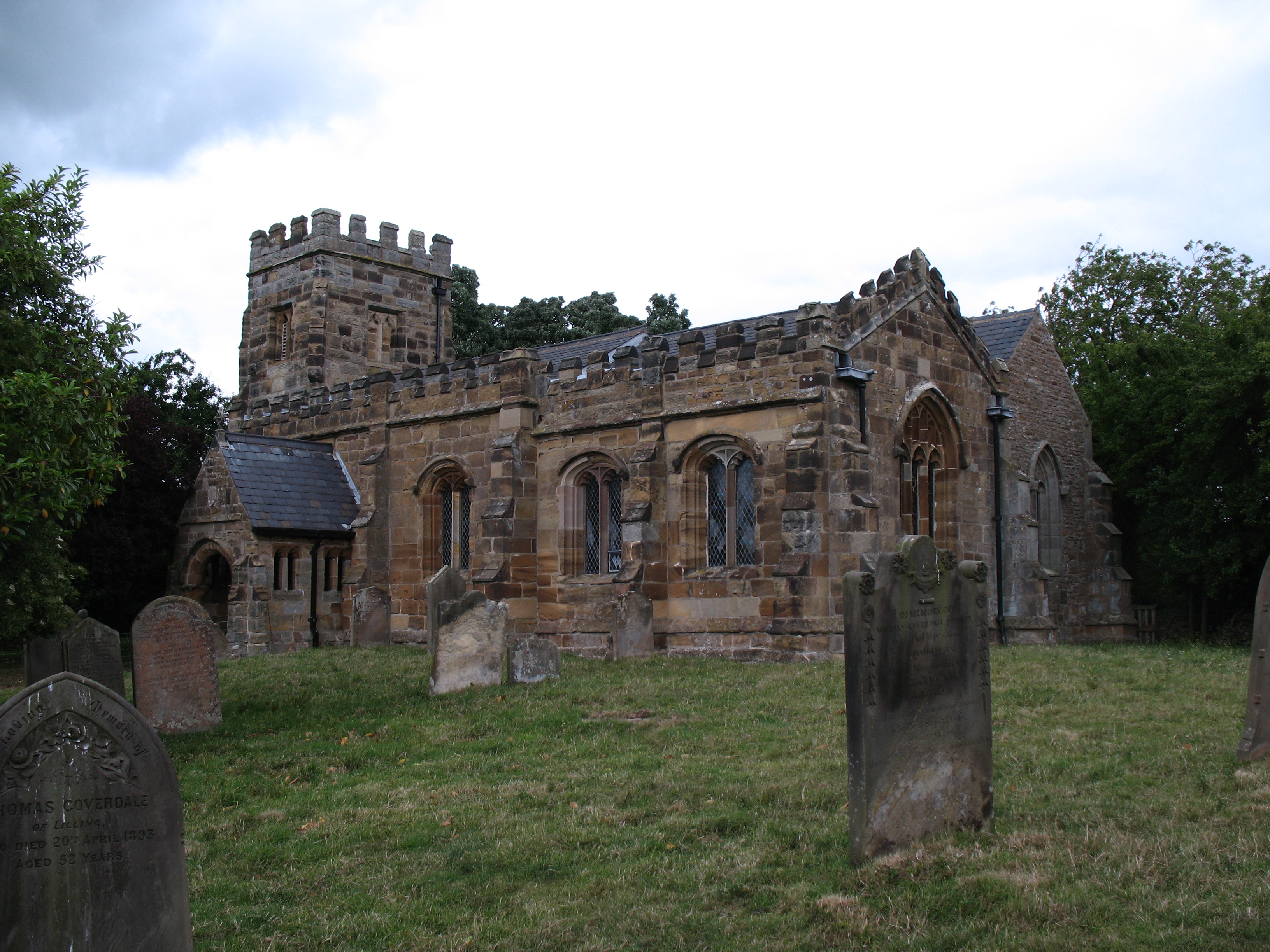
St Martin's Church is a redundant Anglican church in the village of Whenby, North Yorkshire, England. It is recorded in the National Heritage List for England as a designated Grade II* listed building, and is under the care of the Churches Conservation Trust. History It is considered that the church was reconstructed in the 15th century on the site of an earlier church. It was extensively restored between 1871 and 1910. St Martin's was declared redundant on 1 April 1982, and was vested in the Trust on 19 October 1983. Architecture Structure The church is constructed in ironstone with Welsh slate roofs. Its plan consists of a two-bay nave, a two-bay chancel, an aisle running to the north of the nave and the chancel, a south porch and a west tower. The architectural style is Perpendicular. The east end of the aisle forms a chapel. The tower is in two stages, it has angle buttresses and an embattled parapet. In the bottom stage is a blocked we ... [...More Info...] [...Related Items...] OR: [Wikipedia] [Google] [Baidu] |
United Kingdom Census 2011
A Census in the United Kingdom, census of the population of the United Kingdom is taken every ten years. The 2011 census was held in all countries of the UK on 27 March 2011. It was the first UK census which could be completed online via the Internet. The Office for National Statistics (ONS) is responsible for the census in England and Wales, the General Register Office for Scotland (GROS) is responsible for the census in Scotland, and the Northern Ireland Statistics and Research Agency (NISRA) is responsible for the census in Northern Ireland. The Office for National Statistics is the executive office of the UK Statistics Authority, a non-ministerial department formed in 2008 and which reports directly to Parliament. ONS is the UK Government's single largest statistical producer of independent statistics on the UK's economy and society, used to assist the planning and allocation of resources, policy-making and decision-making. ONS designs, manages and runs the census in England an ... [...More Info...] [...Related Items...] OR: [Wikipedia] [Google] [Baidu] |
Hambleton District
Hambleton is a local government district in North Yorkshire, England. The administrative centre is Northallerton, and the district includes the outlying towns and villages of Bedale, Thirsk, Great Ayton, Stokesley, and Easingwold. The district was formed by the Local Government Act 1972 on 1 April 1974, as a merger of Northallerton Urban District, Bedale Rural District, Easingwold Rural District, Northallerton Rural District, and parts of Thirsk Rural District, Stokesley Rural District and Croft Rural District, all in the North Riding of Yorkshire. Geography Hambleton covers an area of 1,311.17 km² most of which, 1,254.90 km², is green space. The district is named after the Hambleton Hills, part of the North York Moors National Park, on the eastern edge of the district. This area is the subject of a national habitat protection scheme as articulated in the United Kingdom's Biodiversity Action Plan. About 75% of the district lies in the Vales of Mowbray and of ... [...More Info...] [...Related Items...] OR: [Wikipedia] [Google] [Baidu] |
North Yorkshire
North Yorkshire is the largest ceremonial counties of England, ceremonial county (lieutenancy area) in England, covering an area of . Around 40% of the county is covered by National parks of the United Kingdom, national parks, including most of the Yorkshire Dales and the North York Moors. It is one of four counties in England to hold the name Yorkshire; the three other counties are the East Riding of Yorkshire, South Yorkshire and West Yorkshire. North Yorkshire may also refer to a non-metropolitan county, which covers most of the ceremonial county's area () and population (a mid-2016 estimate by the Office for National Statistics, ONS of 602,300), and is administered by North Yorkshire County Council. The non-metropolitan county does not include four areas of the ceremonial county: the City of York, Middlesbrough, Redcar and Cleveland and the southern part of the Borough of Stockton-on-Tees, which are all administered by Unitary authorities of England, unitary authorities. ... [...More Info...] [...Related Items...] OR: [Wikipedia] [Google] [Baidu] |
York
York is a cathedral city with Roman origins, sited at the confluence of the rivers Ouse and Foss in North Yorkshire, England. It is the historic county town of Yorkshire. The city has many historic buildings and other structures, such as a minster, castle, and city walls. It is the largest settlement and the administrative centre of the wider City of York district. The city was founded under the name of Eboracum in 71 AD. It then became the capital of the Roman province of Britannia Inferior, and later of the kingdoms of Deira, Northumbria, and Scandinavian York. In the Middle Ages, it became the northern England ecclesiastical province's centre, and grew as a wool-trading centre. In the 19th century, it became a major railway network hub and confectionery manufacturing centre. During the Second World War, part of the Baedeker Blitz bombed the city; it was less affected by the war than other northern cities, with several historic buildings being gutted and restore ... [...More Info...] [...Related Items...] OR: [Wikipedia] [Google] [Baidu] |
Civil Parish
In England, a civil parish is a type of administrative parish used for local government. It is a territorial designation which is the lowest tier of local government below districts and counties, or their combined form, the unitary authority. Civil parishes can trace their origin to the ancient system of ecclesiastical parishes, which historically played a role in both secular and religious administration. Civil and religious parishes were formally differentiated in the 19th century and are now entirely separate. Civil parishes in their modern form came into being through the Local Government Act 1894, which established elected parish councils to take on the secular functions of the parish vestry. A civil parish can range in size from a sparsely populated rural area with fewer than a hundred inhabitants, to a large town with a population in the tens of thousands. This scope is similar to that of municipalities in Continental Europe, such as the communes of France. However, ... [...More Info...] [...Related Items...] OR: [Wikipedia] [Google] [Baidu] |
Sheriff Hutton
Sheriff Hutton is a village and civil parish in the Ryedale district of North Yorkshire, England. It lies about north by north-east of York. History The village is mentioned twice in the Domesday Book of 1086, as ''Hotun'' in the Bulford hundred. Before the Norman invasion the manor was split between several land owners. Those named included ''Ligulf'', ''Northmann'', ''Thorkil'', ''Thorsten'' and ''Thorulf''. Afterwards some of the land was retained by the Crown and other portions given to Count Robert of Mortain who installed Nigel Fossard as lord of the manor. Soon after this, the land was in the possession of the Bulmer family. Bertram de Bulmer built the first castle in the village during the reign of King Stephen. After the civil war between Stephen and Matilda, the castle and manor were seized by the Crown before being held for the king by the Mauley family. The manor eventually came into the possession of the Neville family in the 14th century until 1480, when it was ... [...More Info...] [...Related Items...] OR: [Wikipedia] [Google] [Baidu] |
Brandsby
Brandsby is a village in North Yorkshire, England. The village is the main constituent of the Brandsby-cum-Stearsby Civil Parish in the District of Hambleton. The village is mentioned in the ''Domesday book''. It lies between Easingwold and Hovingham, some north of York. History The village toponymy is of Scandinavian origin named after a Norseman called Brand and the suffix of ''by'' meaning settlement or habitation. At the time of the Norman conquest, it was held by Cnut, son of Karli and afterwards by Hugh, son of Baldric. Later the village and the surrounding lands were given to Baron Roger de Mowbray. It was part of the Bulford Hundred. The Baron left the lordship of the manor to Nicholas de Riparia (or de le Ryver), whose family held it until the reign of Queen Elizabeth I. After this the lordship passed via marriage to the Cholmeley family, descended from the Cholmondeley family of Cheshire. They provided a long lineage of Brandsby squires but, unfortunately, few reco ... [...More Info...] [...Related Items...] OR: [Wikipedia] [Google] [Baidu] |
Howardian Hills
The Howardian Hills are an Area of Outstanding Natural Beauty located between the Yorkshire Wolds, the North York Moors National Park, and the Vale of York. They take their name from the Howard family who still own local lands. Topography The Howardian Hills form 79 square miles of well-wooded undulating countryside between the flat agricultural Vales of Pickering and York. The irregular high ridges of the Howardian Hills are a southern extension of the rocks of the Hambleton Hills in the North York Moors. Jurassic limestone, pastures, and extensive woodland overlook the agricultural plains below. On the eastern edge, the River Derwent cuts through the Hills in the Kirkham Gorge, a deep winding valley formed as an overflow channel from glacial Lake Pickering. Settlement Although there are no towns within the AONB, the market towns of Helmsley and Malton lie just beyond the boundary. From Malton to Hovingham is a line of spring line villages. The majority of older buildin ... [...More Info...] [...Related Items...] OR: [Wikipedia] [Google] [Baidu] |
Easingwold
Easingwold is a market town, electoral ward and civil parish in the Hambleton District in North Yorkshire, England. Historically, part of the North Riding of Yorkshire, it had a population of 4,233 at the 2001 census, increasing to 4,627 at the 2011 Census. It is located about north of York, at the foot of the Howardian Hills. History The town is mentioned in the Domesday Book of 1086 as "Eisicewalt" in the Bulford hundred. At the time of the Norman conquest, the manor was owned by Earl Morcar, but subsequently passed to the King. In 1265 the manor was passed to Edmund Crouchback by his father, Henry III. The manor was caught up in the dispute between the 2nd Earl of Lancaster and Edward I and the manor passed back to the crown following the Battle of Boroughbridge in 1322 which resulted in the execution of the Earl at Pontefract. The manor was restored to the Earl's brother some six years later, but he left no male heir, so the lands passed to his son-in-law, John of Gaunt ... [...More Info...] [...Related Items...] OR: [Wikipedia] [Google] [Baidu] |
St Martins, Whenby - Geograph
ST, St, or St. may refer to: Arts and entertainment * Stanza, in poetry * Suicidal Tendencies, an American heavy metal/hardcore punk band * Star Trek, a science-fiction media franchise * Summa Theologica, a compendium of Catholic philosophy and theology by St. Thomas Aquinas * St or St., abbreviation of "State", especially in the name of a college or university Businesses and organizations Transportation * Germania (airline) (IATA airline designator ST) * Maharashtra State Road Transport Corporation, abbreviated as State Transport * Sound Transit, Central Puget Sound Regional Transit Authority, Washington state, US * Springfield Terminal Railway (Vermont) (railroad reporting mark ST) * Suffolk County Transit, or Suffolk Transit, the bus system serving Suffolk County, New York Other businesses and organizations * Statstjänstemannaförbundet, or Swedish Union of Civil Servants, a trade union * The Secret Team, an alleged covert alliance between the CIA and American indus ... [...More Info...] [...Related Items...] OR: [Wikipedia] [Google] [Baidu] |
Redundant Church
A redundant church, now referred to as a "closed church", is a church building that is no longer used for Christian worship. The term most frequently refers to former Anglican churches in the United Kingdom, but may also be used for disused churches in other countries. Reasons for redundancy include population movements, changing social patterns, merging of parishes, and decline in church attendance (especially in the Global North). Historically, redundant churches were often demolished or left to ruin. Today, many are repurposed as community centres, museums or homes, and are demolished only if no alternative can be found. Anglican buildings Although church buildings fall into disuse around the world, the term "redundancy" was particularly used by the Church of England, which had a Redundant Churches Division. As of 2008, it instead refers to such churches as "closed for regular public worship", and the Redundant Churches Division became the Closed Churches Division. [...More Info...] [...Related Items...] OR: [Wikipedia] [Google] [Baidu] |


