|
West Lincoln, Ontario
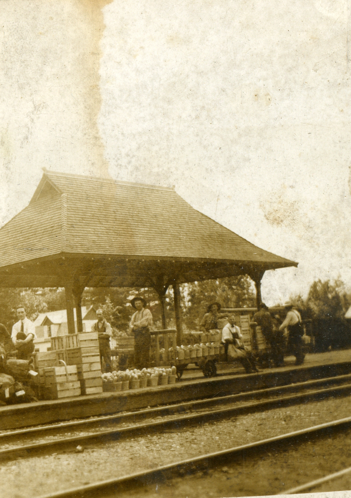
West Lincoln is a township in the Niagara Region of Ontario, Canada. Main urban areas are located along the former provincial Highway 20. The administrative centre of West Lincoln is the community of Smithville, situated halfway between Hamilton and Pelham. Communities The township comprises the communities of Abingdon, Allens Corner, Attercliffe, Basingstoke, Bismark, Boyle, Caistor Centre, Caistorville, Elcho, Fulton, Grassie, Kimbo, Port Davidson, Rosedene, Silverdale, Smithville, St. Anns, Vaughan, Warner, Wellandport, Wilcox Corners and Winslow. Business Retail establishments in Smithville are congregated amongst two major nodes: the downtown core, and the Village Square Mall. Smithville also has a Farmers Market that runs every Friday afternoon in the summer. The market features a carefully selected variety of vendors showcasing local produce, preserves, meat, honey, flowers and baking. Demographics In the 2021 Census of Population conducted by Statistics Canada, ... [...More Info...] [...Related Items...] OR: [Wikipedia] [Google] [Baidu] |
List Of Township Municipalities In Ontario
A township is a type of municipality in the Canadian province of Ontario. They can have either single-tier status or lower-tier status. Ontario has 200 townships that had a cumulative population of 990,396 and an average population of 4,952 in the 2011 Census. Ontario's largest and smallest townships are Centre Wellington and Cockburn Island with populations of 26,693 and 0 respectively. History Under the former ''Municipal Act, 1990'', a township was a type of local municipality. Under this former legislation, a locality with a population of 1,000 or more could have been incorporated as a township by Ontario's Municipal Board upon review of an application from 75 or more residents of the locality. It also provided that a township could include "a union of townships and a municipality composed of two or more townships". In the transition to the ''Municipal Act, 2001'', these requirements were abandoned and, as at December 31, 2002, every township ... [...More Info...] [...Related Items...] OR: [Wikipedia] [Google] [Baidu] |
Township Municipalities In Ontario
A township is a kind of human settlement or administrative subdivision, with its meaning varying in different countries. Although the term is occasionally associated with an urban area, that tends to be an exception to the rule. In Australia, Canada, Scotland and parts of the United States, the term refers to settlements too small or scattered to be considered urban. Australia ''The Australian National Dictionary'' defines ''township'' as: "A site reserved for and laid out as a town; such a site at an early stage of its occupation and development; a small town". The term refers purely to the settlement; it does not refer to a unit of government. Townships are governed as part of a larger council (such as that of a shire, district or city) or authority. Canada In Canada, two kinds of township occur in common use. *In Eastern Canada, a township is one form of the subdivision of a county. In Canadian French, this is a . Townships are referred to as "lots" in Prince Edward I ... [...More Info...] [...Related Items...] OR: [Wikipedia] [Google] [Baidu] |
Wainfleet, Ontario
Wainfleet is a rural township in southern Niagara Region, Ontario, Canada. There is a small and growing tourist industry, near and on Lake Erie at the southern area of Wainfleet called Long Beach. Wainfleet is also the home of the Marshville Heritage Village, a living history museum, recreating life in Ontario c. 1850-1910. Communities The township includes the communities of Attercliffe, Beckett's Bridge, Belleview Beach, Burnaby, Camelot Beach, Chambers Corners, Long Beach, Morgan's Point, O'Reilly's Bridge, Ostryhon Corners, Perry, Wainfleet (known until the 1920s as Marshville), Wellandport (which straddles the border with the neighbouring Township of West Lincoln), Willow Bay and Winger. Wainfleet is near Willow Bay. The administrative offices of the township are located in Wainfleet. Coat of arms Wainfleet Township's Coat of Arms consists of a white shield depicting a red cross, which symbolizes the arms of Lincoln, England, with a maple leaf in its centre. The maple l ... [...More Info...] [...Related Items...] OR: [Wikipedia] [Google] [Baidu] |
Haldimand County
Haldimand County is a rural city-status single-tier municipality on the Niagara Peninsula in Southern Ontario, Canada, on the north shore of Lake Erie, and on the Grand River. Despite its name, it is no longer a county by definition, as all municipal services are handled by a single level of government. Municipal offices are located in Cayuga. The county is adjacent to Norfolk County, the County of Brant, the City of Hamilton, and the Regional Municipality of Niagara. History Haldimand's history has been closely associated with that of neighbouring Norfolk County. Upper Canada was created in 1791 by being separated from the old Province of Quebec, Haldimand was created in 1798 as part of the Niagara District. It was named after Sir Frederick Haldimand, the governor of the Province of Quebec from 1778 to 1785. In 1844, the land was surrendered by the Six Nations to the Crown in an agreement that was signed by the vast majority of Chiefs in the Haldimand tract. From 1974 ... [...More Info...] [...Related Items...] OR: [Wikipedia] [Google] [Baidu] |
Lincoln, Ontario
Lincoln is a town on Lake Ontario in the Niagara Region, Ontario, Canada. The town's administrative and commercial centre is in the community of Beamsville. Geography Lincoln's location between the southern shore of Lake Ontario and the Niagara Escarpment provides for a moderate climate with mild winters. The area is known in Canada for its orchards, vineyards, wineries and restaurants that feature local produce and wines. Fruit crops grown in Lincoln include cherries, peaches, apples and pears, and during the summer attract many tourists from all over Ontario, particularly Toronto. Since November 2017, the town has been served by the "uLinc" bus network, which runs three routes. GO Transit also serves the town. Communities The township comprises the communities of Beamsville, Campden, Jordan, Jordan Station, Rockway, Tintern, Vineland and Vineland Station. History Lincoln's earliest known inhabitants was the Neutral Confederacy, also called the Attawandaron. Archaeologists fro ... [...More Info...] [...Related Items...] OR: [Wikipedia] [Google] [Baidu] |
Grimsby, Ontario
Grimsby is a town on Lake Ontario in the Niagara Region, Ontario, Canada. Grimsby is at the eastern end of the Hamilton Census Metropolitan Area. It is named after the English fishing town of Grimsby in north-east Lincolnshire. The majority of residents reside in the area bounded by Lake Ontario and the Niagara Escarpment, home to a section of the Bruce Trail. Grimsby has experienced significant growth over the past two decades due to its position between Hamilton and St. Catharines. Growth is limited by the natural boundaries of Lake Ontario and the Niagara Escarpment. Some residents feel development is detrimental to the town as orchards close to the town centre are used for residential development; however, most of the orchards in Grimsby were replaced by houses between the 1950s and 1980s and very few orchards remain. According to a late 2019 report, the town has 33 small parks, 17 larger and "many more green spaces, sport fields, parkettes, trails, and facilities". Some no ... [...More Info...] [...Related Items...] OR: [Wikipedia] [Google] [Baidu] |
Atlas Of Canada
The Atlas of Canada (french: L'Atlas du Canada) is an online atlas published by Natural Resources Canada that has information on every city, town, village, and hamlet in Canada. It was originally a print atlas, with its first edition being published in 1906 by geographer James White and a team of 20 cartographers. Much of the geospatial data used in the atlas is available for download and commercial re-use from the Atlas of Canada site or from GeoGratis. Information used to develop the atlas is used in conjunction with information from Mexico and the United States to produce collaborative continental-scale tools such as the North American Environmental Atlas The ''North American Environmental Atlas'' is an interactive mapping tool created through a partnership of government agencies in Canada, Mexico and the United States, along with the Commission for Environmental Cooperation, a trilateral internati .... External links {{Portal, Geography, Canada The Atlas of Canada * The 1915 ... [...More Info...] [...Related Items...] OR: [Wikipedia] [Google] [Baidu] |
Natural Resources Canada
Natural Resources Canada (NRCan; french: Ressources naturelles Canada; french: RNCan, label=none)Natural Resources Canada is the applied title under the Federal Identity Program; the legal title is Department of Natural Resources (). is the department of the Government of Canada responsible for natural resources, energy, minerals and metals, forests, earth sciences, mapping, and remote sensing. It was formed in 1994 by amalgamating the Department of Energy, Mines and Resources with the Department of Forestry. Under the ''Constitution Act, 1867'', primary responsibility for natural resources falls to provincial governments, however, the federal government has jurisdiction over off-shore resources, trade and commerce in natural resources, statistics, international relations, and boundaries. The department administers federal legislation relating to natural resources, including energy, forests, minerals and metals. The department also collaborates with American and Mexican governme ... [...More Info...] [...Related Items...] OR: [Wikipedia] [Google] [Baidu] |
List Of Townships In Ontario
This is a list of townships in the Canadian province of Ontario. Townships are listed by census division. Northern Ontario Northeastern Ontario Algoma District Historical/Geographic Townships *Abbott *Aberdeen Additional *Abigo *Abotossaway *Abraham *Acton *Aguonie *Alanen *Alarie *Albanel *Albert *Alderson *Allenby *Allouez *Amik *Amundsen *Anderson *André *Archibald *Arnott *Ashley *Assad *Assef *Asselin *Atkinson *Avis *Awenge *Aweres *Bailloquet *Barager *Barnes *Bayfield *Beange *Beaton *Beaudin *Beaudry *Beauparlant *Beebe *Behmann *Bernst *Bird *Bolger *Boon *Bostwick *Bouck *Bourinot *Bracci *Bray *Breckenbridge *Bridgland *Bright Additional *Bright *Brimacombe *Broome *Broughton *Brule *Bruyere *Buchan *Buckles *Bullock *Butcher *Byng *Cadeau *Cannard *Carmody *Carney *Casson *Chabanel *Challener *Chapais *Charbonneau *Chelsea *Chenard *Chesley Additional *Chesley *Cholette *Clouston *Cobden *Coderre *Coffin Additional *Common *Concobar *Conking *Cooper *Copenace *Cor ... [...More Info...] [...Related Items...] OR: [Wikipedia] [Google] [Baidu] |
Statistics Canada
Statistics Canada (StatCan; french: Statistique Canada), formed in 1971, is the agency of the Government of Canada commissioned with producing statistics to help better understand Canada, its population, resources, economy, society, and culture. It is headquartered in Ottawa.Statistics Canada, 150 Tunney's Pasture Driveway Ottawa, Ontario K1A 0T6; Statistique Canada 150, promenade du pré Tunney Ottawa, Ontario K1A 0T6 The agency is led by the chief statistician of Canada, currently Anil Arora, who assumed the role on September 19, 2016. StatCan is responsible to Parliament through the Minister of Innovation, Science and Industry, currently François-Philippe Champagne. Statistics Canada acts as the national statistical agency for Canada, and Statistics Canada produces statistics for all the provinces as well as the federal government. In addition to conducting about 350 active surveys on virtually all aspects of Canadian life, the '' Statistics Act'' mandates that Statistic ... [...More Info...] [...Related Items...] OR: [Wikipedia] [Google] [Baidu] |
2021 Canadian Census
The 2021 Canadian census was a detailed enumeration of the Canadian population with a reference date of May 11, 2021. It follows the 2016 Canadian census, which recorded a population of 35,151,728. The overall response rate was 98%, which is slightly lower than the response rate for the 2016 census. It recorded a population of 36,991,981, a 5.2% increase from 2016. Planning Consultation on census program content was from September 11 to December 8, 2017. The census was conducted by Statistics Canada, and was contactless as a result of the COVID-19 pandemic in Canada. The agency had considered delaying the census until 2022. About 900 supervisors and 31,000 field enumerators were hired to conduct the door-to-door survey of individuals and households who had not completed the census questionnaire by late May or early June. Canvassing agents wore masks and maintained a physical distance to comply with COVID-19 safety regulations. Questionnaire In early May 2021, Statistics Can ... [...More Info...] [...Related Items...] OR: [Wikipedia] [Google] [Baidu] |

.jpg)

