|
Wauwatosa
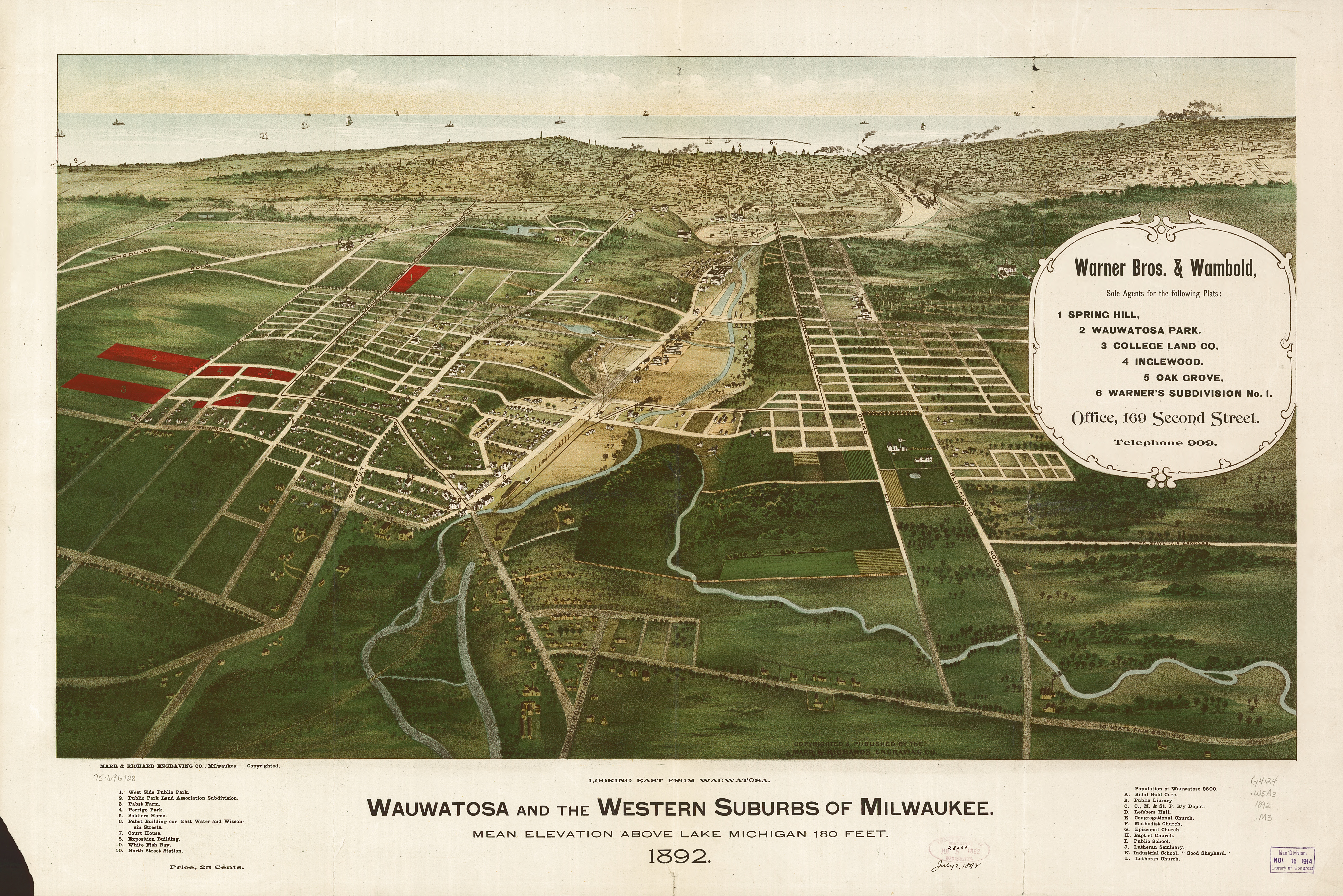
Wauwatosa (; known informally as Tosa; originally Wau-wau-too-sa or Hart's Mill) is a city in Milwaukee County, Wisconsin, United States. The population was 48,387 at the 2020 census. Wauwatosa is located immediately west of Milwaukee, and is a part of the Milwaukee metropolitan area. It is named after the Potawatomi Chief Wauwataesie and the Potawatomi word for firefly. History The lush Menomonee Valley of the Wauwatosa area provided a key overland gateway between the rich glacial farmland of southeastern Wisconsin and the Port of Milwaukee. In 1835, Charles Hart became the first Euro-American to settle here, followed that year by 17 other families. The following year a United States Road was built from Milwaukee through Wauwatosa, eventually reaching Madison. Charles Hart built a mill in 1845 on the Menomonee River which gave the settlement its original name of "Hart's Mill." The mill was torn down in 1914. The Town of Wau-wau-too-sa was created by act of the Wisconsin Territori ... [...More Info...] [...Related Items...] OR: [Wikipedia] [Google] [Baidu] |
Milwaukee
Milwaukee ( ), officially the City of Milwaukee, is both the most populous and most densely populated city in the U.S. state of Wisconsin and the county seat of Milwaukee County. With a population of 577,222 at the 2020 census, Milwaukee is the 31st largest city in the United States, the fifth-largest city in the Midwestern United States, and the second largest city on Lake Michigan's shore behind Chicago. It is the main cultural and economic center of the Milwaukee metropolitan area, the fourth-most densely populated metropolitan area in the Midwest. Milwaukee is considered a global city, categorized as "Gamma minus" by the Globalization and World Cities Research Network, with a regional GDP of over $102 billion in 2020. Today, Milwaukee is one of the most ethnically and culturally diverse cities in the U.S. However, it continues to be one of the most racially segregated, largely as a result of early-20th-century redlining. Its history was heavily influenced ... [...More Info...] [...Related Items...] OR: [Wikipedia] [Google] [Baidu] |
Milwaukee County, Wisconsin
Milwaukee County is located in the U.S. state of Wisconsin. At the 2020 census, the population was 939,489, down from 947,735 in 2010. It is both the most populous and most densely populated county in Wisconsin, and the 45th most populous county nationwide; Milwaukee, its eponymous county seat, is also the most populous city in the state. The county was created in 1834 as part of Michigan Territory and organized the following year. Milwaukee County is the most populous county of the Milwaukee- Waukesha-West Allis, WI Metropolitan Statistical Area, as well as of the Milwaukee-Racine-Waukesha, WI Combined Statistical Area (See Milwaukee metropolitan area). Uniquely among Wisconsin counties, Milwaukee County is completely incorporated (i.e.: no part of the county has the Town form of local government - see Administrative divisions of Wisconsin#Town). There are 19 municipalities in Milwaukee County, 10 incorporated as cities and 9 incorporated as villages. After the city of Milw ... [...More Info...] [...Related Items...] OR: [Wikipedia] [Google] [Baidu] |
Milwaukee Metropolitan Area
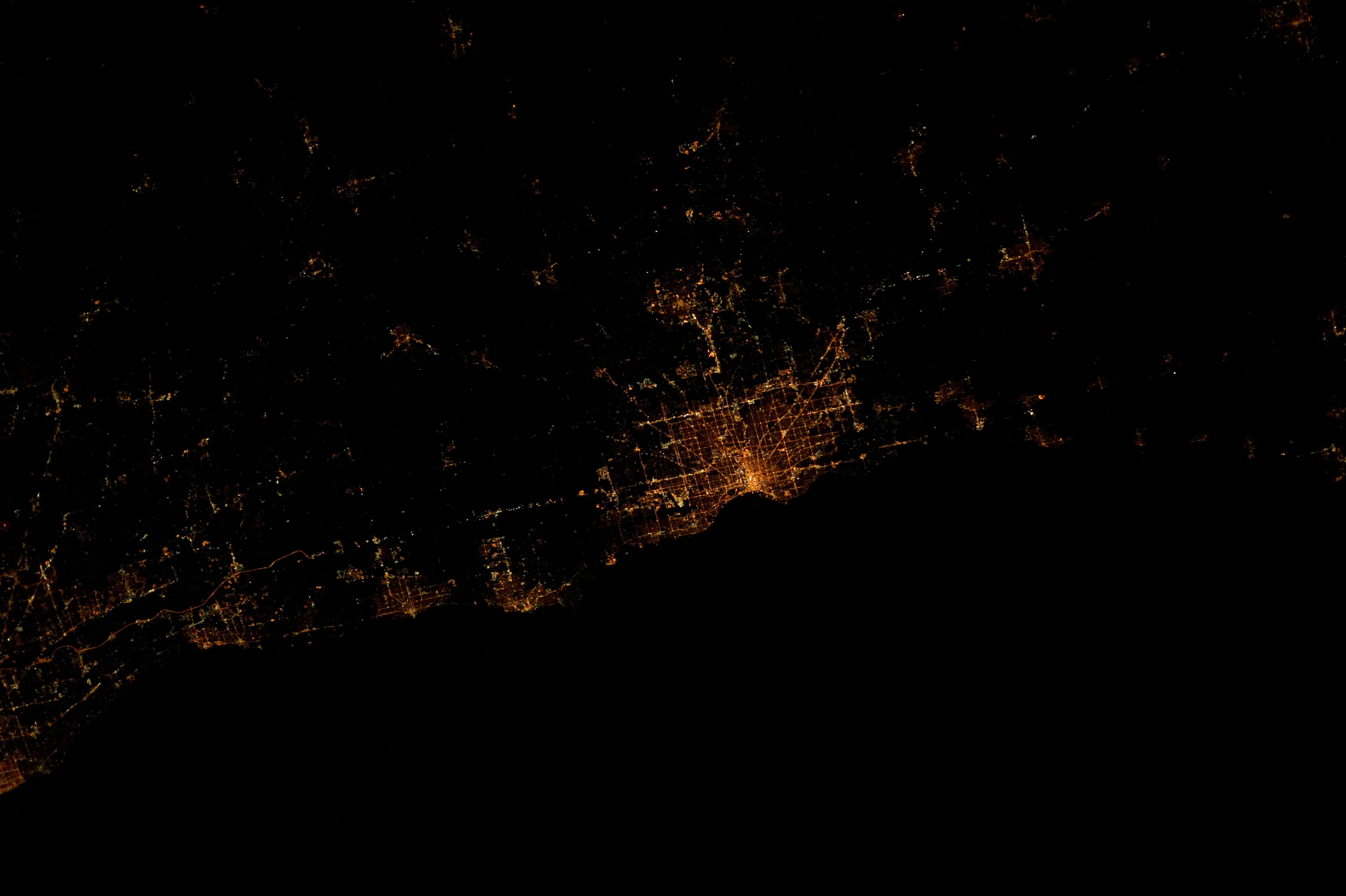
The Milwaukee metropolitan area (also known as Metro Milwaukee or Greater Milwaukee) is a major metropolitan area located in Southeastern Wisconsin, consisting of the city of Milwaukee and the surrounding area. There are several definitions of the area, including the Milwaukee–Waukesha–West Allis metropolitan area and the Milwaukee–Racine–Waukesha combined statistical area. It is the largest metropolitan area in Wisconsin, and the 39th largest metropolitan area in the United States. Definitions Metropolitan area The U.S. Census Bureau defines the Milwaukee Metropolitan area as containing four counties in southeastern Wisconsin: Milwaukee and the three WOW counties: Ozaukee, Washington, and Waukesha. The Metropolitan population of Milwaukee was 1,575,179 in the Census Bureau's 2019 estimate, making it the 39th largest in the United States. The city of Milwaukee is the hub of the metropolitan area. The eastern parts of Racine County, eastern parts of Wa ... [...More Info...] [...Related Items...] OR: [Wikipedia] [Google] [Baidu] |
The Milwaukee Road
The Chicago, Milwaukee, St. Paul and Pacific Railroad (CMStP&P), often referred to as the "Milwaukee Road" , was a Class I railroad that operated in the Midwest and Northwest of the United States from 1847 until 1986. The company experienced financial difficulty through the 1970s and 1980s, including bankruptcy in 1977 (though it filed for bankruptcy twice in 1925 and 1935, respectively). In 1980, it abandoned its Pacific Extension, which included track in the states of Montana, Idaho, and Washington. The remaining system was merged into the Soo Line Railroad , a subsidiary of Canadian Pacific Railway , on January 1, 1986. Much of its historical trackage remains in use by other railroads. The company brand is commemorated by buildings like the historic Milwaukee Road Depot in Minneapolis and preserved locomotives such as Milwaukee Road 261 which operates excursion trains. History Chicago, Milwaukee, St. Paul and Minneapolis Railroad The railroad that became the Milwaukee Roa ... [...More Info...] [...Related Items...] OR: [Wikipedia] [Google] [Baidu] |
Menomonee River
:''See also Menominee River'' The Menomonee River is one of three primary rivers in Milwaukee, Wisconsin, along with the Kinnickinnic River and Milwaukee River. Description Named after the Menomonee (also spelled Menominee) Indians, the word was given to the Menomonee people by the Chippewa people, and in the Chippewa language literally means "rice eaters" referring to the abundant wild rice that once grew along its shores in the Menomonee Valley. A tributary of the Milwaukee River, it is the most industrialized within the Milwaukee River Basin. Watershed The Menomonee River is long,U.S. Geological Survey. National Hydrography Dataset high-resolution flowline dataThe National Map, accessed May 19, 2011 and empties into Lake Michigan at Milwaukee. Not to be confused with longer rivers named after the same Indian tribe. With a watershed that covers approximately of urban landscape, it is home to a population of more than 336,670 people. This includes portions of Washington, Oz ... [...More Info...] [...Related Items...] OR: [Wikipedia] [Google] [Baidu] |
Waukesha County, Wisconsin
Waukesha County () is a county in the U.S. state of Wisconsin. As of the 2020 United States Census, the population was 406,978, making it the third-most populous county in Wisconsin. Its county seat and largest city is Waukesha. Waukesha County is included in the Milwaukee– Waukesha–West Allis, WI Metropolitan Statistical Area. History Known as forested and prairie land, the region was first home to Indigenous tribes like Menomonie, Ojibwe (Chippewa), Potawatomi, and Ho-Chunk (Winnebago), who practiced agriculture and trade. In 1836, Native American tribes formally lost title to the land when treaties were disregarded and were forcibly removed by the Federal Army. Prior to the 1830s, the area was unoccupied by settlers due to its inland location and the fact that the Fox River was not a water highway. The New England settlers only came to the area to set up fur trading posts between their new encampments and established cities like Milwaukee. Morris D. Cutler and Alonso ... [...More Info...] [...Related Items...] OR: [Wikipedia] [Google] [Baidu] |
Madison, Wisconsin
Madison is the county seat of Dane County and the capital city of the U.S. state of Wisconsin. As of the 2020 census the population was 269,840, making it the second-largest city in Wisconsin by population, after Milwaukee, and the 80th-largest in the U.S. The city forms the core of the Madison Metropolitan Area which includes Dane County and neighboring Iowa, Green, and Columbia counties for a population of 680,796. Madison is named for American Founding Father and President James Madison. The city is located on the traditional land of the Ho-Chunk, and the Madison area is known as ''Dejope'', meaning "four lakes", or ''Taychopera'', meaning "land of the four lakes", in the Ho-Chunk language. Located on an isthmus and lands surrounding four lakes—Lake Mendota, Lake Monona, Lake Kegonsa and Lake Waubesa—the city is home to the University of Wisconsin–Madison, the Wisconsin State Capitol, the Overture Center for the Arts, and the Henry Vilas Zoo. Madison is ho ... [...More Info...] [...Related Items...] OR: [Wikipedia] [Google] [Baidu] |
Civil Township
A civil township is a widely used unit of local government in the United States that is subordinate to a county, most often in the northern and midwestern parts of the country. The term town is used in New England, New York, and Wisconsin to refer to the equivalent of the civil township in these states; Minnesota uses "town" officially but often uses it and "township" interchangeably. Specific responsibilities and the degree of autonomy vary based on each state. Civil townships are distinct from survey townships, but in states that have both, the boundaries often coincide and may completely geographically subdivide a county. The U.S. Census Bureau classifies civil townships as minor civil divisions. Currently, there are 20 states with civil townships. Township functions are generally overseen by a governing board (the name varies from state to state) and a clerk, trustee, or mayor (in New Jersey and the metro townships of Utah). Township officers frequently include justice of ... [...More Info...] [...Related Items...] OR: [Wikipedia] [Google] [Baidu] |
North Milwaukee, Wisconsin
North Milwaukee (originally Schwartzburg and later briefly Northern Junction) was a village in northern Milwaukee County, Wisconsin, United States. History The original Schwartzburg was a hamlet centered on a large farm settled by one Christian Schwartzburg on land bought from Byron Kilbourn, and was named after the settlement's most prominent citizen. In the 1850s Schwartzburg began to sell some of his land holding to others, and a railroad depot was established in the area. Expansion was fuelled by real estate developer and streetcar magnate Henry Clay Payne, and the village (now renamed North Milwaukee) was incorporated in 1897 and merged with the City of Milwaukee on January 1, 1929. The village (later to become a city) covered an area from Congress Street to Silver Spring Drive between 27th Street and Sherman Boulevard. The main street was Villard Avenue, but the village had the economic advantages of a Milwaukee Road railroad crossing near 35th and Hampton, supplemented by ... [...More Info...] [...Related Items...] OR: [Wikipedia] [Google] [Baidu] |
West Allis, Wisconsin
West Allis is a city in Milwaukee County, Wisconsin, Milwaukee County, Wisconsin, United States. A suburb of Milwaukee, it is part of the Milwaukee metropolitan area. The population was 60,325 at the 2020 United States Census, 2020 census. History The name West Allis derives from Edward P. Allis, whose Edward P. Allis Company was a large Milwaukee-area manufacturing firm in the late 19th century. In 1901, the Allis company became Allis-Chalmers, and in 1902 built a large new manufacturing plant west of its existing plant. The locale in which the new plant was constructed was at the time called North Greenfield, and prior to the 1880s had been called Honey Creek. With the building of the western Allis plant, the area was incorporated as the Village of West Allis, and it became the City of West Allis in 1906. With the presence of Allis-Chalmers, the largest manufacturer in the area, West Allis became the largest suburb of Milwaukee in the early 20th century. After that, West Allis ... [...More Info...] [...Related Items...] OR: [Wikipedia] [Google] [Baidu] |
Menomonee Valley
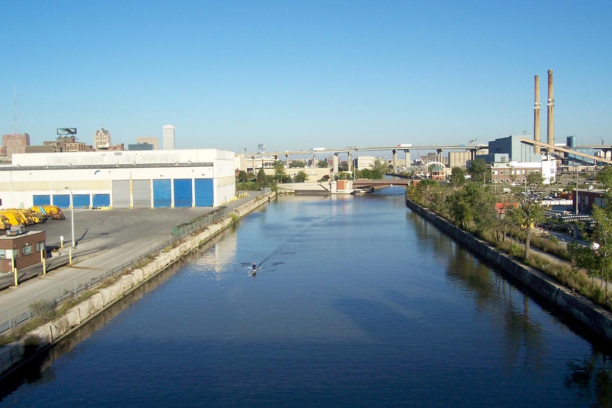
The Menomonee Valley or Menomonee River Valley is a U-shaped land formation along the southern bend of the Menomonee River in Milwaukee, Wisconsin. Because of its easy access to Lake Michigan and other waterways, the neighborhood has historically been home to the city's stockyards, rendering plants, shipping, and other heavy industry. It was also a primary source of pollution for the river. Glacial meltwater formed the Menomonee Valley over 10,000 years ago when the Lake Michigan Lobe of the Wisconsin Glaciation retreated and eroded a swath four miles (6 km) long and half of a mile wide. Today, it is roughly bounded by the 6th Street Viaduct near the river confluence and Miller Park stadium to the west. The valley effectively cuts Milwaukee in half, limiting access to a handful of viaducts that span the chasm. With a historically predominant white south side and black near north side, the valley has been perceived as a social and racial divide during times of civil unrest. ... [...More Info...] [...Related Items...] OR: [Wikipedia] [Google] [Baidu] |


.jpg)


