|
Waunlwyd
Waun-Lwyd or Waunlwyd is a village in the Ebbw Valley in Blaenau Gwent. It belongs in the community of Cwm. It is located south of Ebbw Vale and north of Newport. The A4046 runs through the village. The population of the community is 1,556. History The Gwent Heritage voluntary group have extensively documented the history of the village as far back as its initial mining establishment. The Cwm and Waunlwyd branch of the group meets regularly to contribute to the collection of material about the region. The River Ebbw flows past the west of the village. To the east is Mynydd Carn-y-cefn (550m). Village today Facilities in Waun-Lwyd include a public phone box, the Caersalem United Reformed Church (since 2018 a Baptist Church), an Off Licence shop, a hair and beauty store, and a Smiling Valley Chinese restaurant. Waunlwyd Methodist Chapel is a noted post medieval chapel building but its location has been unclear since 2002. The town had an NHS Wales branch surgery until ... [...More Info...] [...Related Items...] OR: [Wikipedia] [Google] [Baidu] |
Cwm, Blaenau Gwent
Cwm (from cy, Y Cwm, ) is a former coal mining village, community (Wales), community and Wards and electoral divisions of the United Kingdom, electoral ward south of Ebbw Vale in the county borough of Blaenau Gwent, Wales, within the historic boundaries of Monmouthshire, United Kingdom. In the far north of the community lies Waunlwyd. Etymology The name Cwm is thought to have derived from the farm on the present day nature reserve (Silent Valley), Cwm Merddog. Cwm is the Welsh language, Welsh word for valley and the name Merddog is believed to be a corruption of the name of the old farm that used to be here, Troed y Rhiw y Myrdd Fach, which translated means 'the foot of the myriad little hills'. But with the development of the village and coal industry the name was just simply shortened to Cwm. Locally the village to its inhabitants and neighbouring areas is sometimes referred to as The Cwm. A photograph of an old farm house, Troed y rhiw y Myrydd Fach, located behind Tirzah Ch ... [...More Info...] [...Related Items...] OR: [Wikipedia] [Google] [Baidu] |
Ebbw Vale Parkway Railway Station
, symbol_location = gb , symbol = rail , image = Ebbw Vale Parkway railway station in 2010.jpg , borough = Ebbw Vale, Blaenau Gwent , country = Wales , coordinates = , grid_name = Grid reference , grid_position = , owned = Network Rail , manager = Transport for Wales , platforms = 1 , code = EBV , classification = DfT category F1 , original = Network Rail , years1 = August 1852 , events1 = Opened as Victoria (Blaenau Gwent) , years2 = 30 April 1962 , events2 = Closed , years3 = 6 February 2008 , events3 = Reopened as Ebbw Vale Parkway , mpassengers = , footnotes = Passenger statistics from the Office of Rail and Road Ebbw Vale Parkway railway station ( cy, Gorsaf reilffordd Parcffordd Glyn Ebwy) is a station on the Ebbw ... [...More Info...] [...Related Items...] OR: [Wikipedia] [Google] [Baidu] |
Ebbw Vale Garden Festival
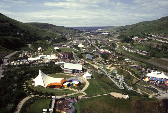
The Ebbw Vale Garden Festival of Wales ( National Garden Festival 1992) attracted over two million visitors to Ebbw Vale in South Wales. Background The national garden festivals were a high-profile 1980s initiative by the then Conservative government in response to criticism of their alleged neglect of areas hit by the decline of heavy industry. Environment Minister Michael Heseltine proposed that derelict land should be reclaimed for a Garden Festival as a symbol of the rebirth of such areas. The festivals were held every two years. The first such festival was held in Liverpool in 1984. Subsequent festivals were held in Stoke-on-Trent (1986), Glasgow (1988), Gateshead (1990) and Ebbw Vale Garden Festival (1992) which eventually won the competition. The festivals were highly successful in attracting millions of visitors from all over the country to industrial areas long ignored by British tourists. However they did not always lead to the hoped-for long-term injection of private i ... [...More Info...] [...Related Items...] OR: [Wikipedia] [Google] [Baidu] |
Nick Smith (British Politician)
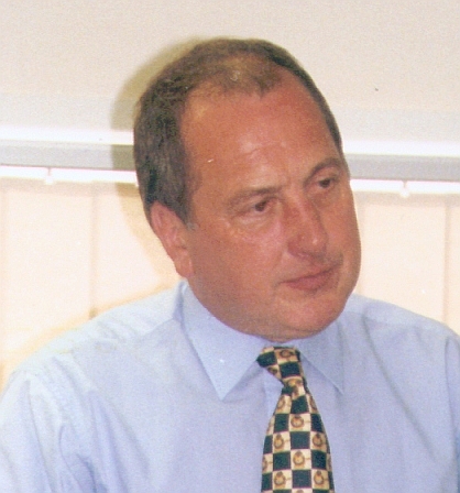
Nicholas Desmond John Smith (born 14 January 1960) is a Welsh Labour Party politician serving as Member of Parliament (MP) for Blaenau Gwent since 2010. From 1998 to 2006 he was a councillor in the London Borough of Camden. Early life Born in 1960 into a family of miners and steel workers, Smith grew up in Tredegar and was educated at its comprehensive school. As a young man Nick was a member of the Tredegar Workman's Hall Snooker Club. Now he co-chairs the parliamentary group in support of the sport. Nick went on to study at Birkbeck College, University of London, where he graduated with an MSc in Economic Change.About me at nick-smith.net Career Smith became a Labour Party organiser in Wales, and later worked around the world ...[...More Info...] [...Related Items...] OR: [Wikipedia] [Google] [Baidu] |
Welsh Labour
Welsh Labour ( cy, Llafur Cymru) is the branch of the United Kingdom Labour Party in Wales and the largest party in modern Welsh politics. Welsh Labour and its forebears won a plurality of the Welsh vote at every UK general election since 1922, Senedd election since 1999, and European Parliament election in 1979–2004 and 2014. Welsh Labour holds 22 of the 40 Welsh seats in the UK Parliament, 30 of the 60 seats in the Welsh Senedd and 576 of the 1,264 councillors in principal local authorities, including overall control of 10 of the 22 principal local authorities. Structure Welsh Labour is formally part of the Labour Party, not separately registered with the Electoral Commission under the terms of the Political Parties, Elections and Referendums Act. In 2016, the Labour Party Conference voted to institute the office of leader of Welsh Labour, a position currently held by Mark Drakeford. Welsh Labour has autonomy in policy formulation for the areas now devolved to the Senedd a ... [...More Info...] [...Related Items...] OR: [Wikipedia] [Google] [Baidu] |
Alun Davies (politician)
Thomas Alun Rhys Davies (born 12 February 1964) is a Welsh Labour and Co-operative party politician serving as the Member of the Senedd (MS) for Blaenau Gwent since 2011, and formerly Mid and West Wales from 2007 to 2011. He has served in several Welsh government offices, including Cabinet Secretary for Local Government and Public Services, Minister for Lifelong Learning and Welsh Language, and Minister for Natural Resources and Food. Davies previously worked as a public affairs consultant, and began his political career in Plaid Cymru before joining Welsh Labour. He was sacked from his Cabinet role in 2014 for pressuring civil servants to reveal private information about opposition Members, shortly after facing calls to resign after an investigation determined he had breached the Ministerial Code on a separate issue. Background Davies was born in Tredegar and went to Tredegar Comprehensive School followed by the University College of Wales, Aberystwyth where he graduated wi ... [...More Info...] [...Related Items...] OR: [Wikipedia] [Google] [Baidu] |
Senedd
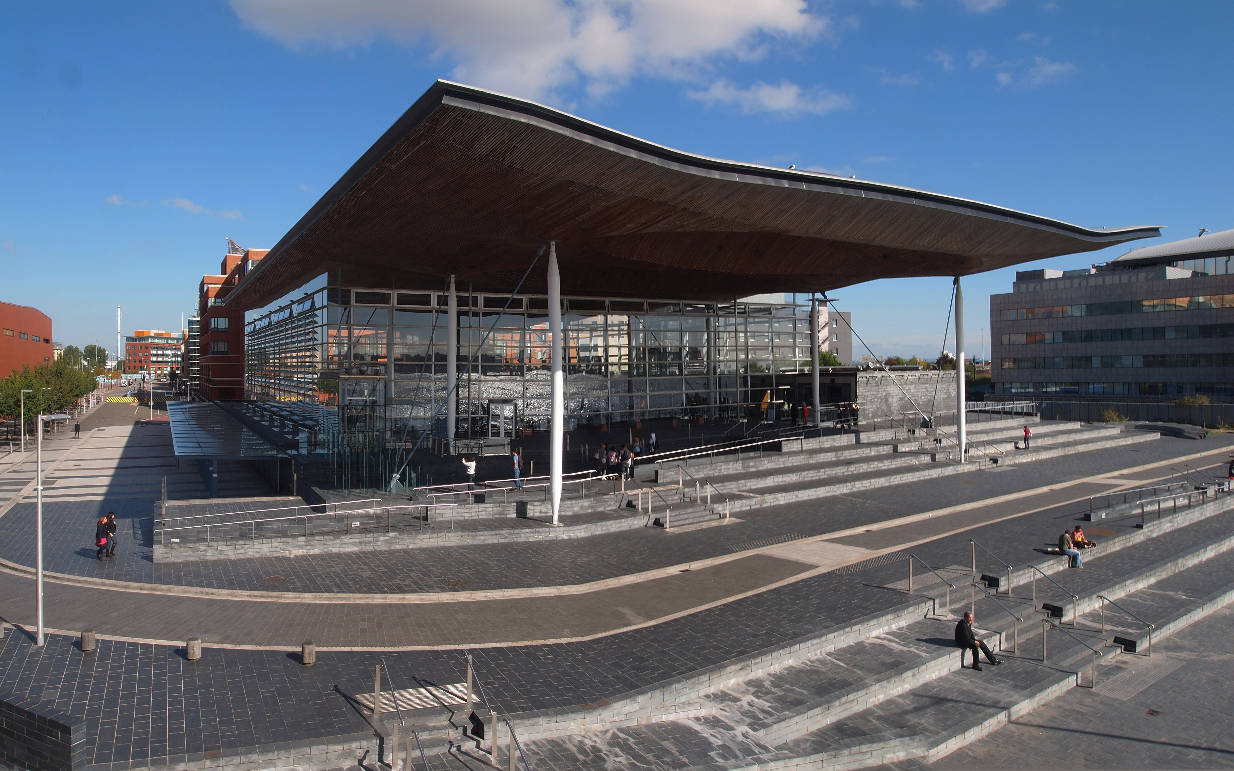
The Senedd (; ), officially known as the Welsh Parliament in English and () in Welsh, is the devolved, unicameral legislature of Wales. A democratically elected body, it makes laws for Wales, agrees certain taxes and scrutinises the Welsh Government. It is a bilingual institution, with both Welsh and English being the official languages of its business. From its creation in May 1999 until May 2020, the Senedd was known as the National Assembly for Wales ( cy, Cynulliad Cenedlaethol Cymru, lang, link=no). The Senedd comprises 60 members who are known as Members of the Senedd (), abbreviated as "MS" (). Since 2011, members are elected for a five-year term of office under an additional member system, in which 40 MSs represent smaller geographical divisions known as "constituencies" and are elected by first-past-the-post voting, and 20 MSs represent five "electoral regions" using the D'Hondt method of proportional representation. Typically, the largest party in the Senedd forms ... [...More Info...] [...Related Items...] OR: [Wikipedia] [Google] [Baidu] |
Blaenau Gwent County Borough Council
Blaenau Gwent County Borough Council ( cy, Cyngor bwrdeistref Sirol Blaenau Gwent) is the governing body for Blaenau Gwent, one of the Subdivisions of Wales, Principal Areas of Wales. History The borough council was created in 1974 under the Local Government Act 1972 as a lower-tier Districts of Wales, district council with borough status in the United Kingdom, borough status. Gwent County Council provided county-level services for the area. The county council was abolished in 1996 and Blaenau Gwent became a Local government in Wales, principal area with county borough status, with the council taking over the functions previously performed by the county council. Borough status allows Blaenau Gwent to give the chair of the council the title of mayor. However, the council discontinued the role of mayor in 2017, with the last mayor being Barrie Sutton. A presiding member role has been created instead to chair meetings. Political control The first election to the council was held i ... [...More Info...] [...Related Items...] OR: [Wikipedia] [Google] [Baidu] |
Wards And Electoral Divisions Of The United Kingdom
The wards and electoral divisions in the United Kingdom are electoral districts at sub-national level, represented by one or more councillors. The ward is the primary unit of English electoral geography for civil parishes and borough and district councils, the electoral ward is the unit used by Welsh principal councils, while the electoral division is the unit used by English county councils and some unitary authorities. Each ward/division has an average electorate of about 5,500 people, but ward population counts can vary substantially. As of 2021 there are 8,694 electoral wards/divisions in the UK. England The London boroughs, metropolitan boroughs and non-metropolitan districts (including most unitary authorities) are divided into wards for local elections. However, county council elections (as well as those for several unitary councils which were formerly county councils, such as the Isle of Wight and Shropshire Councils) instead use the term ''electoral division''. In s ... [...More Info...] [...Related Items...] OR: [Wikipedia] [Google] [Baidu] |
Abertillery
Abertillery (; cy, Abertyleri) is a town and a community of the Ebbw Fach valley in the historic county of Monmouthshire, Wales. Following local government reorganisation it became part of the Blaenau Gwent County Borough administrative area. The surrounding landscape borders the Brecon Beacons National Park and the Blaenavon World heritage Site. Formerly a major coal mining centre the Abertillery area was transformed in the 1990s using EU and other funding to return to a greener environment. Situated on the A467 the town is north of the M4 and south of the A465 "Heads of the Valleys" trunk road. It is about by road from Cardiff and from Bristol. According to the 2011 Census, 4.8% of the ward's 4,416 (212 residents) resident-population can speak, read, and write Welsh. [...More Info...] [...Related Items...] OR: [Wikipedia] [Google] [Baidu] |
Cwmbran Bus Station
Cwmbran bus station ( cy, Gorsaf bws Cwmbrân) is a bus terminus and interchange located in the town centre of Cwmbran, South Wales. Background The station was commissioned along with the wider development of the town of Cwmbran in August 1949, following the end of the Second World War. The UK embarked on a series of new towns in order to meet high demand for housing and employment, particularly in war ravaged communities. Under the New Towns Act 1946, Cwmbran became the first New Town in Wales. A body, Cwmbran Development Corporation, was created to oversee work. A 55-acre town centre was designed, and the bus station was the key interchange for both the retail and residential area. Layout The bus station diverts from the circular Glyndwr Road around the town, just after the roundabout on St David's Road. The station has eight bus stands, identified with letters A-H. It is surrounded by the retail centre, Cwmbran Centre, and opposite is the newer ''Leisure @ Cwmbran'' ... [...More Info...] [...Related Items...] OR: [Wikipedia] [Google] [Baidu] |
Brynmawr
Brynmawr (; , ,) is a market town, community and electoral ward in Blaenau Gwent, Wales. The town, sometimes cited as the highest town in Wales, is situated at above sea level at the head of the South Wales Valleys. It grew with the development of the coal mining and iron industries in the early 19th century. Until the reorganisation of local authorities in 1974, Brynmawr was administered as part of the county of Brecknockshire. Welsh language According to the 2011 Census, 6.0% of the ward's 5,530 (332 residents) resident-population can speak, read, and write Welsh. This is above the county's figure of 5.5% of 67,348 (3,705 residents) who can speak, read, and write Welsh. The town had the only Welsh-medium primary school, Ysgol Gymraeg Brynmawr, in Blaenau Gwent with 310 pupils ranging from nursery to year 6 until 2010, when the school re-located to a brand new, purpose-built building in Blaina. History Prior to the Industrial Revolution and the founding of Brynmawr, a s ... [...More Info...] [...Related Items...] OR: [Wikipedia] [Google] [Baidu] |
.jpg)


