|
Waterville, County Kerry
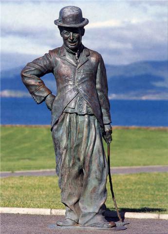
Waterville, historically known as Coirean (), is a village in County Kerry, Republic of Ireland, Ireland, on the Iveragh Peninsula. The town is sited on a narrow isthmus, with Lough Currane on the east side of the town, and Ballinskelligs Bay on the west, and the Currane River connecting the two. The N70 road (Ireland), N70 Ring of Kerry roads in Ireland, route passes through the town. As of the 2016 Central Statistics Office of Ireland, CSO census, Waterville had a population of 462. Name The town's name in Irish language, Irish, ''Coireán'', means "little cauldron" or "little whirlpool", and refers to the shape of Ballinskelligs Bay on which the town sits. This name, however, has been transplanted onto the lake with the lake's Irish name being ''Loch Luíoch'' or ''Loch Luidheach''. The Butler family built a house at the mouth of the River Currane in the latter part of the 18th century. They named their house and estate Waterville. The village that developed on the estate ... [...More Info...] [...Related Items...] OR: [Wikipedia] [Google] [Baidu] |
Republic Of Ireland
Ireland ( ga, Éire ), also known as the Republic of Ireland (), is a country in north-western Europe consisting of 26 of the 32 counties of the island of Ireland. The capital and largest city is Dublin, on the eastern side of the island. Around 2.1 million of the country's population of 5.13 million people resides in the Greater Dublin Area. The sovereign state shares its only land border with Northern Ireland, which is part of the United Kingdom. It is otherwise surrounded by the Atlantic Ocean, with the Celtic Sea to the south, St George's Channel to the south-east, and the Irish Sea to the east. It is a unitary, parliamentary republic. The legislature, the , consists of a lower house, ; an upper house, ; and an elected President () who serves as the largely ceremonial head of state, but with some important powers and duties. The head of government is the (Prime Minister, literally 'Chief', a title not used in English), who is elected by the Dáil and appointed by ... [...More Info...] [...Related Items...] OR: [Wikipedia] [Google] [Baidu] |
Central Statistics Office Of Ireland
The Central Statistics Office (CSO; ga, An Phríomh-Oifig Staidrimh) is the statistical agency responsible for the gathering of "information relating to economic, social and general activities and conditions" in Republic of Ireland, Ireland, in particular the census, National Census which is held every five years. The office is answerable to the Taoiseach and has its main offices in Cork (city), Cork.The Director General of the CSO is Pádraig Dalton. History The CSO was established on a statutory basis in 1994 to reduce the number of separate offices responsible for collecting statistics for the state. The CSO had existed, as an independent ad hoc office within the Department of the Taoiseach since June 1949, and its work greatly increased in the following decades particularly from 1973 with Ireland joining the European Community. Previous to the 1949 reforms, statistics were collected by the Statistics Branch of Department of Enterprise, Trade and Employment, Department of I ... [...More Info...] [...Related Items...] OR: [Wikipedia] [Google] [Baidu] |
England
England is a country that is part of the United Kingdom. It shares land borders with Wales to its west and Scotland to its north. The Irish Sea lies northwest and the Celtic Sea to the southwest. It is separated from continental Europe by the North Sea to the east and the English Channel to the south. The country covers five-eighths of the island of Great Britain, which lies in the North Atlantic, and includes over 100 smaller islands, such as the Isles of Scilly and the Isle of Wight. The area now called England was first inhabited by modern humans during the Upper Paleolithic period, but takes its name from the Angles, a Germanic tribe deriving its name from the Anglia peninsula, who settled during the 5th and 6th centuries. England became a unified state in the 10th century and has had a significant cultural and legal impact on the wider world since the Age of Discovery, which began during the 15th century. The English language, the Anglican Church, and Engli ... [...More Info...] [...Related Items...] OR: [Wikipedia] [Google] [Baidu] |
Weston-super-Mare
Weston-super-Mare, also known simply as Weston, is a seaside town in North Somerset, England. It lies by the Bristol Channel south-west of Bristol between Worlebury Hill and Bleadon Hill. It includes the suburbs of Mead Vale, Milton, Oldmixon, West Wick, Worlebury, Uphill and Worle. Its population at the 2011 census was 76,143. Since 1983, Weston has been twinned with Hildesheim in Germany. The local area has been occupied since the Iron Age. It was still a small village until the 19th century when it developed as a seaside resort. A railway station and two piers were built. In the second half of the 20th century it was connected to the M5 motorway but the number of people holidaying in the town declined and some local industries closed, although the number of day visitors has risen. Attractions include The Helicopter Museum, Weston Museum, and the Grand Pier. Cultural venues include The Playhouse, the Winter Gardens and the Blakehay Theatre. The Bristol Channel has a l ... [...More Info...] [...Related Items...] OR: [Wikipedia] [Google] [Baidu] |
SS Great Eastern
SS ''Great Eastern'' was an iron sail-powered, paddle wheel and screw-propelled steamship designed by Isambard Kingdom Brunel, and built by John Scott Russell & Co. at Millwall Iron Works on the River Thames, London. She was the largest ship ever built at the time of her 1858 launch, and had the capacity to carry 4,000 passengers from England to Australia without refuelling. Her length of was surpassed only in 1899 by the 17,274-gross-ton , her gross tonnage of 18,915 was only surpassed in 1901 by the 20,904-gross-ton and her 4,000-passenger capacity was surpassed in 1913 by the 4,234-passenger . The ship having five funnels (which were later reduced to four) was unusual for the time. The vessel also had the largest set of paddle wheels. Brunel knew her affectionately as the "Great Babe". He died in 1859 shortly after her maiden voyage, during which she was damaged by an explosion. After repairs, she plied for several years as a passenger liner between Britain and North Ame ... [...More Info...] [...Related Items...] OR: [Wikipedia] [Google] [Baidu] |
Nova Scotia
Nova Scotia ( ; ; ) is one of the thirteen provinces and territories of Canada. It is one of the three Maritime provinces and one of the four Atlantic provinces. Nova Scotia is Latin for "New Scotland". Most of the population are native English-speakers, and the province's population is 969,383 according to the 2021 Census. It is the most populous of Canada's Atlantic provinces. It is the country's second-most densely populated province and second-smallest province by area, both after Prince Edward Island. Its area of includes Cape Breton Island and 3,800 other coastal islands. The Nova Scotia peninsula is connected to the rest of North America by the Isthmus of Chignecto, on which the province's land border with New Brunswick is located. The province borders the Bay of Fundy and Gulf of Maine to the west and the Atlantic Ocean to the south and east, and is separated from Prince Edward Island and the island of Newfoundland by the Northumberland and Cabot straits, ... [...More Info...] [...Related Items...] OR: [Wikipedia] [Google] [Baidu] |
Canso, Nova Scotia
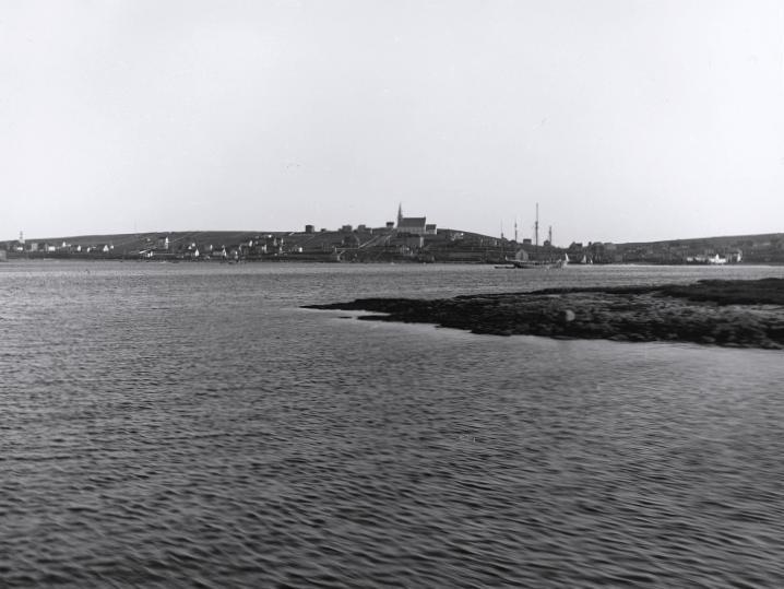
Canso is a community in Guysborough County, on the north-eastern tip of mainland Nova Scotia, Canada, next to Chedabucto Bay. In January 2012, it ceased to be a separate town and as of July 2012 was amalgamated into the Municipality of the District of Guysborough. The area was established in 1604, along with the original Port-Royal. The British construction of a fort in the village (1720), was instrumental in contributing to Dummer's War (1722–1725). The town is of national historic importance because it was one of only two British settlements in Nova Scotia prior to the establishment of Halifax (1749). Canso played a key role in the defeat of Louisbourg. Today, the town attracts people internationally for the annual Stan Rogers Folk Festival. Geography The community is located on the southern shore of Chedabucto Bay. The southern limit of the bay is at Cape Canso, a headland approximately southeast of the community. Canso is the southeastern terminus of Trunk 16, an ... [...More Info...] [...Related Items...] OR: [Wikipedia] [Google] [Baidu] |
Commercial Cable Company
The Commercial Cable Company was founded in New York in 1884 by John William Mackay and James Gordon Bennett, Jr. Their motivation was to break the then virtual monopoly of Jay Gould on transatlantic telegraphy and bring down prices (particularly for Bennett's newspaper empire). Their most famous ship was the CS Mackay-Bennett, named after the founders. The technology was well established by this time, and they were able to lay cables from Waterville in Ireland to Canso, Nova Scotia, without the major technical problems of the first Transatlantic telegraph cable. Onward connections to New York City and beyond were initially overland and later submarine. Connections from Waterville to Weston-super-Mare in England and Le Havre in France were soon established by the submarine route after initial use of landlines from Waterville onward to mainland Britain. Commercial Cable also had a relationship with the German Atlantic submarine cable system. Domestically the cable distributed i ... [...More Info...] [...Related Items...] OR: [Wikipedia] [Google] [Baidu] |
Valentia Island
Valentia Island () is one of Ireland's most westerly points. It lies off the Iveragh Peninsula in the southwest of County Kerry. It is linked to the mainland by the Maurice O'Neill Memorial Bridge at Portmagee. A car ferry also departs from Reenard Point to Knightstown, the island's main settlement, from April to October. Another, smaller village named Chapeltown sits at roughly the midpoint of the island, from the bridge. Valentia Island's permanent population is 665 (). It is about long by almost wide, making it the fifth-biggest island off the Irish coast. Name The English name 'Valentia' or 'Valencia' Island does not come from the Spanish city of Valencia. Instead it comes from the Irish name of Valentia Harbour, ''cuan Bhéil Inse'', "harbour-mouth of the island". It was anglicized as 'Bealinche' and 'Ballentia' before evolving into 'Valentia'. It is possible the spelling was influenced by Spanish sailors; there is a grave marker to Spanish sailors lost at sea in th ... [...More Info...] [...Related Items...] OR: [Wikipedia] [Google] [Baidu] |
Heart's Content, Newfoundland And Labrador
Heart's Content is an incorporated town in Trinity Bay on the Bay de Verde Peninsula of Newfoundland and Labrador, Canada. Geography The natural harbour that makes up the town is located on the east side of Trinity Bay and it is built along the northeast side and the southeast base of this harbour. It opens out to Trinity Bay in a generally southwestern direction and protected from the harsh northern and eastern winds of the North Atlantic. Heart's Content is also at the crossroads of the main highway for Trinity Bay on the western side of the Bay de Verde peninsula and the highway cutting across the Bay de Verde peninsula between Victoria on the Conception Bay side and Heart's Content. The climate of the Atlantic Ocean and adjacent land areas is influenced by the temperatures of the surface waters and water currents as well as the winds blowing across the waters. Because of the oceans' great capacity for retaining heat, the climate of Heart's Content are moderate and free o ... [...More Info...] [...Related Items...] OR: [Wikipedia] [Google] [Baidu] |
Transatlantic Telegraph Cable
Transatlantic telegraph cables were undersea cables running under the Atlantic Ocean for telegraph communications. Telegraphy is now an obsolete form of communication, and the cables have long since been decommissioned, but telephone and data are still carried on other transatlantic telecommunications cables. The first cable was laid in the 1850s from Valentia Island off the west coast of Ireland to Bay of Bulls, Trinity Bay, Newfoundland. The first communications occurred on 16 August 1858, but the line speed was poor, and efforts to improve it caused the cable to fail after three weeks. The Atlantic Telegraph Company led by Cyrus West Field constructed the first transatlantic telegraph cable. The project began in 1854 and was completed in 1858. The cable functioned for only three weeks, but was the first such project to yield practical results. The first official telegram to pass between two continents was a letter of congratulations from Queen Victoria of the United ... [...More Info...] [...Related Items...] OR: [Wikipedia] [Google] [Baidu] |
Eightercua
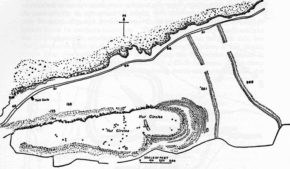
Eightercua ) is a four-stone alignment (stone-row) Megalithic tomb, located 1.5 km south-south-east of Waterville, County Kerry, Ireland Ireland ( ; ga, Éire ; Ulster Scots dialect, Ulster-Scots: ) is an island in the Atlantic Ocean, North Atlantic Ocean, in Northwestern Europe, north-western Europe. It is separated from Great Britain to its east by the North Channel (Grea .... The tallest stone reaches 9 feet in height, and the alignment streaches for twenty five feet in an east-west direction. Surrounding artifacts, including remains of a possible tomb and an ancient enclosure, suggest that the site had a ritual purpose at one time. Eightercua is thought to originate from circa. 1700 BC, and by tradition is the burial place of Scéine, wife of the leader of the Milesian invaders, Amergin mac Míled. The site features four tall slabs from 1.8m to 3m high running east and west. From one stone a slab runs south and could be part of a tomb chamber or cist set in ... [...More Info...] [...Related Items...] OR: [Wikipedia] [Google] [Baidu] |


