|
Warzyce
Warzyce is a village in the administrative district of Gmina Jasło, within Jasło County, Subcarpathian Voivodeship, in south-eastern Poland. It lies approximately east of Jasło and south-west of the regional capital Rzeszów. History In 1938, there were 2636 Jews living in Jasło. During World War II, the Warzyce forest became a place of martyrdom of about 5000 Poles, Jews and Russians who were murdered there by the Nazis in many mass executions. The majority of Jewish victims were Jews from ghettos in Frysztak, Jasło, Tarnów Tarnów () is a city in southeastern Poland with 105,922 inhabitants and a metropolitan area population of 269,000 inhabitants. The city is situated in the Lesser Poland Voivodeship since 1999. From 1975 to 1998, it was the capital of the Tarnów ..., Nowy Zmigrod and Korczyn. One of the biggest mass shootings took place on the 3rd of August, 1942. That day, the Nazis shot in that forest about 690 Jews who were next buried in huge pits. After the w ... [...More Info...] [...Related Items...] OR: [Wikipedia] [Google] [Baidu] |
Gmina Jasło
__NOTOC__ Gmina Jasło is a rural gmina (administrative district) in Jasło County, Subcarpathian Voivodeship, in south-eastern Poland. Its seat is the town of Jasło, although the town is not part of the territory of the gmina. The gmina covers an area of , and as of 2006 its total population is 15,774. Villages Gmina Jasło contains the villages and settlements of Bierówka, Brzyście, Chrząstówka, Gorajowice, Jareniówka, Kowalowy, Łaski, Niegłowice, Niepla, Opacie, Osobnica, Sobniów, Szebnie, Trzcinica, Warzyce, Wolica, Zimna Woda and Żółków. Neighbouring gminas Gmina Jasło is bordered by the gminas of Brzyska, Dębowiec, Frysztak, Jedlicze, Kołaczyce, Lipinki, Skołyszyn, Tarnowiec and Wojaszówka Wojaszówka is a village in Krosno County, Subcarpathian Voivodeship, in south-eastern Poland. It is the seat of the gmina (administrative district) called Gmina Wojaszówka. It lies approximately north-west of Krosno and south-west of the reg ... [...More Info...] [...Related Items...] OR: [Wikipedia] [Google] [Baidu] |
Voivodeships Of Poland
A voivodeship (; pl, województwo ; plural: ) is the highest-level administrative division of Poland, corresponding to a province in many other countries. The term has been in use since the 14th century and is commonly translated into English as "province". The Polish local government reforms adopted in 1998, which went into effect on 1 January 1999, created sixteen new voivodeships. These replaced the 49 former voivodeships that had existed from 1 July 1975, and bear a greater resemblance (in territory, but not in name) to the voivodeships that existed between 1950 and 1975. Today's voivodeships are mostly named after historical and geographical regions, while those prior to 1998 generally took their names from the cities on which they were centered. The new units range in area from under (Opole Voivodeship) to over (Masovian Voivodeship), and in population from nearly one million (Opole Voivodeship) to over five million (Masovian Voivodeship). Administrative authority at th ... [...More Info...] [...Related Items...] OR: [Wikipedia] [Google] [Baidu] |
Subcarpathian Voivodeship
Subcarpathian Voivodeship or Subcarpathia Province (in pl, Województwo podkarpackie ) is a voivodeship, or province, in the southeastern corner of Poland. Its administrative capital and largest city is Rzeszów. Along with the Marshall, it is governed by the Subcarpathian Regional Assembly. Historically, most of the province's territory was part of the Kingdom of Galicia–Volhynia, the Kingdom of Galicia and Lodomeria and the Ruthenian Voivodeship. In the interwar period, it was part of the Lwów Voivodeship. The voivodeship was created on 1 January 1999 out of the former Rzeszów, Przemyśl, Krosno and (partially) Tarnów and Tarnobrzeg Voivodeships, pursuant to the Polish local-government reforms adopted in 1998. The name derives from the region's location near the Carpathian Mountains, and the voivodeship comprises areas of two historic regions of Eastern Europe — Lesser Poland (western and northwestern counties) and Red Ruthenia. During the interwar period (1918-1 ... [...More Info...] [...Related Items...] OR: [Wikipedia] [Google] [Baidu] |
Powiat
A ''powiat'' (pronounced ; Polish plural: ''powiaty'') is the second-level unit of local government and administration in Poland, equivalent to a county, district or prefecture ( LAU-1, formerly NUTS-4) in other countries. The term "''powiat''" is most often translated into English as "county" or "district" (sometimes "poviat"). In historical contexts this may be confusing because the Polish term ''hrabstwo'' (an administrative unit administered/owned by a ''hrabia'' (count) is also literally translated as "county". A ''powiat'' is part of a larger unit, the voivodeship (Polish ''województwo'') or province. A ''powiat'' is usually subdivided into '' gmina''s (in English, often referred to as "communes" or "municipalities"). Major towns and cities, however, function as separate counties in their own right, without subdivision into ''gmina''s. They are termed " city counties" (''powiaty grodzkie'' or, more formally, ''miasta na prawach powiatu'') and have roughly the same ... [...More Info...] [...Related Items...] OR: [Wikipedia] [Google] [Baidu] |
Jasło County
__NOTOC__ Jasło County ( pl, powiat jasielski) is a unit of territorial administration and local government (powiat) in Subcarpathian Voivodeship, south-eastern Poland, on the Slovakia, Slovak border. It came into being on January 1, 1999, as a result of the Polish local government reforms passed in 1998. Its administrative seat is Jasło, which lies south-west of the regional capital Rzeszów. The only other town in the county is Kołaczyce, which is north of Jasło. The county covers an area of . As of 2019 its total population was 113,730, out of which the population of Jasło was 35,063, that of Jasło was 1,409, and the rural population was 77,258. Neighbouring counties Jasło County is bordered by Gorlice County to the west, Tarnów County to the north-west, Dębica County to the north, Strzyżów County to the north-east and Krosno County to the east. It also borders Slovakia to the south. Administrative division The county is subdivided into 10 gminas (one urban, one u ... [...More Info...] [...Related Items...] OR: [Wikipedia] [Google] [Baidu] |
Gmina
The gmina (Polish: , plural ''gminy'' , from German ''Gemeinde'' meaning ''commune'') is the principal unit of the administrative division of Poland, similar to a municipality. , there were 2,477 gminas throughout the country, encompassing over 43,000 villages. 940 gminas include cities and towns, with 302 among them constituting an independent urban gmina ( pl, gmina miejska) consisting solely of a standalone town or one of the 107 cities, the latter governed by a city mayor (''prezydent miasta''). The gmina has been the basic unit of territorial division in Poland since 1974, when it replaced the smaller gromada (cluster). Three or more gminas make up a higher level unit called powiat, except for those holding the status of a city with powiat rights. Each and every powiat has the seat in a city or town, in the latter case either an urban gmina or a part of an urban-rural one. Types There are three types of gmina: #302 urban gmina ( pl, gmina miejska) constituted either by a sta ... [...More Info...] [...Related Items...] OR: [Wikipedia] [Google] [Baidu] |
Village
A village is a clustered human settlement or community, larger than a hamlet but smaller than a town (although the word is often used to describe both hamlets and smaller towns), with a population typically ranging from a few hundred to a few thousand. Though villages are often located in rural areas, the term urban village is also applied to certain urban neighborhoods. Villages are normally permanent, with fixed dwellings; however, transient villages can occur. Further, the dwellings of a village are fairly close to one another, not scattered broadly over the landscape, as a dispersed settlement. In the past, villages were a usual form of community for societies that practice subsistence agriculture, and also for some non-agricultural societies. In Great Britain, a hamlet earned the right to be called a village when it built a church. [...More Info...] [...Related Items...] OR: [Wikipedia] [Google] [Baidu] |
Jasło
Jasło is a county town in south-eastern Poland with 36,641 inhabitants, as of 31 December 2012. It is situated in the Subcarpathian Voivodeship (since 1999), and it was previously part of Krosno Voivodeship (1975–1998). It is located in Lesser Poland, in the heartland of the Doły (Pits), and its average altitude is 320 metres above sea level, although there are some hills located within the confines of the city. The Patron Saint of the city is Saint Anthony of Padua. History In the early days of Polish statehood, Jasło was part of the Castellany of Biecz, out of which ''Biecz County'' emerged in the 14th century. A list of rectories, created for collecting tithes, a church in "Jassel" in Zręcin deanery, Kraków diocese, is shown in 1328.Sulimierski, Filip, Bronisław Chlebowski, and Władysław Walewski. ''Słownik Geograficzny Królestwa Polskiego I Innych Krajów Słowiańskich: Warszawa 1880-1902''. Translated by William F. "Fred" Hoffman. Warszawa: BUW. Sekcja Dok ... [...More Info...] [...Related Items...] OR: [Wikipedia] [Google] [Baidu] |
Rzeszów
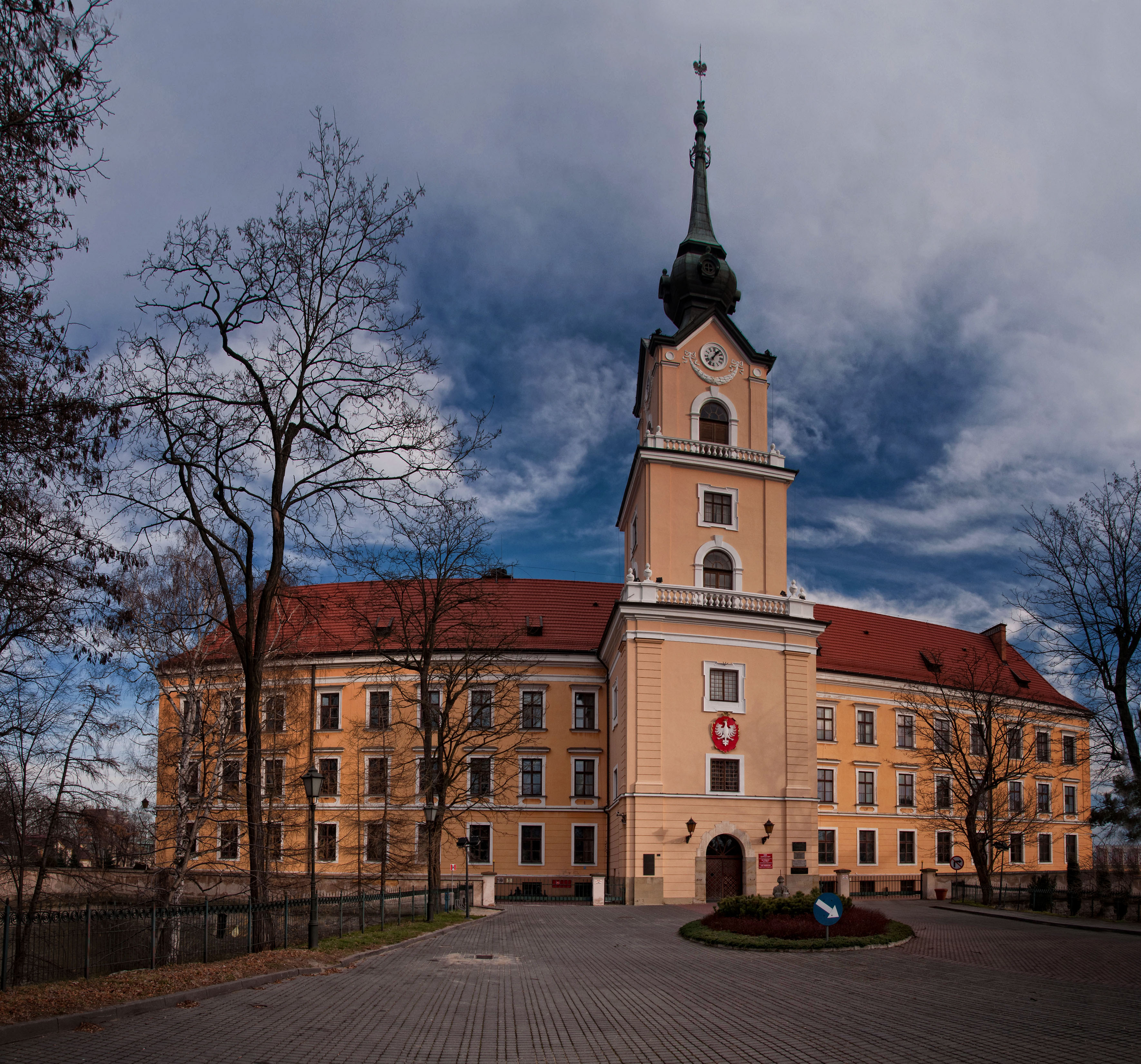
Rzeszów ( , ; la, Resovia; yi, ריישא ''Raisha'')) is the largest city in southeastern Poland. It is located on both sides of the Wisłok River in the heartland of the Sandomierz Basin. Rzeszów has been the capital of the Subcarpathian Voivodeship (province) since 1 January 1999, and is also the county seat, seat of Rzeszów County. The history of Rzeszów dates back to the Middle Ages. It received city rights and privileges from King Casimir III the Great in 1354. Local trade routes connecting Europe with the Middle East and the Ottoman Empire resulted in the city's early prosperity and development. In the 16th century, Rzeszów had a connection with Gdańsk and the Baltic Sea. It also experienced growth in commerce and craftsmanship, especially under local Szlachta, rulers and noblemen. Following the Partitions of Poland, Rzeszów was annexed by the Austrian Empire and did not regain its position until it Second Polish Republic, returned to Poland after World War I. Rze ... [...More Info...] [...Related Items...] OR: [Wikipedia] [Google] [Baidu] |
Frysztak
Frysztak ( yi, פֿריסטיק Fristik; german: Freistadt) is a village in the Gmina Frysztak, Strzyżów County, Subcarpathian Voivodeship, Poland, from Krosno. Frysztak lies in historic Lesser Poland. It is located on a hillock near the river Wisłok, on the road from Rzeszów to Krosno. History Frysztak was mentioned in a 1259 AD document as a town with Magdeburg Rights given by King Bolesław V the Chaste and named after the German ''Freistadt'', literally "Freestead". For centuries, it was a private town, administratively located in the Sandomierz Voivodeship in the Lesser Poland Province. In 1474, the town was completely destroyed by Hungarian army of King Matthias Corvinus, after which Frysztak declined. Its German-speaking population of the Walddeutsche became Polonized in the course of the time. The Hasidic leader Rabbi Menachem Mendel of Rimanov (1745–1815) lived and worked there for many years. In 1772, it was annexed by Austria in the First Partition of Poland ... [...More Info...] [...Related Items...] OR: [Wikipedia] [Google] [Baidu] |
Tarnów
Tarnów () is a city in southeastern Poland with 105,922 inhabitants and a metropolitan area population of 269,000 inhabitants. The city is situated in the Lesser Poland Voivodeship since 1999. From 1975 to 1998, it was the capital of the Tarnów Voivodeship. It is a major rail junction, located on the strategic east–west connection from Lviv to Kraków, and two additional lines, one of which links the city with the Slovak border. Tarnów is known for its traditional Polish architecture, which was influenced by foreign cultures and foreigners that once lived in the area, most notably Jews, Germans and Austrians. The Old Town, featuring 16th century tenements, houses and defensive walls, has been preserved. Tarnów is also the warmest city of Poland, with the highest long-term mean annual temperature in the whole country. Companies headquartered in the city include Poland's largest chemical industry company Grupa Azoty and defence industry company ZMT. The city is currently ... [...More Info...] [...Related Items...] OR: [Wikipedia] [Google] [Baidu] |


