|
Warsop
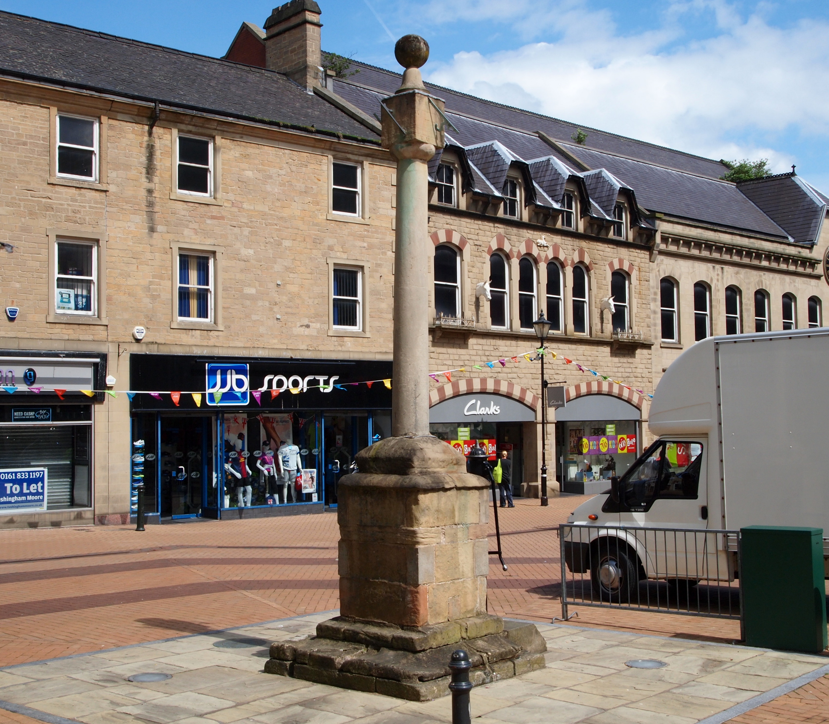
Warsop is a town and civil parish in the Mansfield district, Nottinghamshire, England, on the outskirts of the remnants of Sherwood Forest.OS Explorer Map 270: Sherwood Forest: (1:25 000): At the 2001 census it had a population of 12,365, reducing to 11,999 at the 2011 Census including Church Warsop, Meden Vale and Spion Kop. Governance The parish was an urban district in Nottinghamshire until 1974, when it joined with Mansfield Borough and Woodhouse Urban District Council to form Mansfield District Council. Warsop retains a council, as a successor parish, including the localities of Market Warsop, Church Warsop, Meden Vale, Warsop Vale and Spion Kop. The council is based at Warsop Town Hall. After re-alignment of local wards within Mansfield District Council before the 2011 local elections to achieve a standard format of one councillor-per-ward, Warsop has four designated areas named as Warsop Carrs, Netherfield, Market Warsop and Meden. Warsop is a part of the Mansfield Pa ... [...More Info...] [...Related Items...] OR: [Wikipedia] [Google] [Baidu] |
Warsop Vale
Warsop Vale is a small village in the Mansfield district of western Nottinghamshire, England. It is north west of London, north of the county town and city of Nottingham, and north of the town of Mansfield. It is in the civil parish of Warsop. Warsop Vale's heritage is primarily as a former mining village. It lies in the very picturesque area known as the Dukeries and is easily accessible to Clumber Park, Thoresby Park and hall, Rufford Park and the Earl of Portland estate of Welbeck, together all part of Sherwood Forest. Geography Location Warsop Vale is surrounded by the following local Nottinghamshire areas: * Nether Langwith and Cuckney to the north * Sookholme to the south * Church Warsop and Market Warsop to the east * Shirebrook in Derbyshire to the west This area lies in the north west of the district and west of Nottinghamshire county, as well as being close to the Derbyshire boundary. The core of the hamlet is accessed from the B6031 Church Warsop-Shirebr ... [...More Info...] [...Related Items...] OR: [Wikipedia] [Google] [Baidu] |
Warsop Town Hall
Warsop Town Hall is a municipal building in Church Street in Warsop, Nottinghamshire, England. The building is home to Warsop Parish Council, and was formerly the offices of Warsop Urban District Council and the local offices of Nottinghamshire County Council. History Following significant population growth, largely associated with mineral quarrying, the area became an urban district in 1894. In the early years, the clerk to the council, John Harrop White, was based in offices in Bank Chambers in Mansfield. Shortly after the First World War, the council established its own offices: it was in this building that a post mortem was carried out on the body of Samuel Fell Wilson, a Warsop grocer, wine merchant, and publisher of the ''Warsop and District Almanack'', after he had been shot in the head and chest as he sat in his car outside Warsop Windmill on 23 September 1930. In the early 1930s the council decided to commission more substantial offices: the site selected on Church Stre ... [...More Info...] [...Related Items...] OR: [Wikipedia] [Google] [Baidu] |
Sookholme
Sookholme is a village and former civil parish, now in the parish of Warsop in the Mansfield district of western Nottinghamshire, England. It is north west of London, north of the county town and city of Nottingham, and north of the town of Mansfield. It retains an agricultural character, having been largely unaffected by the Industrial Revolution, which had a transformative impact on the settlement pattern and built form of numerous other settlements situated within the North Midlands coalfields. Whilst relatively close to the built up areas of Mansfield and Shirebrook, Sookholme is remote and rural. In 1931 the parish had a population of 210. Toponymy Sookholme was not recorded in the Domesday Book of 1086. It first appeared in 1189 public records as ''Sulcholm,'' and centuries later, ''Sokeholme''. It lies in the Meden river valley, the Old English translation for this early spelling form is 'marshy land in the valley,' An alternative interpretation is the use of the ... [...More Info...] [...Related Items...] OR: [Wikipedia] [Google] [Baidu] |
Warsop Railway Station
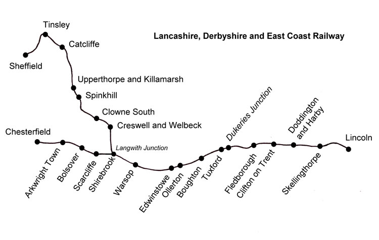
Warsop railway station is a former railway station in Market Warsop, Nottinghamshire, England. History The station was opened by the Lancashire, Derbyshire & East Coast Railway in March 1897 and closed by British Railways in 1955. The station building made use of the LD&ECR's standard modular architecture. After leaving Shirebrook North station, the line crossed the Midland Nottingham to Worksop line (now the Robin Hood Line and passed the LD&ECR Warsop yard near Warsop Junction. These yards are still in use, currently by DB Cargo UK. To the north was a branch to Warsop Main Colliery with extensive marshalling yards, now closed. Shortly after this, in the days when the line was built, the line ran into countryside, crossing Warsop Vale, and arrived at Warsop station. These were in the days before the deep mines appeared penetrating the limestone cap. Between Warsop and Edwinstowe the line climbed from the valley of the River Meden, heading for that of the River Maun. Th ... [...More Info...] [...Related Items...] OR: [Wikipedia] [Google] [Baidu] |
Church Warsop
Church Warsop is a village in Nottinghamshire, England. It is located 1 mile north of Warsop and is within the Warsop civil parish. The parish church of St Peter and St Paul is early Norman.Pevsner, Nikolaus. 1979. ''The Buildings of England:Nottinghamshire''. page 364. Harmondsworth, Middx. Penguin. The village was built in the 1926 by the Staveley Coal and Iron Company The Staveley Coal and Iron Company Limited was an industrial company based in Staveley, near Chesterfield, North Derbyshire. History The company was registered in 1863, appearing in provincial stock exchange reports from 1864. It exploited loc ... to house colliery workers and their families working at their Warsop Main Colliery located in nearby Warsop Vale. There is also a second church, the "Chapel of Bethlem", from the same date as much of the village. References External links Villages in Nottinghamshire Mansfield District {{Nottinghamshire-geo-stub ... [...More Info...] [...Related Items...] OR: [Wikipedia] [Google] [Baidu] |
Warsop Urban District
Warsop was an urban district in Nottinghamshire, England from 1894 to 1974.F. A. Youngs Jr., ''Guide to the Local Administrative Units of England, Vol II: Northern England'', London, 1991 It was created under the Local Government Act 1894. It was enlarged in 1935 when the Sookholme civil parish was transferred to the district. The district was abolished in 1974 under the Local Government Act 1972 and combined with the Municipal Borough of Mansfield and Mansfield Woodhouse Urban District to form the new Mansfield Mansfield is a market town and the administrative centre of Mansfield District in Nottinghamshire, England. It is the largest town in the wider Mansfield Urban Area (followed by Sutton-in-Ashfield). It gained the Royal Charter of a market tow ... district. References Districts of England created by the Local Government Act 1894 Districts of England abolished by the Local Government Act 1972 History of Nottinghamshire Urban districts of Nottinghamshire Ma ... [...More Info...] [...Related Items...] OR: [Wikipedia] [Google] [Baidu] |
Mansfield 103
Mansfield is a market town and the administrative centre of Mansfield District in Nottinghamshire, England. It is the largest town in the wider Mansfield Urban Area (followed by Sutton-in-Ashfield). It gained the Royal Charter of a market town in 1227. The town lies in the Maun Valley, north of Nottingham and near Sutton-in-Ashfield. Most of the 109,000 population live in the town itself (including Mansfield Woodhouse), with Warsop as a secondary centre. Mansfield is the one local authority in Nottinghamshire with a publicly elected mayor. History Roman to Mediaeval Period Settlement dates to the Roman period. Major Hayman Rooke in 1787 discovered a villa between Mansfield Woodhouse and Pleasley; a cache of denarii was found near King's Mill in 1849. Early English royalty stayed there; Mercian Kings used it as a base to hunt in Sherwood Forest. The Royal Manor of Mansfield was held by the King. In 1042 Edward the Confessor possessed a manor in Mansfield. William the Conqu ... [...More Info...] [...Related Items...] OR: [Wikipedia] [Google] [Baidu] |
Mansfield District Council
Mansfield District is a local government district in Nottinghamshire, England. Its council is based in the town of Mansfield. The district is bounded by the districts of Ashfield, Newark and Sherwood and Gedling, as well as the Derbyshire districts of Bolsover and North East Derbyshire. It is also part of the Mansfield urban area. History The district was formed on 1 April 1974, under the Local Government Act 1972, by the merger of the Municipal Borough of Mansfield with Mansfield Woodhouse Urban District and Warsop Urban District. Geography As well as the town of Mansfield, settlements in the district include Mansfield Woodhouse, Forest Town and parts of Pleasley, with Warsop and Meden Vale distanced and annexed by open countryside. The district is entirely unparished apart from Warsop, which retains a parish council. Mansfield District Council Unlike most English councils, Mansfield District Council is led by a directly elected mayor, following a campaign in 2002 by lo ... [...More Info...] [...Related Items...] OR: [Wikipedia] [Google] [Baidu] |
Mansfield (district)
Mansfield District is a Non-metropolitan district, local government district in Nottinghamshire, England. Its council is based in the town of Mansfield. The district is bounded by the districts of Ashfield District, Ashfield, Newark and Sherwood and Gedling, as well as the Derbyshire districts of Bolsover District, Bolsover and North East Derbyshire. It is also part of the Mansfield urban area. History The district was formed on 1 April 1974, under the Local Government Act 1972, by the merger of the Municipal Borough of Mansfield with Mansfield Woodhouse Urban District and Warsop Urban District. Geography As well as the town of Mansfield, settlements in the district include Mansfield Woodhouse, Forest Town, Nottinghamshire, Forest Town and parts of Pleasley, with Market Warsop, Warsop and Meden Vale distanced and annexed by open countryside. The district is entirely unparished apart from Warsop, which retains a parish council. Mansfield District Council Unlike most English c ... [...More Info...] [...Related Items...] OR: [Wikipedia] [Google] [Baidu] |
Spion Kop, Nottinghamshire
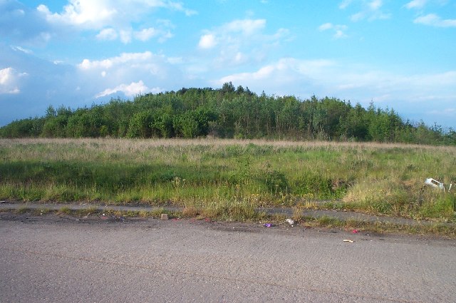
Spion Kop is a small residential and former industrial area in Nottinghamshire, England, stretching for a few hundred yards on both sides of the main A60 road surrounded by open farmland. It is in the civil parish of Warsop. It is located about a mile to the south of Warsop on the A60, Mansfield Road. It is a settlement built and named after the Battle of Spion Kop which took place during the Second Boer War in Natal, South Africa, in January 1900. A major military figure in the conflict was John Talbot Coke, grandson of D'Ewes Coke, born at Mansfield Woodhouse, a well-known Nottinghamshire industrialist and clergyman. At Mansfield Woodhouse a Coke Street was renamed Newhaven Avenue. The one residential side-street adjoining the main A60 road formerly known as George Street has been renamed Mosscar Close. A modern, large-scale mixed-residential development has been built on the extensive site of the old Wood Brothers timber business on Mansfield Road following a successful pla ... [...More Info...] [...Related Items...] OR: [Wikipedia] [Google] [Baidu] |
Mansfield (UK Parliament Constituency)
Mansfield is a constituency created in 1885 represented in the House of Commons of the UK Parliament since 2017 by Ben Bradley of the Conservative Party, who gained the seat at the 2017 general election, from the Labour Party. This is the first time the seat has been represented by a Conservative since its creation in 1885. The seat is centred on Mansfield in Nottinghamshire. The seat, in recent times, has been considered a relatively marginal seat. The Mansfield council area voted with more than 70% to Leave the European Union in the 2016 referendum. In 2019, the Conservatives received 63.9% of the vote in the formerly safe Labour constituency. Boundaries The constituency covers the towns of Mansfield and Warsop, Nottinghamshire. Latest boundary review The Boundary Commission for England caused changes to constituency to allow for regional and local population changes, noticeably by moving the small town of Market Warsop from Bassetlaw into Mansfield constituency. The ... [...More Info...] [...Related Items...] OR: [Wikipedia] [Google] [Baidu] |
Meden Vale
Meden Vale is a small former coal mining village originally known as Welbeck Colliery Village prior to renaming in the late 1960s. It is situated close to the small town of Market Warsop, in north Nottinghamshire, England, off the main A60 Mansfield to Worksop road, and lies within Mansfield District Council administrative area and Mansfield Parliamentary constituency, represented since 2017 by Ben Bradley of the Conservative Party. It is in the civil parish of Warsop. There is a small collection of shops, Post Office, a garage and the Three Lions public house. The River Meden flows through the village alongside the main road. The village has a rugby union side which plays in the RFU Midlands 5 East (North) division. Former colliery The economy was based mainly on Welbeck Colliery, which started up when two shafts were sunk between 1912 and 1915. It was determined by owner UK Coal for closure in 2007 due to limited reserves, with the last coal produced 11 May 2010. Most of ... [...More Info...] [...Related Items...] OR: [Wikipedia] [Google] [Baidu] |


.jpg)