|
Wallan
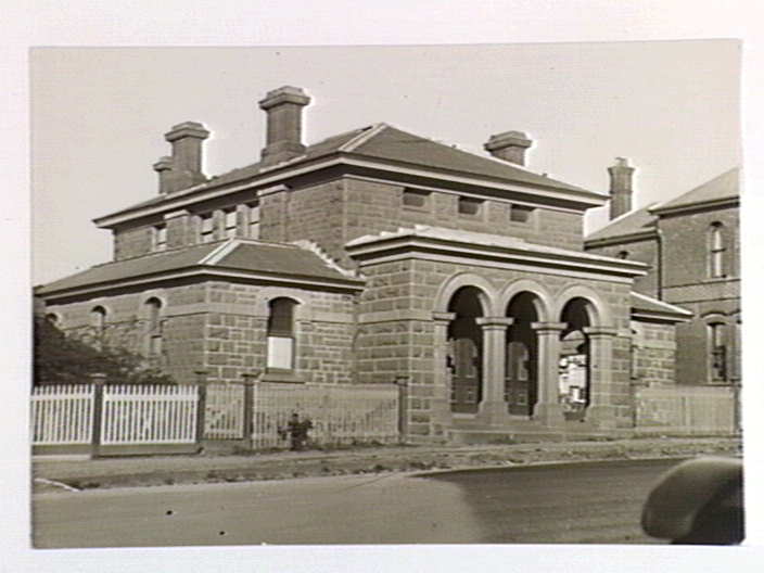
Wallan , traditionally known as Wallan Wallan (large circular place of water), is a town in Victoria, north of Melbourne's Central Business District. The town sits at the southern end of the large and diverse Shire of Mitchell which extends from the northern fringes of Melbourne into the farming country of north-central Victoria and the lower Goulburn Valley. The township flanks the Hume Freeway and is set against the backdrop of the Great Dividing Range. At the , Wallan had a population of 8,520. Overview The fastest growing town and now largest town in the shire, Wallan is a link between the city and rural towns such as Kilmore, Broadford and Seymour. 15 kilometres to the north is a turnoff to Strath Creek which leads through the Valley of a Thousand Hills. History A Wallan Wallan Post Office opened on 1 April 1858. A Wallan Railway Station Post Office opened on 1 October 1873, later renamed as Wallan Wallan East and closing in 1992. The first and only surviving s ... [...More Info...] [...Related Items...] OR: [Wikipedia] [Google] [Baidu] |
Wallan Railway Station
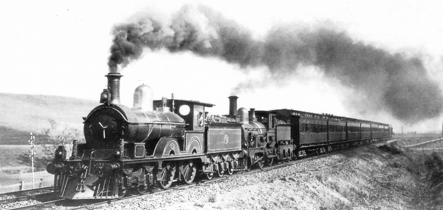
Wallan railway station is located on the North East railway line, North East line in Victoria (Australia), Victoria, Australia. It serves the town of Wallan, and opened on 18 April 1872.Wallan Vicsig History The station opened as Wallan Wallan on 18 April 1872, the North East line to Wodonga railway station, Wodonga having opened a few months earlier. The main town on the Hume Highway has since become known as Wallan, while the township beside the railway has become known as Wallan East. The first goods shed was provided in 1873, with a loading platform for timber erected the following year. In 1876, the goods shed was replaced, and the current wooden building on the Rail_directions#Up_and_down, down platform (Platform 2) provided. The first lever frame was provi ...[...More Info...] [...Related Items...] OR: [Wikipedia] [Google] [Baidu] |
Towns In Victoria (Australia)
This is a list of locality names and populated place names in the state of Victoria, Australia, outside the Melbourne metropolitan area. It is organised by region from the south-west of the state to the east and, for convenience, is sectioned by Local Government Area (LGA). Localities are bounded areas recorded on VICNAMES, although boundaries are the responsibility of each council. Many localities cross LGA boundaries, some being partly within three LGAs, but are listed here once under the LGA in which the major population centre or area occurs. The Office of Geographic Names (OGN), led by the Registrar of Geographic Names, administers the naming or renaming of localities (as well as roads, and other features) in Victoria, and maintains the Register of Geographic Names, referred as the VICNAMES register, pursuant to the ''Geographic Place Names Act 1998''. The OGN has issued the mandatory ''Naming rules for places in Victoria, Statutory requirements for naming roads, features ... [...More Info...] [...Related Items...] OR: [Wikipedia] [Google] [Baidu] |
Shire Of Mitchell
The Shire of Mitchell is a local government area in the Hume region of Victoria, Australia, located North of Melbourne. It covers an area of and, in June 2018, had a population of 44,299. It includes the towns of Broadford, Kilmore, Seymour, Tallarook, Pyalong and Wallan. It was formed in 1994 from the amalgamation of the Shire of Pyalong, the Shire of Kilmore, most of the Shire of Broadford, and parts of the Shire of McIvor and Rural City of Seymour. The Shire is governed and administered by the Mitchell Shire Council; its seat of local government and administrative centre is located at the council headquarters in Broadford, it also has service centres located in Kilmore, Seymour and Wallan. The Shire is named after an early British surveyor and explorer, Major Thomas Mitchell, who explored the south-eastern part of Australia, and whose return route for his third expedition passed through the present-day LGA. It is one of the fastest growing regional municipalitie ... [...More Info...] [...Related Items...] OR: [Wikipedia] [Google] [Baidu] |
Beveridge, Victoria
Beveridge is a town in Victoria, Australia, north of Melbourne's Central Business District, located within the City of Whittlesea and the Shire of Mitchell local government areas. Beveridge recorded a population of 4,642 at the 2021 census. History Beveridge was named after Scottish sheep farmer Andrew Beveridge, who built the Hunters' Tryst Inn in 1845. The Inn still serves as a hotel, as well as post office and general store. Beveridge Post Office opened on 1 January 1865. Near Beveridge is Mount Fraser, an eroded extinct volcanic cone. It is a large scoria volcano with two craters, which last erupted about one million years ago. The north side of the hill is quite steep and reaches a height of 125 metres above the surrounding basalt plain. From this location, the explorers Hume and Hovell first saw Port Phillip on 14 December 1824. A quarry now operates at the side of the hill and supplies most of Melbourne's scoria. A copy of the original Eureka flag flies atop this ... [...More Info...] [...Related Items...] OR: [Wikipedia] [Google] [Baidu] |
North East Railway Line
The North East railway line is a railway line in Victoria (Australia), Victoria, Australia. The line runs from Albury railway station in the border settlement of Albury–Wodonga to Southern Cross railway station on the western edge of the Melbourne Melbourne City Centre, central business district, serving the cities of Wangaratta and Seymour, Victoria, Seymour, and smaller towns in northeastern Victoria. The line is owned by VicTrack, but leased to, and maintained by, the Australian Rail Track Corporation, and forms part of the Sydney–Melbourne rail corridor. Unlike most other heavy rail lines in Victoria, the line is completely standard gauge, after works were carried out between 2008 and 2010. However, the 5 ft 3 in gauge railways, broad gauge Tocumwal railway line, Victoria, Tocumwal line runs parallel to the line between Seymour railway station, Seymour and Broadmeadows railway station, Melbourne, Broadmeadows. History The Melbourne and Essendon Railway Compa ... [...More Info...] [...Related Items...] OR: [Wikipedia] [Google] [Baidu] |
Kilmore, Victoria
Kilmore () is a town in the Australian state of Victoria. Located north of Melbourne, it is the oldest inland town in Victoria by the combination of age and physical occupation, and because it had unique agricultural attributes to drive that earliest settlement. It grew very rapidly to become four times bigger than its nearest inland rival by 1851. Its spectacular growth continued to match that of the major gold mining towns of Ballarat, Bendigo and Beechworth until at least 1861. History The traditional owners of Kilmore and the Kilmore Plains are the Taungurung people, a part of the Kulin nation that inhabited a large portion of central Victoria including Port Phillip Bay and its surrounds. The Tommy McRae artwork held by the National Gallery of Australia depicts the "Kilmore Tribe Holding Corobboree", and a child pioneer of Kilmore, James Hamilton, describes in detail just such a corroboree at Kilmore in 1845. The area was known to the Taungurung as ''Mumillinuck''. Kilmo ... [...More Info...] [...Related Items...] OR: [Wikipedia] [Google] [Baidu] |
Wandong, Victoria
Wandong is a town in Victoria, Australia. The town is about north of the state capital, Melbourne, on the Hume Highway. It adjoins the town of Heathcote Junction, and at the , the two towns had a population of 1,340. The main centre nearest Wandong is Kilmore. History The traditional owners of Wandong are the Taungurong people, a part of the Kulin nation that inhabited a large portion of central Victoria including Port Phillip Bay and its surrounds. Wandong itself is an Aboriginal word meaning "Spirit". The first Europeans to reach Wandong were Hamilton Hume and Captain William Hilton Hovell who travelled through the centre of the future town of Wandong on the 13th December, 1824. The explorers proceeded 1260 metres South of Arkell’s Lane, Wandong and crossed the Dividing Range at the low peak there that they named Hume’s Pass. They then moved South along Eastern Ridge, Hidden Valley, and downhill to the Merri Creek, Wallan East near Kelby Lane. That made Wandong th ... [...More Info...] [...Related Items...] OR: [Wikipedia] [Google] [Baidu] |
List Of Reduplicated Australian Place Names
These names are examples of reduplication, a common theme in Australian toponymy, especially in names derived from Indigenous Australian languages such as Wiradjuri. Reduplication is often used as an intensifier such as "Wagga Wagga" ''many crows'' and " Tilba Tilba" ''many waters''. The phenomenon has been the subject of interest in popular culture, including the song by Australian folk singer Greg Champion (written by Jim Haynes and Greg Champion), ''Don't Call Wagga Wagga Wagga''. British comedian Spike Milligan, an erstwhile resident of Woy Woy, once wrote "Woy it is called Woy Woy Oi will never know". Place names See also * Reduplication for general linguistic analysis * List of reduplicated place names * List of reduplicated New Zealand place names * List of Australian place names of Aboriginal origin Place names in Australia have names originating in the Australian Aboriginal languages for three main reasons: * Historically, European explorers and surve ... [...More Info...] [...Related Items...] OR: [Wikipedia] [Google] [Baidu] |
Hume Freeway
Hume Highway, inclusive of the sections now known as Hume Freeway and Hume Motorway, is one of Australia's major inter-city national highways, running for between Melbourne in the southwest and Sydney in the northeast. Upgrading of the route from Sydney's outskirts to Melbourne's outskirts to dual carriageway was completed on 7 August 2013. From north to south, the road is called Hume Highway in metropolitan Sydney, Hume Motorway between the Cutler Interchange and Berrima, Hume Highway elsewhere in New South Wales and Hume Freeway in Victoria. It is part of the Auslink National Network and is a vital link for road freight to transport goods to and from the two cities as well as serving Albury-Wodonga and Canberra. Route At its Sydney end, Hume Highway begins at Parramatta Road, in Ashfield. This route is numbered as A22. The first of the highway was known as Liverpool Road until August 1928, when it was renamed as part of Hume Highway, as part of the creation of the NS ... [...More Info...] [...Related Items...] OR: [Wikipedia] [Google] [Baidu] |
Division Of McEwen
The Division of McEwen is an Australian Electoral Division in the state of Victoria. Classed as a rural seat, the electorate is located in the centre of the state, north of its capital city Melbourne. It includes the outer northern suburbs of Doreen, Mernda, and Wollert, and extends along the Hume Freeway north of the metropolitan area to include the towns of Gisborne as well as Wallan as well as many other small towns. Geography Since 1984, federal electoral division boundaries in Australia have been determined at redistributions by a redistribution committee appointed by the Australian Electoral Commission. Redistributions occur for the boundaries of divisions in a particular state, and they occur every seven years, or sooner if a state's representation entitlement changes or when divisions of a state are malapportioned. History The Division was proclaimed at the redistribution of 14 September 1984, and was first contested at the 1984 federal election. It was named aft ... [...More Info...] [...Related Items...] OR: [Wikipedia] [Google] [Baidu] |
Electoral District Of Kalkallo
The Electoral district of Kalkallo is an electoral district of the Victorian Legislative Assembly in Australia. It was created in the redistribution of electoral boundaries in 2021, and will come into effect at the 2022 Victorian state election. It covers an area in the north western suburbs of Melbourne and outlying northern towns that was previously covered by the districts of Electoral district of Yuroke, Yuroke and Electoral district of Yan Yean, Yan Yean. It includes the suburbs of Craigieburn, Victoria, Craigieburn, Mickleham, Victoria, Mickleham, Kalkallo, Victoria, Kalkallo, and the towns of Beveridge, Victoria, Beveridge and Wallan, Victoria, Wallan. Members for Kalkallo Election results See also *Parliaments of the Australian states and territories *List of members of the Victorian Legislative Assembly References Electoral districts of Victoria (Australia), Kalkallo, Electoral district of 2022 establishments in Australia Shire of Mitchell City of Hume ... [...More Info...] [...Related Items...] OR: [Wikipedia] [Google] [Baidu] |
Lancefield, Victoria
Lancefield is a town in the Shire of Macedon Ranges local government area in Victoria, Australia north of the state capital, Melbourne and had a population of 2,743 at the 2021 census. History The area was used by the indigenous aboriginal people as a quarry site for the manufacture of stone axes and was first settled by European squatters in 1837. The main source of these stone tools was at Mount William, to the north east of Lancefield. A Lancefield Post Office opened on 16 January 1858 in the Romsey/Five Mile Creek area, to the south. In 1860 this was renamed Five Mile Creek when Lancefield Post Office opened in the present township. Lancefield's elevation and climate made it a popular summer resort in the 1880s. In recent years, many local wineries have been established in the area. The town has a connection to the Kelly Gang; for it was here that Constable Fitzpatrick, the instigator of the Kelly Outbreak in 1878 was finally found by the Victorian police to be ... [...More Info...] [...Related Items...] OR: [Wikipedia] [Google] [Baidu] |


_Distances.gif)
