|
Waldron, Missouri
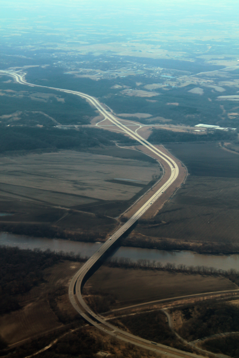
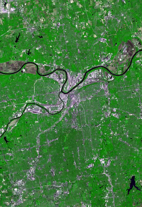
Waldron is an unincorporated community in southwestern Platte County, Missouri in the United States. Waldron is located on the edge of the Missouri River floodplain approximately one mile southeast of Route 45. I-435 crosses the Missouri River 2.5 miles south of the community. The Burlington Northern Railroad passes the community. It is within the Kansas City metropolitan area The Kansas City metropolitan area is a bi-state metropolitan area anchored by Kansas City, Missouri. Its 14 counties straddle the border between the U.S. states of Missouri (9 counties) and Kansas (5 counties). With and a population of more th .... History Waldron was laid out in 1869 by J. M. and M. H. Waldron, and named for them. A post office called Waldron has been in operation since 1869. File:Photo of Waldron MO.jpg, Historic Photo of Waldron early 1900s File:McCormick Distillery in Waldron.png, Original McCormick Distillery in Waldron before moving to Weston File:Waldron Bank.jpg, Waldron S ... [...More Info...] [...Related Items...] OR: [Wikipedia] [Google] [Baidu] |
Unincorporated Area
An unincorporated area is a region that is not governed by a local municipal corporation. Widespread unincorporated communities and areas are a distinguishing feature of the United States and Canada. Most other countries of the world either have no unincorporated areas at all or these are very rare: typically remote, outlying, sparsely populated or List of uninhabited regions, uninhabited areas. By country Argentina In Argentina, the provinces of Chubut Province, Chubut, Córdoba Province (Argentina), Córdoba, Entre Ríos Province, Entre Ríos, Formosa Province, Formosa, Neuquén Province, Neuquén, Río Negro Province, Río Negro, San Luis Province, San Luis, Santa Cruz Province, Argentina, Santa Cruz, Santiago del Estero Province, Santiago del Estero, Tierra del Fuego Province, Argentina, Tierra del Fuego, and Tucumán Province, Tucumán have areas that are outside any municipality or commune. Australia Unlike many other countries, Australia has only local government in Aus ... [...More Info...] [...Related Items...] OR: [Wikipedia] [Google] [Baidu] |
Platte County, Missouri
Platte County is a county located in the northwestern portion of the U.S. state of Missouri and is part of the Kansas City metropolitan area. As of the 2020 census, the population was 106,718. Its county seat is Platte City. The county was organized December 31, 1838, from the Platte Purchase, named for the Platte River. (''Platte'' is derived from the French word for a low, shallow, or intermittent stream.) The Kansas City International Airport is located in the county, approximately one mile west of Interstate 29 between mile markers 12 and 15. The land for the airport was originally in an unincorporated portion of Platte County before being annexed by Platte City, and eventually Kansas City. Geography According to the U.S. Census Bureau, the county has a total area of , of which is land and (1.5%) is water. The county's southwestern border with Kansas is formed by the Missouri River. Adjacent counties * Buchanan County (north) *Clinton County (northeast) *Clay County ... [...More Info...] [...Related Items...] OR: [Wikipedia] [Google] [Baidu] |
Missouri
Missouri is a U.S. state, state in the Midwestern United States, Midwestern region of the United States. Ranking List of U.S. states and territories by area, 21st in land area, it is bordered by eight states (tied for the most with Tennessee): Iowa to the north, Illinois, Kentucky and Tennessee to the east, Arkansas to the south and Oklahoma, Kansas and Nebraska to the west. In the south are the Ozarks, a forested highland, providing timber, minerals, and recreation. The Missouri River, after which the state is named, flows through the center into the Mississippi River, which makes up the eastern border. With more than six million residents, it is the List of U.S. states and territories by population, 19th-most populous state of the country. The largest urban areas are St. Louis, Kansas City, Missouri, Kansas City, Springfield, Missouri, Springfield and Columbia, Missouri, Columbia; the Capital city, capital is Jefferson City, Missouri, Jefferson City. Humans have inhabited w ... [...More Info...] [...Related Items...] OR: [Wikipedia] [Google] [Baidu] |
Floodplain
A floodplain or flood plain or bottomlands is an area of land adjacent to a river which stretches from the banks of its channel to the base of the enclosing valley walls, and which experiences flooding during periods of high discharge.Goudie, A. S., 2004, ''Encyclopedia of Geomorphology'', vol. 1. Routledge, New York. The soils usually consist of clays, silts, sands, and gravels deposited during floods. Because the regular flooding of floodplains can deposit nutrients and water, floodplains frequently have high soil fertility; some important agricultural regions, such as the Mississippi river basin and the Nile, rely heavily on the flood plains. Agricultural regions as well as urban areas have developed near or on floodplains to take advantage of the rich soil and fresh water. However, the risk of flooding has led to increasing efforts to control flooding. Formation Most floodplains are formed by deposition on the inside of river meanders and by overbank flow. Whereve ... [...More Info...] [...Related Items...] OR: [Wikipedia] [Google] [Baidu] |
Route 45 (Missouri)
Route 45 is a highway in northwest Missouri, US in Buchanan County and Platte County which is largely in the bottom land alongside the Missouri River. Route description Its northern terminus is U.S. Route 59 just east of Atchison, Kansas where 59 turns sharply to St. Joseph, Missouri north while 45 heads south towards Kansas City, Missouri. It overlaps Route 273 until just south of Weston, Missouri where 273 breaks off to head east. At Beverly, Missouri, in what is referred to locally as the "Beverly Curve", it intersects Route 92 going east to Platte City, Missouri and west to Leavenworth, Kansas. About three miles (5 km) later at East Leavenworth, Missouri, Route 45 intersects its spur which goes northwest to Leavenworth. The spur, which is signed as "Route 45" and also known as the "Leavenworth cutoff", was built as a shortcut from Leavenworth, Kansas to Kansas City during the construction of the Centennial Bridge (Leavenworth, Kansas). Even though it is in Misso ... [...More Info...] [...Related Items...] OR: [Wikipedia] [Google] [Baidu] |
I-435
Interstate 435 (I-435) is an Interstate Highway beltway that encircles much of the Kansas City metropolitan area within the states of Kansas and Missouri in the United States. Route description I-435, a loop route of I-35, is long and intersects with nearly every other Interstate Highway in the Kansas City area (except for I-635 and I-670). An additional near Kansas City International Airport is signed along with I-29 and U.S. Route 71 (US 71), making I-435 the second-longest complete beltway numbered as a single Interstate Highway in the US and seventh longest in the world after I-275 in Cincinnati, Ohio, at ; Beltway 8 in Houston, Texas, at ; Bundesautobahn 10 in Berlin at ; and M25 motorway in London at ; as well as 7th and 8th ring roads in Beijing. The majority——of I-435 is within the state of Missouri, and most of that roadway lies within the city limits of Kansas City. The first/last exit is at I-435's parent route, I-35, in Lenexa, Kansas. Goi ... [...More Info...] [...Related Items...] OR: [Wikipedia] [Google] [Baidu] |
Burlington Northern Railroad
The Burlington Northern Railroad was a United States-based railroad company formed from a Mergers and acquisitions, merger of four major U.S. railroads. Burlington Northern operated between 1970 and 1996. Its historical lineage begins in the earliest days of railroading with the chartering in 1848 of the Chicago and Aurora Railroad, a direct ancestor line of the Chicago, Burlington and Quincy Railroad, which lends Burlington to the names of various merger-produced successors. Burlington Northern acquired the Atchison, Topeka and Santa Fe Railway on December 31, 1996, to form the Burlington Northern and Santa Fe Railway (later renamed BNSF Railway), which was owned by the Burlington Northern Santa Fe Corporation. That corporation was purchased by Berkshire Hathaway in 2009 which is controlled by investor Warren Buffett. History The Burlington Northern Railroad was the product of the merger of four major railroads: the Great Northern Railway (U.S.), Great Northern Railway, the N ... [...More Info...] [...Related Items...] OR: [Wikipedia] [Google] [Baidu] |
Kansas City Metropolitan Area
The Kansas City metropolitan area is a bi-state metropolitan area anchored by Kansas City, Missouri. Its 14 counties straddle the border between the U.S. states of Missouri (9 counties) and Kansas (5 counties). With and a population of more than 2.2 million people, it is the second-largest metropolitan area centered in Missouri (after Greater St. Louis) and is the largest metropolitan area in Kansas, though Wichita is the largest metropolitan area centered in Kansas. Alongside Kansas City, Missouri, these are the suburbs with populations above 100,000: Overland Park, Kansas; Kansas City, Kansas; Olathe, Kansas; Independence, Missouri; and Lee's Summit, Missouri. Business enterprises and employers include Cerner Corporation (the largest, with almost 10,000 local employees and about 20,000 global employees), AT&T Inc., AT&T, BNSF Railway, GEICO, Asurion, T-Mobile (formerly Sprint Corporation, Sprint), Black & Veatch, AMC Theatres, Citigroup, Garmin, Hallmark Cards, Macquarie Grou ... [...More Info...] [...Related Items...] OR: [Wikipedia] [Google] [Baidu] |
Weston, Missouri
Weston is a town in Platte County, Missouri within the United States. The population was 1,641 at the 2010 census. History The Lewis and Clark Expedition stopped at "Bear Medison" island, near the location of today's city hall. Weston was the oldest settlement in the Platte Purchase of 1836 and was therefore also the farthest western settlement (thus, "West Town") in the United States until the admission of Texas as a state in 1845. Another suggested theory of origin is related to a story about a discharged US Army dragoon by the name of Joseph Moore. He bought the land and then had First Sergeant Tom Weston of D Company, First Dragoons, stationed at Fort Leavenworth across the Missouri River, lay out a town plan. The town may have therefore been named for Sgt. Weston. William "Buffalo Bill" Cody was at one time a resident of Weston, and the town was a major "jumping off" point for the Santa Fe Trail, the Oregon Trail and the California Gold Rush. In 1881, Weston was the site o ... [...More Info...] [...Related Items...] OR: [Wikipedia] [Google] [Baidu] |
Unincorporated Communities In Platte County, Missouri
Unincorporated may refer to: * Unincorporated area, land not governed by a local municipality * Unincorporated entity, a type of organization * Unincorporated territories of the United States, territories under U.S. jurisdiction, to which Congress has determined that only select parts of the U.S. Constitution apply * Unincorporated association Unincorporated associations are one vehicle for people to cooperate towards a common goal. The range of possible unincorporated associations is nearly limitless, but typical examples are: :* An amateur football team who agree to hire a pitch onc ..., also known as voluntary association, groups organized to accomplish a purpose * ''Unincorporated'' (album), a 2001 album by Earl Harvin Trio {{disambig ... [...More Info...] [...Related Items...] OR: [Wikipedia] [Google] [Baidu] |


.jpg)
