|
Waikato County
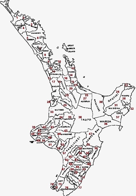
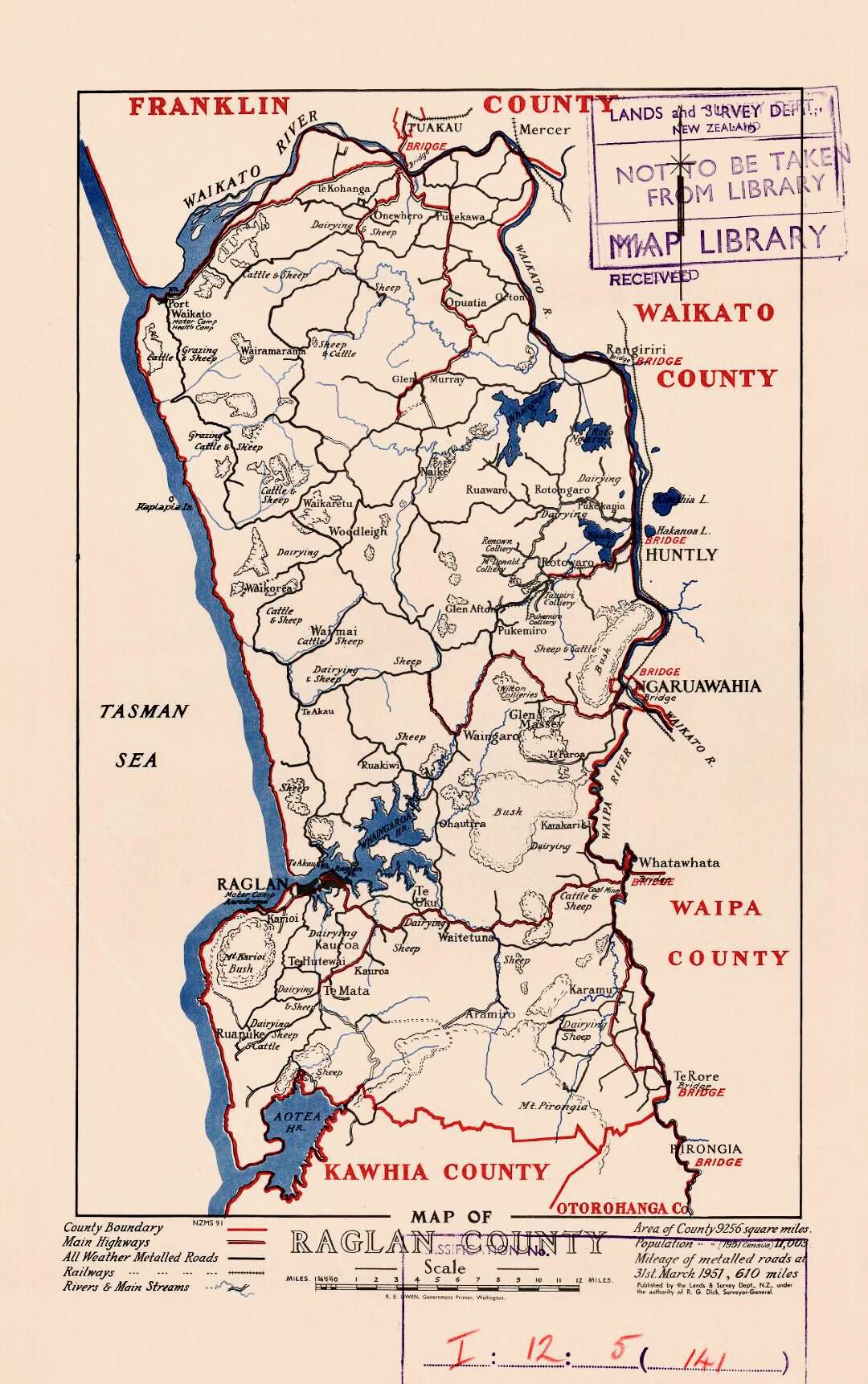
Waikato County was one of the counties of New Zealand on the North Island. Under the Local Government (Waikato Region) Reorganisation Order of 1989, nearly all of the county was added to the boroughs of Huntly, Ngāruawāhia, most of Raglan County Council, and a small part of Waipa County Council, to form Waikato District Council. The council first met on 9 January 1877 at the Court House in Cambridge. In 1923 Waikato County covered and had a population of 8,350, with of gravel roads A gravel road is a type of unpaved road surfaced with gravel that has been brought to the site from a quarry or stream bed. They are common in less-developed nations, and also in the rural areas of developed nations such as Canada and the Uni ..., of mud roads and of tracks. The former County Council office at 455 Grey Street in Hamilton East opened in 1910. It has not been greatly altered and is now used by a travel agent. It is protected by a Category B listing in Hamilton City's Distr ... [...More Info...] [...Related Items...] OR: [Wikipedia] [Google] [Baidu] |
Hamilton East, New Zealand
Hamilton East is a suburb in central Hamilton in New Zealand. The suburb's primary commercial and retail precinct is located along Grey Street. Hamilton East is characterised by villas and bungalows built early in the 20th century. History Hamilton East is one of Hamilton's oldest suburbs. From the 1870s until the mid-20th century, Hamilton East was sometimes known as 'Irishtown'. A significant number of the militiamen who settled there were of Irish descent, and many other Irish Catholics came to live near the Catholic Church and convent. The town of Hamilton East merged with Hamilton West in 1877. Many of the streets were named after famous figures of the New Zealand Wars, including Governor George Grey and Maori chief Te Awaitaia, who went by the name William Naylor/Wiremu Neera when he converted to Christianity. Evidence of planning for the centre of the village can be seen in the village green concept of Steele Park and the planting of English trees along Grey Street. H ... [...More Info...] [...Related Items...] OR: [Wikipedia] [Google] [Baidu] |
County (New Zealand)
A system of counties of New Zealand was instituted after the country dissolved its provinces in 1876, and these counties were similar to other countries' systems, lasting with little change (except mergers and other localised boundary adjustments) until 1989, when they were reorganised into district and city councils within a system of larger regions. History The Counties Bill of 1876 was initiated to merge 314 road boards into 39 counties. However, as a result of lobbying the number of counties had grown to 63 by the time the bill was enacted. They had chairmen, not mayors as boroughs and cities had; many legislative provisions (such as burial and land subdivision control) were different for the counties. By 1966, there were 112 counties. During the second half of the 20th century, many counties received overflow population from nearby cities. The result was often a merger of the two into a "district" (e.g., Rotorua) or a change of name to "district" (e.g., Waimairi) or "c ... [...More Info...] [...Related Items...] OR: [Wikipedia] [Google] [Baidu] |
Waikato District Council
Waikato District Council ( mi, Te Kaunihera ā-Rohe o Waikato) is the territorial authority for the Waikato District of New Zealand. The council is led by the mayor of Waikato The Mayor of Waikato officiates over the Waikato District of New Zealand's North Island. Jacqui Church is the current mayor. The previous mayor was Allan Sanson, a third generation farmer who had served on the council since 2001 and had been may ..., who is currently . There are also ward councillors. Composition Mayor Councillors * History The council was established in 1989, replacing Raglan County Council (established in 1876), Waikato County Council (established in 1876), Ngāruawāhia Borough Council (established in 1920), and Huntly Borough Council (established in 1931). References External links Official website {{coord, -37.6680745, 175.1487314, display=title Waikato District Politics of Waikato Territorial authorities of New Zealand ... [...More Info...] [...Related Items...] OR: [Wikipedia] [Google] [Baidu] |
List Of Former Territorial Authorities In New Zealand
This is a list of former territorial authorities in New Zealand. "Territorial authority" is the generic term used for local government entities in New Zealand. Local government has gone through three principal phases with different structures: the provincial era, from 1853 to 1876; the counties and boroughs system from 1876 until 1989; and the current system of regions, cities and districts. This article attempts to list all territorial authorities which have been disestablished. Provincial era (until 1876) The original three provinces were established in 1841 by Royal Charter. The New Zealand Constitution Act 1846 reduced the number of provinces to two. The New Zealand Constitution Act 1852 re-divided New Zealand into six provinces, and four additional provinces emerged during the remainder of the Provincial Era. This era came to end with the Abolition of Provinces Act 1876. Post-provincial era (1876–1989) After New Zealand abolished its provinces in 1876, a system of ... [...More Info...] [...Related Items...] OR: [Wikipedia] [Google] [Baidu] |
Gravel Road
A gravel road is a type of unpaved road surfaced with gravel that has been brought to the site from a quarry or stream bed. They are common in less-developed nations, and also in the rural areas of developed nations such as Canada and the United States. In New Zealand, and other Commonwealth countries, they may be known as metal roads. They may be referred to as "dirt roads" in common speech, but that term is used more for unimproved roads with no surface material added. If well constructed and maintained, a gravel road is an all-weather road. Characteristics Construction Compared to sealed roads, which require large machinery to work and pour concrete or to lay and smooth a bitumen-based surface, gravel roads are easy and cheap to build. However, compared to dirt roads, all-weather gravel highways are quite expensive to build, as they require front loaders, dump trucks, graders, and roadrollers to provide a base course of compacted earth or other material, sometimes maca ... [...More Info...] [...Related Items...] OR: [Wikipedia] [Google] [Baidu] |
Cambridge, New Zealand
Cambridge (Māori: ''Kemureti'') is a town in the Waipa District of the Waikato region of the North Island of New Zealand. Situated southeast of Hamilton, on the banks of the Waikato River, Cambridge is known as "The Town of Trees & Champions". The town has a population of , making it the largest town in the Waipa District, and the third largest urban area in the Waikato (after Hamilton and Taupo). Cambridge was a finalist in the 2017 and 2019 New Zealand's Most Beautiful Large Town awards, run by Keep New Zealand Beautiful. It was awarded the title New Zealand's Most Beautiful Large Town in October 2019. History Prior to the arrival of Europeans there were a number of Maori pā in the vicinity of what would become Cambridge. In the 1850s missionaries and farmers from Britain settled in the area and introduced modern farming practices to local Maori, helping them set up two flour mills and importing grinding wheels from England and France. During the 1850s, wheat was a profi ... [...More Info...] [...Related Items...] OR: [Wikipedia] [Google] [Baidu] |
Waikato District
Waikato District is a territorial authority of New Zealand, in the northern part of Waikato region, North Island. Waikato District is administered by the Waikato District Council, with headquarters in Ngāruawāhia. The district is centred to the north and west of the city of Hamilton, and takes in much of the northern Waikato Plains and also the Hakarimata Range. The north of the district contains swampy floodplain of the Waikato River and several small lakes, of which the largest is Lake Waikare. Other than Ngāruawāhia, the main population centres are Huntly, Raglan, and Te Kauwhata. The main industries in the district are dairy farming, forestry, and coal mining. There is a major coal-fired power station at Huntly. Te Kauwhata is at the centre of a major wine region. Demographics At the 2006 census the district had a population of 43,959. Of these, 6834 lived in Huntly, 5106 in Ngāruawāhia, 2637 in Raglan, and 1294 in Te Kauwhata. In 2010, the district acquired part o ... [...More Info...] [...Related Items...] OR: [Wikipedia] [Google] [Baidu] |
Waipa (New Zealand Electorate)
Waipa is a former parliamentary electorate in the Waikato region of New Zealand, which existed for various periods between 1876 and 1996. Population centres In the 1875 electoral redistribution, the House of Representatives increased representation by 10 seats, but this was mostly achieved through adding more members to existing electorates. Only two new electorates were created, and the Waipa electorate was one of them. It was created by splitting the area of the electorate. For the first election in 1876, polling booths were in Hamilton West (the Waikato River was the electorate's boundary), Ngāruawāhia, Alexandra (since renamed to Pirongia), Raglan, and Ōhaupō. In the 1881 electoral redistribution, the Waipa electorate was not altered. In the 1887 electoral redistribution, the Waipa electorate lost some area in the south and east, and Awakino went to the electorate, whilst Turangi went to the electorate. In the 1890 electoral redistribution, Waipa was abolished and t ... [...More Info...] [...Related Items...] OR: [Wikipedia] [Google] [Baidu] |
Ngāruawāhia
Ngāruawāhia () is a town in the Waikato region of the North Island of New Zealand. It is located north-west of Hamilton at the confluence of the Waikato and Waipā Rivers, adjacent to the Hakarimata Range. Ngāruawāhia is in the Hamilton Urban Area, the fourth largest urban area in New Zealand. The location was once considered as a potential capital of New Zealand. Demographics Ngāaruawāhia covers and had an estimated population of as of with a population density of people per km2. Ngāruawāhia had slightly smaller boundaries in the 2018 Census, covering . It had a population of 6,621, an increase of 1,257 people (23.4%) since the 2013 census, and an increase of 1,287 people (24.1%) since the 2006 census. There were 1,962 households, comprising 3,234 males and 3,384 females, giving a sex ratio of 0.96 males per female, with 1,914 people (28.9%) aged under 15 years, 1,434 (21.7%) aged 15 to 29, 2,661 (40.2%) aged 30 to 64, and 606 (9.2%) aged 65 or older. Ethniciti ... [...More Info...] [...Related Items...] OR: [Wikipedia] [Google] [Baidu] |
New Zealand
New Zealand ( mi, Aotearoa ) is an island country in the southwestern Pacific Ocean. It consists of two main landmasses—the North Island () and the South Island ()—and over 700 smaller islands. It is the sixth-largest island country by area, covering . New Zealand is about east of Australia across the Tasman Sea and south of the islands of New Caledonia, Fiji, and Tonga. The country's varied topography and sharp mountain peaks, including the Southern Alps, owe much to tectonic uplift and volcanic eruptions. New Zealand's capital city is Wellington, and its most populous city is Auckland. The islands of New Zealand were the last large habitable land to be settled by humans. Between about 1280 and 1350, Polynesians began to settle in the islands and then developed a distinctive Māori culture. In 1642, the Dutch explorer Abel Tasman became the first European to sight and record New Zealand. In 1840, representatives of the United Kingdom and Māori chiefs ... [...More Info...] [...Related Items...] OR: [Wikipedia] [Google] [Baidu] |
Huntly
Huntly ( gd, Srath Bhalgaidh or ''Hunndaidh'') is a town in Aberdeenshire, Scotland, formerly known as Milton of Strathbogie or simply Strathbogie. It had a population of 4,460 in 2004 and is the site of Huntly Castle. Its neighbouring settlements include Keith and Rothiemay. Both Huntly and the surrounding district of Gordon are named for a town and family that originated in the Border country. Huntly is the historic home of the Gordon Highlanders regiment which traditionally recruited throughout the North-East of Scotland. Huntly has a primary school (Gordon Primary) and a secondary school (The Gordon Schools) beside Huntly Castle. It is the home of the Deans bakers, which produce shortbread biscuits. In November 2007, Deans of Huntly opened their new visitor centre. Four of the owls from the local falconry centre starred in the Harry Potter films. History Settlement around the confluence of the Bogie and Deveron rivers dates back to the Neolithic period. Settlement rem ... [...More Info...] [...Related Items...] OR: [Wikipedia] [Google] [Baidu] |
North Island
The North Island, also officially named Te Ika-a-Māui, is one of the two main islands of New Zealand, separated from the larger but much less populous South Island by the Cook Strait. The island's area is , making it the world's 14th-largest island. The world's 28th-most-populous island, Te Ika-a-Māui has a population of accounting for approximately % of the total residents of New Zealand. Twelve main urban areas (half of them officially cities) are in the North Island. From north to south, they are Whangārei, Auckland, Hamilton, Tauranga, Rotorua, Gisborne, New Plymouth, Napier, Hastings, Whanganui, Palmerston North, and New Zealand's capital city Wellington, which is located at the south-west tip of the island. Naming and usage Although the island has been known as the North Island for many years, in 2009 the New Zealand Geographic Board found that, along with the South Island, the North Island had no official name. After a public consultation, the board officially ... [...More Info...] [...Related Items...] OR: [Wikipedia] [Google] [Baidu] |


