|
Waikato District
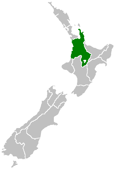
Waikato District is a territorial authority of New Zealand, in the northern part of Waikato region, North Island. Waikato District is administered by the Waikato District Council, with headquarters in Ngāruawāhia. The district is centred to the north and west of the city of Hamilton, and takes in much of the northern Waikato Plains and also the Hakarimata Range. The north of the district contains swampy floodplain of the Waikato River and several small lakes, of which the largest is Lake Waikare. Other than Ngāruawāhia, the main population centres are Huntly, Raglan, and Te Kauwhata. The main industries in the district are dairy farming, forestry, and coal mining. There is a major coal-fired power station at Huntly. Te Kauwhata is at the centre of a major wine region. Demographics At the 2006 census the district had a population of 43,959. Of these, 6834 lived in Huntly, 5106 in Ngāruawāhia, 2637 in Raglan, and 1294 in Te Kauwhata. In 2010, the district acq ... [...More Info...] [...Related Items...] OR: [Wikipedia] [Google] [Baidu] |
Mayor Of Waikato ...
The Mayor of Waikato officiates over the Waikato District of New Zealand's North Island. Jacqui Church is the current mayor. The previous mayor was Allan Sanson, a third generation farmer who had served on the council since 2001 and had been mayor since 2010. His predecessor was another conservative farmer, Peter Harris, who took over the job when the first mayor, another farmer, Angus Macdonald, stood down in 2001. Angus Macdonald died in 2010. The 2021 salary of the mayor was $148,500. List of mayors There have been 4 mayors of Waikato. List of deputy mayors References {{Mayors in New Zealand Waikato Waikato Waikato District Waikato Waikato () is a local government region of the upper North Island of New Zealand. It covers the Waikato District, Waipa District, Matamata-Piako District, South Waikato District and Hamilton City, as well as Hauraki, Coromandel Peninsula, t ... [...More Info...] [...Related Items...] OR: [Wikipedia] [Google] [Baidu] |
Waikato District Council
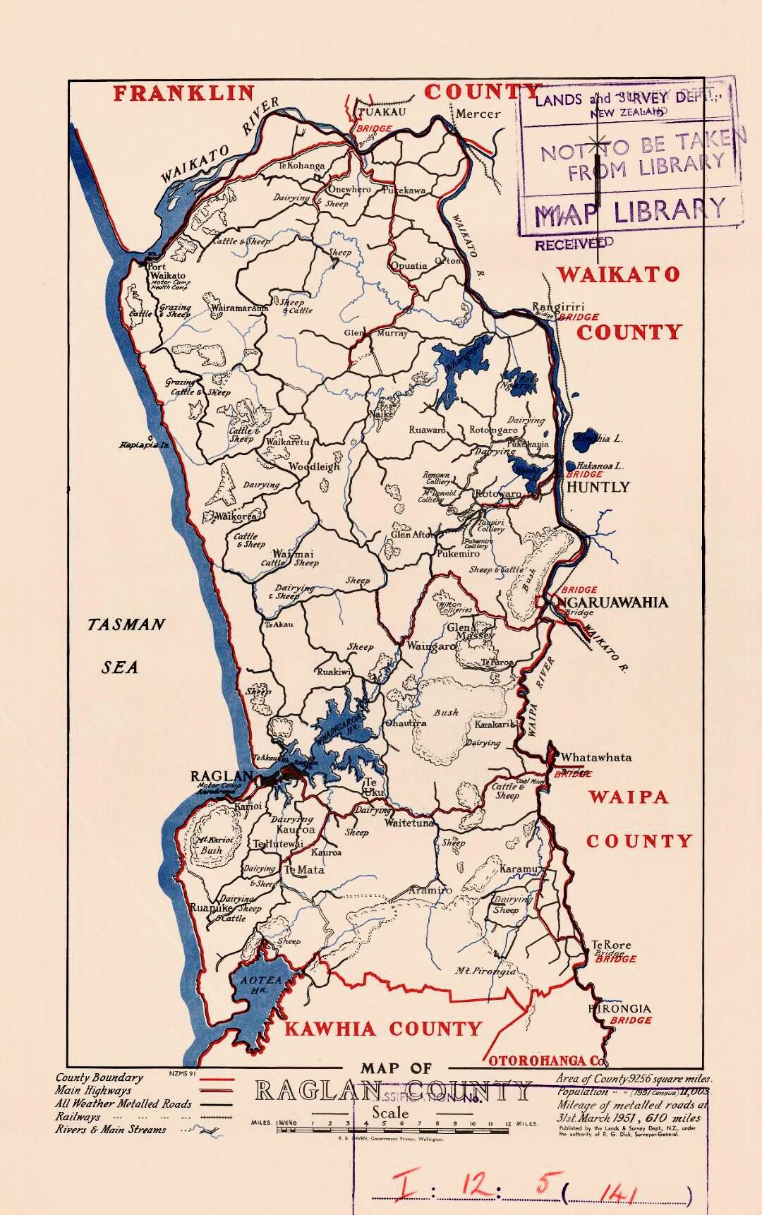
Waikato District Council ( mi, Te Kaunihera ā-Rohe o Waikato) is the territorial authority for the Waikato District of New Zealand New Zealand ( mi, Aotearoa ) is an island country in the southwestern Pacific Ocean. It consists of two main landmasses—the North Island () and the South Island ()—and over 700 List of islands of New Zealand, smaller islands. It is the .... The council is led by the mayor of Waikato, who is currently . There are also ward councillors. Composition Mayor Councillors * History The council was established in 1989, replacing Raglan County Council (established in 1876), Waikato County Council (established in 1876), Ngāruawāhia Borough Council (established in 1920), and Huntly Borough Council (established in 1931). References External links Official website {{coord, -37.6680745, 175.1487314, display=title Waikato District Politics of Waikato Territorial authorities of New Zealand ... [...More Info...] [...Related Items...] OR: [Wikipedia] [Google] [Baidu] |
Districts Of New Zealand
A district in New Zealand is a territorial authorities of New Zealand, territorial authority area governed by a district council as a second-tier of local government in New Zealand, below regions of New Zealand, regional councils. They were formed as a result of the 1989 New Zealand local government reforms, local government reforms in 1989. There are 53 districts in New Zealand, and they do not include the 12 list of cities in New Zealand, city councils, the Auckland Council, and the Chatham Islands#Government, Chatham Islands Council. District councils serve a combination of rural and urban communities, while city councils administer the larger urban areas of New Zealand, urban areas. Three districts (Gisborne District Council, Gisborne, Tasman District Council, Tasman, and Marlborough District Council, Marlborough) are Unitary authority#New Zealand, unitary authorities also performing the functions of a regional council. Districts are not subdivisions of regions, and some of them ... [...More Info...] [...Related Items...] OR: [Wikipedia] [Google] [Baidu] |
Te Kauwhata
Te Kauwhata is a small town in the north of the Waikato region of New Zealand, situated close to the western shore of Lake Waikare, some 40 km north of Hamilton and approximately 58 km south of Manukau City. Description ''Te Kauwhata'' may translate as "''the empty storehouse''", possibly referring to food storehouses in the original ancient Māori settlement. ''Te Kauwhata'' can also translate as "''the spiritual medium''" or "''the frame''". The original name of the research farm and railway station was Wairangi, changed to Waerenga in 1897. Waerenga means a bush clearing for farming. The name Te Kauwhata was used for the settlement from 1910, Te Kauwhata was surveyed for a township in 1912. Te Kauwhata is the site of a range of farms, including dairy and dry stock, as well as extensive horticulture. Of note is that Te Kauwhata, or "TK" as the locals say, is bordered by the Whangamarino Swamp. Demographics Te Kauwhata covers and had an estimated population ... [...More Info...] [...Related Items...] OR: [Wikipedia] [Google] [Baidu] |
List Of Localities In Waikato
This is a list of localities in Waikato as defined by government agency Statistics New Zealand in 2013, listed by the territorial authorities to which each locality belongs. Waikato is a region of New Zealand in the central North Island which reaches from coast to coast and from Coromandel Peninsula in the north to Lake Taupo and King Country in the south. Many boundaries and names were changed in the 2018 census. It is bordered by Auckland to the north, Bay of Plenty to the east, and Taranaki, Manawatū-Whanganui and Hawke's Bay to the south. Thames-Coromandel District The Thames-Coromandel District is located in the area around the Firth of Thames and Coromandel Peninsula, to the southeast of Auckland. At the 2006 Census, Thames-Coromandel had 25,941 people (including 4,020 self-identified Maori) and 22,704 occupied dwellings. The district council is seated in the district's largest town, Thames The River Thames ( ), known alternatively in parts as the River Isis, i ... [...More Info...] [...Related Items...] OR: [Wikipedia] [Google] [Baidu] |
Tuakau
Tuakau ( mi, Tūākau) is a town in the Waikato region at the foot of Bombay hills, formerly part of the Franklin district until 2010, when it became part of Waikato District in the North Island of New Zealand. The town serves to support local farming, and is the residence of many employees of New Zealand Steel at Glenbrook. Toponymy The place name is believed to be a geographical reference to the high bluff nearby that offers views down the Waikato river. In Māori the word can mean 'to stand' and 'river bank'. History and culture Pre-European history The area was first used as a trading centre for passing waka that would transport goods up and down the Waikato River. European settlement A flax mill was built in 1855. In 1863 war broke out because the British Crown forced the Waikato people out of their lands just south of the river and the New Zealand Government stationed in Tuakau Imperial troops brought over from Great Britain. To help defend the area the Alexandra R ... [...More Info...] [...Related Items...] OR: [Wikipedia] [Google] [Baidu] |
Tauwhare
Tauwhare is a small rural community in the Waikato District on the outskirts of Hamilton. The Waitakaruru Arboretum and Sculpture Park is located here. There is a Community Committee and a Memorial Hall. The 1902 Cyclopedia of New Zealand noted that Tauwhare had a scattered population, a school, a cheese factory (owned by the New Zealand Loan and Mercantile Agency Company) and could be reached by coach from Tamahere railway station. Demographics The 2006 census counted a Tamahere and Tauwhare area of . In 2018 Tauwhare was grouped in the Eureka Tauwhare area, which covers . These areas had the statistics in the table below, which show people are wealthier and slightly older than the 37.4 years of the national average. In 2013 Tauwhere was covered by meshblocks 0957700 and 0958200 with a population totalling 486 in 156 households. In 2018 the main ethnic groups of the area were 89.4% European, 9.5% Māori and 5.3% Asian. Marae Te Iti o Hauā Marae is the mana whenua in T ... [...More Info...] [...Related Items...] OR: [Wikipedia] [Google] [Baidu] |
Tamahere
Tamahere is a locality (located on a semi-rural ward that bears the same name) within Waikato District, New Zealand; on the outskirts of Hamilton. The majority of the Ward is zoned as Country Living, with a minimum lot size of 0.5ha. The landscape is dominated by several large gully systems that contribute to the Waikato River. Communities Alongside the village proper, the ward of Tamahere also includes the locality of The Narrows. In 2019, a new recreational reserve (Tamahere Park) was opened and includes sports fields for cricket, rugby, junior soccer and La Crosse. Destination playground and skate-park were jointly funded by community funds and Waikato District Council. A commercial hub was also added, due to be completed in 2020, including a 4 Square supermarket, a medical centre, a pharmacy, and a bakery, Waikato council office and serviced offices. Demographics Tamahere covers and had an estimated population of as of with a population density of people per km2. ... [...More Info...] [...Related Items...] OR: [Wikipedia] [Google] [Baidu] |
Auckland Council
Auckland Council ( mi, Te Kaunihera o Tāmaki Makaurau) is the local government council for the Auckland Region in New Zealand. It is a territorial authority that has the responsibilities, duties and powers of a regional council and so is a unitary authority, according to the Local Government (Auckland Council) Act 2009, which established the council. The governing body consists of a mayor and 20 councillors, elected from 13 wards. There are also 149 members of 21 local boards who make decisions on matters local to their communities. It is the largest council in Oceania, with a $3 billion annual budget, $29 billion of ratepayer equity, and 9,870 full-time staff as of 30 June 2016. The council began operating on 1 November 2010, combining the functions of the previous regional council and the region's seven city and district councils into one "super council" or "super city". The council was established by a number of Acts of Parliament, and an Auckland Transition Agency, also ... [...More Info...] [...Related Items...] OR: [Wikipedia] [Google] [Baidu] |
Franklin District
Franklin District was a New Zealand territorial authority that lay between the Auckland metropolitan area and the Waikato Plains. As a formal territory it was abolished on 31 October 2010 and divided between Auckland Council in the Auckland Region (39.82 percent by land area) to the north and Waikato and Hauraki districts in the Waikato region (60.18 percent) to the south and east. The Auckland portion is now part of the Franklin ward, which also includes rural parts of the former Manukau City. Before its abolition, it was administered from the town of Pukekohe. Out-going Franklin District Mayor Mark Ball had proposed that Franklin district become an independent unitary authority, fulfilling both the functions of a local and regional council. However, this was rejected by Minister Rodney Hide. Location and extent The district was bounded in the north by the start of the Auckland metropolitan area and the waters of the Manukau Harbour. Awhitu Peninsula stretches up the Tasma ... [...More Info...] [...Related Items...] OR: [Wikipedia] [Google] [Baidu] |
Wine
Wine is an alcoholic drink typically made from fermented grapes. Yeast consumes the sugar in the grapes and converts it to ethanol and carbon dioxide, releasing heat in the process. Different varieties of grapes and strains of yeasts are major factors in different styles of wine. These differences result from the complex interactions between the biochemical development of the grape, the reactions involved in fermentation, the grape's growing environment ( terroir), and the wine production process. Many countries enact legal appellations intended to define styles and qualities of wine. These typically restrict the geographical origin and permitted varieties of grapes, as well as other aspects of wine production. Wines not made from grapes involve fermentation of other crops including rice wine and other fruit wines such as plum, cherry, pomegranate, currant and elderberry. Wine has been produced for thousands of years. The earliest evidence of wine is from the Cau ... [...More Info...] [...Related Items...] OR: [Wikipedia] [Google] [Baidu] |
Huntly Power Station
The Huntly Power Station is the largest thermal power station in New Zealand and is located in the town of Huntly in the Waikato. It is operated by Genesis Energy Limited, a publicly listed company (currently 51% owned by the NZ Government). The station has five operational generating units – three 250 MW coal-and-gas-fired steam turbine units, a 50 MW gas peaking plant, and a 403 MW combined cycle gas turbine plant. The station also plays an important role in voltage support for the Northland, Auckland and Waikato regions. Operation Generation Each of the four original generating units, which are capable of burning either coal or gas, installed in stages between 1973 and 1985, is capable of generating 250 MW (Megawatts) of electricity, giving a historical generating capacity of 1000 MW. Its chimneys are 150 metres high and each chimney has two flues that are 7 metres in diameter. The plant uses a reheat steam cycle, with C A Parsons turbines and Combustion En ... [...More Info...] [...Related Items...] OR: [Wikipedia] [Google] [Baidu] |


