|
Villa Nueva, Guatemala
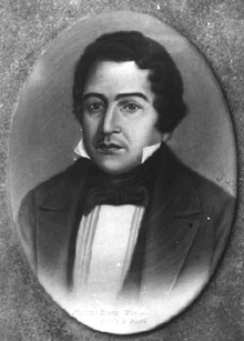
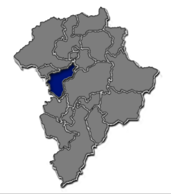
Villa Nueva is a City in the Guatemala department of Guatemala. The city centre of Villa Nueva at Villa Nueva Central Park is located south of Guatemala City. The city has a population of 618,397 (2018 census), making it the second largest in Guatemala Department, after Guatemala City. It was founded on 17 April 1763, long before Guatemala declared its independence from the Spanish Empire. The local economy largely depends on industry, with the municipality having some 100 factories that produce such products as textiles, metallurgical goods, and plastics. The area's agricultural products include rice, dairy, fruits, and vegetables. Mayor Salvador Gándara, serving from 2000 to 2011, was longlisted for the 2008 World Mayor award; Sites of interest include the Naciones Unidas National Park, . and several malls, like Metrocentro and Santa Clara.url=www.walmart.com.gt History Amatitlán Department creation During governor Mariano Rivera Paz' time in office, a decree was issue ... [...More Info...] [...Related Items...] OR: [Wikipedia] [Google] [Baidu] |
Departments Of Guatemala
Guatemala is divided into 22 Department (country subdivision), departments (Spanish language, Spanish: ''departamentos'') which are in turn divided into 340 Municipalities of Guatemala, municipalities. In addition, Guatemala has claimed that all or part of the nation of Belize is a department of Guatemala, and this claim is sometimes reflected in maps of the region. Guatemala formally recognized Belize in 1991, but the Belizean–Guatemalan territorial dispute, border disputes between the two nations have not been resolved. Departments See also *ISO 3166-2:GT References External resources Interactive map of Guatemalan departments and municipalities {{Americas topic, Administrative divisions of Departments of Guatemala, Subdivisions of Guatemala Lists of administrative divisions, Guatemala, Departments Administrative divisions in North America, Guatemala 1 First-level admin ... [...More Info...] [...Related Items...] OR: [Wikipedia] [Google] [Baidu] |
Vicente Cerna Y Cerna
Vicente Cerna y Cerna (22 January 1815 – 27 June 1885) was president of Guatemala from 24 May 1865 to 29 June 1871. Loyal friend and comrade of Rafael Carrera, was appointed army's Field Marshal after Carraera's victory against Salvadorian leader Gerardo Barrios in 1863. He was appointed Carrera's successor after the caudillo's death in 1865 even though Guatemalan leaders would have preferred Field Marshal José Víctor Zavala. After the presidential elections of 1869, that Cerna won over liberal candidate Zavala, there were severe fraud accusations, and from then on Cerna's presidency was marred by constant uprising until he was eventually ousted by the liberal leaders Miguel Garcia Granados and Justo Rufino Barrios on 30 June 1871. Biography Cerna y Cerna was from Ipala, Chiquimula where he later served as major and "Corregidor". He was a loyal friend and camarade of Rafael Carrera and was a distinguished officer of the caudillo's army. He was one of the Guatemalan of ... [...More Info...] [...Related Items...] OR: [Wikipedia] [Google] [Baidu] |
Sacatepéquez Department
Sacatepéquez () is one of the 22 departments of Guatemala. The name comes from Sacatepéquez, a city from November 21, 1542, until July 29, 1773, when it was destroyed by the 1773 Guatemalan Earthquake (Santa Marta Earthquake). Sacatepéquez means ''grasshill'' in the Nahuatl language. The capital of Sacatepéquez is Antigua Guatemala which is home to an extensive textile marketplace. Other important cities include Ciudad Vieja and San Lucas Sacatepéquez, which also hosts a marketplace and is a culinary attraction. The Chajoma were a group of indigenous people who were Kaqchikel speaking Indians identified Mixco Viejo as their capital, and spread throughout the Sacatepequez Department until their capital was moved to Ciudad Vieja, in Antigua. Name Sacatepéquez has also been spelled ''Zacatepeques''. Population Sacatepéquez Department has a population of 330,469 (2018 census). In 1850, the area had a population of an estimated 56,000. The southern area, which is closer ... [...More Info...] [...Related Items...] OR: [Wikipedia] [Google] [Baidu] |
San Lucas Sacatepéquez
San Lucas Sacatepéquez () is a town, with a population of 20,723 (2018 census), Population of cities & towns in Guatemala and a in the n department of . History Doctrine of Order of Preachers [...More Info...] [...Related Items...] OR: [Wikipedia] [Google] [Baidu] |
Santa Lucía Milpas Altas
Santa Lucía Milpas Altas () is a town and municipality in the Guatemalan department of Sacatepéquez. The town has a population of 12,234 (2018 census). Population of cities & towns in Guatemala History In the 1540s, bishop split the ecclesiastical administration of the central valley of Guatemala between the and the , assigning Sumpango's curato to the former. In 16 ...[...More Info...] [...Related Items...] OR: [Wikipedia] [Google] [Baidu] |
Magdalena Milpas Altas
Magdalena Milpas Altas () is a town and municipality in the Guatemalan department of Sacatepéquez Sacatepéquez () was a city in Guatemala from November 21, 1542 until July 29, 1773 when it was destroyed by the Santa Marta earthquake. Sacatepéquez means ''grasshill'' and gave its name to the Sacatepéquez Department. Sacatepéquez and Antig .... As of the 2018 census, the population of the municipality is 11,856 References {{reflist External linksMunicipality of Magdalena Milpas Altas — Official site Municipalities of the Sacatepéquez Department ... [...More Info...] [...Related Items...] OR: [Wikipedia] [Google] [Baidu] |
Mixco
Mixco () is a city and municipality in the Guatemala department of Guatemala. It is next to the main Guatemala City municipality and has become part of the Guatemala City Metropolitan Area. Most of Mixco is separated from the city by canyons, for which a multitude of bridges have been created. Ciudad San Cristóbal, one of Guatemala's largest cities, is located in this municipality. It is the second largest city in Guatemala Department, after Guatemala City, with a population of 465,773. Administrative division The municipality is divided into zones with residential neighborhoods, villages, settlements and the municipal capital. Due to its close proximity to Guatemala City, several villages were turned into residential neighborhoods. From the residential neighborhoods it is excluded "La Florida", which separated from Mixco to join Guatemala City in 1958. Mayors Universities * UruralG * UPANA * USAC * URL *UNI Sports Deportivo Mixco football club play in the G ... [...More Info...] [...Related Items...] OR: [Wikipedia] [Google] [Baidu] |
List Of Places In Guatemala ...
This is a list of places in Guatemala. List of most populous cities in Guatemala Population data up to number 30 is based on the 2018 census. Ancient cities and important ruins * Cancuén * Dos Pilas * El Baul * Iximche * Kaminaljuyu * Machaquila * El Mirador * La Joyanca * Mixco Viejo * Naranjo * Nakbé * Piedras Negras * Quirigua * Q'umarkaj * Tikal Natural features * Caribbean Sea * Pacific Ocean * Volcán de Agua * Volcán de Fuego Lakes See also * List of national parks of Guatemala * Lists of cities in Central America * '''' * '''' References External links * {{North America topic, List of towns in Guatemala Cities Guatemala Guatemala ( ; ), officially the Republic of Guatemala ( es, República de Guatemala, links=no), is a country in Central America. It is bordered to the north and west by Mexico; to the northeast by Belize and the Caribbean; to the east by H ... [...More Info...] [...Related Items...] OR: [Wikipedia] [Google] [Baidu] |
Tropical Savanna Climate
Tropical savanna climate or tropical wet and dry climate is a tropical climate sub-type that corresponds to the Köppen climate classification categories ''Aw'' (for a dry winter) and ''As'' (for a dry summer). The driest month has less than of precipitation and also less than 100-\left (\frac \right)mm of precipitation. This latter fact is in a direct contrast to a tropical monsoon climate, whose driest month sees less than of precipitation but has ''more'' than 100-\left (\frac \right) of precipitation. In essence, a tropical savanna climate tends to either see less overall rainfall than a tropical monsoon climate or have more pronounced dry season(s). In tropical savanna climates, the dry season can become severe, and often drought conditions prevail during the course of the year. Tropical savanna climates often feature tree-studded grasslands due to its dryness, rather than thick jungle. It is this widespread occurrence of tall, coarse grass (called savanna) which has led to ... [...More Info...] [...Related Items...] OR: [Wikipedia] [Google] [Baidu] |
Escuintla Department
Escuintla () is one of the 22 departments of Guatemala. The capital of the department is the city of Escuintla. Escuintla covers an area of 4,384 km² and is situated in the coastal lowland region, directly south of Guatemala City, and bordered by the Pacific Ocean. Escuintla produces about 43 percent of gross domestic product of Guatemala. Municipalities # Escuintla # Guanagazapa # Iztapa # La Democracia # La Gomera # Masagua # Nueva Concepción # Palín # San José # San Vicente Pacaya # Santa Lucía Cotzumalguapa # Sipacate # Siquinalá # Tiquisate Tiquisate () is a town, with a population of 29,193 (2018 census), and a municipality in the Escuintla department Escuintla () is one of the 22 departments of Guatemala. The capital of the department is the city of Escuintla. Escuintla covers ... Museums * Museo Regional de Arqueología de la Democracia Notes External linksInteractive department map {{Authority control Departments of Guatemala ... [...More Info...] [...Related Items...] OR: [Wikipedia] [Google] [Baidu] |
San Vicente Pacaya
San Vicente Pacaya () is a town and municipality in the Escuintla department of Guatemala. Climate San Vicente Pacaya has a subtropical highland climate (Köppen: ''Cwb''). Geographic location Films The municipality was the filming location for the Guatemalan movie ''Ixcanul'', from director Jayro Bustamante, a film that had earn international praise and 17 international awards, including several major European circuits. Based on a true story, ''Ixcanul'' tells the story of María, a young girl that goes from a peaceful arranged married while working at a coffee plantation near Ixcanul ''Ixcanul'' (, Kaqchikel for "volcano") is a 2015 Guatemalan drama film, a debut written and directed by Jayro Bustamante. It was screened in the main competition section of the 65th Berlin International Film Festival where it won the Alfred Ba ... Volcano to dealing with the harsh reality of children traffic and machismo in her society after she unwillingly gets pregnant after a night ... [...More Info...] [...Related Items...] OR: [Wikipedia] [Google] [Baidu] |
Villa Canales
Villa Canales is a city and municipality in the Guatemala department of Guatemala, situated 22 km south of the capital Guatemala City. As of the 2018 census, the city had a population of 124,680, Population of the major cities in Guatemala making it the eleventh largest city in Guatemala. Economy The economy of Villa Canales is based around , , and pineapple. The city is the largest producer of pineapple in the nation, due to the nearby Pacaya Volcano which fertilizes the soil. Due to rapid ...[...More Info...] [...Related Items...] OR: [Wikipedia] [Google] [Baidu] |


