|
Mixco
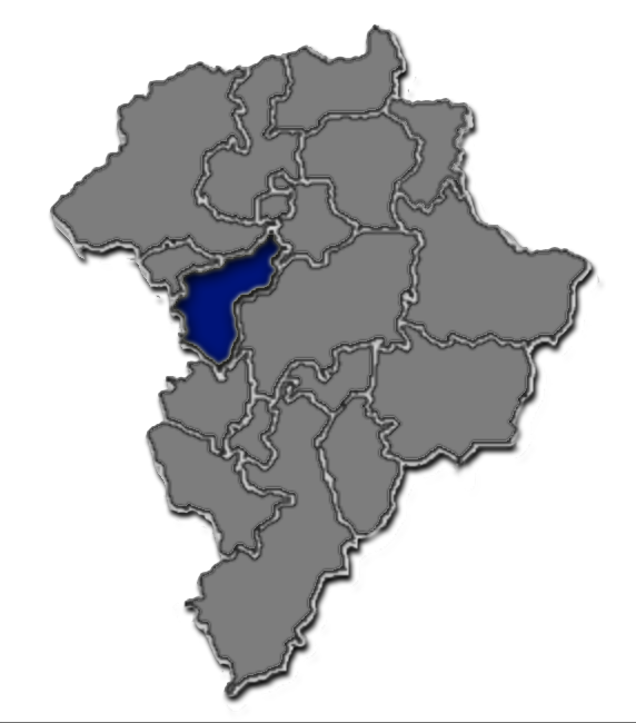
Mixco () is a city and municipality in the Guatemala department of Guatemala. It is next to the main Guatemala City municipality and has become part of the Guatemala City Metropolitan Area. Most of Mixco is separated from the city by canyons, for which a multitude of bridges have been created. Ciudad San Cristóbal, one of Guatemala's largest cities, is located in this municipality. It is the second largest city in Guatemala Department, after Guatemala City, with a population of 465,773. Administrative division The municipality is divided into zones with residential neighborhoods, villages, settlements and the municipal capital. Due to its close proximity to Guatemala City, several villages were turned into residential neighborhoods. From the residential neighborhoods it is excluded "La Florida", which separated from Mixco to join Guatemala City in 1958. Mayors Universities * UruralG * UPANA * USAC * URL *UNI Sports Deportivo Mixco football club play in the ... [...More Info...] [...Related Items...] OR: [Wikipedia] [Google] [Baidu] |
Deportivo Mixco
Club Social y Deportivo Mixco is a Guatemalan Association football, football club based in Mixco, a municipality in the Guatemala City metropolitan area. They play in the Liga Nacional de Fútbol de Guatemala, Liga Nacional, the top tier of Guatemalan football, after achieving promotion during the Primera Division de Ascenso, Clausura 2022 Primera Division. In 2018, the club founded their new stadium Santo Domingo de Guzmán, until then they played at the Estadio Municipal de San Miguel Petapa, Estadio Julio Armando Cobar in San Miguel Petapa. In the Apertura 2010 they played their home games at the Estadio Municipal San Miguel Dueñas. History Nicknamed ''Los Chicharroneros'', the club was founded in 1964 and made their debut at the Primera División de Ascenso, Guatemalan second level in the 2001/2002 season. They got relegated in 2003 but went back in 2005 and have stayed there since. Current squad List of coaches * Jaime García (footbal ... [...More Info...] [...Related Items...] OR: [Wikipedia] [Google] [Baidu] |
Ciudad San Cristóbal
Ciudad San Cristóbal is a neighbourhoodSubdivisions in the municipality of MixcoMixco municipality official website/ref> in the city of Mixco, and part of the department of Guatemala. One of the biggest housing developments near Guatemala City, it was first developed by DEINCO, a major real estate company, in 1973. It spans over more than 10 square kilometers, separated from the capital by a canyon A canyon (from ; archaic British English spelling: ''cañon''), or gorge, is a deep cleft between escarpments or cliffs resulting from weathering and the erosive activity of a river over geologic time scales. Rivers have a natural tendency to cut ..., which had made it previously very difficult to develop. DEINCO built a bridge, called the San Cristobal Bridge, to enable people to easily reach the new development from the city. At first only two lanes, the bridge had to be later expanded to 4 lanes to accommodate the enormous amount of traffic going and coming from the city. A ... [...More Info...] [...Related Items...] OR: [Wikipedia] [Google] [Baidu] |
List Of Places In Guatemala
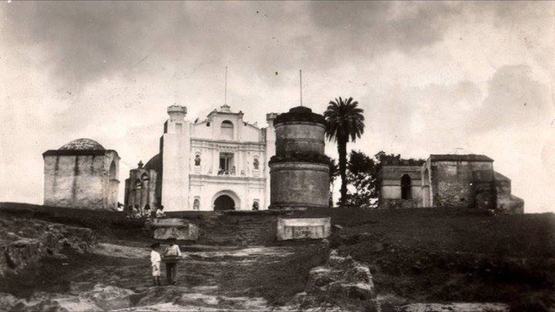
This is a list of places in Guatemala. List of most populous cities in Guatemala Population data up to number 30 is based on the 2018 census. Ancient cities and important ruins * Cancuén * Dos Pilas * El Baul * Iximche * Kaminaljuyu * Machaquila * El Mirador * La Joyanca * Mixco Viejo * Naranjo * Nakbé * Piedras Negras * Quirigua * Q'umarkaj * Tikal Natural features * Caribbean Sea * Pacific Ocean * Volcán de Agua * Volcán de Fuego Lakes See also * List of national parks of Guatemala * Lists of cities in Central America * '''' * '''' References External links * {{North America topic, List of towns in Guatemala Cities A city is a human settlement of notable size.Goodall, B. (1987) ''The Penguin Dictionary of Human Geography''. London: Penguin.Kuper, A. and Kuper, J., eds (1996) ''The Social Science Encyclopedia''. 2nd edition. London: Routledge. It can be def ... Guatemala ... [...More Info...] [...Related Items...] OR: [Wikipedia] [Google] [Baidu] |
San Pedro Sacatepéquez, Guatemala
San Pedro Sacatepéquez () is a town, with a population of 36,932 (2018 census), and a municipality in the Guatemala department of Guatemala. According to the 1998 edition of ''The Columbia Gazetteer of the World'', its elevation is 6,890 ft (2,100 m) and it is a market center. Its economy is based on manufacturing, including tile making and textiles, and agriculture, including the cultivation of corn, black beans, and vegetables. Doctrine of Order of Preachers After the conquest, the Spanish crown focused on the Catholic indoctrination of the natives. Human settlements founded by royal missionaries in the New World were called "Indian doctrines" or simply "doctrines". Originally, friars had only temporary missions: teach the Catholic faith to the natives, and then transfer the settlements to secular parishes, just like the ones that existed in Spain at the time; the friars were supposed to teach Spanish and Catholicism to the natives. And when the natives were ready, th ... [...More Info...] [...Related Items...] OR: [Wikipedia] [Google] [Baidu] |
Guatemala City
Guatemala City ( es, Ciudad de Guatemala), known locally as Guatemala or Guate, is the capital and largest city of Guatemala, and the most populous urban area in Central America. The city is located in the south-central part of the country, nestled in a mountain valley called Valle de la Ermita ( en, Hermitage Valley). The city is the capital of the Municipality of Guatemala and of the Guatemala Department. Guatemala City is the site of the Mayan city of Kaminaljuyu, founded around 1500 BC. Following the Spanish conquest, a new town was established, and in 1776 it was made capital of the Kingdom of Guatemala. In 1821, Guatemala City was the scene of the declaration of independence of Central America from Spain, after which it became the capital of the newly established United Provinces of Central America (later the Federal Republic of Central America). In 1847, Guatemala declared itself an independent republic, with Guatemala City as its capital. The city was originally ... [...More Info...] [...Related Items...] OR: [Wikipedia] [Google] [Baidu] |
Universidad De San Carlos De Guatemala
The Universidad de San Carlos de Guatemala (USAC, ''University of San Carlos of Guatemala'') is the largest and oldest university of Guatemala; it is also the fourth founded in the Americas. Established in the Kingdom of Guatemala during the Spanish colony, it was the only university in Guatemala until 1954,In 1954 a coup led by the National Liberation Movement which was sponsored by the United Fruit Company and coordinated by CIA and State Department American operatives who had links with the US company triumphed . although it continues to hold distinction as the only public university in the entire country. The university has had five major transformations: * Royal and Pontifical University of San Carlos Borromeo (1676–1829): Established during the colony by the Spanish Crown in the 17th century, approved by the Vatican and directed by regular orders of the Catholic Church. After the Independence in 1821, it was called Pontifical University. * Academia de Ciencias (Academy ... [...More Info...] [...Related Items...] OR: [Wikipedia] [Google] [Baidu] |
Chinautla
Chinautla () is a city and municipality in the Guatemala department of Guatemala. The city has a population of 104,972 (2018 census) making it the fourteenth largest city in the country and the seventh largest in the Guatemala Department. Administrative division Chinautla has eleven villages: # Los Jocotales # San Martín # San José Buena Vista # El Durazno # Tres Sabanas # Las Lomas # Cumbre de Guayabo # San Antonio las Flores # San Rafael las Flores # La Laguneta # El Chan # Concepción Sacojito Climate Chinautla has tropical climate ( Köppen: ''Aw''). Geographic location Located at the center of Guatemala Department, it is surrounded by municipalities of that Department only: See also * * * List of places in Guatemala *Guatemala City Guatemala City ( es, Ciudad de Guatemala), known locally as Guatemala or Guate, is the capital and largest city of Guatemala, and the most populous urban area in Central America. The city is located in the south-central par ... [...More Info...] [...Related Items...] OR: [Wikipedia] [Google] [Baidu] |
Villa Nueva, Guatemala
Villa Nueva is a City in the Guatemala department of Guatemala. The city centre of Villa Nueva at Villa Nueva Central Park is located south of Guatemala City. The city has a population of 618,397 (2018 census), making it the second largest in Guatemala Department, after Guatemala City. It was founded on 17 April 1763, long before Guatemala declared its independence from the Spanish Empire. The local economy largely depends on industry, with the municipality having some 100 factories that produce such products as textiles, metallurgical goods, and plastics. The area's agricultural products include rice, dairy, fruits, and vegetables. Mayor Salvador Gándara, serving from 2000 to 2011, was longlisted for the 2008 World Mayor award; Sites of interest include the Naciones Unidas National Park, . and several malls, like Metrocentro and Santa Clara.url=www.walmart.com.gt History Amatitlán Department creation During governor Mariano Rivera Paz' time in office, a decree was ... [...More Info...] [...Related Items...] OR: [Wikipedia] [Google] [Baidu] |
Guatemala Department
Guatemala Department is one of the 22 departments of Guatemala. The capital is Guatemala City, which also serves as the national capital. The department consists of Guatemala City and several of its suburbs. The department covers a surface area of , and had a population of 3,015,081 at the 2018 census. Municipalities # Amatitlán # Chinautla # Chuarrancho # Fraijanes # Guatemala City # Mixco # Palencia, Guatemala, Palencia # San José del Golfo # San José Pinula # San Juan Sacatepéquez # San Miguel Petapa # San Pedro Ayampuc # San Pedro Sacatepéquez, Guatemala, San Pedro Sacatepéquez # San Raymundo # Santa Catarina Pinula # Villa Canales # Villa Nueva, Guatemala, Villa Nueva References {{Authority control Guatemala Department, Departments of Guatemala ... [...More Info...] [...Related Items...] OR: [Wikipedia] [Google] [Baidu] |
Sacatepéquez Department
Sacatepéquez () is one of the 22 departments of Guatemala. The name comes from Sacatepéquez, a city from November 21, 1542, until July 29, 1773, when it was destroyed by the 1773 Guatemalan Earthquake (Santa Marta Earthquake). Sacatepéquez means ''grasshill'' in the Nahuatl language. The capital of Sacatepéquez is Antigua Guatemala which is home to an extensive textile marketplace. Other important cities include Ciudad Vieja and San Lucas Sacatepéquez, which also hosts a marketplace and is a culinary attraction. The Chajoma were a group of indigenous people who were Kaqchikel speaking Indians identified Mixco Viejo as their capital, and spread throughout the Sacatepequez Department until their capital was moved to Ciudad Vieja, in Antigua. Name Sacatepéquez has also been spelled ''Zacatepeques''. Population Sacatepéquez Department has a population of 330,469 (2018 census). In 1850, the area had a population of an estimated 56,000. The southern area, which is closer ... [...More Info...] [...Related Items...] OR: [Wikipedia] [Google] [Baidu] |
Tikal
Tikal () (''Tik’al'' in modern Mayan orthography) is the ruin of an ancient city, which was likely to have been called Yax Mutal, found in a rainforest in Guatemala. It is one of the largest archeological sites and urban centers of the pre-Columbian Maya civilization. It is located in the archeological region of the Petén Basin in what is now northern Guatemala. Situated in the Departments of Guatemala, department of El Petén, the site is part of Guatemala's Tikal National Park and in 1979 it was declared a UNESCO World Heritage Site. Tikal was the capital of a conquest state that became one of the most powerful kingdoms of the ancient Maya. Though monumental architecture at the site dates back as far as the 4th century BC, Tikal reached its apogee during the Mesoamerican chronology, Classic Period, c. 200 to 900. During this time, the Maya city, city dominated much of the Maya region politically, economically, and militarily, while interacting with areas throughout Mesoamer ... [...More Info...] [...Related Items...] OR: [Wikipedia] [Google] [Baidu] |
Universidad Panamericana De Guatemala
Universidad Panamericana de Guatemala is a university in Zone 16 of Guatemala City Guatemala City ( es, Ciudad de Guatemala), known locally as Guatemala or Guate, is the capital and largest city of Guatemala, and the most populous urban area in Central America. The city is located in the south-central part of the country, ne .... " Universidad Panamericana de Guatemala. Retrieved on June 1, 2014. "Informacion de Contacto PBX: 2506-3600 Diagonal 34, 31-43 zona 16 Guatemala, C. A." References External links Official site Universities in Guatemala City {{Guatemala-university-stub ... [...More Info...] [...Related Items...] OR: [Wikipedia] [Google] [Baidu] |


