|
Vyttila Mobility Hub
Vyttila Mobility Hub is an integrated transit terminal in the city of Kochi. It is designed as a converging point of various forms of public transportation, such as local and long-distance buses, metro rail and inland water transport. It is planned over an area of in Vyttila, making it one of the largest bus termini in India. The foundation stone for Mobility Hub in Vytilla was laid by the Chief Minister of Kerala V. S. Achuthanandan on 7 June 2010. Construction of the first phase, consisting of the terminal for long-distance buses and the basic amenities, started in December 2010; the first phase was opened on 26 February 2011. When fully implemented, it will have facilities to integrate all modes of public transportation, as well as for shopping, entertainment and hospitality. History A fast-growing city like Kochi requires a comprehensive plan to meet the demands and requirements in Traffic and Transport. Travelling in the city is a Herculean task due to congested roads ... [...More Info...] [...Related Items...] OR: [Wikipedia] [Google] [Baidu] |
Kochi, India
Kochi (), also known as Cochin ( ) ( the official name until 1996) is a major port city on the Malabar Coast of India bordering the Laccadive Sea, which is a part of the Arabian Sea. It is part of the district of Ernakulam in the state of Kerala and is commonly referred to as Ernakulam. Kochi is the most densely populated city in Kerala. As of 2011, it has a corporation limit population of 677,381 within an area of 94.88 km2 and a total urban population of more than of 2.1 million within an area of 440 km2, making it the largest and the most populous metropolitan area in Kerala. Kochi city is also part of the Greater Cochin region and is classified as a Tier-II city by the Government of India. The civic body that governs the city is the Kochi Municipal Corporation, which was constituted in the year 1967, and the statutory bodies that oversee its development are the Greater Cochin Development Authority (GCDA) and the Goshree Islands Development Authority (GIDA). Th ... [...More Info...] [...Related Items...] OR: [Wikipedia] [Google] [Baidu] |
Vyttila, Kochi, Kerala
Vyttila, , is an intersection as well as the name of a region in the city of Kochi, in the state of Kerala, India. It is the busiest as well as one of the largest intersections in Kerala. This node intersects the main north–south artery of the state of ''Kerala'', namely, the Kochi Bypass, with three city roads of ''Kochi'' viz, the S. A. Road (One of the city's most prominent arterial road in the east–west direction), the ''Vyttila-Petta Road'', and the ''Thammanam Road''. The name ''Vyttila'' is said to be evolved from the word "Vayal Thala" meaning the main part of the paddy field. Once the area including Elamkulam, were paddy fields and paddy cultivation were the main sources of income. The paddy field existed from Ernakulam, Girinagar, Panampilly Nagar, Gandhi Nagar, Jawahar Nagar, Kumarananshan Nagar and extended to Kaniyampuzha and Panamkutyy bridge. Some also say that because there existed a bunch of dacoits, who murdered and looted the travelers the name evolv ... [...More Info...] [...Related Items...] OR: [Wikipedia] [Google] [Baidu] |
Kochi Bypass
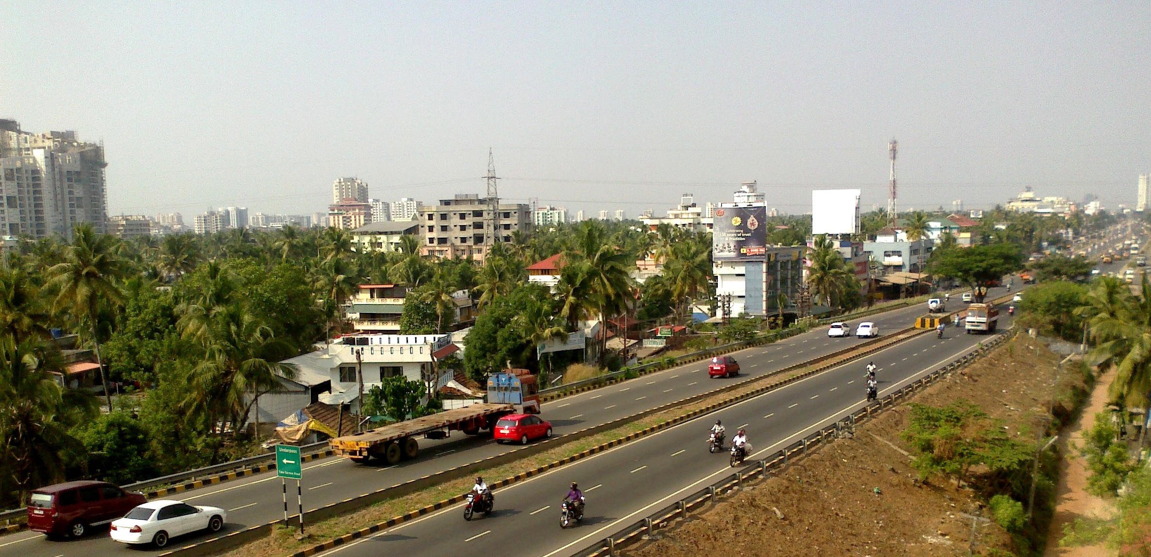
The Kochi Bypass is a segment of NH66(National Highway 66) that bypasses the CBD of the city of Kochi in Kerala, India. The highway stretches 17 km from Edapally in the Ernakulam district to Aroor in Alappuzha district , via. Palarivattom, Vyttila, Kundannoor, Madavana, Kumbalam. The Government of Kerala began the preliminary works in 1973. After a slow progress, it was partially opened for traffic in the beginning years of the 1980s. The section between Edapally and Vyttila had four lanes from the beginning. The rest of the carriageway was also upgraded to different sections of 4 lane, 5lane and 6 lanes by 2010 The idea was to bypass the truck traffic out of the city proper. However now the city has outgrown the bypass leading to a heavy suburban traffic. Today, this road has turned out to be the most important arterial road in Kochi. The spacious road is going to replace the MG Road as the state's major commercial avenue in a few years time. Space crunch has really ... [...More Info...] [...Related Items...] OR: [Wikipedia] [Google] [Baidu] |
Bus Stations In Kerala
A bus (contracted from omnibus, with variants multibus, motorbus, autobus, etc.) is a road vehicle that carries significantly more passengers than an average car or van. It is most commonly used in public transport, but is also in use for charter purposes, or through private ownership. Although the average bus carries between 30 and 100 passengers, some buses have a capacity of up to 300 passengers. The most common type is the single-deck rigid bus, with double-decker and articulated buses carrying larger loads, and midibuses and minibuses carrying smaller loads. Coaches are used for longer-distance services. Many types of buses, such as city transit buses and inter-city coaches, charge a fare. Other types, such as elementary or secondary school buses or shuttle buses within a post-secondary education campus, are free. In many jurisdictions, bus drivers require a special large vehicle licence above and beyond a regular driving licence. Buses may be used for scheduled bus ... [...More Info...] [...Related Items...] OR: [Wikipedia] [Google] [Baidu] |
Kochi Water Metro
Kochi Water Metro is an integrated ferry transport project in Greater Kochi region proposed by Kochi Metro Rail Limited. It is the first of its kind transport system in India and South Asia, that will connect Kochi’s 10 island communities with the mainland through a fleet of 78 battery-operated electric hybrid boats plying along 38 terminals and 16 routes spanning 76 kilometers. It also serves as a feeder service to suburbs along the rivers where transport accesibility is limited. The project obtained the final environment clearance in October 2019 and its first route between Vytilla and InfoPark was inaugurated in February 2021. As of December 2022, it is expected to be in operation by the early 2023. The project is expected to become fully operational by 2035 with a daily readership of 1.5 lakh passengers. Overview Two variants of modernised air-conditioned and Wi-Fi enabled catamaran passenger boats were proposed for the project. The electric propulsion boats has a pass ... [...More Info...] [...Related Items...] OR: [Wikipedia] [Google] [Baidu] |
Ambalamugal
Ambalamugal is an industrial suburb in the city of Kochi, Kerala, India. Situated around 12 km from the city centre, the area is heavily industrialised. Kochi Refineries and Hindustan Organic Chemicals are located here. In 2010, it was declared "critically polluted" by the Ministry of Environment and Forests, which placed a moratorium on approval of new projects. The Hindu
''The Hindu'' is an Indian English-language daily newspaper owned by The Hindu Group, headquartered in Chennai, Tamil Nadu. It began as a weekly in 1878 a ...
[...More Info...] [...Related Items...] OR: [Wikipedia] [Google] [Baidu] |
Pettah, Thiruvananthapuram
Pettah is an urban neighbourhood of Thiruvananthapuram, the capital of the Indian state of Kerala. Location Pettah is on the way to Thiruvananthapuram International Airport and Shanghumugham Beach. Private and KSRTC buses connect Pettah to most parts of the city. The railway station at Pettah is 3 km from Thiruvananthapuram Central railway station. Thiruvananthapuram International Airport International Terminal is around 2 km away. Prominent institutions * Railway Hospital * Kerala Kaumudi Buildings * Pettah Juma Masjid * Tourist villages * Hospitals - Lords, KIMS, Ananthapuri * Temples - Puthen Kovil, Kanjiravilakom, Kaniyattiamman Kovil * St. Anne's Church Notable people *Palpu Padmanabhan Palpu Licentiate in Medicine and Surgery, LMS, DPH (Cantab) FRIPH (London) (2 November 1863 – 25 January 1950) was the second public health doctor in Travancore and a social revolutionary, who become the chief medical officer of My ... References External links Ab ... [...More Info...] [...Related Items...] OR: [Wikipedia] [Google] [Baidu] |
Tripunithura
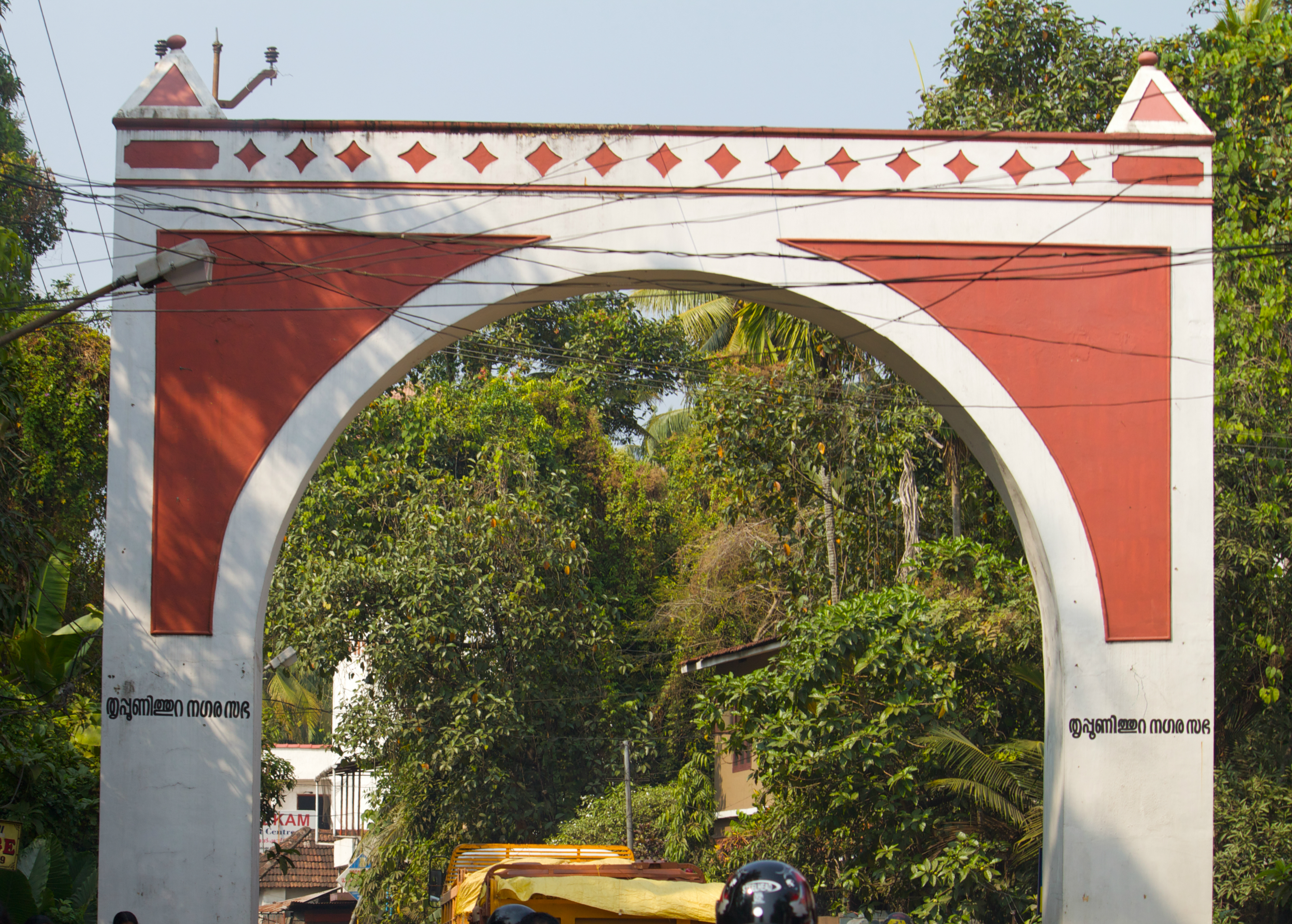
Thrippunithura or Tripunithura (), is a prominent historical and residential region in the City of Kochi in Kerala, India. Located about 7 km (4 mi) from the city centre, Tripunithura was the capital of the erstwhile Kingdom of Cochin. The descendants of the Cochin royal family still live in the palaces here. The Hill Palace situated in Tripunithura was the palace of Maharaja of Cochin, the ruler of Kingdom of Cochin. Tripunithura is also well known for its historical cultures and worldwide famous because of Sree Poornathrayeesa Temple and the annual festival ''Vrishchikoltsawam'' that takes place at the temple. In local administration, it is a municipality named Tripunithura Municipality. In the state administrative structure, Tripunithura is part of the Ernakulam District in the state of Kerala. Etymology Some latter day Sanskrit enthusiasts describe the origin of the name to "pūrṇa vēda puri" — the town of Vedas in its entirety. Another possible origi ... [...More Info...] [...Related Items...] OR: [Wikipedia] [Google] [Baidu] |
Vytilla
Vyttila, , is an intersection as well as the name of a region in the city of Kochi, in the state of Kerala, India. It is the busiest as well as one of the largest intersections in Kerala. This node intersects the main north–south artery of the state of ''Kerala'', namely, the Kochi Bypass, with three city roads of ''Kochi'' viz, the S. A. Road (One of the city's most prominent arterial road in the east–west direction), the ''Vyttila-Petta Road'', and the ''Thammanam Road''. The name ''Vyttila'' is said to be evolved from the word "Vayal Thala" meaning the main part of the paddy field. Once the area including Elamkulam, were paddy fields and paddy cultivation were the main sources of income. The paddy field existed from Ernakulam, Girinagar, Panampilly Nagar, Gandhi Nagar, Jawahar Nagar, Kumarananshan Nagar and extended to Kaniyampuzha and Panamkutyy bridge. Some also say that because there existed a bunch of dacoits, who murdered and looted the travelers the name evolve ... [...More Info...] [...Related Items...] OR: [Wikipedia] [Google] [Baidu] |
Palarivattom
Palarivattom (MRC) is a region in the city of Kochi in the state of Kerala, India. Kerala Police It is part of the District of Ernakulam. The region makes a four-directional intersection at its highway signal point on the , which leads to 1) the Vyttila Junction in the South (which further extends to the Southern regions of Kerala like , , < ... [...More Info...] [...Related Items...] OR: [Wikipedia] [Google] [Baidu] |
Kundannoor
Kundannoor is a region in the city of Kochi, in the state of Kerala, India. It is located around 3.5 km from Vytilla Junction and around 7 km from Ernakulam Junction Railway Station. Kundanoor is located on the busiest road of the city and state, the Kochi Bypass, at the junction of three National Highways, namely NH 66, NH 85 and NH 966B. NH 966B is the second shortest National highway in India. The junction now has a six-lane flyover due to the high traffic it handles. Since the current Kochi Bypass carries over twice the traffic it is designed to handle, the National Highways Authority of India had come up with a proposal for a new bypass for Kochi city a few years ago. As per the selected alignment, the Kochi New Bypass will begin from NH 544 at Karayamparambu, north of Kochi's suburb Angamaly, and end at NH 66 at Nettoor region of Maradu. In addition to this new greenfield National Highway project, the existing NH 85 (Kochi-Dhanushkodi) starting from Kundannoor junction ... [...More Info...] [...Related Items...] OR: [Wikipedia] [Google] [Baidu] |

.jpg)


