|
Voskresenske
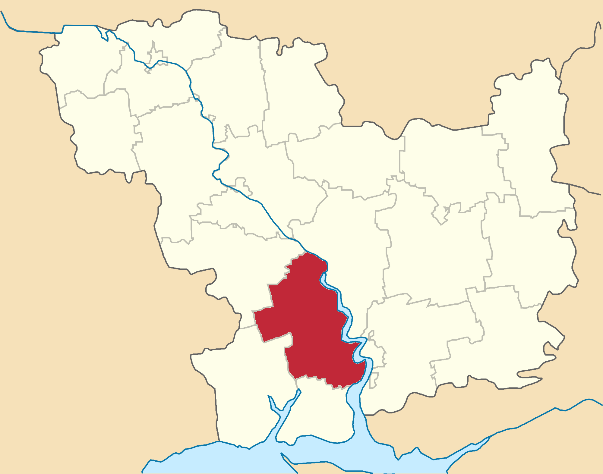
Voskresenske ( uk, Воскресенське, russian: Воскресенское) is an urban-type settlement in Mykolaiv Raion, Mykolaiv Oblast, Mykolaiv Raion in the south of Mykolaiv Oblast, Ukraine. It hosts the administration of Voskresenske settlement hromada, one of the hromadas of Ukraine. Population: Voskresenske is located on the left bank of the Southern Bug and is adjacent to the city of Mykolaiv. History The settlement was founded in 1790 as Horochivka and in 1793 was renamed Voskresensk. It was an admiralty settlement and belonged to Kherson Governorate. Between 1864 and 1900, it belonged to Nikolayev Military Governorate, which was a part of Kherson Governorate. In December 1920, Kherson Governorate was renamed Nikolayev Governorate, and in 1921 it was merged into Odessa Governorate. In 1923, governorates were abolished in the Ukrainian Soviet Socialist Republic. Mykolaiv Raion, Mykolaiv Oblast, Mykolaiv Raion, with the administrative center in Mykolaiv, was esta ... [...More Info...] [...Related Items...] OR: [Wikipedia] [Google] [Baidu] |
Voskresenske Settlement Hromada
Voskresenske ( uk, Воскресенське, russian: Воскресенское) is an urban-type settlement in Mykolaiv Raion, Mykolaiv Oblast, Mykolaiv Raion in the south of Mykolaiv Oblast, Ukraine. It hosts the administration of Voskresenske settlement hromada, one of the hromadas of Ukraine. Population: Voskresenske is located on the left bank of the Southern Bug and is adjacent to the city of Mykolaiv. History The settlement was founded in 1790 as Horochivka and in 1793 was renamed Voskresensk. It was an admiralty settlement and belonged to Kherson Governorate. Between 1864 and 1900, it belonged to Nikolayev Military Governorate, which was a part of Kherson Governorate. In December 1920, Kherson Governorate was renamed Nikolayev Governorate, and in 1921 it was merged into Odessa Governorate. In 1923, governorates were abolished in the Ukrainian Soviet Socialist Republic. Mykolaiv Raion, Mykolaiv Oblast, Mykolaiv Raion, with the administrative center in Mykolaiv, was esta ... [...More Info...] [...Related Items...] OR: [Wikipedia] [Google] [Baidu] |
Vitovka Raion
Vitovka Raion ( uk, Вітовський район) was a subdivision of Mykolaiv Oblast of Ukraine. Its administrative center was the city of Mykolaiv, which was incorporated separately as a city of oblast significance and did not belong to the raion. The raion was abolished on 18 July 2020 as part of the administrative reform of Ukraine, which reduced the number of raions of Mykolaiv Oblast to four. The area of Vitovka Raion was merged into Mykolaiv Raion. The last estimate of the raion population was History In 1939, Mykolaiv Rural Raion (sometimes referred to as Mykolaiv Raion) in Mykolaiv Oblast was established with the center in the city of Mykolaiv. On 12 September 1944, Mykolaiv Rural Raion was renamed Zhovtneve Raion, and the administrative center of the raion was transferred from Mykolaiv to the city of Zhovtneve (named after October Revolution; previously known as Bohoyavlenskyi and Vitovka). On 27 December 1973, Zhovtneve was merged into the city of Mykolaiv, and ... [...More Info...] [...Related Items...] OR: [Wikipedia] [Google] [Baidu] |
Mykolaiv Raion, Mykolaiv Oblast
Mykolaiv Raion ( uk, Миколаївський район) is located in Mykolaiv Oblast of Ukraine. Its administrative center is the city of Mykolaiv. Population: History In the 19th century, the area belonged to Kherson Governorate. In December 1920, it was renamed Nikolayev Governorate, and in 1921 it was merged into Odessa Governorate. In 1923, governorates were abolished in the Ukrainian Soviet Socialist Republic. In 1923, Mykolaiv Raion of Mykolaiv Okruha, with the administrative center in Mykolaiv, was established. The city of Mykolaiv belonged to the raion. In 1925, the governorates were abolished, and okruhas were directly subordinated to Ukrainian SSR. In 1930, okruhas were abolished, and Mykolaiv Raion was abolished. The area was transferred to Varvarivka Raion. On 27 February 1932, Odessa Oblast was established, and the area was transferred to Odessa Oblast. On 22 September 1937, Mykolaiv Oblast was established on lands which previously belonged to Dnipropetrovsk an ... [...More Info...] [...Related Items...] OR: [Wikipedia] [Google] [Baidu] |
List Of Sovereign States
The following is a list providing an overview of sovereign states around the world with information on their status and recognition of their sovereignty. The 206 listed states can be divided into three categories based on membership within the United Nations System: 193 UN member states, 2 UN General Assembly non-member observer states, and 11 other states. The ''sovereignty dispute'' column indicates states having undisputed sovereignty (188 states, of which there are 187 UN member states and 1 UN General Assembly non-member observer state), states having disputed sovereignty (16 states, of which there are 6 UN member states, 1 UN General Assembly non-member observer state, and 9 de facto states), and states having a special political status (2 states, both in free association with New Zealand). Compiling a list such as this can be a complicated and controversial process, as there is no definition that is binding on all the members of the community of nations concerni ... [...More Info...] [...Related Items...] OR: [Wikipedia] [Google] [Baidu] |
Mykolaiv Okruha
Mykolaiv ( uk, Миколаїв, ) is a city and municipality in Southern Ukraine, the administrative center of the Mykolaiv Oblast. Mykolaiv city, which provides Ukraine with access to the Black Sea, is the location of the most downriver bridge crossing of the Southern Bug river. This city is one of the main shipbuilding centers of the Black Sea. Aside from three shipyards within the city, there are a number of research centers specializing in shipbuilding such as the State Research and Design Shipbuilding Center, Zoria-Mashproekt and others. As of 2021, the city has a population of Mykolaiv holds the honorary title Hero City of Ukraine. The city serves as a transportation hub for Ukraine, containing a sea port, commercial port, river port, highway, railway junction, and airport. Much of Mykolaiv's land area consists of parks. Park Peremohy (''Victory'') is a large park on the peninsula just north of the city center of Mykolaiv, on the north side of the Inhul river. N ... [...More Info...] [...Related Items...] OR: [Wikipedia] [Google] [Baidu] |
Einsatzgruppen
(, ; also ' task forces') were (SS) paramilitary death squads of Nazi Germany that were responsible for mass murder, primarily by shooting, during World War II (1939–1945) in German-occupied Europe. The had an integral role in the implementation of the so-called "Final Solution to the Jewish question" () in territories conquered by Nazi Germany, and were involved in the murder of much of the intelligentsia and cultural elite of Poland, including members of the Catholic priesthood. Almost all of the people they murdered were civilians, beginning with the intelligentsia and swiftly progressing to Soviet political commissars, Jews, and Romani people, as well as actual or alleged partisans throughout Eastern Europe. Under the direction of Heinrich Himmler and the supervision of SS- Reinhard Heydrich, the operated in territories occupied by the Wehrmacht (German armed forces) following the invasion of Poland in September 1939 and the invasion of the Soviet Union in Ju ... [...More Info...] [...Related Items...] OR: [Wikipedia] [Google] [Baidu] |
Dnipropetrovsk Oblast
Dnipropetrovsk Oblast ( uk, Дніпропетро́вська о́бласть, translit=Dnipropetrovska oblast), also referred to as Dnipropetrovshchyna ( uk, Дніпропетро́вщина), is an administrative divisions of Ukraine, oblast (province) of central-eastern Ukraine, the most important industrial region of the country. It was created on February 27, 1932. Dnipropetrovsk Oblast has a population of about approximately 80% of whom live centering on administrative centers: Dnipro, Kryvyi Rih, Kamianske, Nikopol, Ukraine, Nikopol and Pavlohrad. The Dnieper River runs through the oblast. In 2019, the Constitutional Court of Ukraine approved the change of the oblast's name to Sicheslav Oblast ( uk, Січесла́вська о́бласть, translit=Sicheslavska oblast). Geography The Dnipropetrovsk Oblast is located in southeastern Ukraine. The area of the oblast (31,974 km2) comprises about 5.3% of the total area of the country. Its longitude from north to ... [...More Info...] [...Related Items...] OR: [Wikipedia] [Google] [Baidu] |
Odessa Oblast
Odesa Oblast ( uk, Оде́ська о́бласть, translit=Odeska oblast), also referred to as Odeshchyna ( uk, Оде́щина) is an administrative divisions of Ukraine, oblast (province) of southwestern Ukraine, located along the northern coast of the Black Sea. Its administrative centre is the city of Odesa ( uk, Одеса). Population: The length of coastline (sea-coast and estuaries) reaches , while the state border stretches for .Tell about Ukraine. Odessa Oblast 24 Kanal (youtube). The region has eight seaports, over of vineyards, and five of the biggest lakes in Ukraine. One of the largest, Yalpuh Lake, is as large as the city of Odesa itself. History Evidence of the earliest inhabitants in this area comes from the settlements a ...[...More Info...] [...Related Items...] OR: [Wikipedia] [Google] [Baidu] |
Okruhas Of The Ukrainian SSR
An okruha ( uk, округа) is an historical administrative division of the Ukrainian Soviet Socialist Republic that existed between 1923 and 1930. The system was intended as a transitional system between the Russian Imperial division of governorates and the modern equivalent of oblasts. As a literal translation, the word ''okruha'' means vicinity or neighborhood (sharing a root with the words "circle" and "around", a close equivalent is the German term ). This level of subdivision is roughly equivalent to that of a county, parish, or borough. Okruhas were first established in 1918 when the Polissya Okruha and Taurida Okruha were created as temporary territories of the Ukrainian State of 1918. History Formation First okruhas, created just before 1918, were Polissya Okruha centered in Mozyr and Taurida Okruha centered in Berdyansk. Okruhas were first introduced on a widespread scale on April 12, 1923, at the 2nd session of the Central Executive Committee of Ukraine which a ... [...More Info...] [...Related Items...] OR: [Wikipedia] [Google] [Baidu] |


.jpg)
