|
Vogel (mountain)
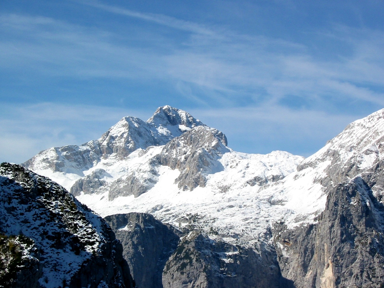
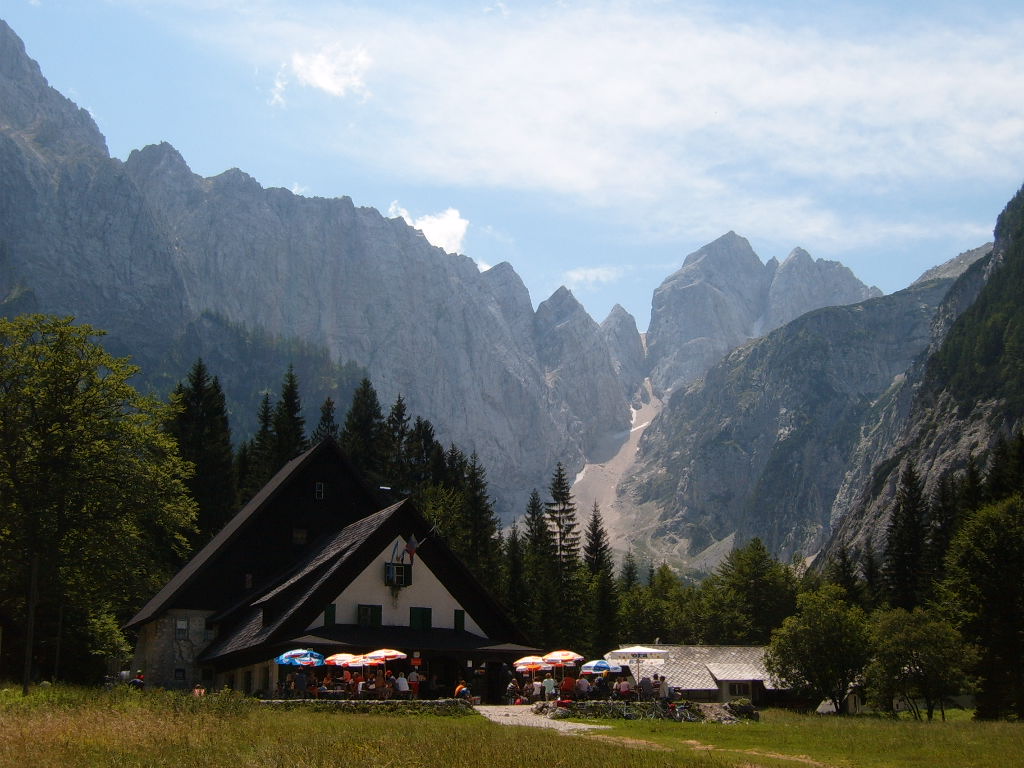
Vogel is a 1922 m high mountain in Slovenia, part of southern Julian Alps and Triglav National Park. There is a cable car from Lake Bohinj to a height of 1537 m. Vogel Ski Resort is one of the biggest of its kind in Slovenia. Routes * 2½h from Ski hotel Vogel * 2¾h from Planina Kuk * 3½h Planina Kuk via Globoko * 3¾h from Planina Storeča raven * 4½h from Ukanc via planina Zadnji Vogel Gallery File:Vogel2.jpg, Ski resort Vogel with Triglav in the background File:Triglav-izVogla.jpg, View of Triglav File:Vogel4.jpg, View of Lake Bohinj Lake Bohinj ( sl, Bohinjsko jezero, german: Wocheiner See), covering , is the largest permanent lake in Slovenia. It is located within the Bohinj Valley of the Julian Alps, in the northwestern Upper Carniola region, and part of Triglav National Par ... File:Vogel3.JPG, Panoramic restaurant References * Slovenska planinska pot, Planinski vodnik, PZS, 2012, Milenko Arnejšek - Prle, Andraž Poljanec {{Reflist External links Vog ... [...More Info...] [...Related Items...] OR: [Wikipedia] [Google] [Baidu] |
Slovenia
Slovenia ( ; sl, Slovenija ), officially the Republic of Slovenia (Slovene: , abbr.: ''RS''), is a country in Central Europe. It is bordered by Italy to the west, Austria to the north, Hungary to the northeast, Croatia to the southeast, and the Adriatic Sea to the southwest. Slovenia is mostly mountainous and forested, covers , and has a population of 2.1 million (2,108,708 people). Slovenes constitute over 80% of the country's population. Slovene, a South Slavic language, is the official language. Slovenia has a predominantly temperate continental climate, with the exception of the Slovene Littoral and the Julian Alps. A sub-mediterranean climate reaches to the northern extensions of the Dinaric Alps that traverse the country in a northwest–southeast direction. The Julian Alps in the northwest have an alpine climate. Toward the northeastern Pannonian Basin, a continental climate is more pronounced. Ljubljana, the capital and largest city of Slovenia, is geogr ... [...More Info...] [...Related Items...] OR: [Wikipedia] [Google] [Baidu] |
Julian Alps
The Julian Alps ( sl, Julijske Alpe, it, Alpi Giulie, , ) are a mountain range of the Southern Limestone Alps that stretch from northeastern Italy to Slovenia, where they rise to 2,864 m at Mount Triglav, the highest peak in Slovenia. A large part of the Julian Alps is included in Triglav National Park. The second highest peak of the range, the 2,755 m high Jôf di Montasio, lies in Italy. The Julian Alps cover an estimated 4,400 km2 (of which 1,542 km2 lies in Italy). They are located between the Sava Valley and Canale Valley. They are divided into the Eastern and Western Julian Alps. Name The Julian Alps were known in antiquity as ''Alpe Iulia'', and also attested as ''Alpes Juliana'' AD 670, ''Alpis Julia'' 734, and ''Alpes Iulias'' in 1090. Like the municipium of ''Forum Julii'' (now Cividale del Friuli) at the foot of the mountains, the range was named after Julius Caesar of the Julian clan, perhaps due to a road built by Julius Caesar and completed by Aug ... [...More Info...] [...Related Items...] OR: [Wikipedia] [Google] [Baidu] |
Triglav National Park
Triglav National Park (TNP) ( sl, Triglavski narodni park) is the only national park in Slovenia. It was established in its modern form in 1981 and is located in the northwestern part of the country, respectively the southeastern part of the Alpine massif. Mount Triglav, the highest peak of the Julian Alps, stands almost in the middle of the national park. From it the valleys spread out radially, supplying water to two large river systems with their sources in the Julian Alps: the Soča and the Sava, flowing to the Adriatic and Black Sea, respectively. History The proposal for the protection of the Triglav Lakes Valley area was first put forward by the seismologist Albin Belar in 1906 or 1908. However, the proposal was not accepted, as there was no legal base for it and the then valid laws prohibited any restriction of pasture. The strategic basis for the protection of the area, titled ''The Memorandum'' (), and which explicitly mentioned the proposal of Belar, was submitted to ... [...More Info...] [...Related Items...] OR: [Wikipedia] [Google] [Baidu] |
Aerial Lift
An aerial lift, also known as a cable car or ropeway, is a means of cable transport in which ''cabins'', ''cars'', ''gondolas'', or open chairs are hauled above the ground by means of one or more cables. Aerial lift systems are frequently employed in a mountainous territory where roads are relatively difficult to build and use, and have seen extensive use in mining. Aerial lift systems are relatively easy to move and have been used to cross rivers and ravines. In more recent times, the cost-effectiveness and flexibility of aerial lifts have seen an increase of gondola lift being integrated into urban public transport systems. Types Cable Car A cable car (British English) or an aerial tramway, aerial tram (American English), uses one or two stationary ropes for support while a separate moving rope provides propulsion. The grip of an aerial tramway is permanently fixed onto the propulsion rope. Aerial trams used for urban transport include the Roosevelt Island Tramway ( New Yor ... [...More Info...] [...Related Items...] OR: [Wikipedia] [Google] [Baidu] |
Lake Bohinj
Lake Bohinj ( sl, Bohinjsko jezero, german: Wocheiner See), covering , is the largest permanent lake in Slovenia. It is located within the Bohinj Valley of the Julian Alps, in the northwestern Upper Carniola region, and part of Triglav National Park. Geography Lake Bohinj is long and at its maximum width. It is a glacial lake dammed by a moraine. The largest of the streams that flow into the lake, the Savica ('little Sava'),Baedeker, Karl (1879) "Terglou: The Valley of the Wocheiner Save" ''The Eastern Alps: Including the Bavarian Highlands, the Tyrol, Salzkammergut, Styria, and Carinthia'' (4th ed.) Dulau and Co., Londonp. 353 is fed from ''Črno jezero'' (Black Lake), the lowest-lying lake in the Triglav Lakes Valley. The outflow at the eastern end is the Jezernica creek which merges with the Mostnica to form the Sava Bohinjka, which in turn becomes the larger Sava River at the confluence with the Sava Dolinka. As found out already by Belsazar Hacquet in the 18th century, muc ... [...More Info...] [...Related Items...] OR: [Wikipedia] [Google] [Baidu] |
Vogel Ski Resort
Vogel Ski Resort is a Slovenian ski resort located above Bohinj next to Lake Bohinj. The nearest city is Bled. Ljubljana is about an hour away. The resort was opened in 1964. It has a total of of ski slopes, tracks for cross country skiing and a snowboard park. The ski resort is located on the outskirts of Triglav National Park, therefore all snowmaking activities are forbidden on the area. The ski resort is named after nearby Mount Vogel. History First cargo funifor started operating in 1961, but it was broken down because of the lightning strike A lightning strike or lightning bolt is an electric discharge between the atmosphere and the ground. Most originate in a cumulonimbus cloud and terminate on the ground, called cloud-to-ground (CG) lightning. A less common type of strike, ground- .... In 1964 the passenger funifor was built with capacity of 15 passengers. In the fall of 1964 also the first surface lift ''Križ'' started operating. In the following 3 years new chair ... [...More Info...] [...Related Items...] OR: [Wikipedia] [Google] [Baidu] |
Ukanc
Ukanc () is a settlement near Lake Bohinj in the Municipality of Bohinj in the Upper Carniola region of Slovenia. It is southwest of the lake. The majority of buildings in the settlement are either hotels or holiday houses. Geography Ukanc is a scattered settlement on a shady rolling plain at the west end of Lake Bohinj at the end of the valley, where mountain walls rise on three sides, closed in by Mount Vogel (), Little Peak (''Mali vrh'', ), Mount Peršivec (), and the Komarča Cliff (). It is connected by road to Bohinjska Bistrica. The soil largely consists of alluvium from the Ukanc Suha River (''Ukanška Suha'') and Žagar Gorge (''Žagarjev graben''), as well as the Savica River. In meteorological terms, Ukanc is one of the wettest places in Slovenia. Name Ukanc was attested in written sources in 1498 under various names: ''Vkanes'', ''Vkentzi'', ''Vkantzich'', ''Nakonczi'', ''Vkonczich'', and ''Vkansczich''. The name is a fused dialect form of the prepositional phrase ''v ... [...More Info...] [...Related Items...] OR: [Wikipedia] [Google] [Baidu] |
Triglav
Triglav (; german: Terglau; it, Tricorno), with an elevation of , is the highest mountain in Slovenia and the highest peak of the Julian Alps. The mountain is the pre-eminent symbol of the Slovene nation. It is the centrepiece of Triglav National Park, Slovenia's only national park. Triglav was also the highest peak in Yugoslavia before Slovenia's independence in 1991. Name Various names have been used for the mountain through history. An old map from 1567 named it ''Ocra mons'', whereas Johann Weikhard von Valvasor named it ''Krma'' in the second half of the 17th century. According to the German mountaineer and professor Adolf Gstirner, the name ''Triglav'' first appeared in written sources as ''Terglau'' in 1452, but the original source has been lost. The next known occurrence of ''Terglau'' is cited by Gstirner and is from a court description of the border in 1573. Early forms of the name ''Triglav'' also include ''Terglau'' in 1612, ''Terglou'' in 1664 and ''Terklou'' arou ... [...More Info...] [...Related Items...] OR: [Wikipedia] [Google] [Baidu] |
Mountains Of The Julian Alps
A mountain is an elevated portion of the Earth's crust, generally with steep sides that show significant exposed bedrock. Although definitions vary, a mountain may differ from a plateau in having a limited summit area, and is usually higher than a hill, typically rising at least 300 metres (1,000 feet) above the surrounding land. A few mountains are isolated summits, but most occur in mountain ranges. Mountains are formed through tectonic forces, erosion, or volcanism, which act on time scales of up to tens of millions of years. Once mountain building ceases, mountains are slowly leveled through the action of weathering, through slumping and other forms of mass wasting, as well as through erosion by rivers and glaciers. High elevations on mountains produce colder climates than at sea level at similar latitude. These colder climates strongly affect the ecosystems of mountains: different elevations have different plants and animals. Because of the less hospitable terrain and ... [...More Info...] [...Related Items...] OR: [Wikipedia] [Google] [Baidu] |


