|
Vitiaz Strait
Vitiaz Strait is a strait between New Britain and the Huon Peninsula, northern New Guinea. The Vitiaz Strait was so named by Nicholai Nicholaievich Mikluho-Maklai to commemorate the Russian corvette '' Vitiaz'' in which he sailed from October 1870 by way of South America and the Pacific Islands reaching Astrolabe Bay in September 1871. Hydrography The 1200 m deep Vitiaz Strait "was a focus of attention by Australian and USA oceanographers on voyages in 1985, 1986, 1988, 1991 and 1992 as part of the Western Equatorial Pacific Ocean Circulation Study, WEPOCS". The New Guinea Coastal Undercurrent transports "high-salinity, low-tritium, high-oxygen, low-nutrient water from the Solomon Sea northwestward along the north coast of Papua New Guinea through the Vitiaz Strait". However, the surface layer current running through the strait, the New Guinea Coastal Current, experiences a seasonal reversal. In boreal summer (northern hemisphere summer) characterized by the south-easterly ... [...More Info...] [...Related Items...] OR: [Wikipedia] [Google] [Baidu] |
Strait
A strait is an oceanic landform connecting two seas or two other large areas of water. The surface water generally flows at the same elevation on both sides and through the strait in either direction. Most commonly, it is a narrow ocean channel that lies between two land masses. Some straits are not navigable, for example because they are either too narrow or too shallow, or because of an unnavigable reef or archipelago. Straits are also known to be loci for sediment accumulation. Usually, sand-size deposits occur on both the two opposite strait exits, forming subaqueous fans or deltas. Terminology The terms ''channel'', ''pass'', or ''passage'' can be synonymous and used interchangeably with ''strait'', although each is sometimes differentiated with varying senses. In Scotland, ''firth'' or ''Kyle'' are also sometimes used as synonyms for strait. Many straits are economically important. Straits can be important shipping routes and wars have been fought for control of them. ... [...More Info...] [...Related Items...] OR: [Wikipedia] [Google] [Baidu] |
Umboi Island
Umboi (also named Rooke or Siassi) is a volcanic island between the mainland of Papua New Guinea and the island of New Britain. It is separated from New Britain by the Dampier Strait and Huon Peninsula, and New Guinea by the Vitiaz Strait. It has an elevation of . Languages are Papuan Kobai; and Austronesian: Mbula, Karanai, and Saveng languages. The Siassi Archipelago lies off the southeast coast of Umboi Island (a total of 18 islands, only seven are inhabited). During the mid-1920s, the population of the Siassi Islands was a little over 700 people. It had more than doubled (to almost 1700 people) by the early 1960s, and then decreased to a little more than 1600 people by the early 1980s. The Siassi support themselves through traditional trade based on a barter system; they are important middlemen who deliver pigs, pots and wooden bowls by sea in their canoes. See also * List of volcanoes in Papua New Guinea * Siassi Rural LLG Siassi Rural LLG is a local-level govern ... [...More Info...] [...Related Items...] OR: [Wikipedia] [Google] [Baidu] |
Admiralty Islands
The Admiralty Islands are an archipelago group of 18 islands in the Bismarck Archipelago, to the north of New Guinea in the South Pacific Ocean. These are also sometimes called the Manus Islands, after the largest island. These rainforest-covered islands form part of Manus Province, the smallest and least-populous province of Papua New Guinea, in its Islands Region. The total area is . Many of the Admiralty Islands are atolls and uninhabited. Islands The larger islands in the center of the group are Manus Island and Los Negros Island. The other larger islands are Tong Island, Pak Island, Rambutyo Island, Lou Island, and Baluan Island to the east, Mbuke Island to the south and Bipi Island to the west of Manus Island. Other islands that have been noted as significant places in the history of Manus include Ndrova Island, Pitylu Island and Ponam Island. Geography The temperature of the Admiralty Islands varies little throughout the year, reaching daily highs of and at night. ... [...More Info...] [...Related Items...] OR: [Wikipedia] [Google] [Baidu] |
Douglas MacArthur
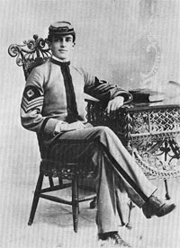
Douglas MacArthur (26 January 18805 April 1964) was an American military leader who served as General of the Army for the United States, as well as a field marshal to the Philippine Army. He had served with distinction in World War I, was Chief of Staff of the United States Army during the 1930s, and he played a prominent role in the Pacific theater during World War II. MacArthur was nominated for the Medal of Honor three times, and received it for his service in the Philippines campaign. This made him along with his father Arthur MacArthur Jr. the first father and son to be awarded the medal. He was one of only five men to rise to the rank of General of the Army in the U.S. Army, and the only one conferred the rank of field marshal in the Philippine Army. Raised in a military family in the American Old West, MacArthur was valedictorian at the West Texas Military Academy where he finished high school, and First Captain at the United States Military Academy at West Point ... [...More Info...] [...Related Items...] OR: [Wikipedia] [Google] [Baidu] |
Finschhafen
Finschhafen is a town east of Lae on the Huon Peninsula in Morobe Province of Papua New Guinea. The town is commonly misspelt as Finschafen or Finschaven. During World War II, the town was also referred to as Fitch Haven in the logs of some U.S. Navy men. History The area was charted by the British navigator Captain John Moresby in 1873–74. Finschhafen was surveyed in 1884 by the German scientist and explorer Otto Finsch who gave his name to the town. A town was built in 1885 as part of the colony of German New Guinea and was named after the discoverer (-hafen = -harbour). In 1886, Johann Flierl and two other Lutheran missionaries settled in the area, creating a Mission station at Simbang. A malaria epidemic in 1891 caused the town to be abandoned by the German plantation owners and government officials. It was resettled afterward and was claimed by the Germans in 1894. It was finally abandoned in 1901. Finschhafen was occupied by the Imperial Japanese Army on 10 March 1942 ... [...More Info...] [...Related Items...] OR: [Wikipedia] [Google] [Baidu] |
Huon Gulf
Huon Gulf is a large gulf in eastern Papua New Guinea. It is bordered by Huon Peninsula in the north. Both are named after French explorer Jean-Michel Huon de Kermadec. Huon Gulf is a part of the Solomon Sea. Its northern boundary is marked by Cape Cretin, southern by Cape Longerue. The coast, which quickly increases in elevation from the beach, is bordered by the Rawlinson Range to the north and the Kuper Range to the west, which rises to about . Lae, capital of the Morobe Province, is located on the northern coast of the gulf. Markham Bay forms the north-western corner of Huon Gulf, where the Markham River The Markham River is a river in eastern Papua New Guinea. It originates in the Finisterre Range and flows for to empty into the Huon Gulf at Lae. The river was named in 1873 by Captain John Moresby, R.N., in honour of Sir Clements Markham, then ... ends. Bodies of water of Papua New Guinea Gulfs of the Pacific Ocean Morobe Province {{MorobeProvince-geo-stub ... [...More Info...] [...Related Items...] OR: [Wikipedia] [Google] [Baidu] |
Salamaua
Salamaua () was a small town situated on the northeastern coastline of Papua New Guinea, in Salamaua Rural LLG, Morobe province. The settlement was built on a minor isthmus between the coast with mountains on the inland side and a headland. The closest city is Lae, which can be reached only via boat across the gulf. History In the 1920s prospective gold miners used Salamaua as a staging post to explore for gold in the inland areas. Gold was discovered at Wau and miners came from all over and made for the goldfields via the rough Black Cat Track. The town was captured by the Japanese on 8 March 1942 during World War II and later retaken by Australian and United States forces led by General Douglas MacArthur on 11 September 1943 during the Salamaua–Lae campaign. During reoccupation the town was destroyed. Today the villages of Kela and Lagui occupy the site, as well as holiday houses that are mainly owned by expatriates based in Lae. See also * Invasion of Salamaua–Lae * Sa ... [...More Info...] [...Related Items...] OR: [Wikipedia] [Google] [Baidu] |
New Guinea Campaign
The New Guinea campaign of the Pacific War lasted from January 1942 until the end of the war in August 1945. During the initial phase in early 1942, the Empire of Japan invaded the Australian-administered Mandated Territory of New Guinea (23 January) and the Australian Territory of Papua (21 July) and overran western New Guinea (beginning 29/30 March), which was a part of the Netherlands East Indies. During the second phase, lasting from late 1942 until the Japanese surrender, the Allies—consisting primarily of Australian forces—cleared the Japanese first from Papua, then the Mandate and finally from the Dutch colony. The campaign resulted in a crushing defeat and heavy losses for the Empire of Japan. As in most Pacific War campaigns, disease and starvation claimed more Japanese lives than enemy action. Most Japanese troops never even came into contact with Allied forces, and were instead simply cut off and subjected to an effective blockade by Allied naval forces. Garrison ... [...More Info...] [...Related Items...] OR: [Wikipedia] [Google] [Baidu] |
Crown Island
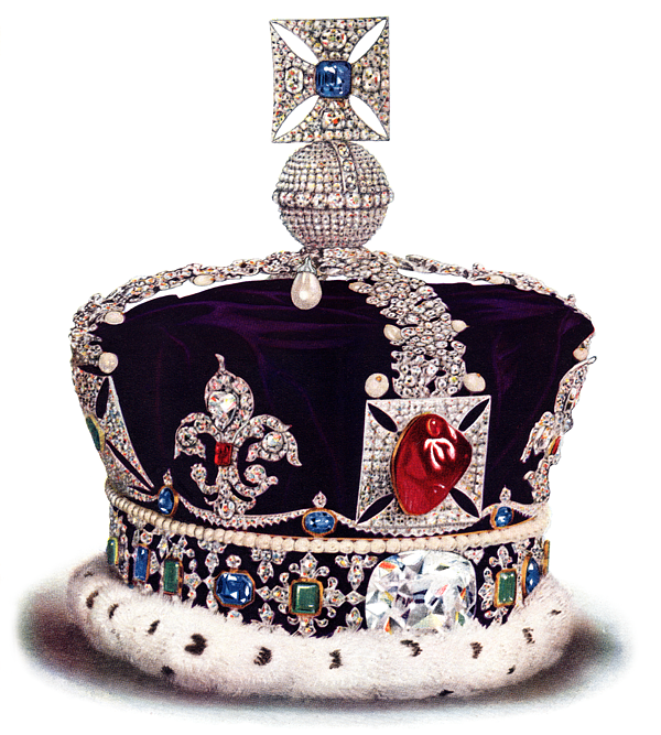
A crown is a traditional form of head adornment, or hat, worn by monarchs as a symbol of their power and dignity. A crown is often, by extension, a symbol of the monarch's government or items endorsed by it. The word itself is used, particularly in Commonwealth countries, as an abstract name for the monarchy itself, as distinct from the individual who inhabits it (that is, ''The Crown''). A specific type of crown (or coronet for lower ranks of peerage) is employed in heraldry under strict rules. Indeed, some monarchies never had a physical crown, just a heraldic representation, as in the constitutional kingdom of Belgium, where no coronation ever took place; the royal installation is done by a solemn oath in parliament, wearing a military uniform: the King is not acknowledged as by divine right, but assumes the only hereditary public office in the service of the law; so he in turn will swear in all members of "his" federal government''. Variations * Costume headgear imitati ... [...More Info...] [...Related Items...] OR: [Wikipedia] [Google] [Baidu] |
Long Island (Papua New Guinea)
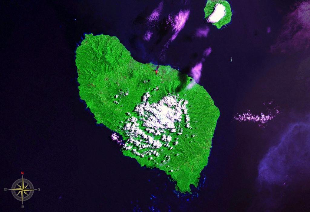
Long Island is a volcanic island in Papua New Guinea. It is located north of the island of New Guinea, separated from it by the Vitiaz Strait. Geography Two stratovolcanoes are located on the island: Mount Reaumur and Cerisy Peak. The summit of the volcanic complex collapsed during at least three major explosive eruptions, about 16,000, 4000, and 300 years ago. These produced a large caldera 10 x 12.5 km in size, now filled with a freshwater crater lake, Lake Wisdom. In 1953-1954 and 1968, volcanic activity created Motmot Island on the crater lake, 200 x 200 m in size. The 1660 eruption was one of the largest in Papua New Guinea's recent history with an estimated air-fall volume in excess of 11 cu km, comparable to the 1991 eruption of Mount Pinatubo, but the Global Volcanism Program gives a much higher estimate of 30 cu km. This cataclysmic event prompted legends of a "Time of Darkness". The most recent (and a smaller) eruption occurred in 1993. The crater holds ... [...More Info...] [...Related Items...] OR: [Wikipedia] [Google] [Baidu] |
Dampier Strait (Papua New Guinea)
Dampier Strait in Papua New Guinea separates Umboi Island and New Britain, linking the Bismarck Sea to the north with the deeper Solomon Sea to the south. History The strait is named after the first European to sail through it, British navigator William Dampier in 1700 in . Dampier described his discoveries in his ''A Continuation of a Voyage to New Holland'Ch. 4 New Britain Discoveredin these terms: NEW BRITAIN. The easternmost part of New Guinea lies 40 miles to the westward of this tract of land, and by hydrographers they are made joining together: but here I found an opening and passage between, with many islands; the largest of which lie on the north side of this passage or strait. The channel is very good, between the islands and the land to the eastward. ... As we stood over to the islands we looked out very well to the north, but could see no land that way; by which I was well assured that we were got through, and that this east land does not join to New Guinea; the ... [...More Info...] [...Related Items...] OR: [Wikipedia] [Google] [Baidu] |
William Dampier
William Dampier (baptised 5 September 1651; died March 1715) was an English explorer, pirate, privateer, navigator, and naturalist who became the first Englishman to explore parts of what is today Australia, and the first person to circumnavigate the world three times. He has also been described as Australia's first natural historian, as well as one of the most important British explorers of the period between Francis Drake (16th century) and James Cook (18th century), he "bridged those two eras" with a mix of piratical derring-do of the former and scientific inquiry of the later. His expeditions were among the first to identify and name a number of plants, animals, foods, and cooking techniques for a European audience; being among the first English writers to use words such as avocado, barbecue, and chopsticks. In describing the preparation of avocados, he was the first European to describe the making of guacamole, named the breadfruit plant, and made frequent documenta ... [...More Info...] [...Related Items...] OR: [Wikipedia] [Google] [Baidu] |


.jpg)

