|
Dampier Strait (Papua New Guinea)
Dampier Strait in Papua New Guinea separates Umboi Island and New Britain, linking the Bismarck Sea to the north with the deeper Solomon Sea to the south. History The strait is named after the first European to sail through it, British navigator William Dampier in 1700 in . Dampier described his discoveries in his ''A Continuation of a Voyage to New Holland'Ch. 4 New Britain Discoveredin these terms: NEW BRITAIN. The easternmost part of New Guinea lies 40 miles to the westward of this tract of land, and by hydrographers they are made joining together: but here I found an opening and passage between, with many islands; the largest of which lie on the north side of this passage or strait. The channel is very good, between the islands and the land to the eastward. ... As we stood over to the islands we looked out very well to the north, but could see no land that way; by which I was well assured that we were got through, and that this east land does not join to New Guinea; the ... [...More Info...] [...Related Items...] OR: [Wikipedia] [Google] [Baidu] |
Umboi Island
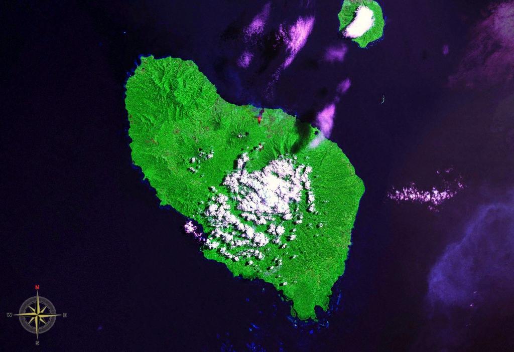
Umboi (also named Rooke or Siassi) is a volcanic island between the mainland of Papua New Guinea and the island of New Britain. It is separated from New Britain by the Dampier Strait and Huon Peninsula, and New Guinea by the Vitiaz Strait. It has an elevation of . Languages are Papuan Kobai; and Austronesian: Mbula, Karanai, and Saveng languages. The Siassi Archipelago lies off the southeast coast of Umboi Island (a total of 18 islands, only seven are inhabited). During the mid-1920s, the population of the Siassi Islands was a little over 700 people. It had more than doubled (to almost 1700 people) by the early 1960s, and then decreased to a little more than 1600 people by the early 1980s. The Siassi support themselves through traditional trade based on a barter system; they are important middlemen who deliver pigs, pots and wooden bowls by sea in their canoes. See also * List of volcanoes in Papua New Guinea * Siassi Rural LLG Siassi Rural LLG is a local-level govern ... [...More Info...] [...Related Items...] OR: [Wikipedia] [Google] [Baidu] |
World War I
World War I (28 July 1914 11 November 1918), often abbreviated as WWI, was one of the deadliest global conflicts in history. Belligerents included much of Europe, the Russian Empire, the United States, and the Ottoman Empire, with fighting occurring throughout Europe, the Middle East, Africa, the Pacific, and parts of Asia. An estimated 9 million soldiers were killed in combat, plus another 23 million wounded, while 5 million civilians died as a result of military action, hunger, and disease. Millions more died in genocides within the Ottoman Empire and in the 1918 influenza pandemic, which was exacerbated by the movement of combatants during the war. Prior to 1914, the European great powers were divided between the Triple Entente (comprising France, Russia, and Britain) and the Triple Alliance (containing Germany, Austria-Hungary, and Italy). Tensions in the Balkans came to a head on 28 June 1914, following the assassination of Archduke Franz Ferdin ... [...More Info...] [...Related Items...] OR: [Wikipedia] [Google] [Baidu] |
Douglas MacArthur
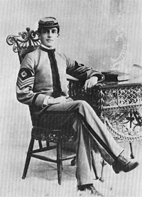
Douglas MacArthur (26 January 18805 April 1964) was an American military leader who served as General of the Army for the United States, as well as a field marshal to the Philippine Army. He had served with distinction in World War I, was Chief of Staff of the United States Army during the 1930s, and he played a prominent role in the Pacific theater during World War II. MacArthur was nominated for the Medal of Honor three times, and received it for his service in the Philippines campaign. This made him along with his father Arthur MacArthur Jr. the first father and son to be awarded the medal. He was one of only five men to rise to the rank of General of the Army in the U.S. Army, and the only one conferred the rank of field marshal in the Philippine Army. Raised in a military family in the American Old West, MacArthur was valedictorian at the West Texas Military Academy where he finished high school, and First Captain at the United States Military Academy at West Point ... [...More Info...] [...Related Items...] OR: [Wikipedia] [Google] [Baidu] |
Vitiaz Strait
Vitiaz Strait is a strait between New Britain and the Huon Peninsula, northern New Guinea. The Vitiaz Strait was so named by Nicholai Nicholaievich Mikluho-Maklai to commemorate the Russian corvette '' Vitiaz'' in which he sailed from October 1870 by way of South America and the Pacific Islands reaching Astrolabe Bay in September 1871. Hydrography The 1200 m deep Vitiaz Strait "was a focus of attention by Australian and USA oceanographers on voyages in 1985, 1986, 1988, 1991 and 1992 as part of the Western Equatorial Pacific Ocean Circulation Study, WEPOCS". The New Guinea Coastal Undercurrent transports "high-salinity, low-tritium, high-oxygen, low-nutrient water from the Solomon Sea northwestward along the north coast of Papua New Guinea through the Vitiaz Strait". However, the surface layer current running through the strait, the New Guinea Coastal Current, experiences a seasonal reversal. In boreal summer (northern hemisphere summer) characterized by the south-easterly ... [...More Info...] [...Related Items...] OR: [Wikipedia] [Google] [Baidu] |
Huon Gulf
Huon Gulf is a large gulf in eastern Papua New Guinea. It is bordered by Huon Peninsula in the north. Both are named after French explorer Jean-Michel Huon de Kermadec. Huon Gulf is a part of the Solomon Sea. Its northern boundary is marked by Cape Cretin, southern by Cape Longerue. The coast, which quickly increases in elevation from the beach, is bordered by the Rawlinson Range to the north and the Kuper Range to the west, which rises to about . Lae, capital of the Morobe Province, is located on the northern coast of the gulf. Markham Bay forms the north-western corner of Huon Gulf, where the Markham River The Markham River is a river in eastern Papua New Guinea. It originates in the Finisterre Range and flows for to empty into the Huon Gulf at Lae. The river was named in 1873 by Captain John Moresby, R.N., in honour of Sir Clements Markham, then ... ends. Bodies of water of Papua New Guinea Gulfs of the Pacific Ocean Morobe Province {{MorobeProvince-geo-stub ... [...More Info...] [...Related Items...] OR: [Wikipedia] [Google] [Baidu] |
Salamaua
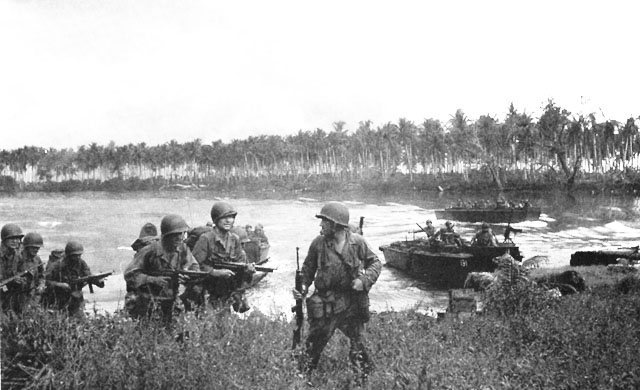
Salamaua () was a small town situated on the northeastern coastline of Papua New Guinea, in Salamaua Rural LLG, Morobe province. The settlement was built on a minor isthmus between the coast with mountains on the inland side and a headland. The closest city is Lae, which can be reached only via boat across the gulf. History In the 1920s prospective gold miners used Salamaua as a staging post to explore for gold in the inland areas. Gold was discovered at Wau and miners came from all over and made for the goldfields via the rough Black Cat Track. The town was captured by the Japanese on 8 March 1942 during World War II and later retaken by Australian and United States forces led by General Douglas MacArthur on 11 September 1943 during the Salamaua–Lae campaign. During reoccupation the town was destroyed. Today the villages of Kela and Lagui occupy the site, as well as holiday houses that are mainly owned by expatriates based in Lae. See also * Invasion of Salamaua–Lae * Sa ... [...More Info...] [...Related Items...] OR: [Wikipedia] [Google] [Baidu] |
League Of Nations Mandate
A League of Nations mandate was a legal status for certain territories transferred from the control of one country to another following World War I, or the legal instruments that contained the internationally agreed-upon terms for administering the territory on behalf of the League of Nations. These were of the nature of both a treaty and a constitution, which contained minority rights clauses that provided for the rights of petition and adjudication by the Permanent Court of International Justice. The mandate system was established under Article 22 of the Covenant of the League of Nations, entered into force on 28 June 1919. With the dissolution of the League of Nations after World War II, it was stipulated at the Yalta Conference that the remaining Mandates should be placed under the trusteeship of the United Nations, subject to future discussions and formal agreements. Most of the remaining mandates of the League of Nations (with the exception of South-West Africa ... [...More Info...] [...Related Items...] OR: [Wikipedia] [Google] [Baidu] |
Treaty Of Versailles
The Treaty of Versailles (french: Traité de Versailles; german: Versailler Vertrag, ) was the most important of the peace treaties of World War I. It ended the state of war between Germany and the Allied Powers. It was signed on 28 June 1919 in the Palace of Versailles, exactly five years after the assassination of Archduke Franz Ferdinand, which led to the war. The other Central Powers on the German side signed separate treaties. Although the armistice of 11 November 1918 ended the actual fighting, it took six months of Allied negotiations at the Paris Peace Conference to conclude the peace treaty. The treaty was registered by the Secretariat of the League of Nations on 21 October 1919. Of the many provisions in the treaty, one of the most important and controversial was: "The Allied and Associated Governments affirm and Germany accepts the responsibility of Germany and her allies for causing all the loss and damage to which the Allied and Associated Governments and the ... [...More Info...] [...Related Items...] OR: [Wikipedia] [Google] [Baidu] |
German New Guinea
German New Guinea (german: Deutsch-Neu-Guinea) consisted of the northeastern part of the island of New Guinea and several nearby island groups and was the first part of the German colonial empire. The mainland part of the territory, called , became a German protectorate in 1884. Other island groups were added subsequently. The Bismarck Archipelago (New Britain, New Ireland and several smaller islands), and the North Solomon Islands were declared a German protectorate in 1885; in the same year the Marshall Islands were bought from Spain for $4.5 million by the Hispano-German Protocol of Rome; Nauru was annexed to the Marshall Islands protectorate in 1888, and finally the Caroline Islands, Palau, and the Mariana Islands (except for Guam) were bought from Spain in 1899. German Samoa, though part of the German colonial empire, was not part of German New Guinea. Following the outbreak of the First World War in 1914, Kaiser-Wilhelmsland and nearby islands fell to Australian for ... [...More Info...] [...Related Items...] OR: [Wikipedia] [Google] [Baidu] |
Bismarck Archipelago
The Bismarck Archipelago (, ) is a group of islands off the northeastern coast of New Guinea in the western Pacific Ocean and is part of the Islands Region of Papua New Guinea. Its area is about 50,000 square km. History The first inhabitants of the archipelago arrived around 30–40,000 years ago. They may have traveled from New Guinea, by boat across the Bismarck Sea or via a temporary land bridge, created by an uplift in the Earth's Crust (geology), crust. Later arrivals included the Lapita people. The first European to visit these islands was Dutch explorer Willem Schouten in 1616. The islands remained unsettled by western Europeans until they were annexed as part of the German protectorate of German New Guinea in 1884. The area was named in honour of the Chancellor of Germany (German Reich), Chancellor Otto von Bismarck. On 1888 Ritter Island eruption and tsunami, 13 March 1888, a volcano erupted on Ritter Island causing a megatsunami. Almost the entire volcano fell into t ... [...More Info...] [...Related Items...] OR: [Wikipedia] [Google] [Baidu] |
New Britain
New Britain ( tpi, Niu Briten) is the largest island in the Bismarck Archipelago, part of the Islands Region of Papua New Guinea. It is separated from New Guinea by a northwest corner of the Solomon Sea (or with an island hop of Umboi the Dampier and Vitiaz Straits) and from New Ireland by St. George's Channel. The main towns of New Britain are Rabaul/Kokopo and Kimbe. The island is roughly the size of Taiwan. While the island was part of German New Guinea, it was named Neupommern ("New Pomerania"). In common with most of the Bismarcks it was largely formed by volcanic processes, and has active volcanoes including Ulawun (highest volcano nationally), Langila, the Garbuna Group, the Sulu Range, and the volcanoes Tavurvur and Vulcan of the Rabaul caldera. A major eruption of Tavurvur in 1994 destroyed the East New Britain provincial capital of Rabaul. Most of the town still lies under metres of ash, and the capital has been moved to nearby Kokopo. Geography New Britain e ... [...More Info...] [...Related Items...] OR: [Wikipedia] [Google] [Baidu] |
History Of Queensland
The history of Queensland encompasses both a long Aboriginal Australian presence as well as the more recent periods of European colonisation and as a state of Australia.A History of Queensland by Raymond Evans, Cambridge University Press, 2007 () Before being charted and claimed for the Kingdom of Great Britain by Lieutenant James Cook in 1770, the coast of north-eastern Australia was explored by Dutch and French navigators. Queensland separated from the Colony of New South Wales as a self-governing Crown colony in 1859. In 1901 it became one of the six founding states of Australia. Indigenous people Established theories estimate that between 50,000 to 60,000 years ago, humans first arrived in Australia - although some theories suggest this figure to be much higher. They are thought to have arrived either by boat or by land bridge. The most likely route was from Southeast Asia across the Torres Strait. During the initial ten thousand years, these people and their descendants ... [...More Info...] [...Related Items...] OR: [Wikipedia] [Google] [Baidu] |


.jpg)