|
Verkeerder Kill
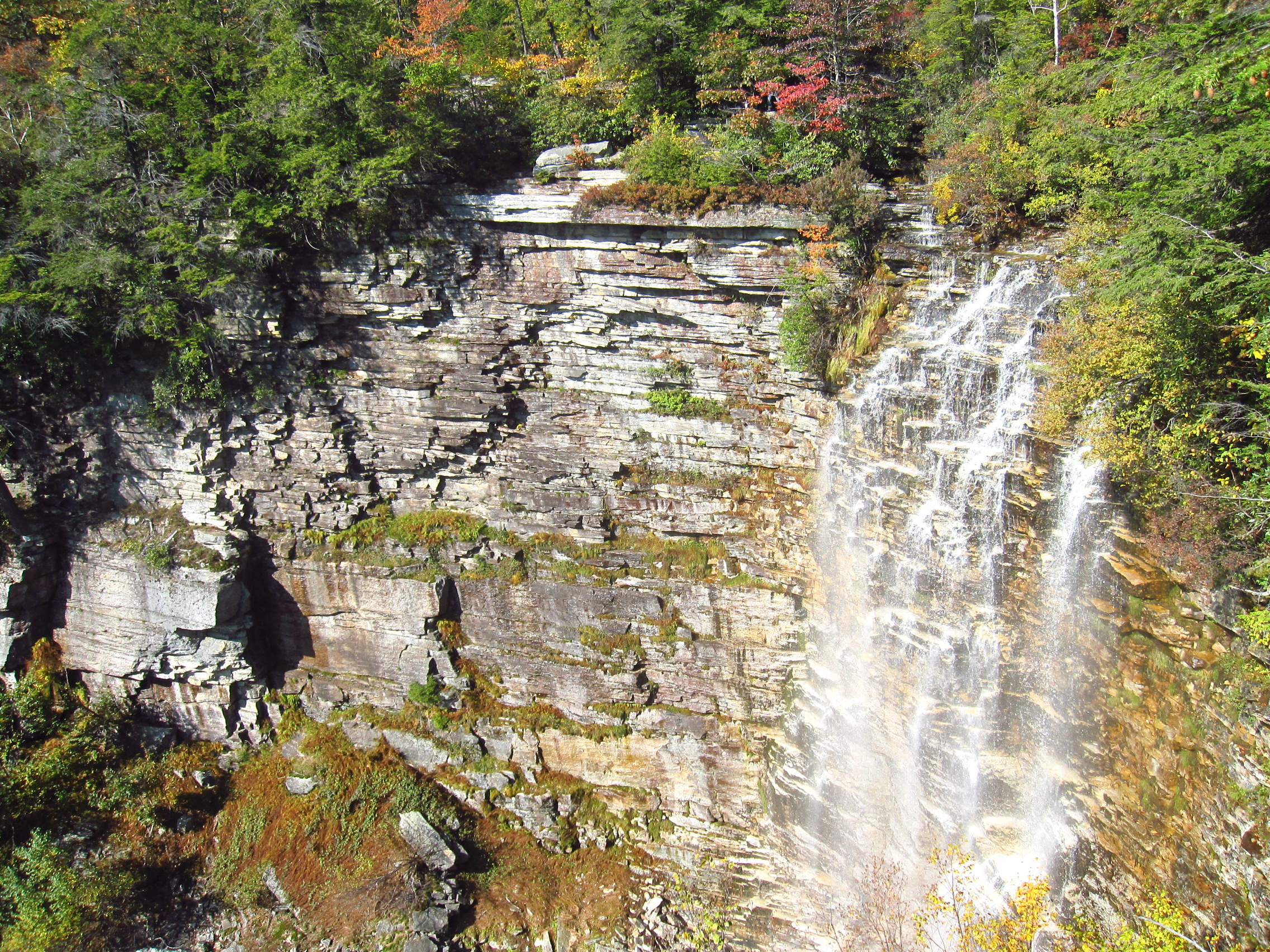
The Verkeerder Kill, sometimes Verkeerderkill and locally shortened to Kaidy Kill is an stream in Ulster County, New York, United States. It rises on the Shawangunk Ridge, in the town of Wawarsing, and flows southwards through the town of Shawangunk, toward the Shawangunk Kill, itself a major tributary of the Wallkill River. Ultimately it is a part of the Hudson River's watershed. It is best known for Verkeerder Kill Falls, a waterfall located on its headwaters just below its source, on the border between the two towns. The falls are a popular hiking destination along the Long Path, a long-distance hiking trail from New York City to the Capital District that traverses the area. Course The Verkeerder rises as two small streams a short distance apart in the dwarf pine barrens of Sam's Point Preserve atop the Shawangunk Ridge near the southern boundary of the town of Wawarsing. The higher of the two, on the east, has its source at . After flowing roughly south from th ... [...More Info...] [...Related Items...] OR: [Wikipedia] [Google] [Baidu] |
Dutch Language
Dutch ( ) is a West Germanic language spoken by about 25 million people as a first language and 5 million as a second language. It is the third most widely spoken Germanic language, after its close relatives German and English. ''Afrikaans'' is a separate but somewhat mutually intelligible daughter languageAfrikaans is a daughter language of Dutch; see , , , , , . Afrikaans was historically called Cape Dutch; see , , , , , . Afrikaans is rooted in 17th-century dialects of Dutch; see , , , . Afrikaans is variously described as a creole, a partially creolised language, or a deviant variety of Dutch; see . spoken, to some degree, by at least 16 million people, mainly in South Africa and Namibia, evolving from the Cape Dutch dialects of Southern Africa. The dialects used in Belgium (including Flemish) and in Suriname, meanwhile, are all guided by the Dutch Language Union. In Europe, most of the population of the Netherlands (where it is the only official language spoken country ... [...More Info...] [...Related Items...] OR: [Wikipedia] [Google] [Baidu] |
Hudson River
The Hudson River is a river that flows from north to south primarily through eastern New York. It originates in the Adirondack Mountains of Upstate New York and flows southward through the Hudson Valley to the New York Harbor between New York City and Jersey City, eventually draining into the Atlantic Ocean at Lower New York Bay. The river serves as a political boundary between the states of New Jersey and New York at its southern end. Farther north, it marks local boundaries between several New York counties. The lower half of the river is a tidal estuary, deeper than the body of water into which it flows, occupying the Hudson Fjord, an inlet which formed during the most recent period of North American glaciation, estimated at 26,000 to 13,300 years ago. Even as far north as the city of Troy, the flow of the river changes direction with the tides. The Hudson River runs through the Munsee, Lenape, Mohican, Mohawk, and Haudenosaunee homelands. Prior to European ... [...More Info...] [...Related Items...] OR: [Wikipedia] [Google] [Baidu] |
Lake Maratanza
Lake Maratanza is the highest lake in New York's Shawangunk Ridge at 2,245 feet (684 m) above sea level. It is within Sam's Point Preserve. The lake is dammed and supplies drinking water to Ellenville. The outlet brook drains to the other side of the ridge, into the Verkeerder Kill, a tributary of the Shawangunk Kill and by extension the Wallkill River The Wallkill River, a tributary of the Hudson, drains Lake Mohawk in Sparta, New Jersey, flowing from there generally northeasterly U.S. Geological Survey. National Hydrography Dataset high-resolution flowline dataThe National Map, accessed Oct .... References See also * List of dams and reservoirs in New York Reservoirs in New York (state) Shawangunks Protected areas of Ulster County, New York Reservoirs in Ulster County, New York {{UlsterCountyNY-geo-stub ... [...More Info...] [...Related Items...] OR: [Wikipedia] [Google] [Baidu] |
New York State Office Of Parks, Recreation And Historic Preservation
The New York State Office of Parks, Recreation and Historic Preservation (NYS OPRHP) is a state agency within the New York State Executive Department Parks, Recreation and Historic Preservation Law § 3.03. "The office of parks, recreation and historic preservation is hereby continued in the executive department. .. charged with the operation of state parks and historic sites within the U.S. state of New York. As of 2014, the NYS OPRHP manages nearly of public lands and facilities, including 180 state parks and 35 historic sites, that are visited by over 78 million visitors each year. History The agency that would become the New York State Office of Parks, Recreation and Historic Preservation (NYS OPRHP) was created in 1970; however, the history of state parks and historic sites in New York stretches back to the latter part of the 19th century. Management of state-owned parks, and guidance for the entire state park system, was accomplished by various regional co ... [...More Info...] [...Related Items...] OR: [Wikipedia] [Google] [Baidu] |
Ford (crossing)
A ford is a shallow place with good footing where a river or stream may be crossed by wading, or inside a vehicle getting its wheels wet. A ford may occur naturally or be constructed. Fords may be impassable during high water. A low-water crossing is a low bridge that allows crossing over a river or stream when water is low but may be treated as a ford when the river is high and water covers the crossing. Description A ford is a much cheaper form of river crossing than a bridge, and it can transport much more weight than a bridge, but it may become impassable after heavy rain or during flood conditions. A ford is therefore normally only suitable for very minor roads (and for paths intended for walkers and horse riders etc.). Most modern fords are usually shallow enough to be crossed by cars and other wheeled or tracked vehicles (a process known as "fording"). Fords may be accompanied by stepping stones for pedestrians. The United Kingdom has more than 2,000 fords, and most ... [...More Info...] [...Related Items...] OR: [Wikipedia] [Google] [Baidu] |
Confluence
In geography, a confluence (also: ''conflux'') occurs where two or more flowing bodies of water join to form a single channel. A confluence can occur in several configurations: at the point where a tributary joins a larger river (main stem); or where two streams meet to become the source of a river of a new name (such as the confluence of the Monongahela and Allegheny rivers at Pittsburgh, forming the Ohio); or where two separated channels of a river (forming a river island) rejoin at the downstream end. Scientific study of confluences Confluences are studied in a variety of sciences. Hydrology studies the characteristic flow patterns of confluences and how they give rise to patterns of erosion, bars, and scour pools. The water flows and their consequences are often studied with mathematical models. Confluences are relevant to the distribution of living organisms (i.e., ecology) as well; "the general pattern ownstream of confluencesof increasing stream flow and decreasing s ... [...More Info...] [...Related Items...] OR: [Wikipedia] [Google] [Baidu] |
Sam's Point Preserve
Sam's Point Preserve, or Sam's Point Dwarf Pine Ridge Preserve, is a preserve in Ulster County on the highest point () of the Shawangunk Ridge in New York, on the Wawarsing, New York- Shawangunk town line. It is owned and managed by the New York State Office of Parks, Recreation and Historic Preservation after having previously been managed by The Nature Conservancy. Its unique environment features dwarf pitch pine trees along the ridgetop. Located within the park is Lake Maratanza, the highest lake on the ridge, and the Ellenville Fault Ice Caves. History The name derives from a folktale in which a noted Spanish settler named Samuel Gonzales, pursued by Indians, jumped off the cliff to avoid capture and miraculously survived the drop with the trees breaking his fall, around the time of the French and Indian War. Roads throughout the preserve were built as fire roads in the 1930s by the Civilian Conservation Corps. The land was once owned by the nearby village of Ellenville ... [...More Info...] [...Related Items...] OR: [Wikipedia] [Google] [Baidu] |
Pine Barrens
Pine barrens, pine plains, sand plains, or pineland areas occur throughout the U.S. from Florida to Maine (see Atlantic coastal pine barrens) as well as the Midwest, West, and Canada and parts of Eurasia. Perhaps the most well known pine-barrens area is the New Jersey Pine Barrens. "Pine barrens" are generally pine forests in otherwise "barren" and agriculturally difficult areas. Such pine forests often occur on dry, acidic, infertile soils, which also include grasses, forbs, and low shrubs. The most extensive pine barrens occur in large areas of sandy glacial deposits (including outwash plains), lakebeds, and outwash terraces along rivers. Description Botany The most common trees are the jack pine, red pine, pitch pine, blackjack oak, and scrub oak; a scattering of larger oaks is not unusual. The understory includes grasses, sedges, and forbs, many of them common in dry prairies, and rare plants such as the sand-plain gerardia (''Agalinis acuta''). Plants of the heath fami ... [...More Info...] [...Related Items...] OR: [Wikipedia] [Google] [Baidu] |
Dwarf Forest
Dwarf forest, elfin forest, or pygmy forest is an uncommon ecosystem featuring miniature trees, inhabited by small species of fauna such as rodents and lizards. They are usually located at high elevations, under conditions of sufficient air humidity but poor soil. There are two main dwarf forest ecosystem types, involving different species and environmental characteristics: coastal temperate and montane tropical regions. Temperate coastal dwarf forest is common for parts of Southern California. Montane tropical forests are found across tropical highlands of Central America, northern South America and Southeast Asia. There are also other isolated examples of dwarf forests scattered across the world, while the largest dwarf forest is found in the Philippines. High-elevation tropical dwarf forest High-elevation tropical locations in cloud forests contain mossy wet elfin forests due to high-elevation precipitation. These regions are characterized by low rainfall, with most of the wa ... [...More Info...] [...Related Items...] OR: [Wikipedia] [Google] [Baidu] |
Capital District, New York
The Capital District, also known as the Capital Region, is the metropolitan area surrounding Albany, the capital of the U.S. state of New York. The Capital District was first settled by the Dutch in the early 17th century and came under English control in 1664. Albany has been the permanent capital of the state of New York since 1797. The Capital District is notable for many historical events that predate the independence of the United States, including the Albany Plan of Union and the Battles of Saratoga. Etymology The earliest known reference to the name "Capital District" stems from a Capital Police District that was created in the Albany area in the late 1860s. In the 1910s, several economic and government organizations covering the area used "Capital District" in their name, such as the Capital District Conference of Charities and Corrections in 1913, the Capital District Life Underwriters Association also in 1913, and the Capital District Recreation League. The Capital ... [...More Info...] [...Related Items...] OR: [Wikipedia] [Google] [Baidu] |
Long Path
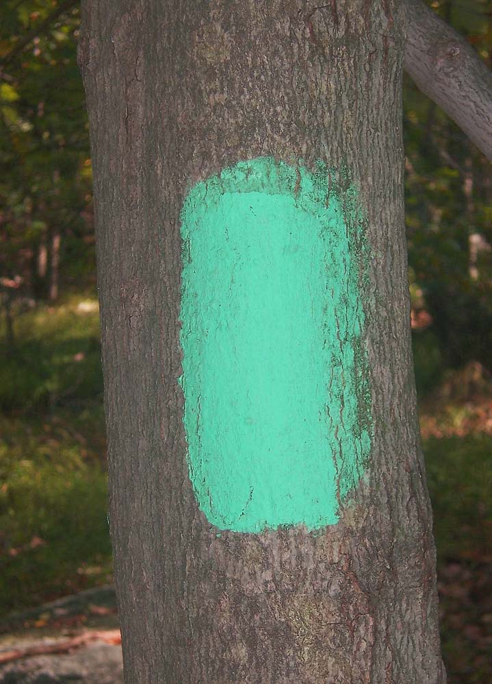
The Long Path is a long-distance hiking trail beginning in New York City, at the West 175th Street subway station near the George Washington Bridge and ending at Altamont, New York, in the Albany area. While not yet a continuous trail, relying on road walks in some areas, it nevertheless takes in many of the popular hiking attractions west of the Hudson River, such as the New Jersey Palisades, Harriman State Park, the Shawangunk Ridge and the Catskill Mountains. It offers hikers a diversity of environments to pass through, from suburbia and sea-level salt marshes along the Hudson to wilderness and boreal forest on Catskill summits in elevation. When conceived in the 1930s, it was to be the antithesis of a hiking trail, with neither a designated route nor blazes, simply a list of points of interest hikers could find their own routes to. However, increasing development after World War II in Orange and Rockland counties made that less workable, and it was revived in the 1960s ... [...More Info...] [...Related Items...] OR: [Wikipedia] [Google] [Baidu] |
Source (hydrology)
The headwaters of a river or stream is the farthest place in that river or stream from its estuary or downstream confluence with another river, as measured along the course of the river. It is also known as a river's source. Definition The United States Geological Survey (USGS) states that a river's "length may be considered to be the distance from the mouth to the most distant headwater source (irrespective of stream name), or from the mouth to the headwaters of the stream commonly known as the source stream". As an example of the second definition above, the USGS at times considers the Missouri River as a tributary of the Mississippi River. But it also follows the first definition above (along with virtually all other geographic authorities and publications) in using the combined Missouri—lower Mississippi length figure in lists of lengths of rivers around the world. Most rivers have numerous tributaries and change names often; it is customary to regard the longest t ... [...More Info...] [...Related Items...] OR: [Wikipedia] [Google] [Baidu] |


