|
Vellarada
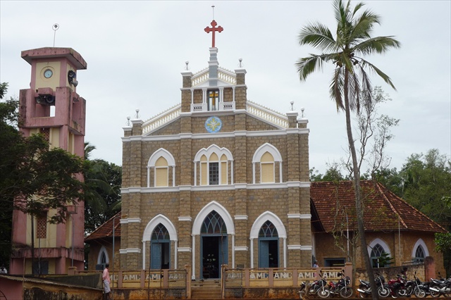
Vellarada is a border village situated in Thiruvananthapuram district in the state of Kerala, India. It is 42 km from Thiruvananthapuram. It is the southernmost part of Kerala state, sharing its border with Tamil Nadu. Vellarada is said to be the threshold to the high-range areas of the eastern part of Thiruvananthapuram district. The southernmost point of Western Ghats in Kerala is near Vellarada. Vellarada is also known for its hilltop shrine "Kurisumala Pilgrim Centre" (also called Thekkan kurisumala) at an elevation of . Thousands of devotees from various parts of Tamil Nadu, Kerala, Andhra Pradesh and Karnataka visit the shrine during Lent every year. Demographics India census, A total of 8285 families resides in Vellarada. Vellarada village had a population of 31839 with 15702 males and 16137 females. There is a positive sex ratio of 1027 existing in Vellarada. Literacy is at 87.78 %. The dominant religions in Vellarada are Hinduism and Christianity. The Scheduled ... [...More Info...] [...Related Items...] OR: [Wikipedia] [Google] [Baidu] |
Perumkadavila
Neyyattinkara, is a Municipal Town and a major industrial and commercial hub located at the southern tip of Thiruvananthapuram metropolitan area in Trivandrum, the capital of Kerala State, and also the headquarters of Neyyattinkara Taluk. The town is situated on the banks of Neyyar River, one of the principal rivers in the district and hence its name. Neyyatinkara in Malayalam literally means "the shore of the river Neyyar". Neyyattinkara is the second most densely populated municipality in the district after Varkala. Administration The town comes under the purview of Neyyattinkara Municipality. It also comes under the Neyyatinkara Assembly Constituency which inturn comes under the Thiruvananthapuram Lok Sabha Constituency. The town is mostly residential, with many government and service sector establishments. The standard and generally accepted abbreviations of Neyyattinkara are NTA (used by general public) or NYY (used by Indian railway) and NTKA used by Kerala State Elect ... [...More Info...] [...Related Items...] OR: [Wikipedia] [Google] [Baidu] |
Neyyattinkara
Neyyattinkara, is a Municipal Town and a major industrial and commercial hub located at the southern tip of Thiruvananthapuram metropolitan area in Trivandrum, the capital of Kerala State, and also the headquarters of Neyyattinkara Taluk. The town is situated on the banks of Neyyar River, one of the principal rivers in the district and hence its name. Neyyatinkara in Malayalam literally means "the shore of the river Neyyar". Neyyattinkara is the second most densely populated municipality in the district after Varkala. Administration The town comes under the purview of Neyyattinkara Municipality. It also comes under the Neyyattinkara (State Assembly constituency), Neyyatinkara Assembly Constituency which inturn comes under the Thiruvananthapuram (Lok Sabha constituency), Thiruvananthapuram Lok Sabha Constituency. The town is mostly residential, with many government and service sector establishments. The standard and generally accepted abbreviations of Neyyattinkara are NTA (used ... [...More Info...] [...Related Items...] OR: [Wikipedia] [Google] [Baidu] |
State Highway 3 (Kerala)
State Highway 3 (SH 3) is a State Highway in Kerala, India that starts at Nedumangad Toll junction and ends at the Kadukkara near Kerala - Tamilnadu border. The highway is 37.5 km long. This was part of hitherto existed Aralvaimozhi - Nedumangad royal state highway of Travancore. Now a part of it is in Kerala and another in Tamilnadu. The road runs parallel to Western Ghats till the Aralvaimozhi pass. The stretch of this highway from Anappara near Vellarada till Aryanad is now part of Hill Highway (Kerala). This highway connects tourist destinations such as Koickal Palace Nedumangadu, Neyyar Dam, Neyyar Safari Park, Dravyappara, Thekkan Kurishumala, Elephant Rehabilitation Center Kottur, Chittar Dam and Thripparappu waterfalls. This road is called as Nedumangad- Shorlacode Road by local people. Shorlacode is a small village near Kulasekaram nearby Perunchani Dam. These days people call it as ''Surulacode'' or ''Churulakode.'' Route description Nedumangad Toll Jn - Ary ... [...More Info...] [...Related Items...] OR: [Wikipedia] [Google] [Baidu] |
Hill Highway (Kerala)
The State Highway 59 (SH-59) is the longest state highway in Kerala. The proposed highway extends from Nandarapadavu in Kasaragod district to Parassala in Thiruvananthapuram district, will have a length of 1332.16 km and will pass through 13 of the 14 districts, the exception being Alappuzha as that district is not part of the hilly ranges of Kerala. The expected outlay for the project is Rs.1,500 crore. The proposed highway would pass through areas including Bandadka, Malom, Chittarikkal, Cherupuzha, Alakode, Payyavoor, Ulikkal, Mananthavady, Kalpetta, Thiruvambady, Nilambur, Karuvarakundu, Pookkottumpadam, Edakkara, Palakkad, Pattikkad, Neriamangalam, Kattappana, Mundakayam, Erumely, Ranni, Konni, Koodal, Vazhathope, Pathanapuram, Punalur, Anchal, Kulathupuzha, Madathara, Palode, Vithura, Aryanadu, Vellarada etc. This highway will pass through 13 out of the 14 districts in Kerala state. Between Kannur and Malappuram districts, this highway will have two parallel ... [...More Info...] [...Related Items...] OR: [Wikipedia] [Google] [Baidu] |
Neyyattinkara Taluk
Neyyattinkara is a Taluk (tehsil) located in the southern region of Thiruvananthapuram district, in the Indian state of Kerala. This taluk encompasses a total of 21 villages and one municipality, making it the southernmost taluk in the state. Notably, the Vizhinjam International Seaport Thiruvananthapuram is situated within Neyyattinkara Taluk." Settlements There are 21 villages and one Municipality in the taluk. Villages Anavoor, Athiyannur, Balaramapuram, |
Thiruvananthapuram District
Thiruvananthapuram District (), is the southernmost district in the Indian state of Kerala. The district was created in 1949, with its headquarters in the city of Thiruvananthapuram, which is also Kerala's administrative centre. The present district was created in 1956 by separating the four southernmost Taluks of the erstwhile district to form Kanyakumari district. The city of Thiruvananthapuram is also known as the Information technology capital of the State, since it is home to the first and largest IT park in India, Technopark, established in 1990. The district is home to more than 9% of total population of the state. The district covers an area of . At the 2011 census, it had a population of 3,301,427, making it the second most populous district in Kerala after Malappuram district. Its population density is the highest in Kerala, with . The district is divided into six subdistricts: Thiruvananthapuram, Chirayinkeezhu, Neyyattinkara, Nedumangadu, Varkala, and Kattakada. ... [...More Info...] [...Related Items...] OR: [Wikipedia] [Google] [Baidu] |
States And Territories Of India
India is a federal union comprising 28 states and 8 union territories, with a total of 36 entities. The states and union territories are further subdivided into districts and smaller administrative divisions. History Pre-independence The Indian subcontinent has been ruled by many different ethnic groups throughout its history, each instituting their own policies of administrative division in the region. The British Raj mostly retained the administrative structure of the preceding Mughal Empire. India was divided into provinces (also called Presidencies), directly governed by the British, and princely states, which were nominally controlled by a local prince or raja loyal to the British Empire, which held ''de facto'' sovereignty ( suzerainty) over the princely states. 1947–1950 Between 1947 and 1950 the territories of the princely states were politically integrated into the Indian union. Most were merged into existing provinces; others were organised into ... [...More Info...] [...Related Items...] OR: [Wikipedia] [Google] [Baidu] |
Parassala
Parassala (പാറശ്ശാല) is a small town located near the border of Kerala and Tamil Nadu.It comes under Thiruvananthapuram district at southern tip of Kerala. It is situated 34 km south of state capital Thiruvananthapuram in Kerala, bordering Tamil Nadu. Demographics A part of earlier generation of the population were involved in the collecting of palmyra nectar and fermenting to produce alcoholic drinks. The typical nectar collected on pots from atop palmyra trees are also used for making ' karupatti' which is known for its medicinal properties. Three generations before, the people of Parassala have achieved socio-economic development because of the establishment of various educational and health care organizations by various religious groups and government. Health The major hospitals in the town are Govt Taluk Hospital, Saraswathy Multispeciality Hospital and SP Multispeciality Hospital. Then a government Sidha hospital,a government Ayurvedha hospital,a gov ... [...More Info...] [...Related Items...] OR: [Wikipedia] [Google] [Baidu] |
Tamil Nadu State Transport Corporation
Tamil Nadu State Transport Corporation Ltd. - (TNSTC) is a Government owned public transport bus operator in Tamil Nadu, India. It operates Intercity bus services to cities within Tamil Nadu, and from Tamil Nadu to its neighbouring states. It also operates town busses from major cities and towns of Tamil Nadu to its neighborhoods, with the exception of Chennai, where the public bus service is operated by MTC, a subsidiary of TNSTC. It is the largest government bus transport corporation in India, and the biggest corporation in the world. History The planning concussion, in consultation with this ministry, have advised the state government to set up a road transport corporation under the Transport Corporations Act and the matter is under the consideration of the state government. Operation of nationalized transport services through a corporation is favoured so as to achieve railroad coordination, and to ensure operation on business lines. The general policy of the government is ... [...More Info...] [...Related Items...] OR: [Wikipedia] [Google] [Baidu] |
Kerala State Road Transport Corporation
Kerala State Road Transport Corporation (KSRTC) is a state-owned road transport corporation in the Indian state of Kerala. It is one of the country's oldest state-run public bus transport services. The corporation is divided into three zones (South, Central and North), and its headquarters is in the state capital Thiruvananthapuram. Daily scheduled service has increased from to , using 6,241 buses on 6,389 routes. The corporation transports an average of 3.145 million commuters per day. The Kerala Urban Road Transport Corporation (KURTC) was formed under KRTC in 2015 to manage affairs related to urban transportation. It was inaugurated on 12 April 2015 at Thevara. On 9 November 2021, a legally independent company called KSRTC SWIFT was formed to operate the long-distance buses of the Kerala Road Transport Corporation for a period of 10 years with an aim overcome the financial crisis faced by the corporation. History Travancore State Transport Department The corporation's ... [...More Info...] [...Related Items...] OR: [Wikipedia] [Google] [Baidu] |
Karamana
Karamana is a suburb of Thiruvananthapuram (formerly and often still known as Trivandrum), the capital city of Kerala, India. It is one of the most densely populated but green parts of Thiruvananthapuram. The land is serviced by the Karamana River, which originates from the southern tip of the Western Ghats at Agastya Mala. The river flows westward and merges into the Arabian Sea at the Thiruvallom-Karumam area near Kovalam. Karamana is a major transit point for both trade and travel to and from the Kanyakumari district of neighbouring Tamil Nadu. Etymology According to myths, the name ''Karamana'' came from a namboothiri (Kerala Brahmin) family who lived on the bank of the river Karamana from the words ''kara'' () and ''mana'' (). Civil society and administration Karamana is situated within the city limits of Thiruvananthapuram Corporation (TC). It is the 20th ward of TC and is represented by a councillor on the TC Council. Like most parts of Thiruvananthapuram, Karamana h ... [...More Info...] [...Related Items...] OR: [Wikipedia] [Google] [Baidu] |
Aralvaimozhi
Aralvaimozhi is a panchayat town in Kanniyakumari District in the state of Tamil Nadu, India. It is a small town situated in southern India. The town was earlier called as ''Aramboly'' during colonial period. History Aralvaimozhi pass was a strategically important gap or mountain pass in the southernmost end of Western Ghats. It connected erstwhile Travancore with Madras Presidency. Many of the invasions faced by the Chera and the successor kingdoms came via this ghat. The name "Aral" was derived from the fort built and maintained by the rulers of Venad and later by the kingdom of Travancore to defend the kingdom from invasions from the east regions. It is also said that Aralvaimozhi means whispering wind. The whistling sound of wind in the region might have led to such a name. Aralvaimozhi Fort was one of the most important forts of Travancore. It was constructed around 1740 by Eustachius De Lannoy along with Udayagiri Fort, Vattakottai Fort and Travancore lines. The fort ... [...More Info...] [...Related Items...] OR: [Wikipedia] [Google] [Baidu] |


