|
Valette Island
Valette Island () is an island, 0.2 nautical miles (0.4 km) long, lying in the west side of the entrance to Mill Cove on the south side of Laurie Island, in the South Orkney Islands. Charted by the Scottish National Antarctic Expedition The Scottish National Antarctic Expedition (SNAE), 1902–1904, was organised and led by William Speirs Bruce, a natural scientist and former medical student from the University of Edinburgh. Although overshadowed in terms of prestige by Robe ..., 1902–1904, under Bruce, who named it for L.H. Valette, Argentine meteorologist at the Laurie Island station during 1904. See also * List of antarctic and sub-antarctic islands Islands of the South Orkney Islands {{SouthOrkneys-geo-stub ... [...More Info...] [...Related Items...] OR: [Wikipedia] [Google] [Baidu] |
Island
An island (or isle) is an isolated piece of habitat that is surrounded by a dramatically different habitat, such as water. Very small islands such as emergent land features on atolls can be called islets, skerries, cays or keys. An island in a river or a lake island may be called an eyot or ait, and a small island off the coast may be called a holm. Sedimentary islands in the Ganges delta are called chars. A grouping of geographically or geologically related islands, such as the Philippines, is referred to as an archipelago. There are two main types of islands in the sea: continental and oceanic. There are also artificial islands, which are man-made. Etymology The word ''island'' derives from Middle English ''iland'', from Old English ''igland'' (from ''ig'' or ''ieg'', similarly meaning 'island' when used independently, and -land carrying its contemporary meaning; cf. Dutch ''eiland'' ("island"), German ''Eiland'' ("small island")). However, the spelling of the word ... [...More Info...] [...Related Items...] OR: [Wikipedia] [Google] [Baidu] |
Mill Cove
Mill Cove () is a cove entered between Cape Anderson and Valette Island on the south coast of Laurie Island, in the South Orkney Islands off Antarctica. It was charted in 1903 by the Scottish National Antarctic Expedition under William Speirs Bruce, who named it for Hugh Robert Mill Hugh Robert Mill (28 May 1861 – 5 April 1950) was a British geographer and meteorologist who was influential in the reform of geography teaching, and in the development of meteorology as a science. He was President of the Royal Meteorologica ..., a British geographer and polar historian. References Coves of the South Orkney Islands {{SouthOrkneys-geo-stub ... [...More Info...] [...Related Items...] OR: [Wikipedia] [Google] [Baidu] |
Laurie Island
Laurie Island is the second largest of the South Orkney Islands. The island is claimed by both Argentina as part of Argentine Antarctica, and the United Kingdom as part of the British Antarctic Territory. However, under the Antarctic Treaty System all sovereignty claims are frozen, as the island lies south of the parallel 60°. Buchanan Point at the north-eastern end of the island, with Cape Whitson on its south coast, are Important Bird Areas. History Laurie Island was discovered by Captains George Powell and Nathaniel Palmer in the course of their 1821 expedition to the South Atlantic. Richard Holmes Laurie used Powell's observations to create a map of the island, and subsequently, the island was named after him. Two years later, James Weddell mapped the island for the second time, though his charts turned out to be much less accurate than Powell's charts. Weddell attempted to rename the island to Melville Island for the 2nd Viscount Melville, but the name failed to stick ... [...More Info...] [...Related Items...] OR: [Wikipedia] [Google] [Baidu] |
South Orkney Islands
The South Orkney Islands are a group of islands in the Southern Ocean, about north-east of the tip of the Antarctic Peninsula''Antarctica: Secrets of the Southern Continent'' p. 122 David McGonigal, 2009 and south-west of . They have a total area of about . The islands are claimed both by Britain (as part of the since 1962, previously as a [...More Info...] [...Related Items...] OR: [Wikipedia] [Google] [Baidu] |
Scottish National Antarctic Expedition
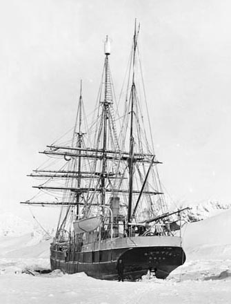
The Scottish National Antarctic Expedition (SNAE), 1902–1904, was organised and led by William Speirs Bruce, a natural scientist and former medical student from the University of Edinburgh. Although overshadowed in terms of prestige by Robert Falcon Scott's concurrent Discovery Expedition, the SNAE completed a full programme of exploration and scientific work. Its achievements included the establishment of a staffed meteorological station, the first in Antarctic territory, and the discovery of new land to the east of the Weddell Sea. Its large collection of biological and geological specimens, together with those from Bruce's earlier travels, led to the establishment of the Scottish Oceanographical Laboratory in 1906. Bruce had spent most of the 1890s engaged on expeditions to the Antarctic and Arctic regions, and by 1899 was Britain's most experienced polar scientist. In March of that year, he applied to join the Discovery Expedition; however, his proposal to extend that e ... [...More Info...] [...Related Items...] OR: [Wikipedia] [Google] [Baidu] |


