|
Uqturpan
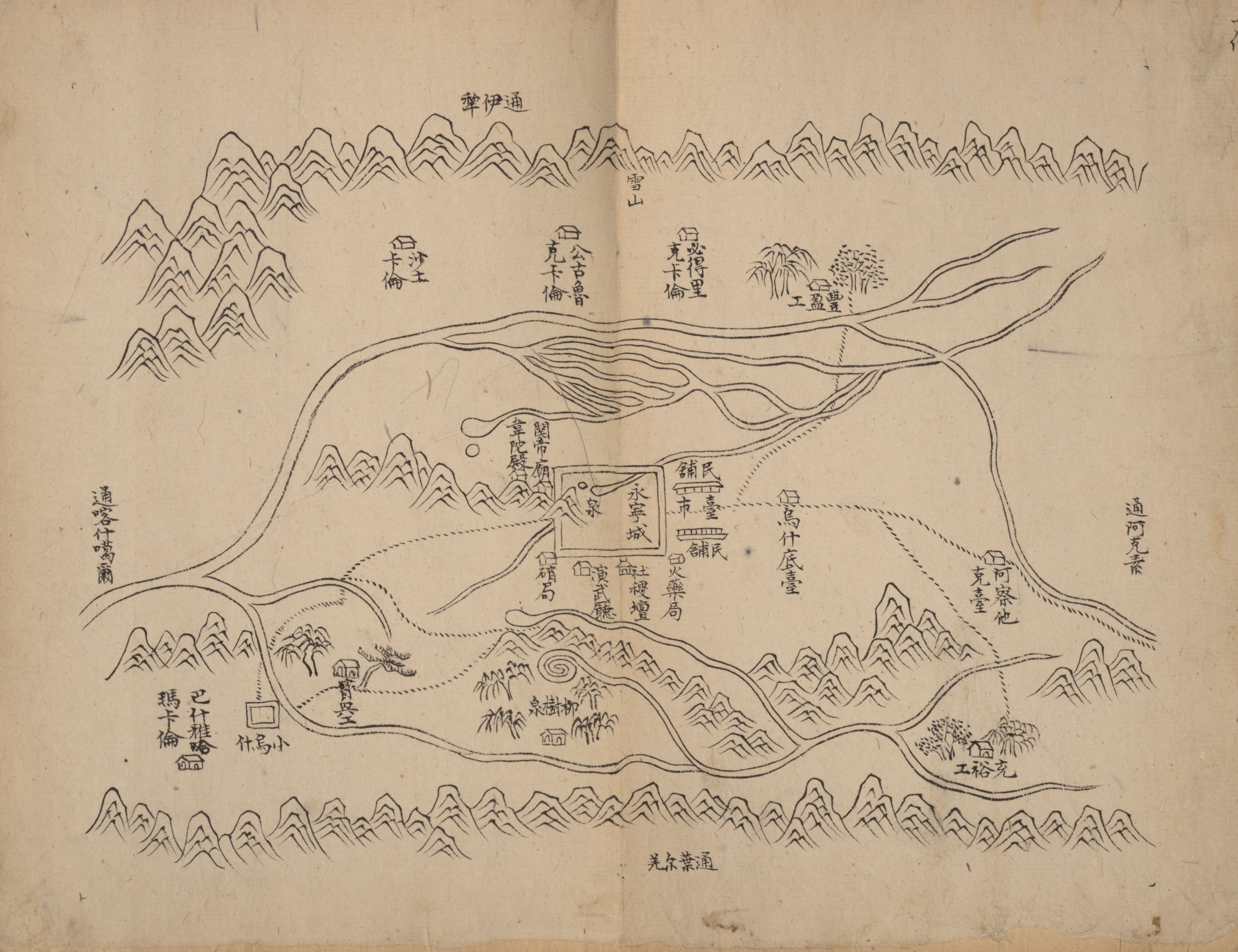
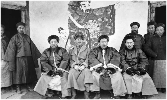
Uqturpan County, United States National Geospatial-Intelligence Agency or Uchturpan County ( transliterated from ; ), also Wushi County (), is a county in the Xinjiang Uyghur Autonomous Region under the administration of Aksu Prefecture and shares an approximately long border with Kyrgyzstan's Issyk-Kul Region. The county is bordered to the northeast by Onsu County (Wensu), to the southeast by Aksu city, to the west by Akqi County in Kizilsu Kyrgyz Autonomous Prefecture and to the south by Kalpin County (Keping). It has an area of and a population of 180,000. Name Uqturpan is also spelled Uchturpan and Uch-Turfan. History Tang During the Battle of Aksu (717), the Umayyad Caliphate and their Turgesh and Tibetan Empire allies hope to seize Uqturpan (then known as Dai-dʑiᴇk-dʑiᴇŋ) from Tang-Karluks-Exiled Western Turkic Khaganate allies but were repelled. Qing Ush Turfan was the site of a battle between Barhanuddin and Abdulla during the Revolt of the Altishahr Kho ... [...More Info...] [...Related Items...] OR: [Wikipedia] [Google] [Baidu] |
Aksu Prefecture
Aksu PrefectureThe official spelling according to is located in mid-Western Xinjiang, People's Republic of China. It has an area of and 2.37 million inhabitants at the 2010 census whom 535,657 lived in the built-up (or metro) area made up of Aksu urban district. The name Aksu is Turkic for 'white water'. Aksu Prefecture has a long international boundary with Kyrgyzstan and Kazakhstan. Etymology The name Aksu comes from the name of the Aksu River which is Turkic for 'white water'. The name is similar to that of the nearby Zhetysu region which means "seven rivers". The name of Aksu Prefecture's Onsu County (Wensu) means "ten water" in Uyghur and other Turkic languages, and 'Kizilsu' in Kizilsu Kyrgyz Autonomous Prefecture means 'red water'- all of these names consist of a descriptor followed by 'su' (river; water). History In 717 AD, the Arabs, guided by their Turgesh allies, besieged Buat-ɦuɑn ( Aksu) and Dai-dʑiᴇk-dʑiᴇŋ (Uqturpan) in the Battle of Aksu. During the ... [...More Info...] [...Related Items...] OR: [Wikipedia] [Google] [Baidu] |
Battle Of Aksu (717)
The Battle of Aksu () was fought between Arabs of the Umayyad Caliphate and their Turgesh and Tibetan Empire allies against the Tang dynasty of China. In 717 AD, the Arabs, guided by their Turgesh allies, besieged Buat-ɦuɑn ( Aksu) and Dai-dʑiᴇk-dʑiᴇŋ (Uqturpan) in the Aksu region of Xinjiang. Tang troops backed by their protectorates in the region attacked and routed the besieging Arabs forcing them to retreat. Location The battle took place somewhere in the Xinjiang region near modern China's border with Kyrgyzstan. Background The first encounter between the Tang Chinese and the Umayyad Arabs had occurred in 715 AD when Ikhshid, the king of the Fergana Valley, was deposed with the help of the Arabs of the Umayyad Caliphate and a new king Alutar was installed on the throne. The deposed king fled to Kucha (seat of the Anxi Protectorate), and sought Chinese intervention. The Chinese sent 10,000 troops under Zhang Xiaosong to Ferghana. He defeated Alutar and the Arab ... [...More Info...] [...Related Items...] OR: [Wikipedia] [Google] [Baidu] |
Xinjiang
Xinjiang, SASM/GNC: ''Xinjang''; zh, c=, p=Xīnjiāng; formerly romanized as Sinkiang (, ), officially the Xinjiang Uygur Autonomous Region (XUAR), is an autonomous region of the People's Republic of China (PRC), located in the northwest of the country at the crossroads of Central Asia and East Asia. Being the largest province-level division of China by area and the 8th-largest country subdivision in the world, Xinjiang spans over and has about 25 million inhabitants. Xinjiang borders the countries of Mongolia, Russia, Kazakhstan, Kyrgyzstan, Tajikistan, Afghanistan, Pakistan and India. The rugged Karakoram, Kunlun and Tian Shan mountain ranges occupy much of Xinjiang's borders, as well as its western and southern regions. The Aksai Chin and Trans-Karakoram Tract regions, both administered by China, are claimed by India. Xinjiang also borders the Tibet Autonomous Region and the provinces of Gansu and Qinghai. The most well-known route of the historic Silk Ro ... [...More Info...] [...Related Items...] OR: [Wikipedia] [Google] [Baidu] |
Akqi County
Akqi County (also as ''Aheqi County''; ) is a county in Xinjiang Uygur Autonomous Region, China. It is under the administration of the Kizilsu Kyrgyz Autonomous Prefecture. The county has a town and five townships, six communities and 25 villages under its jurisdiction in 2018, its county seat is ''Akqi Town'' (). The county has a population of about 46,000 (as of 2018) with main ethnic groups of Kyrgyz, Han and Uyghur peoples. The name of Akqi was from the Kyrgyz language, meaning ''white achnatherum calamagrostis'' (). The ''Administrative Division of Akqi'' () was first established, it was named after its seat located in the ''Village of Akqi'' (). The county of Akqi is located in alpine areas of the southern hinterland in Western Tianshan. Its altitude is between , with a terrain characteristics of the "two mountains and one valley", its whole territory is in a mountain valley area, of which, highland accounts for 90 percent, farmland for five percent and water body for fi ... [...More Info...] [...Related Items...] OR: [Wikipedia] [Google] [Baidu] |
Aksu City
Aksu is a city in and the seat of Aksu Prefecture, Xinjiang, lying at the northern edge of the Tarim Basin. The name Aksu literally means "white water" (in Turkic) and is used for both the oasis town and the Aksu River. The economy of Aksu is mostly agricultural, with cotton, in particular long-staple cotton (''Gossypium hirsutum''), as the main product. Also produced are grain, fruits, oils and beets. The industry mostly consists of weaving, cement and chemical industries. The land currently under the administration of the Aksu City is divided in two parts, separated by the Aral City. The northern part hosts the city center, while the southern part is occupied by the Taklamakan Desert. Aksu airport is considered a military airport in China (although also available for civil usage). Only aircraft registered in China can land in Aksu. This means if you are flying to Aksu from international origins you have to land in a major airport in China like Beijing, Shanghai, Guangzhou a ... [...More Info...] [...Related Items...] OR: [Wikipedia] [Google] [Baidu] |
Onsu County
Onsu County, United States National Geospatial-Intelligence Agency ( ug, ئونسۇ ناھىيىسى, lat=Onsu Nahiyisi) and from Mandarin Chinese Wensu County ( zh, s=温宿县), is a county in the Xinjiang Uyghur Autonomous Region and is under the administration of the Aksu Prefecture, bordering Kyrgyzstan's Issyk-Kul Region to the northwest. It contains an area of . Etymology The toponym Wensu () had appeared in historical records of the Western Han Dynasty as one of the 36 states in the Western Regions. The name 'Onsu' (Wensu) means "ten water" in Uyghur and other Turkic languages. The name is similar to that of the nearby Zhetysu region which means "seven rivers"- both names consist of a number followed by 'su' (river; water). The name Aksu is Turkic for 'white water'. In Uyghur, the county is called Aksu Konaxahar () meaning 'the old city of Aksu'. History Onsu County was established in 1902. On May 29, 1958, Onsu County was eliminated and its territory made part of ... [...More Info...] [...Related Items...] OR: [Wikipedia] [Google] [Baidu] |
Counties Of China
Counties ( zh, t=縣, s=县, hp=Xiàn), formally county-level divisions, are found in the third level of the administrative hierarchy in Provinces and Autonomous regions and the second level in municipalities and Hainan, a level that is known as "county level" and also contains autonomous counties, county-level cities, banners, autonomous banners and City districts. There are 1,355 counties in Mainland China out of a total of 2,851 county-level divisions. The term ''xian'' is sometimes translated as "district" or "prefecture" when put in the context of Chinese history. History ''Xian'' have existed since the Warring States period and were set up nationwide by the Qin Dynasty. The number of counties in China proper gradually increased from dynasty to dynasty. As Qin Shi Huang reorganized the counties after his unification, there were about 1,000. Under the Eastern Han Dynasty, the number of counties increased to above 1,000. About 1400 existed when the Sui dynasty abolish ... [...More Info...] [...Related Items...] OR: [Wikipedia] [Google] [Baidu] |
SASM/GNC Romanization
The former State Administration of Surveying and Mapping, Geographical Names Committee and former Script Reform Committee of the People's Republic of China have adopted several romanizations for Chinese, Mongolian, Tibetan and Uyghur, officially known as pinyin, Regulation of Phonetic Transcription in Hanyu Pinyin Letters of Place Names in Minority Nationality Languages and Orthography of Chinese Personal Name in Hanyu Pinyin Letters. These systems may be referred to as SASM/GNC/SRC transcriptions or SASM/GNC romanizations. These romanization systems have been used for foreign translations of Chinese personal names and toponyms since 1978.国务院批转《关于改用汉语拼音方案作为我国人名地名罗马字母拼写法的统一规范的报告》 All schemes except pinyin have a strict form and a broad form, where the broad form is used in general. In the case of pinyin, tone marks are omitted in practice. Chinese Hanyu Pinyin is used for the romanization of Chin ... [...More Info...] [...Related Items...] OR: [Wikipedia] [Google] [Baidu] |
Umayyad Caliphate
The Umayyad Caliphate (661–750 CE; , ; ar, ٱلْخِلَافَة ٱلْأُمَوِيَّة, al-Khilāfah al-ʾUmawīyah) was the second of the four major caliphates established after the death of Muhammad. The caliphate was ruled by the Umayyad dynasty ( ar, ٱلْأُمَوِيُّون, ''al-ʾUmawīyūn'', or , ''Banū ʾUmayyah'', "Sons of Umayyah"). Uthman ibn Affan (r. 644–656), the third of the Rashidun caliphs, was also a member of the clan. The family established dynastic, hereditary rule with Muawiya ibn Abi Sufyan, long-time governor of Greater Syria, who became the sixth caliph after the end of the First Fitna in 661. After Mu'awiyah's death in 680, conflicts over the succession resulted in the Second Fitna, and power eventually fell into the hands of Marwan I from another branch of the clan. Greater Syria remained the Umayyads' main power base thereafter, with Damascus serving as their capital. The Umayyads continued the Muslim conquests, incorpo ... [...More Info...] [...Related Items...] OR: [Wikipedia] [Google] [Baidu] |
Wikimedia Commons
Wikimedia Commons (or simply Commons) is a media repository of free-to-use images, sounds, videos and other media. It is a project of the Wikimedia Foundation. Files from Wikimedia Commons can be used across all of the Wikimedia projects in all languages, including Wikipedia, Wikivoyage, Wikisource, Wikiquote, Wiktionary, Wikinews, Wikibooks, and Wikispecies, or downloaded for offsite use. As of July 2022, the repository contains over 87 million free-to-use media files, managed and editable by registered volunteers. Statistics page on Wikimedia Commons History The idea for the project came from Erik Möller in March 2004 and Wikimedia Commons were launched in September 7, 2004. In July 2013, the number of edits on Commons reached 100,000,000. Since 2018 it became possible to upload 3D models to the site. One of the first models uploaded to Commons was a reconstruction of the Asad Al-Lat statue which was destroyed in Palmyra by the ISIL in 2015. Various notable organizati ... [...More Info...] [...Related Items...] OR: [Wikipedia] [Google] [Baidu] |
Encyclopædia Britannica
The (Latin for "British Encyclopædia") is a general knowledge English-language encyclopaedia. It is published by Encyclopædia Britannica, Inc.; the company has existed since the 18th century, although it has changed ownership various times through the centuries. The encyclopaedia is maintained by about 100 full-time editors and more than 4,000 contributors. The 2010 version of the 15th edition, which spans 32 volumes and 32,640 pages, was the last printed edition. Since 2016, it has been published exclusively as an online encyclopaedia. Printed for 244 years, the ''Britannica'' was the longest running in-print encyclopaedia in the English language. It was first published between 1768 and 1771 in the Scottish capital of Edinburgh, as three volumes. The encyclopaedia grew in size: the second edition was 10 volumes, and by its fourth edition (1801–1810) it had expanded to 20 volumes. Its rising stature as a scholarly work helped recruit eminent con ... [...More Info...] [...Related Items...] OR: [Wikipedia] [Google] [Baidu] |


