|
Aksu Prefecture
Aksu PrefectureThe official spelling according to is located in mid-Western Xinjiang, China. It has an area of and 2.714 million inhabitants at the 2020 census whom 715,319 lived in the built-up (or metro) area made up of Aksu urban district. The name Aksu is Turkic for 'white water'. Aksu Prefecture has a long international boundary with Kyrgyzstan and Kazakhstan. Etymology The name Aksu comes from the name of the Aksu River which is Turkic for 'white water'. The name is similar to that of the nearby Zhetysu region which means "seven rivers". The name of Aksu Prefecture's Onsu County (Wensu) means "ten water" in Uyghur and other Turkic languages, and 'Kizilsu' in Kizilsu Kyrgyz Autonomous Prefecture means 'red water'- all of these names consist of a descriptor followed by 'su' (river; water). History In 717 AD, the Arabs, guided by their Turgesh allies, besieged Buat-ɦuɑn (撥換, roughly modern Aksu) and Dai-dʑiᴇk-dʑiᴇŋ (大石城, roughly modern Uqturpan) in ... [...More Info...] [...Related Items...] OR: [Wikipedia] [Google] [Baidu] |
Prefectures Of China
zh, p=Dìqū, labels=no , alt_name = , map = , category = Second level administrative division of a unitary state , territory = China , start_date = , current_number = 7 prefectures , number_date = , population_range = 95,465 ( Ngari) – 3,979,362 ( Kaxgar) , area_range = ( Daxing'anling) – ( Ngari) , government = Various, Central Government , subdivision = Counties Prefectures are one of four types of prefecture-level divisions in China, the second-level administrative division in the country. While at one time prefectures were the most common prefecture-level division, they are in the process of being abolished and only seven formally-designated prefectures remain. The term "prefecture" is also used as a translation of three unrelated types of administrative divisions that were historically in use in China: the ''xian'', the ''zhou'', and the ''fu''. Modern prefectur ... [...More Info...] [...Related Items...] OR: [Wikipedia] [Google] [Baidu] |
Licence Plates Of The People's Republic Of China
Vehicle registration plates in China are mandatory metal or plastic plates attached to motor vehicles in mainland China for official identification purposes. The plates are issued by the local traffic management offices, which are sub-branches of local public security bureaus, under the rules of the Ministry of Public Security. Hong Kong and Macau, both of which are special administrative regions of China, issue their own licence plates, a legacy of when they were under British and Portuguese administration. Vehicles from Hong Kong and Macau are required to apply for licence plates, usually from Guangdong province, to travel on roads in mainland China. Vehicles from mainland China have to apply for Hong Kong licence plates or Macau licence plates to enter those territories. The font used are in the Heiti (Traditional: 黑體, Simplified: 黑体) style. History 1986-series plate In July 1986, the 1986-series Plates were put into use. The layout and format for them are ... [...More Info...] [...Related Items...] OR: [Wikipedia] [Google] [Baidu] |
Tibetan Empire
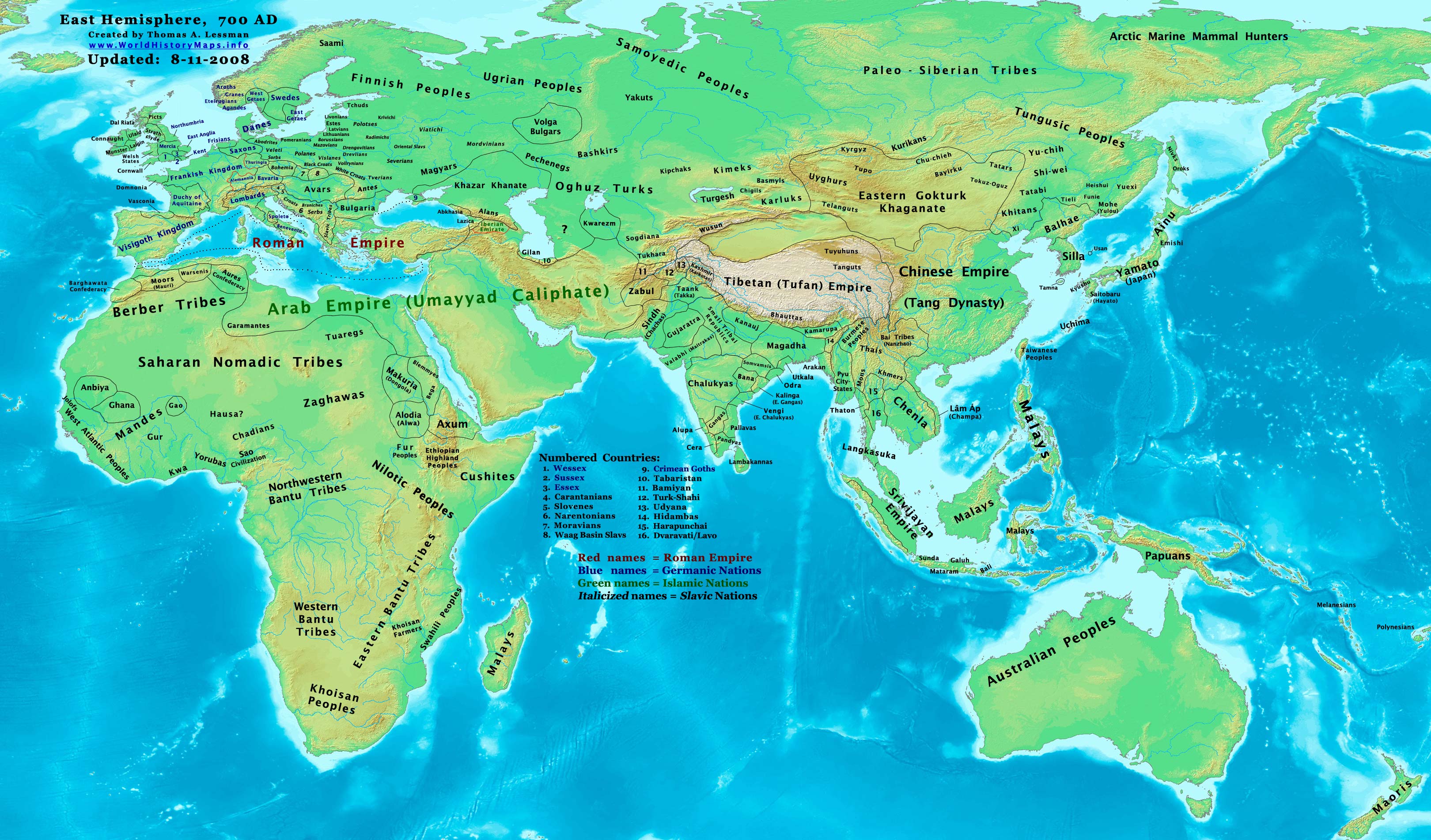
The Tibetan Empire (,) was an empire centered on the Tibetan Plateau, formed as a result of expansion under the Yarlung dynasty heralded by its 33rd king, Songtsen Gampo, in the 7th century. It expanded further under the 38th king, Trisong Detsen, and reached its greatest extent under the 40th king, Ralpacan, Ralpachen, stretching east to Chang'an, west beyond modern Afghanistan, south into modern India and the Bay of Bengal. The Yarlung dynasty was founded in 127 BC in the Yarlung Valley along the Yarlung River, south of Lhasa. The Yarlung capital was moved in the 7th century from the palace Yumbulingka to Lhasa by the 33rd king Songtsen Gampo, and into the Red Fort during the imperial period which continued to the 9th century. The beginning of the imperial period is marked in the reign of the 33rd king of the Yarlung dynasty, Songtsen Gampo. The power of Tibet's military empire gradually increased over a diverse terrain. During the reign of Trisong Detsen, the empire became ... [...More Info...] [...Related Items...] OR: [Wikipedia] [Google] [Baidu] |
Battle Of Aksu (717)
The Battle of Aksu (; ) was fought between the Umayyad Caliphate, and their Turgesh and Tibetan allies, against the Tang dynasty, and their Karluk and Western Turk allies. In 717 AD, the Umayyads, guided by their Turgesh allies, besieged Buat-ɦuɑn ( Aksu) and Dai-dʑiᴇk-dʑiᴇŋ ( Uqturpan) in the Aksu region of Xinjiang. Tang troops backed by their protectorates in the region attacked and routed the besieging Umayyads forcing them to retreat. Location The battle took place somewhere in the Xinjiang region near modern China's border with Kyrgyzstan. Background The first encounter between the Tang Chinese and the Umayyad Arabs had occurred in 715 AD when Ikhshid, the king of the Fergana Valley, was deposed with the help of the Umayyad Caliphate and a new king Alutar was installed on the throne. The deposed king fled to Kucha (seat of the Anxi Protectorate), and sought Chinese intervention. The Chinese sent 10,000 troops under Zhang Xiaosong to Ferghana. He defeated Al ... [...More Info...] [...Related Items...] OR: [Wikipedia] [Google] [Baidu] |
Uqturpan County
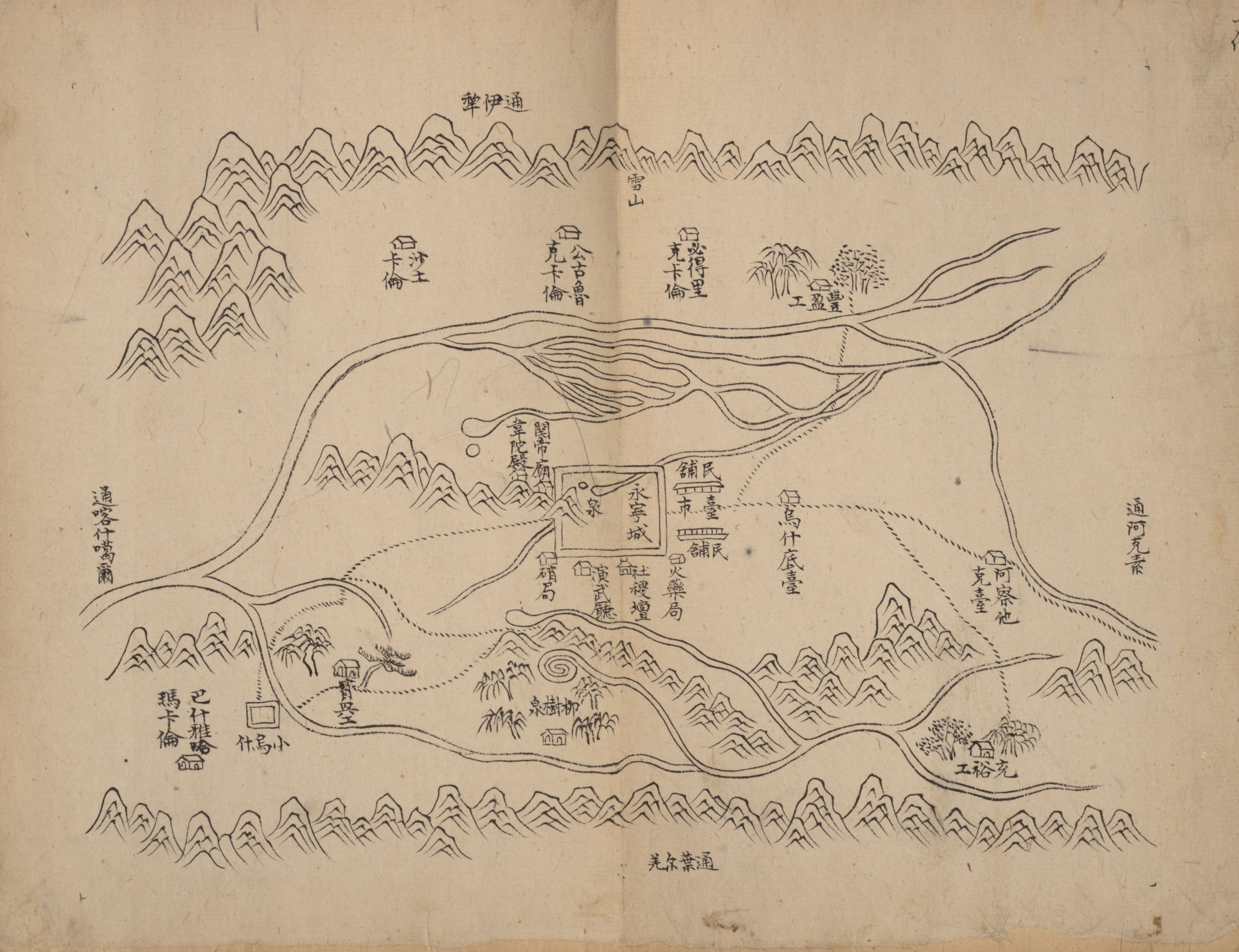
Uqturpan County, United States National Geospatial-Intelligence Agency or Uchturpan County ( transliterated from ; zh, s=乌什吐鲁番县), also Wushi County ( zh, s=乌什县), is a county in the Xinjiang Uyghur Autonomous Region under the administration of Aksu Prefecture and shares an approximately long border with Kyrgyzstan's Issyk-Kul Region. The county is bordered to the northeast by Onsu County (Wensu), to the southeast by Aksu city, to the west by Akqi County in Kizilsu Kyrgyz Autonomous Prefecture and to the south by Kalpin County (Keping). It has an area of and a population of 180,000. Name Uqturpan is also spelled Uchturpan and Uch-Turfan. History Tang During the Battle of Aksu (717), the Umayyad Caliphate and their Turgesh and Tibetan Empire allies hope to seize Uqturpan (then known as Dai-dʑiᴇk-dʑiᴇŋ) from Tang-Karluks- Exiled Western Turkic Khaganate allies but were repelled. Qing Ush Turfan was the site of a battle between Barhanuddin and ... [...More Info...] [...Related Items...] OR: [Wikipedia] [Google] [Baidu] |
Türgesh
The Türgesh or Türgish (; ; Old Tibetan: ''Du-rgyas'') were a Turkic tribal confederation. Once belonging to the Duolu wing of the Western Turkic ''On Oq'' elites, Türgeshes emerged as an independent power after the demise of the Western Turks and established a khaganate in 699. The Türgesh Khaganate lasted until 766 when the Karluks defeated them. Türgesh and Göktürks were related through marriage. Name Atwood (2013), citing Tekin (1968), etymologizes the ethnonym ''Türgiş'' as contains gentilic suffix ''-ş'' affixed onto the name of lake ''Türgi-Yarğun'', which was mentioned in Kültegin inscription. Tribal composition By the 7th century, two or three sub-tribes were recorded: "Yellow" ''Sarï'' Türgesh tribe ''Alishi'' (阿利施) and the "Black" ''Qara'' Türgesh tribe(s) 娑葛 (''Suoge'' < *''Soq'' or *''Saqal'') - 莫賀 (''Mohe'' < *''Bağa''). To the Black Türgesh sub-tribe, Chebishi (車鼻施) (*''çavïş'', from [...More Info...] [...Related Items...] OR: [Wikipedia] [Google] [Baidu] |
Kizilsu Kyrgyz Autonomous Prefecture
Kizilsu Kyrgyz Autonomous Prefecture is an autonomous prefecture in western Xinjiang, China, bordering Kyrgyzstan and Tajikistan. Its Capital (political), capital is Artush. The prefecture is home to 622,222 people () and covers an area of . Most Kyrgyz in China reside in Kizilsu; they make up a little over a quarter of the prefecture's population. The Uyghurs are the largest ethnic group in Kizilsu, consisting of nearly two-thirds of the population. Etymology The name ''Kizilsu'' (also spelled ''Kezilesu'', derived from Chinese pinyin) refers to the Kezi River and means "red water" in the Kyrgyz language. Kiziloy, Kizilto, and the Kizil Caves are nearby places that also use the prefix ''kizil'' (red). History Kizilsu was within the territory of the First East Turkestan Republic, which lasted from November 1933 to April 1934. The establishment of the short-lived breakaway state was thanks in part to a political and military alliance between Uyghurs and Kyrgyz in western Xi ... [...More Info...] [...Related Items...] OR: [Wikipedia] [Google] [Baidu] |
Onsu County
Onsu County, United States National Geospatial-Intelligence Agency () and from Mandarin Chinese Wensu County ( zh, s=温宿县), is a county in the Xinjiang Uygur Autonomous Region and is under the administration of the Aksu Prefecture, bordering Kyrgyzstan's Issyk-Kul Region to the northwest. It contains an area of . Etymology The toponym Wensu () had appeared in historical records of the Western Han Dynasty as one of the 36 states in the Western Regions. The name 'Onsu' (Wensu) means "ten rivers" in Uyghur and other Turkic languages. The name is similar to that of the nearby Zhetysu region which means "seven rivers"- both names consist of a number followed by 'su' (river; water). The name Aksu is Turkic for 'white water'. In Uyghur, the county is called Aksu Konaxahar () meaning 'the old city of Aksu'. History Onsu County was established in 1902. On May 29, 1958, Onsu County was eliminated and its territory made part of Aksu County. In 1962, Onsu County was restored. In ... [...More Info...] [...Related Items...] OR: [Wikipedia] [Google] [Baidu] |
Jetisu
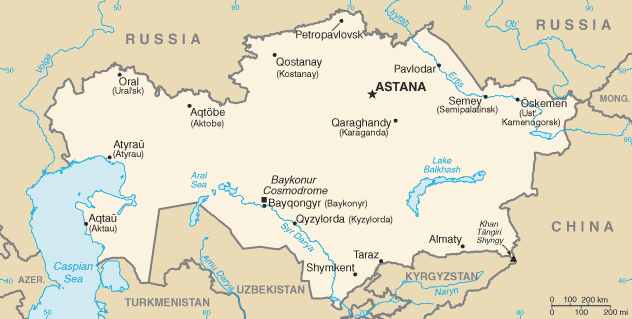
Jetisu ( ) or Semirechye ( rus, Семиречье, p=sʲɪmʲɪˈrʲetɕje) or Heptopotamia is a historical region in Central Asia corresponding to the southeastern part of modern Kazakhstan. Name Jetisu is also transcribed Jeti-Suu (, ), Zhetisu, Jetisuw, Jetysu, Jeti-su or Jity-su, The name comes from "seven rivers" in Kazakh but meant "abounding in water", in contrast to the dry steppes of the eastern Balkhash area. It owes its name to the rivers that flow from the southeast into Lake Balkhash. Jetisu primarily falls into today's Jetisu Region and Almaty Region and other South-Eastern parts of Kazakhstan and some parts of Northern Kyrgyzstan. Geography The lands of the 19th-century Semirechye Oblast included the steppes south of Lake Balkhash and parts of the Tian Shan Mountains around Lake Issyk Kul. The province had an area of 147,300 km², and was bounded by the province of Semipalatinsk on the north, by China (Xinjiang) on the east and south, and by the ... [...More Info...] [...Related Items...] OR: [Wikipedia] [Google] [Baidu] |
Aksu River (Xinjiang)
The Aksu River (; ; means "white/clear water" in Uyghur language, Uyghur and Kyrgyz languages) is a transboundary river in the Xinjiang, Xinjiang province in China and Ak-Suu District of Issyk-Kul Region, Issyk-Kul Province of Kyrgyzstan. Its upper section in Kyrgyzstan is known as the Saryjaz River or Sarydzhaz River (, ). The middle section, between the Kyrgyz-Chinese border and the confluence with the Toshkan River, Toshkan, is called Kumarik River (, ). The total length of the river is , of which are in Kyrgyzstan. It has a drainage basin of in Kyrgyzstan.{{cite book, script-title=ru:Иссык-Куль. Нарын. Энциклопедия., trans-title=Issyk-Kul. Naryn.Encyclopedia. , publisher=Chief Editorial Board of Kyrgyz Soviet Encyclopedia, language=ru, location=Frunze, year=1991, isbn=5-89750-009-6 , page=512 The Aksu is the only one of the Tarim's source rivers to run throughout the year. Course The river takes its roots at the Semyonov glacier in the Central Tian ... [...More Info...] [...Related Items...] OR: [Wikipedia] [Google] [Baidu] |
China–Kazakhstan Border
The China–Kazakhstan border (; zh, s=中哈边界, p=Zhōnghā biānjiè; ), also known as the Sino-Kazakh border, is the international border between the China, People's Republic of China and the Kazakhstan, Republic of Kazakhstan. The border line between the two countries has been largely inherited from the border existing between the Soviet Union and the PRC and, earlier, between the Russian Empire and the Qing dynasty, Qing Empire; however, it has been fully demarcated only in the late 20th and early 21st century. According to the international boundary commissions that have carried out the border demarcation, the border is long. History The origins of the border date from the mid-19th century, when the Russian Empire Russian conquest of Central Asia, expanded into Central Asia and was able to establish its control over the Lake Zaysan region. The establishment of the border between the Russian Empire and the Qing dynasty, Qing Empire, not too different from today's Sin ... [...More Info...] [...Related Items...] OR: [Wikipedia] [Google] [Baidu] |
China–Kyrgyzstan Border
The China–Kyrgyzstan border is in length and runs from the tripoint with Kazakhstan following a roughly south-west line across various mountain ridges and peaks of the Tian Shan range down to the tripoint with Tajikistan. The border divides (from north to south/east to west) Issyk-Kul Region, Naryn Region and Osh Region in Kyrgyzstan from Aksu Prefecture (to the north and east) and Kizilsu Kyrgyz Autonomous Prefecture (to the south and west) in Xinjiang Uygur Autonomous Region, China. History The origins of the border date from the mid-19th century, when the Russian Empire expanded into Central Asia and was able to establish its control over the Lake Zaysan region. The establishment of the border between the Russian Empire and the Qing Empire, not too different from today's Sino-Kazakh/Kyrgyz/Tajik border was provided for in the Convention of Peking of 1860; the actual border line pursuant to the convention was drawn by the Treaty of Tarbagatai ( zh, t=塔爾巴哈台; 1 ... [...More Info...] [...Related Items...] OR: [Wikipedia] [Google] [Baidu] |


