|
Upton, Cornwall
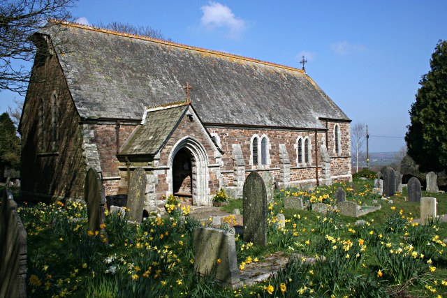
Upton Cross and Upton are hamlets a quarter of a mile apart in east Cornwall, England, United Kingdom. Upton is situated at north of Upton Cross 5 miles (8 kilometres) northwest of Callington. They are on the northeast side of Caradon Hill on the B3254 Liskeard to Launceston road. St Paul's Church at Upton Cross is a mission church built in this corner of the parish of Linkinhorne in 1887 to serve the needs of the local mining community. A little further north are the hamlets of Darleyford and North Darley below Notter Tor and a remarkable tree, the Darley Oak The Darley Oak is a Pedunculate oak tree (''Quercus robur'') which grows near Darleyford in the parish of Linkinhorne on the edge of Bodmin Moor, Cornwall, England, UK. This ancient tree is thought to be at least 1,000 years old, and a considera .... At Netherton Farm Yarg cheese was produced from 1984 to 2006 by Lynher Dairies. Cornish Blue, a cheese made by the Cornish Cheese Company at Upton Cross, was the winni ... [...More Info...] [...Related Items...] OR: [Wikipedia] [Google] [Baidu] |
Upton Cross Church - Geograph
Upton may refer to: Places United Kingdom England * Upton, Slough, Berkshire (in Buckinghamshire until 1974) * Upton, Buckinghamshire, a hamlet near Aylesbury * Upton, Cambridgeshire, Peterborough * Upton, Huntingdonshire, a List of United Kingdom locations: Uppi-Uz#Uppi-Upz, location in Cambridgeshire * Upton, Halton, a List of United Kingdom locations: Uppi-Uz#Uppi-Upz, location in Cheshire * Upton-by-Chester, Cheshire * Upton, Cornwall, Linkinhorne * Upton, Bude–Stratton, a List of United Kingdom locations: Uppi-Uz#Uppi-Upz, location in Cornwall * Upton, Cumbria * Upton, East Devon * Upton, South Hams, Devon * Upton, Torquay, Devon * Upton Hellions, Devon * Upton Pyne, Devon * Upton, Dorset * Upton, East Riding of Yorkshire, a List of United Kingdom locations: Uppi-Uz#Uppi-Upz, location in Cornwall * Tetbury Upton, Gloucestershire, former name Upton * Hawkesbury Upton, Gloucestershire * Upton Cheyney, Gloucestershire * Upton, north Test Valley, Hampshire, a hamlet approximatel ... [...More Info...] [...Related Items...] OR: [Wikipedia] [Google] [Baidu] |
Cornwall
Cornwall (; kw, Kernow ) is a historic county and ceremonial county in South West England. It is recognised as one of the Celtic nations, and is the homeland of the Cornish people. Cornwall is bordered to the north and west by the Atlantic Ocean, to the south by the English Channel, and to the east by the county of Devon, with the River Tamar forming the border between them. Cornwall forms the westernmost part of the South West Peninsula of the island of Great Britain. The southwesternmost point is Land's End and the southernmost Lizard Point. Cornwall has a population of and an area of . The county has been administered since 2009 by the unitary authority, Cornwall Council. The ceremonial county of Cornwall also includes the Isles of Scilly, which are administered separately. The administrative centre of Cornwall is Truro, its only city. Cornwall was formerly a Brythonic kingdom and subsequently a royal duchy. It is the cultural and ethnic origin of the Cornish dias ... [...More Info...] [...Related Items...] OR: [Wikipedia] [Google] [Baidu] |
Callington, Cornwall
Callington ( kw, Kelliwik) is a civil parish and town in east Cornwall, England, United Kingdom about north of Saltash and south of Launceston. Callington parish had a population of 4,783 in 2001, according to the 2001 census. This had increased to 5,786 in the 2011 census. Geography The town is situated in east Cornwall between Dartmoor to the east and Bodmin Moor to the west. A former agricultural market town, it lies at the intersection of the south–north A388 Saltash to Launceston road and the east–west A390 Tavistock to Liskeard road. Kit Hill is a mile north-east of the town and rises to with views of Dartmoor, Bodmin Moor and the River Tamar. The hamlets of Bowling Green, Kelly Bray, Frogwell and Downgate are in the parish. Railway station Callington railway station was the terminus of a branch line from Bere Alston, the junction with the Southern Railway's Tavistock to Plymouth line. The railway line beyond Gunnislake to the Callington terminus was c ... [...More Info...] [...Related Items...] OR: [Wikipedia] [Google] [Baidu] |
Caradon Hill
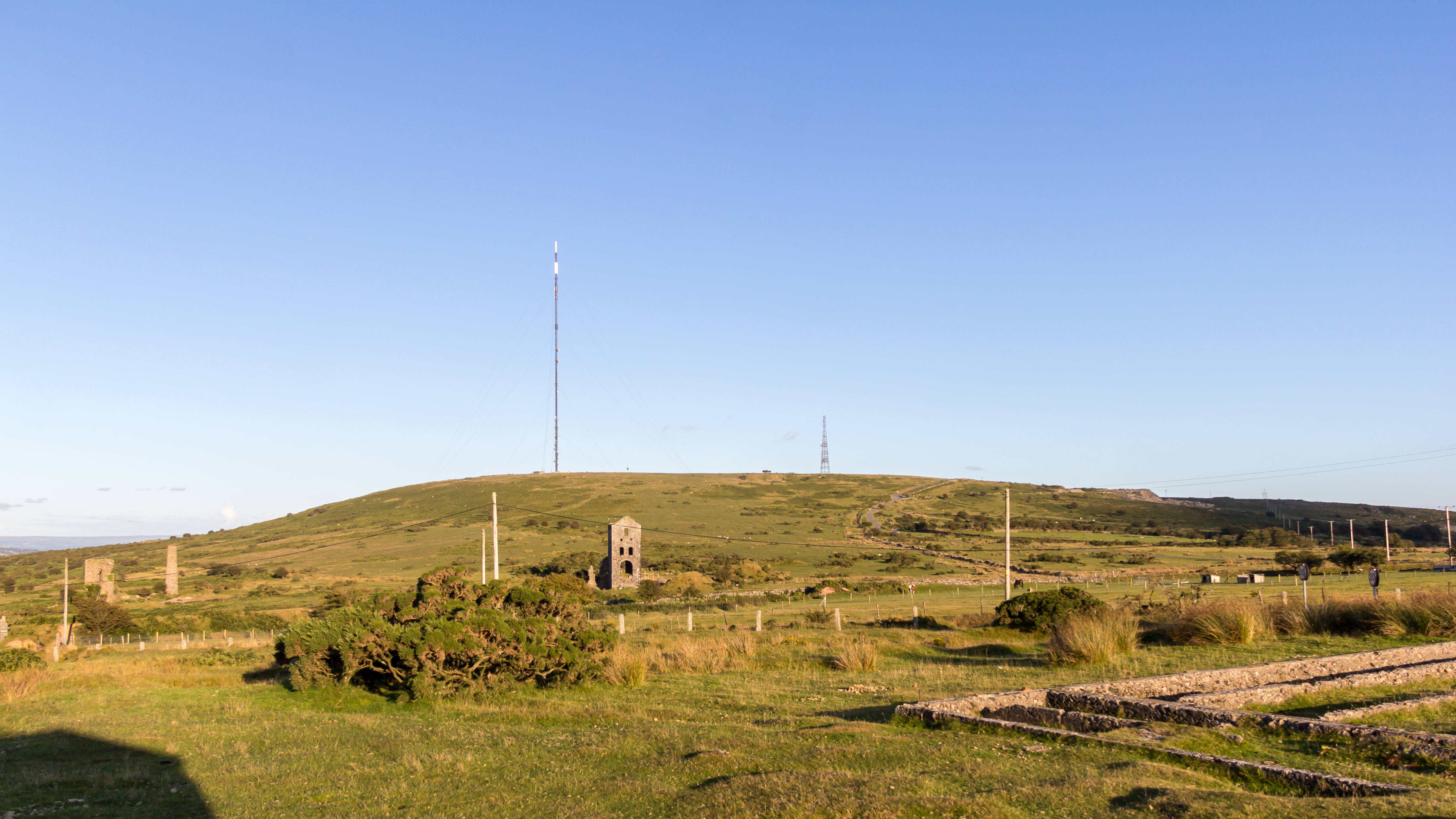
Caradon Hill ( kw, Bre Garn) is on Bodmin Moor in the former Caradon district of Cornwall, England, United Kingdom. The summit is above mean sea level. Caradon Hill is on the southeastern edge of the moor; it is between the villages of Minions (northwest), Upton Cross (northeast), Pensilva (southeast) and Darite (southwest). The hill was once famous for its copper mines but these are now closed. The South Caradon Copper Mine, 1 km to the SW of the transmitter, was the biggest copper mine in the UK in its heyday in the second half of the 19th century. Other disused copper and tin mines are scattered around the base of the hill, including the Wheal Phoenix, well known among mineral collectors. The ruins of the Prince of Wales engine house are prominent at Wheal Phoenix. at < ... [...More Info...] [...Related Items...] OR: [Wikipedia] [Google] [Baidu] |
Liskeard
Liskeard ( ; kw, Lyskerrys) is a small ancient stannary and market town in south-east Cornwall, South West England. It is situated approximately 20 miles (32 km) west of Plymouth, west of the Devon border, and 12 miles (20 km) east of Bodmin. The Bodmin Moor lies to the north-west of the town. The total population of the town at the 2011 census was 11,366 History The Cornish place name element ''Lis'', along with ancient privileges accorded the town, indicates that the settlement was once a high status 'court'. King Dungarth whose cross is a few miles north near St Cleer is thought to be a descendant of the early 8th century king Gerren of Dumnonia and is said to have held his court in Liskeard (''Lis-Cerruyt''). Liskeard (Liscarret) was at the time of the Domesday Survey an important manor with a mill rendering 12d. yearly and a market rendering 4s. William the Conqueror gave it to Robert, Count of Mortain by whom it was held in demesne. Ever since that time ... [...More Info...] [...Related Items...] OR: [Wikipedia] [Google] [Baidu] |
Launceston, Cornwall
Launceston ( or , locally or , kw, Lannstevan; rarely spelled Lanson as a local abbreviation) is a town, ancient borough, and civil parish in Cornwall, England, United Kingdom. It is west of the middle stage of the River Tamar, which constitutes almost the entire border between Cornwall and Devon. The landscape of the town is generally steep particularly at a sharp south-western knoll topped by Launceston Castle. These gradients fall down to the River Kensey and smaller tributaries. The town centre itself is bypassed and is no longer physically a main thoroughfare. The A388 still runs through the town close to the centre. The town remains figuratively the "gateway to Cornwall", due to having the A30, one of the two dual carriageways into the county, pass directly next to the town. The other dual carriageway and alternative main point of entry is the A38 at Saltash over the Tamar Bridge and was completed in 1962. There are smaller points of entry to Cornwall on minor ... [...More Info...] [...Related Items...] OR: [Wikipedia] [Google] [Baidu] |
Linkinhorne
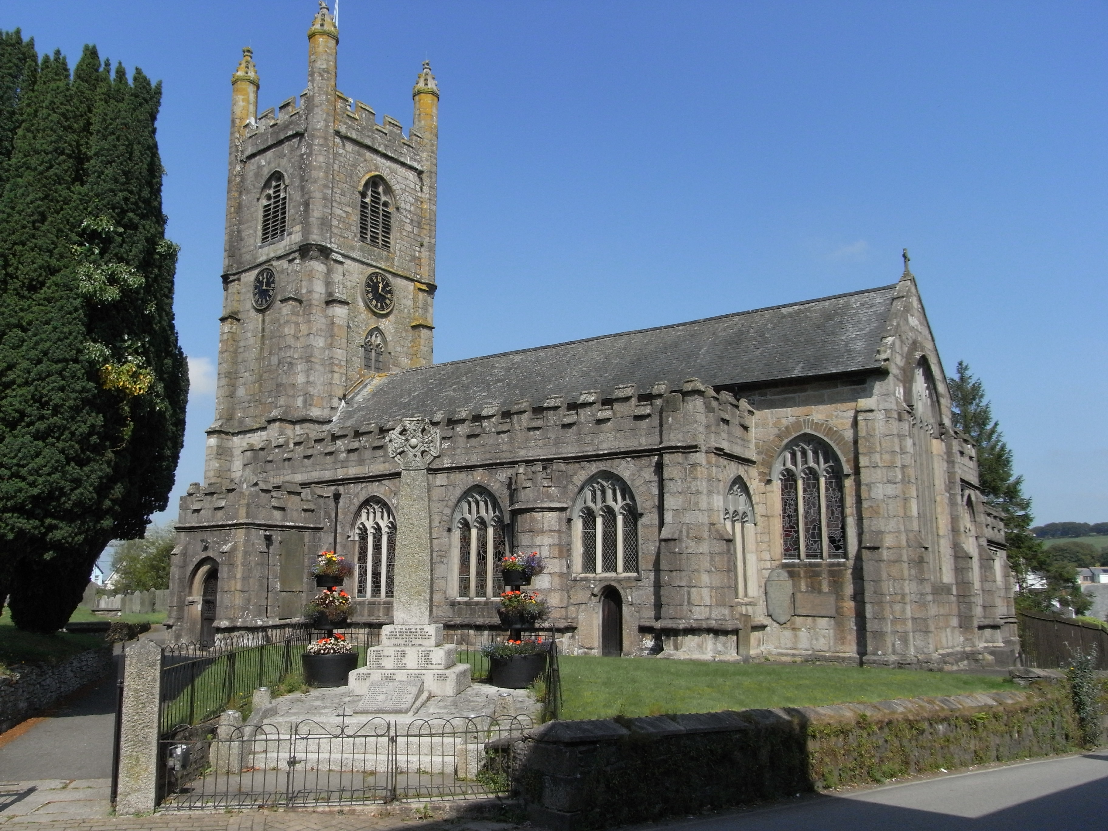
Linkinhorne (in Cornish ''Lanngynhorn'') is a civil parish and village in southeast Cornwall, England, United Kingdom. The village itself is situated at and is approximately four miles (6.5 km) northwest of Callington and seven miles (11 km) south of Launceston.Ordnance Survey: Landranger map sheet 201 ''Plymouth & Launceston'' The parish population at the 2011 census including Downgate was 1,541 Geography As well as Linkinhorne village, other settlements in the parish include (in alphabetical order) Bray Shop, Caradon Town, Downgate, Henwood, Ley Mill, Minions, Plushabridge, Rilla Mill and Upton Cross. The area is bordered by the River Inny in the north-east and Bodmin Moor to the west. The valley of the River Lynher runs through the parish. History Linkinhorne parish is within the Deanery and Hundred of East and is bounded on the north by North Hill and Lezant, on the east by Stoke Climsland and South Hill, on the south and west by St Ive and St Cleer. ... [...More Info...] [...Related Items...] OR: [Wikipedia] [Google] [Baidu] |
Darleyford
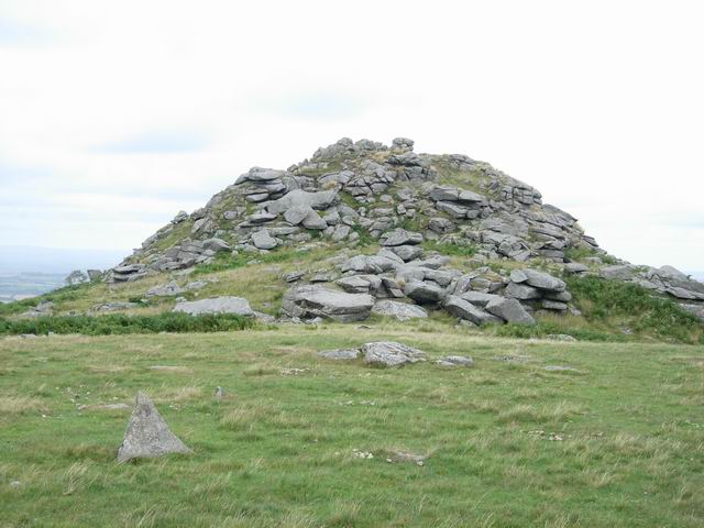
Darleyford ( kw, Rys Dowr Legh, meaning ''ford of the rock slab river'') is a Hamlet (place), hamlet in the parish of Linkinhorne in Cornwall, UK. The Darley Oak is a notable oak tree here. References Hamlets in Cornwall {{Cornwall-geo-stub ... [...More Info...] [...Related Items...] OR: [Wikipedia] [Google] [Baidu] |
Darley Oak
The Darley Oak is a Pedunculate oak tree (''Quercus robur'') which grows near Darleyford in the parish of Linkinhorne on the edge of Bodmin Moor, Cornwall, England, UK. This ancient tree is thought to be at least 1,000 years old, and a considerable number of legends take it as their core. Folk tradition attributes healing properties to the tree, and it is said that any wish made to it will eventually come true. Its acorns are also used as amulets, and were once used by pregnant women during pregnancy, to bring them luck. It was chosen one of the 50 Great British Trees by The Tree Council in 2002. See also *List of Great British Trees *List of individual trees The following is a list of notable trees. Trees listed here are regarded as important or specific by their historical, national, locational, natural or mythological context. The list includes actual trees located throughout the world, as well as ... References {{Reflist Individual oak trees Individual trees in Engl ... [...More Info...] [...Related Items...] OR: [Wikipedia] [Google] [Baidu] |
The Woodland Trust
The Woodland Trust is the largest woodland conservation charity in the United Kingdom and is concerned with the creation, protection, and restoration of native woodland heritage. It has planted over 50 million trees since 1972. The Woodland Trust has three aims: to protect ancient woodland which is rare, unique and irreplaceable, to promote the restoration of damaged ancient woodland, and to plant native trees and woods to benefit people and wildlife. The Woodland Trust maintains ownership of over 1,000 sites covering over 24,700 hectares (247 km2). Of this, 8,070ha (33%) is ancient woodland. It ensures public access to its woods. History The charity was founded in Devon, England in 1972 by retired farmer and agricultural machinery dealer Kenneth Watkins. The Trust's first purchase was part of the Avon Valley Woods, near Kingsbridge, Devon. By 1977 it had 22 woods in six counties. In 1978 it relocated to Grantham in Lincolnshire and announced an expansion of its activit ... [...More Info...] [...Related Items...] OR: [Wikipedia] [Google] [Baidu] |
The Tree Council
The Tree Council was founded in 1974 in the United Kingdom, and became a Charitable organization#Charity registration, registered charity in 1978. Its primary objective is to act as an umbrella organisation for local groups involved in the planting, care and conservation of trees throughout the United Kingdom, and followed the successful government-sponsored Plant A Tree In '73 campaign. The charity is based at Canada Water, Surrey Quays, London. Its initiatives include: * In 2002, selecting Great British Trees, 50 Great British Trees to honour the Queen's Golden Jubilee of Elizabeth II, Golden Jubilee of accession to the throne * Supporting the UK government's The Big Tree Plant, Big Tree Plant campaign, which planted one million trees between 2011 and 2015 * Supporting the 2017 Charter for Trees, Woods and People * Supporting the Queen's Green Canopy to mark her Platinum Jubilee of Elizabeth II, Platinum Jubilee in 2022 * Organising National Tree Week in November each year __NO ... [...More Info...] [...Related Items...] OR: [Wikipedia] [Google] [Baidu] |
Yarg
Cornish Yarg is a semi-hard cow's milk cheese made in Cornwall, United Kingdom. Before being left to mature, the cheese is wrapped in nettle leaves to form an edible, though mouldy, rind. The texture varies from creamy and soft immediately under the nettle coating to a Caerphilly cheese-like crumbly texture in the middle. Production Although made according to an historic method, Cornish Yarg is actually the product of the British cheesemaking renaissance in the 1980s while its roots are inspired by traditional British Territorial cheeses. The cheese is produced at Lynher Dairies Cheese Company on Pengreep Farm near Truro, by Catherine Mead, Dane Hopkins and team. "Yarg" is simply "Gray" spelt backwards. It is named after Alan and Jenny Gray, enterprising farmers who found a 1615 recipe by Gervase Markham Gervase (or Jervis) Markham (ca. 1568 – 3 February 1637) was an English poet and writer. He was best known for his work '' The English Huswife, Containing the In ... [...More Info...] [...Related Items...] OR: [Wikipedia] [Google] [Baidu] |


