|
Ulpia Oescus
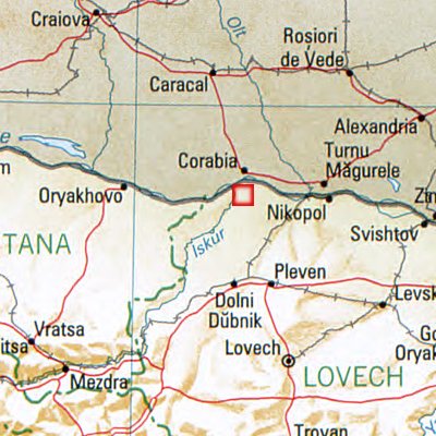
Oescus, Palatiolon or Palatiolum ( bg, Улпия Ескус, ) was an important ancient city on the Danube river in Roman Moesia. It later became known as ''Ulpia Oescus''. It lay northwest of the modern Bulgarian city of Pleven, near the village of Gigen. For a short time it was linked by the longest and most famous stone bridge across the Danube, Constantine's Bridge, with the ancient city of Sucidava (modern-day Corabia, Romania). The city seems to have at one point reached a area of 280,000 m2 and a population of 100,000. Archaeological excavations have brought to light parts of the ancient city and are continuing. Etymology The name of the Roman town comes from the river Oescus (today Iskar). It probably meant "water" in the local Thracian dialect. History The Greek geographer Claudius Ptolemy (ca. 90–168 AD) described Ulpia Oescus as a city of the Triballi, an independent ancient tribe which inhabited today’s northwestern Bulgaria. Under Roman rule, O ... [...More Info...] [...Related Items...] OR: [Wikipedia] [Google] [Baidu] |
Legio V Macedonica
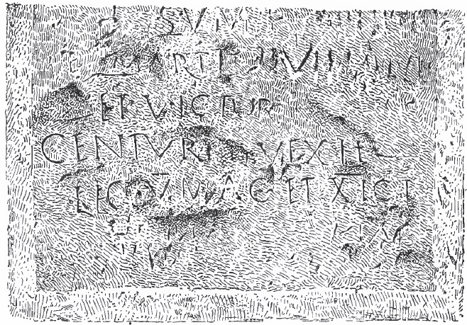
''Legio V Macedonica'' (the Fifth Macedonian Legion) was a Roman legion. It was probably originally levied in 43 BC by consul Gaius Vibius Pansa Caetronianus and Gaius Iulius Caesar Octavianus (later known as the Emperor Augustus). It was based in the Balkan provinces of Macedonia, Moesia and Dacia. In the Notitia Dignitatum records from beginning of the fifth century, the legion was still stationed in Dacia, with detachments stationed in the east and Egypt. The last known evidence shows the legion, or detachments from it, stationed in Egypt in the seventh century one or two years before the Islamic conquest of Egypt. It is often assumed that the legion fought in this war and was destroyed, although it is uncertain whether detachments or the whole legion were in Egypt, and there is no further evidence of the legion's eventual fate. Its symbol was the bull, but the eagle was used as well. History 1st century BC: Creation and deployment in Macedonia The Legio V was one of th ... [...More Info...] [...Related Items...] OR: [Wikipedia] [Google] [Baidu] |
Corabia
Corabia () is a small Danube port located in Olt County, Oltenia, Romania, which used to be part of the now-dissolved Romanați County before World War II. Across the Danube from Corabia lies the Bulgarian village of Gigen. History Beneath Corabia, around the former village of Celei, lie the remains of Sucidava, an old Dacian and Roman town and fortress. Near the town, Emperor Constantine the Great built the longest European bridge over the Danube (). The bridge was destroyed during the Avar invasions, probably in the 7th century. The ruins also contain an old Roman bath and an old basilica. The name ''Corabia'' reflects the fact that the new settlement was built from the remains of a wrecked Genoan ship (''corabia'' is the Romanian language term for "sailing ship", specifically used for "galley"). It became a thriving port in the 1880s. Under the communist regime, Corabia developed as a considerable manufacturing town, with a sugar mill, furniture factory, tannery, a fiber ... [...More Info...] [...Related Items...] OR: [Wikipedia] [Google] [Baidu] |
Pautalia
Pautalia is one of the great ancient cities of Thrace, now located in Kyustendil, Bulgaria. It was a settlement of the Dentheletae, a Thracian tribe, and had been occupied since at least the Iron Age. It is noted for its temple of Asclepius on the hill of Hissarlaka (Hisarlaka). The name is Thracian and means "spring city", referring to the hot springs there. The earliest preserved mention of the city is in a list of 135 Roman Municipia in Thrace from 106 C.E. which list included the settlements on the site of today's Sofia, Plovdiv and Stara Zagora. From the first name of Emperor Trajan Pautalia received its first name — Ulpia Pautalia. During the regnum of the Roman Empire Pautalia minted his own coins, from the time of emperors Antoninus Pius to Caracalla, and possibly into the reign of Elagabalus. The urban planning of Pautalia was similar to that of other ancient Greek and Asia Minor cities. However, the ancient Pautalia streets are noticeably wider than other ancient citi ... [...More Info...] [...Related Items...] OR: [Wikipedia] [Google] [Baidu] |
Stobi
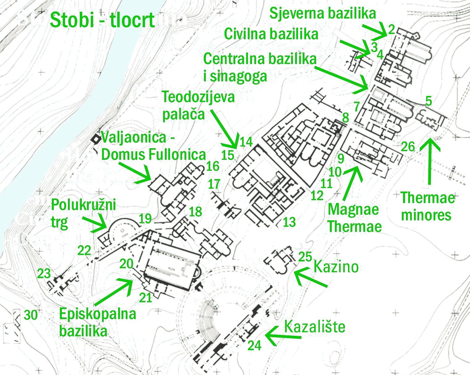
Stobi or Stoboi ( grc, Στόβοι, Stóboi; la, Stobi; mk, Стоби, Stobi), was an ancient town of Paeonia, later conquered by Macedon, and finally turned into the capital of the Roman province of Macedonia Salutaris. It is located near Gradsko, North Macedonia, on the main road that leads from the Danube to the Aegean Sea and is considered by many to be the most famous archaeological site in North Macedonia. Stobi was built where the Erigon (Crna River) joins the Axios (Vardar), making it strategically important as a center for both trade and warfare. The pre-Roman period Stobi developed from a Paeonian settlement established in the Archaic period. Located on the northern side of a terrace, the early town covered an area of about . Its proximity to the junction of the Erigón and Axiós Rivers as well as its position in the fertile central Vardar valley allowed it quickly to develop a flourishing economy and to establish trade. Nearby Mount Klepa was a lucrative s ... [...More Info...] [...Related Items...] OR: [Wikipedia] [Google] [Baidu] |
Heraclea Lyncestis
Heraclea Lyncestis, also transliterated Herakleia Lynkestis ( grc, Ἡράκλεια Λυγκηστίς; la, Heraclea Lyncestis; mk, Хераклеја Линкестис), was an ancient Greek city in Macedon, ruled later by the Romans. Its ruins are situated south of the present-day town of Bitola, North Macedonia. In the early Christian period, Heraclea was an important Episcopal seat and a waypoint on the Via Egnatia that once linked Byzantium with Rome through the Adriatic seaport Dyrrachium. Some of its bishops are mentioned in synods in Serdica and other nearby towns. The city was gradually abandoned in the 6th century AD following an earthquake and Slavic invasions. Foundation by Philip II It was founded by Philip II of Macedon in the middle of the 4th century BC. The city was named in honor of the mythological hero Heracles. The name ''Lynkestis'' originates from the name of the ancient kingdom, conquered by Philip, where the city was built. Heraclea was a stra ... [...More Info...] [...Related Items...] OR: [Wikipedia] [Google] [Baidu] |
Via Egnatia
The Via Egnatia was a road constructed by the Romans in the 2nd century BC. It crossed Illyricum, Macedonia, and Thracia, running through territory that is now part of modern Albania Albania ( ; sq, Shqipëri or ), or , also or . officially the Republic of Albania ( sq, Republika e Shqipërisë), is a country in Southeastern Europe. It is located on the Adriatic and Ionian Seas within the Mediterranean Sea and shares ..., North Macedonia, Greece, and European Turkey as a continuation of the Via Appia. Starting at Dyrrachium (now Durrës) on the Adriatic Sea, the road followed a difficult route along the river Genusus (Shkumbin), over the ''Candaviae'' (Jablanica Mountain, Jablanica) mountains and thence to the highlands around Lake Ohrid. It then turned south, following several high mountain passes to reach the northern coastline of the Aegean Sea at Thessalonica. From there it ran through Thrace to the city of Byzantium (later Constantinople, now Istanbul). It co ... [...More Info...] [...Related Items...] OR: [Wikipedia] [Google] [Baidu] |
Danubian Limes
The Danubian Limes (german: Donaulimes), or Danube Limes, refers to the Roman military frontier or ''limes'' which lies along the River Danube in the present-day German state of Bavaria, in Austria, Slovakia, Hungary, Croatia, Serbia, Bulgaria and Romania. The Danube was not always or everywhere used by the Romans as the military frontier which was moved north or south in some locations according to military conquests, but it was maintained in many places as a fairly permanent defensive structure for long periods. The border was reinforced with numerous watchtowers, legion camps (''castra'') and forts (''castella''). Due to the boggy and dendritic nature of the Danube's river banks no border ramparts were built, unlike the Neckar-Odenwald Limes in Germany. The camps were built in the mid-1st century. Later, under Trajan, the camps, which had originally only been surrounded by earthen embankments, were enclosed by stone walls. A Roman road, the Danube Way ( la, Via Istrum) was la ... [...More Info...] [...Related Items...] OR: [Wikipedia] [Google] [Baidu] |
Triballi
The Triballi ( grc, Τριβαλλοί, Triballoí, lat, Triballi) were an ancient people who lived in northern Bulgaria in the region of Roman Oescus up to southeastern Serbia, possibly near the territory of the Morava Valley in the late Iron Age. The Triballi lived between Thracians to the east, Illyrians the west and Celts to the north and were influenced by them. As such in contemporary sources, they are variably described as an independent, Thracian, Illyrian or Celtic tribe. As an existing people, the Triballi are mentioned for the last time by Roman historian Appian (2nd century CE). According to Appian, the Triballi were reduced in numbers through their wars against the Scordisci and fled among the Getae, north of the Danube before they went extinct as a distinct people. History The Triballi ( grc, Τριβαλλοί, Triballoí) are mentioned for the first in history by ancient Greek authors of Classical period: Aristotle and Demosthenes, both of whom lived in the 4th ... [...More Info...] [...Related Items...] OR: [Wikipedia] [Google] [Baidu] |
Ptolemy
Claudius Ptolemy (; grc-gre, Πτολεμαῖος, ; la, Claudius Ptolemaeus; AD) was a mathematician, astronomer, astrologer, geographer, and music theorist, who wrote about a dozen scientific treatises, three of which were of importance to later Byzantine, Islamic, and Western European science. The first is the astronomical treatise now known as the '' Almagest'', although it was originally entitled the ''Mathēmatikē Syntaxis'' or ''Mathematical Treatise'', and later known as ''The Greatest Treatise''. The second is the ''Geography'', which is a thorough discussion on maps and the geographic knowledge of the Greco-Roman world. The third is the astrological treatise in which he attempted to adapt horoscopic astrology to the Aristotelian natural philosophy of his day. This is sometimes known as the ''Apotelesmatika'' (lit. "On the Effects") but more commonly known as the '' Tetrábiblos'', from the Koine Greek meaning "Four Books", or by its Latin equivalent ''Quadrip ... [...More Info...] [...Related Items...] OR: [Wikipedia] [Google] [Baidu] |


