|
Ulhas
The Ulhas River is a river in Maharashtra, India. It is in the Thane, Raigad, and Pune districts of that state. It flows north and west from it source to where it splits into Vasai Creek and Thane Creek, near Thane. The Ulhas divides Salsette Island from the mainland, and is important for the water supply of Mumbai.https://censusindia.gov.in/2011census/dchb/2724_PART_B_DCHB_RAIGARH.pdf Gallery File:Ulhas River.jpg, Ulhas River at Kondhana village in Raigad district File:Ghodbunder2.jpg, The Ulhas River, as seen from Ghodbunder See also *List of rivers of India *Rivers of India The rivers in India play an important role in the lives of its people. They provide potable water, cheap transportation, electricity, and the livelihood for many people nationwide. This easily explains why nearly all the major cities of India are l ... * Seven Islands of Bombay References {{coord, 19, 18, N, 72, 50, E, display=title, region:IN_type:river_source:GNS-enwiki Rivers of Mah ... [...More Info...] [...Related Items...] OR: [Wikipedia] [Google] [Baidu] |
Thane District
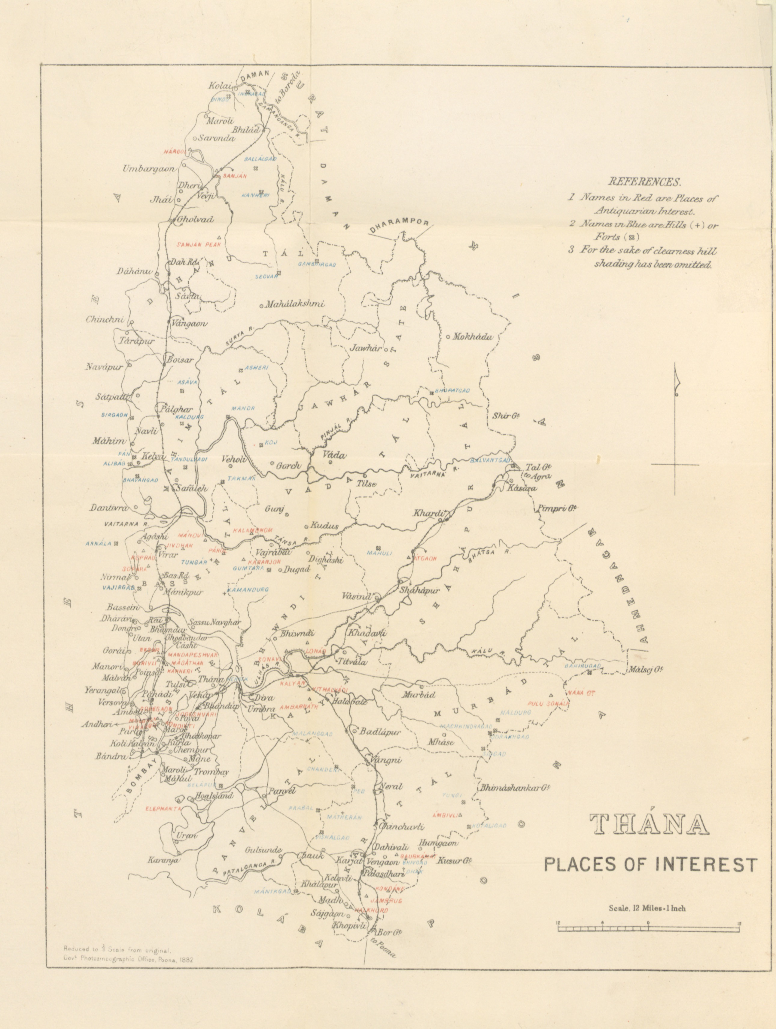
Thane district (Pronunciation: �ʰaːɳe previously named Taana or Thana) is a district in the Konkan Division of Maharashtra, India. At the 2011 Census it was the most populated district in the country, with 11,060,148 inhabitants; however, in August 2014 the district was split into two with the creation of a new Palghar district, leaving the reduced Thane district with a 2011 Census population of 8,070,032. The headquarters of the district is the city of Thane. Other major cities in the district are Navi Mumbai, Kalyan-Dombivli, Mira-Bhayander, Bhiwandi, Ulhasnagar, Ambarnath, Badlapur, Murbad and Shahapur. The district is situated between 18°42' and 20°20' north latitudes and 72°45' and 73°48' east longitudes. The revised area of the district is 4,214 km2. The district is bounded by Nashik district to the north east, Pune and Ahmednagar districts to the east, and by Palghar district to the north. The Arabian Sea forms the western boundary, while it is bounded by M ... [...More Info...] [...Related Items...] OR: [Wikipedia] [Google] [Baidu] |
Palghar District
Palghar District (Marathi pronunciation: aːlɡʱəɾ is a district in the state of Maharashtra in Konkan Division. On 1 Aug 2014, the State government of Maharashtra announced the formation of the 36th district of Maharashtra Palghar, it was partitioned out of the Thane district. Palghar District starts from Dahanu at the north and ends at Naigaon. It comprises the talukas of Palghar, Vada, Vikramgad, Jawhar, Mokhada, Dahanu, Talasari and Vasai. At the 2011 Census, the talukas now comprising the district had a population of 2,990,116. Palghar has an urban population of 1,435,210, that is 48% of total population is living in Urbanized Area. Palghar has all the three categories of the lifestyles, Urban (Nagari), Coastal (Sagari) and Mountains-Hilly Region (Dongari). Palghar District is blessed by beautiful beaches as it is the part of konkan such as "Shirgaon Beach", "Kelve Beach'', "Vadrai Beach", "Dahanu Beach", "Bordi Beach", "Chinchani Beach", "Arnala Beach", "Rajodi Be ... [...More Info...] [...Related Items...] OR: [Wikipedia] [Google] [Baidu] |
Thane
Thane (; also known as Thana, the official name until 1996) is a metropolitan city in Maharashtra, India. It is situated in the north-eastern portion of the Salsette Island. Thane city is entirely within Thane taluka, one of the seven talukas of Thane district; also, it is the headquarters of the namesake district. With a population of 1,841,488 distributed over a land area of about , Thane city is the 15th most populated city in India with a population of 1,890,000 according to the 2011 census. Located on the northwestern side of the state of Maharashtra, the city is an immediate neighbour of Mumbai city and a part of the Mumbai Metropolitan Region. Etymology and other names The ancient name of Thana was . It appears as in early medieval Arab sources. The name Thane has been variously Romanised as Tana, Thana, Thâṇâ, and Thame. Ibn Battuta and Abulfeda knew it as KukinTana; Duarte Barbosa as TanaMayambu. Before 1996, the city was called 'Thana', the British spelling ... [...More Info...] [...Related Items...] OR: [Wikipedia] [Google] [Baidu] |
List Of Rivers Of India
This is a list of rivers of India, starting in the west and moving along the Indian coast southward, then northward. Tributary rivers are listed hierarchically in upstream order: the lower in the list, the more upstream. The overall discharge of rivers in India or passing/originating in India : List of rivers of India by discharge The major rivers of India are: * Flowing into the Arabian Sea: Narmada, Tapi, Sindhu, Sabarmati, Mahi, Purna * Flowing into the Bay of Bengal: Brahmaputra, Yamuna, Ganga, Meghna, Mahanadi, Godavari, Krishna, Kaveri, Penna River Mizoram and Bangladesh. Meghna River Basin The Meghna-Surma-Barak River System is located in India and Bangladesh. * Meghna River (in the Bangladesh) ** ** Dhaleshwari River ** Dakatia River ** Gumti River ** Feni River ** Tista River, also called the Haora River ** Surma River *** Kangsha River **** Someshwari River ** Kushiyara River *** Manu River ** Barak River *** Tuivai River *** Irang River Ganges River Ba ... [...More Info...] [...Related Items...] OR: [Wikipedia] [Google] [Baidu] |
Salsette Island
Salsette Island is an island in Konkan division of the state of Maharashtra on India's west coast. Administratively known as Greater Mumbai, the city district of Mumbai, Mumbai Suburban District, Mira Bhayander and a portion of Thane lie within it, making it very populous and one of the most densely populated islands in the world. It has a population of more 20 million inhabitants living on an area of about . Location Salsette is bounded on the north by Vasai Creek, on the northeast by the Ulhas River, on the east by Thane Creek and Mumbai Harbour, and on the south and west by the Arabian Sea. The original seven islands of Mumbai, which were merged by land reclamation during the 19th and early 20th centuries to form the city of Mumbai, are now practically a southward protruding peninsula of the much larger Salsette Island. The island of Trombay that was to the southeast of Salsette is today part of Salsette as much of the intervening swamps have been reclaimed. It contains ... [...More Info...] [...Related Items...] OR: [Wikipedia] [Google] [Baidu] |
Vasai Creek
Vasai Creek, previously Bassein Creek, is an estuary and one of the two main distributaries of the Ulhas River, in Konkan division of Maharashtra, India. The Ulhas splits at the northeast corner of Salsette island into its two main distributaries, the other one being the Thane Creek, both of which empty west into the Arabian Sea at the Bombay Harbour. The creek forms the northern boundary of Salsette island and separates the island from mainland of Konkan, on which lie the twin cities of Vasai-Virar. The creek separates the northern most part from. To the south of the creek lies Bhayandar suburb of Mumbai (Bombay) district& to the north of the creek lies Naigaon in Vasai (Bassein). Two rail bridges pass through Panju Island which lies in between the satellite cities of Vasai-Virar and Mumbai (Bombay). The old railway crossing bridge was supposedly built in British Bombay, and has been closed since it was declared too dangerous to cross. The two new bridges are functional and ... [...More Info...] [...Related Items...] OR: [Wikipedia] [Google] [Baidu] |
Thane Creek
Thane Creek (or Thana Creek) is an inlet in the shoreline of the Arabian Sea that isolates the city of Mumbai (Bombay) from the Konkan region of the Indian mainland. It comprises the area between Mumbra Retibunder and the Mankhurd-Vashi Bridge. The creek is divided into two parts. The first part lies between Ghodbunder and Thane (Thana), a section from where the Ulhas river flows from the north of Mumbai Island to meet the Arabian Sea on the west. The second part of the waterway lies between the city of Thane and the Arabian Sea at Trombay / Uran, before the Gharapuri islands. Thane Creek was formed due to a seismic fault lying below it which runs from Uran to Thane. In antiquity, Thane served as the capital of the Sheelahar kingdom, and was a large functional port for trade with the Arabian peninsula, along with other ports, such as Ghodbunder and Nagla Bunder. The region of the Thane Creek has been recognized as an Important Bird Area by the Bombay Natural History Society, ... [...More Info...] [...Related Items...] OR: [Wikipedia] [Google] [Baidu] |
Mumbai
Mumbai (, ; also known as Bombay — the official name until 1995) is the capital city of the Indian state of Maharashtra and the ''de facto'' financial centre of India. According to the United Nations, as of 2018, Mumbai is the second-most populous city in India after Delhi and the eighth-most populous city in the world with a population of roughly 20 million (2 crore). As per the Indian government population census of 2011, Mumbai was the most populous city in India with an estimated city proper population of 12.5 million (1.25 crore) living under the Brihanmumbai Municipal Corporation. Mumbai is the centre of the Mumbai Metropolitan Region, the sixth most populous metropolitan area in the world with a population of over 23 million (2.3 crore). Mumbai lies on the Konkan coast on the west coast of India and has a deep natural harbour. In 2008, Mumbai was named an alpha world city. It has the highest number of millionaires and billionaires among all cities i ... [...More Info...] [...Related Items...] OR: [Wikipedia] [Google] [Baidu] |
Raigad District
Raigad district (Marathi pronunciation: Help:IPA/Marathi, [ɾaːjɡəɖ]), previously Colaba fort, Colaba district, is a district in the Konkan division of Maharashtra, India. The district was renamed to Raigad fort, Raigad after the fort that was the first capital of the former Maratha Empire, which in turn was renamed from its earlier name - Rairi. The fort is located in the interior regions of the district, in dense forests on a west-facing spur of the Western Ghats of Sahyadri Range. In 2011 the district had a population of 2,634,200, compared to 2,207,929 in 2001. The name was changed in the regime of Chief Minister A. R. Antulay on 1 January 1981. In 2011 urban dwellers had increased to 36.91% from 24.22% in 2001. Alibag is the headquarters of Raigad district. Raigad district's neighbouring districts are Mumbai, Thane districts on North, Pune district on East, Satara district on South East, Ratnagiri district is present on South side and Arabian sea on West. History Kula ... [...More Info...] [...Related Items...] OR: [Wikipedia] [Google] [Baidu] |
Pune District
Pune district (Marathi pronunciation: Help:IPA/Marathi, [puɳeː]) is the most populous district in the Indian state of Maharashtra. The district's population was 9,429,408 in the 2011 census, making it the fourth most populous district amongst India's 640 List of districts in India, districts. This district has an urban population of 58.08 percent of its total. It is one of the most industrialized districts in India. In recent decades it has also become a hub for information technology. Officer Members of Parliament *Girish Bapat (Bharatiya Janata Party, BJP) - *Supriya Sule (Nationalist Congress Party, NCP) - *Amol Kolhe, Dr. Amol Kolhe (Nationalist Congress Party, NCP) - *Shrirang Barne (Balasahebanchi Shiv Sena, BSS) - Guardian Minister list of Guardian Minister District Magistrate/Collector list of District Magistrate / Collector District Justice District Police Commissioner list of District Police Commissioner President & Vice-President ... [...More Info...] [...Related Items...] OR: [Wikipedia] [Google] [Baidu] |
Arabian Sea
The Arabian Sea ( ar, اَلْبَحرْ ٱلْعَرَبِيُّ, Al-Bahr al-ˁArabī) is a region of the northern Indian Ocean bounded on the north by Pakistan, Iran and the Gulf of Oman, on the west by the Gulf of Aden, Guardafui Channel and the Arabian Peninsula, on the southeast by the Laccadive Sea and the Maldives, on the southwest by Somalia, and on the east by India. Its total area is 3,862,000 km2 (1,491,000 sq mi) and its maximum depth is 4,652 meters (15,262 ft). The Gulf of Aden in the west connects the Arabian Sea to the Red Sea through the strait of Bab-el-Mandeb, and the Gulf of Oman is in the northwest, connecting it to the Persian Gulf. Name The sea is named after Arabia, the historic name of the region to the west of the sea. The Arabian Sea's name in Arabic is ; in Persian it is دریای عرب; in Urdu it is بحیرہ عرب; in Hindi it is अरब सागर; in Gujarati it is અરબી સમુદ્ર; in Marathi it is ... [...More Info...] [...Related Items...] OR: [Wikipedia] [Google] [Baidu] |
Maharashtra
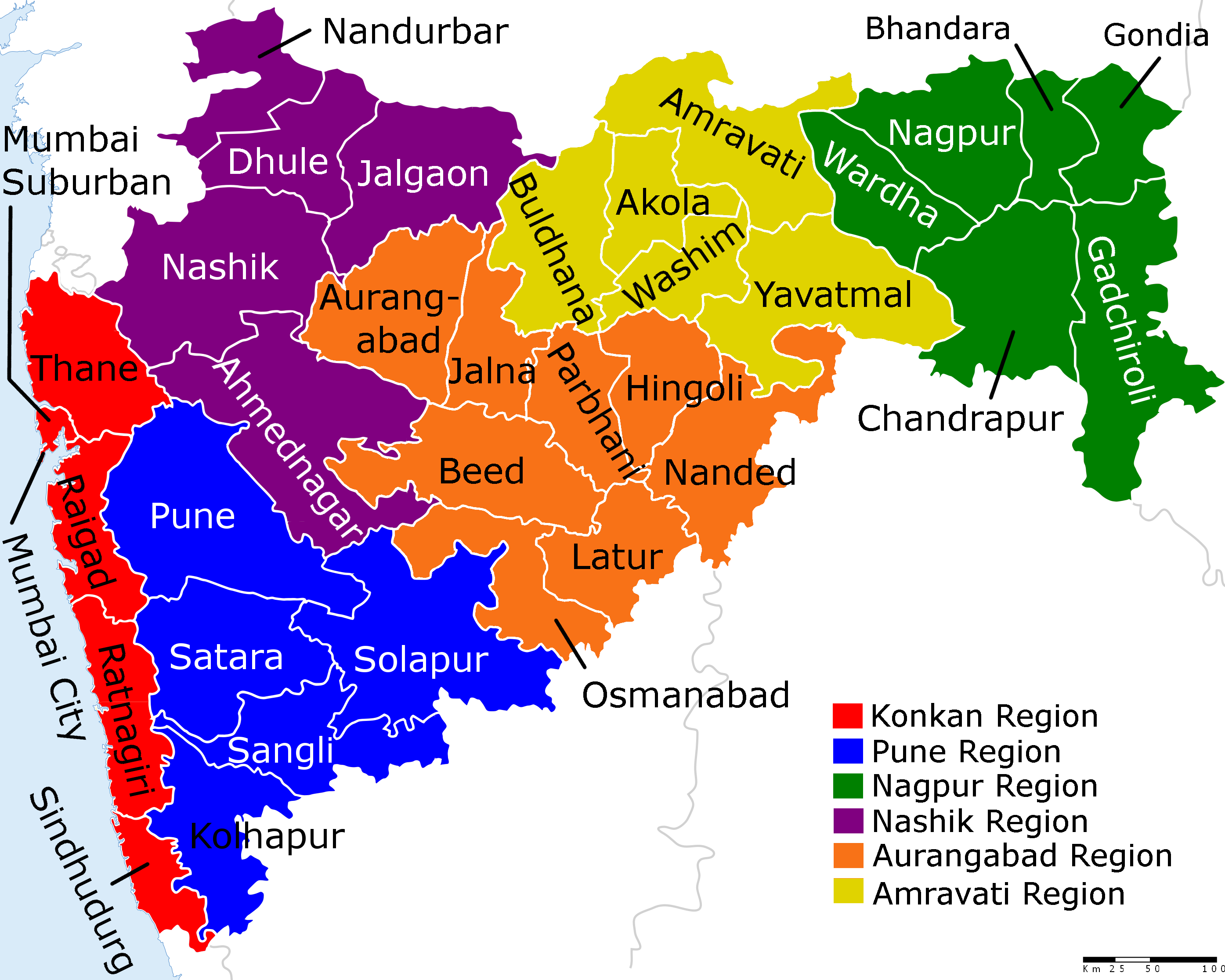
Maharashtra (; , abbr. MH or Maha) is a states and union territories of India, state in the western India, western peninsular region of India occupying a substantial portion of the Deccan Plateau. Maharashtra is the List of states and union territories of India by population, second-most populous state in India and the second-most populous country subdivision globally. It was formed on 1 May 1960 by splitting the bilingual Bombay State, which had existed since 1956, into majority Marathi language, Marathi-speaking Maharashtra and Gujarati language, Gujarati-speaking Gujarat. Maharashtra is home to the Marathi people, the predominant ethno-linguistic group, who speak the Marathi language, Marathi language, the official language of the state. The state is divided into 6 Divisions of Maharashtra, divisions and 36 List of districts of Maharashtra, districts, with the state capital being Mumbai, the List of million-plus urban agglomerations in India, most populous urban area in India ... [...More Info...] [...Related Items...] OR: [Wikipedia] [Google] [Baidu] |


.jpg)

