|
USS Evansville (PF-70)
USS ''Evansville'' (PF-70), a in commission from 1944 to 1945 and from 1950 to 1953, was the second ship of the United States Navy to be named for Evansville, Indiana. She also served in the Soviet Navy as ''EK-30'' and in the Japan Maritime Self-Defense Force as JDS ''Keyaki'' (PF-15), JDS ''Keyaki'' (PF-295) and ''YAC-21''. Construction and commissioning ''Evansville'' was launched on 27 November 1943, by the Leathem D. Smith Shipbuilding Company at Sturgeon Bay, Wisconsin, sponsored by Mrs. Don Davis, daughter of the Mayor of Evansville, Indiana. She was commissioned on 4 December 1944. Service history U.S. Navy, World War II, 1944-1945 ''Evansville'' steamed down the Mississippi River and after calling at Mobile, Alabama, reached Charleston, South Carolina, on 31 December 1944. Through the next six months, she had escort duty along the United States East Coast and to Bermuda, patrolled off New York, and served briefly as a weather ship on ocean weather stat ... [...More Info...] [...Related Items...] OR: [Wikipedia] [Google] [Baidu] |
Evansville
Evansville is a city in, and the county seat of, Vanderburgh County, Indiana, United States. The population was 118,414 at the 2020 census, making it the state's third-most populous city after Indianapolis and Fort Wayne, the largest city in Southern Indiana, and the 249th-most populous city in the United States. It is the central city of the Evansville metropolitan area, a hub of commercial, medical, and cultural activity of southwestern Indiana and the Illinois–Indiana–Kentucky tri-state area, that is home to over 911,000 people. The 38th parallel crosses the north side of the city and is marked on Interstate 69. Situated on an oxbow in the Ohio River, the city is often referred to as the "Crescent Valley" or "River City". Early French explorers named it ''La Belle Rivière'' ("The Beautiful River"). The area has been inhabited by various indigenous cultures for millennia, dating back at least 10,000 years. Angel Mounds was a permanent settlement of the Mississippian c ... [...More Info...] [...Related Items...] OR: [Wikipedia] [Google] [Baidu] |
Ship Naming And Launching
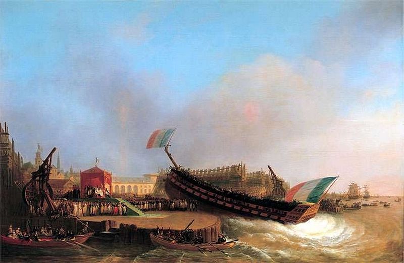
Ceremonial ship launching involves the performance of ceremonies associated with the process of transferring a vessel to the water. It is a nautical tradition in many cultures, dating back thousands of years, to accompany the physical process with ceremonies which have been observed as public celebration and a solemn blessing, usually but not always, in association with the launch itself. Ship launching imposes stresses on the ship not met during normal operation and, in addition to the size and weight of the vessel, represents a considerable engineering challenge as well as a public spectacle. The process also involves many traditions intended to invite good luck, such as christening by breaking a sacrificial bottle of champagne over the bow as the ship is named aloud and launched. Methods There are three principal methods of conveying a new ship from building site to water, only two of which are called "launching". The oldest, most familiar, and most widely used is th ... [...More Info...] [...Related Items...] OR: [Wikipedia] [Google] [Baidu] |
Project Hula
Project Hula was a program during World War II in which the United States transferred naval vessels to the Soviet Union in anticipation of the Soviets eventually joining the Pacific War, war against Japan, specifically in preparation for planned Soviet invasions of southern Sakhalin and the Kuril islands. Based at Cold Bay, Alaska, Cold Bay in the Territory of Alaska, the project was active during the spring and summer of 1945. It was the largest and most ambitious transfer program of World War II. Origins of Project Hula The Russian Empire and Empire of Japan, Japan had previously fought the Russo-Japanese War in 1904–1905, followed by Japan sending troops into Siberia during the Russian Civil War in the Siberian Intervention of 1918–1920. Animosities continued as the two countries remained rivals in Northeast Asia after the establishment of the Soviet Union. Japans increasingly aggressive political and military behavior in East Asia during the 1930s led to border clashes ... [...More Info...] [...Related Items...] OR: [Wikipedia] [Google] [Baidu] |
Ocean Weather Station
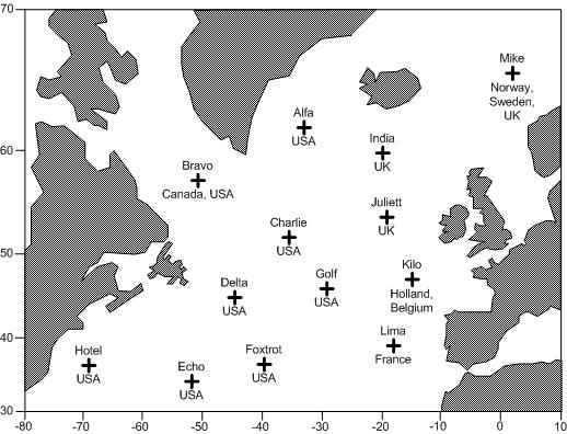
A weather ship, or ocean station vessel, was a ship stationed in the ocean for surface and upper air meteorological observations for use in weather forecasting. They were primarily located in the north Atlantic and north Pacific oceans, reporting via radio. The vessels aided in search and rescue operations, supported transatlantic flights, acted as research platforms for oceanographers, monitored marine pollution, and aided weather forecasting by weather forecasters and in computerized atmospheric models. Research vessels remain heavily used in oceanography, including physical oceanography and the integration of meteorological and climatological data in Earth system science. The idea of a stationary weather ship was proposed as early as 1921 by Météo-France to help support shipping and the coming of transatlantic aviation. They were used during World War II but had no means of defense, which led to the loss of several ships and many lives. On the whole, the establishment of ... [...More Info...] [...Related Items...] OR: [Wikipedia] [Google] [Baidu] |
Weather Ship
A weather ship, or ocean station vessel, was a ship stationed in the ocean for surface and upper air meteorological observations for use in weather forecasting. They were primarily located in the north Atlantic and north Pacific oceans, reporting via radio. The vessels aided in search and rescue operations, supported transatlantic flights, acted as research platforms for oceanographers, monitored marine pollution, and aided weather forecasting by weather forecasters and in computerized atmospheric models. Research vessels remain heavily used in oceanography, including physical oceanography and the integration of meteorological and climatological data in Earth system science. The idea of a stationary weather ship was proposed as early as 1921 by Météo-France to help support shipping and the coming of transatlantic aviation. They were used during World War II but had no means of defense, which led to the loss of several ships and many lives. On the whole, the establishment of wea ... [...More Info...] [...Related Items...] OR: [Wikipedia] [Google] [Baidu] |
New York City
New York, often called New York City or NYC, is the List of United States cities by population, most populous city in the United States. With a 2020 population of 8,804,190 distributed over , New York City is also the List of United States cities by population density, most densely populated major city in the United States, and is more than twice as populous as second-place Los Angeles. New York City lies at the southern tip of New York (state), New York State, and constitutes the geographical and demographic center of both the Northeast megalopolis and the New York metropolitan area, the largest metropolitan area in the world by urban area, urban landmass. With over 20.1 million people in its metropolitan statistical area and 23.5 million in its combined statistical area as of 2020, New York is one of the world's most populous Megacity, megacities, and over 58 million people live within of the city. New York City is a global city, global Culture of New ... [...More Info...] [...Related Items...] OR: [Wikipedia] [Google] [Baidu] |
Bermuda
) , anthem = "God Save the King" , song_type = National song , song = " Hail to Bermuda" , image_map = , map_caption = , image_map2 = , mapsize2 = , map_caption2 = , subdivision_type = Sovereign state , subdivision_name = , established_title2 = English settlement , established_date2 = 1609 (officially becoming part of the Colony of Virginia in 1612) , official_languages = English , demonym = Bermudian , capital = Hamilton , coordinates = , largest_city = Hamilton , ethnic_groups = , ethnic_groups_year = 2016 , government_type = Parliamentary dependency under a constitutional monarchy , leader_title1 = Monarch , leader_name1 = Charles III , leader_title2 = Governor , leader_name2 = Rena Lalgie , leader_title3 = Premier , leader_name3 = Edward David Burt , legislature = Parliament , upper_house = Senate , lower_house = House of Assembly , area_km2 = 53.2 , area_sq_mi = 20.54 , area_rank = , percent_water = 27 , elevation_max_m = 79 , ... [...More Info...] [...Related Items...] OR: [Wikipedia] [Google] [Baidu] |
United States East Coast
The East Coast of the United States, also known as the Eastern Seaboard, the Atlantic Coast, and the Atlantic Seaboard, is the coastline along which the Eastern United States meets the North Atlantic Ocean. The eastern seaboard contains the coastal states and areas east of the Appalachian Mountains that have shoreline on the Atlantic Ocean, namely, Maine, New Hampshire, Massachusetts, Rhode Island, Connecticut, New York, New Jersey, Delaware, Maryland, Virginia, North Carolina, South Carolina, Georgia, and Florida.General Reference Map , , 2003. Toponymy and composition T ...[...More Info...] [...Related Items...] OR: [Wikipedia] [Google] [Baidu] |
South Carolina
)''Animis opibusque parati'' ( for, , Latin, Prepared in mind and resources, links=no) , anthem = " Carolina";" South Carolina On My Mind" , Former = Province of South Carolina , seat = Columbia , LargestCity = Charleston , LargestMetro = Greenville (combined and metro) Columbia (urban) , BorderingStates = Georgia, North Carolina , OfficialLang = English , population_demonym = South Carolinian , Governor = , Lieutenant Governor = , Legislature = General Assembly , Upperhouse = Senate , Lowerhouse = House of Representatives , Judiciary = South Carolina Supreme Court , Senators = , Representative = 6 Republicans1 Democrat , postal_code = SC , TradAbbreviation = S.C. , area_rank = 40th , area_total_sq_mi = 32,020 , area_total_km2 = 82,932 , area_land_sq_mi = 30,109 , area_land_km2 = 77,982 , area_water_sq_mi = 1,911 , area_water_km2 = 4,949 , area_water_percent = 6 , population_rank = 23rd , population_as_of = 2022 , 2010Pop = 5282634 , population ... [...More Info...] [...Related Items...] OR: [Wikipedia] [Google] [Baidu] |
Charleston, South Carolina
Charleston is the largest city in the U.S. state of South Carolina, the county seat of Charleston County, and the principal city in the Charleston–North Charleston metropolitan area. The city lies just south of the geographical midpoint of South Carolina's coastline on Charleston Harbor, an inlet of the Atlantic Ocean formed by the confluence of the Ashley, Cooper, and Wando rivers. Charleston had a population of 150,277 at the 2020 census. The 2020 population of the Charleston metropolitan area, comprising Berkeley, Charleston, and Dorchester counties, was 799,636 residents, the third-largest in the state and the 74th-largest metropolitan statistical area in the United States. Charleston was founded in 1670 as Charles Town, honoring King CharlesII, at Albemarle Point on the west bank of the Ashley River (now Charles Towne Landing) but relocated in 1680 to its present site, which became the fifth-largest city in North America within ten years. It remained unincorpor ... [...More Info...] [...Related Items...] OR: [Wikipedia] [Google] [Baidu] |
Alabama
(We dare defend our rights) , anthem = "Alabama (state song), Alabama" , image_map = Alabama in United States.svg , seat = Montgomery, Alabama, Montgomery , LargestCity = Huntsville, Alabama, Huntsville , LargestCounty = Baldwin County, Alabama, Baldwin County , LargestMetro = Birmingham metropolitan area, Alabama, Greater Birmingham , area_total_km2 = 135,765 , area_total_sq_mi = 52,419 , area_land_km2 = 131,426 , area_land_sq_mi = 50,744 , area_water_km2 = 4,338 , area_water_sq_mi = 1,675 , area_water_percent = 3.2 , area_rank = 30th , length_km = 531 , length_mi = 330 , width_km = 305 , width_mi = 190 , Latitude = 30°11' N to 35° N , Longitude = 84°53' W to 88°28' W , elevation_m = 150 , elevation_ft = 500 , elevation_max_m = 735.5 , elevation_max_ft = 2,413 , elevation_max_point = Mount Cheaha , elevation_min_m = 0 , elevation_min_ft = 0 , elevation_min_point = Gulf of Mexico , OfficialLang = English language, English , Languages = * English ... [...More Info...] [...Related Items...] OR: [Wikipedia] [Google] [Baidu] |
Mobile, Alabama
Mobile ( , ) is a city and the county seat of Mobile County, Alabama, United States. The population within the city limits was 187,041 at the 2020 United States census, 2020 census, down from 195,111 at the 2010 United States census, 2010 census. It is the fourth-most-populous city in Alabama, after Huntsville, Alabama, Huntsville, Birmingham, Alabama, Birmingham, and Montgomery, Alabama, Montgomery. Alabama's only saltwater port, Mobile is located on the Mobile River at the head of Mobile Bay on the north-central Gulf Coast. The Port of Mobile has always played a key role in the economic health of the city, beginning with the settlement as an important trading center between the French colonization of the Americas, French colonists and Native Americans in the United States, Native Americans, down to its current role as the 12th-largest port in the United States.Drechsel, Emanuel. ''Mobilian Jargon: Linguistic and Sociohistorical Aspects of a Native American Pidgin''. New York: ... [...More Info...] [...Related Items...] OR: [Wikipedia] [Google] [Baidu] |

.jpg)


