|
Uruan
Uruan is located in the south of Nigeria and is a Local Government Area of the Akwa Ibom State. Uruan Local Government Area was created in 1988 from the Uyo Local Government Area. It covers an approximate land mass of 449 km2. Its population, according to the 2016 Census is 164,000. The Capital City of Uruan Local Government is Id[ The area lies in the rain forest belt with extensive arable land and the region abounds with the wildlife, raffia palm and timber. The rich coastal plains support the cultivation of crops such as cassava and maize. Uruan people speak the Uruan language. History Uruan people have maintained a good relationship with their neighbors. Their seven-clan structure is also maintained. This is the structure depicted during the coronation and burial of the Edidem Atakpor, the Nsomm of Uruan, by the presence of seven traditional bow-men, seven spear-men, seven sword-men, and seven royal staff-men each of which represent Essien Uruan. The principal deity of ... [...More Info...] [...Related Items...] OR: [Wikipedia] [Google] [Baidu] |
Idu, Akwa Ibom
Idu is both a central village and the headquarters of Uruan local government area of Akwa Ibom state in Nigeria Nigeria ( ), , ig, Naìjíríyà, yo, Nàìjíríà, pcm, Naijá , ff, Naajeeriya, kcg, Naijeriya officially the Federal Republic of Nigeria, is a country in West Africa. It is situated between the Sahel to the north and the Gulf o .... Idu is politically segmented to belong to Uruan Central Ward 1.Weather: 27 °C, Wind S at 10 km/h, 82% Humidity weather.com Local Government Area: Uruan Ward: Uruan Central Ward 1 References Populated places in Akwa Ibom State Villages in Akwa Ibom {{AkwaIbom-geo-stub ... [...More Info...] [...Related Items...] OR: [Wikipedia] [Google] [Baidu] |
Akwa Ibom State
Akwa Ibom State is a state in the South-South geopolitical zone of Nigeria, bordered on the east by Cross River State, on the west by Rivers State and Abia State, and on the south by the Atlantic Ocean. The state takes its name from the Qua Iboe River which bisects the state before flowing into the Bight of Bonny. Akwa Ibom was split from Cross River State in 1987 with its capital Uyo and with 31 local government areas. Of the 36 states, Akwa Ibom is the 30th largest in area and fifteenth most populous with an estimated population of nearly 5.5 million as of 2016. Geographically, the state is divided between the Central African mangroves in the coastal far south and the Cross–Niger transition forests in the rest of the state. Other important geographical features are the Imo and Cross rivers which flow along Akwa Ibom's eastern and western borders, respectively while the Kwa Ibo River bisects the state before flowing into the Bight of Bonny. In the southeast corner of the s ... [...More Info...] [...Related Items...] OR: [Wikipedia] [Google] [Baidu] |
Ekpe
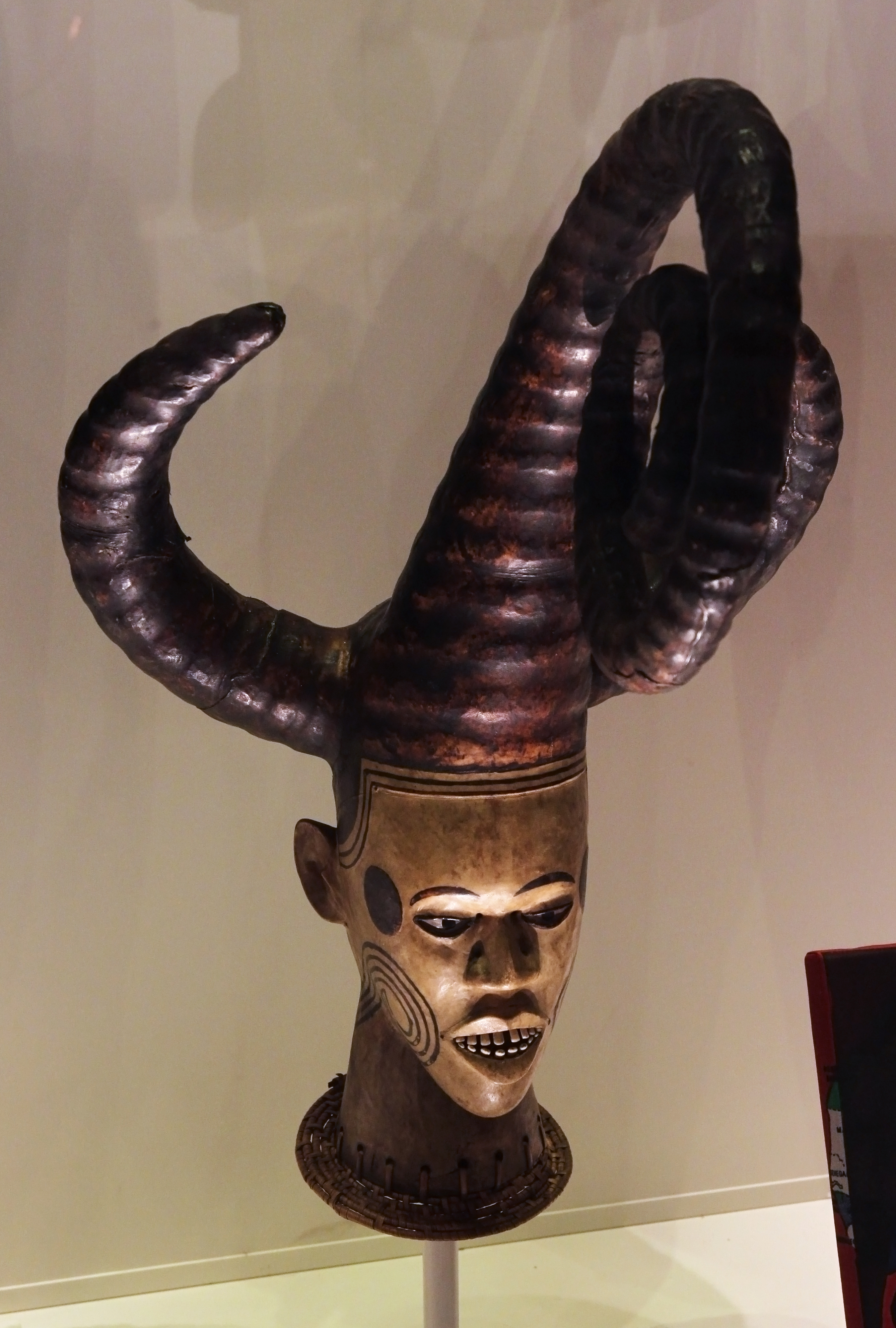
Ekpe, also known as Mgbe/Egbo (Ekoi language: ''leopard''; derived from the Ibibio term for the same), is a West African secret society in Nigeria and Cameroon flourishing chiefly among the Efiks. It is also found among a number of other ethnic groups, including the Bahumono of the Cross River State, the Ibibio, the Uruan and the Oron of Akwa Ibom State, Arochukwu and some other parts of Abia State, as well as in the diaspora, such as in Cuba and Brazil. The society is still active at the beginning of the 21st century, now playing more of a ceremonial role. There are two distinct but related societies. The primary society is located in the Cross River, Akwa Ibom and Arochukwu areas of Nigeria, and the secondary society consists of members from the Southern and Eastern Igbo groups of the same country. Ekpe ''Ekpe'' is a mysterious spirit who is supposed to live in the jungle and to preside at the ceremonies of the society. Members of the Ekpe society are said to act as ... [...More Info...] [...Related Items...] OR: [Wikipedia] [Google] [Baidu] |
Efik Language
Efik (''Usem Efịk'') is the indigenous language of the Efik people, who are situated in the present-day Cross River state and Akwa Ibom state of Nigeria, as well as in the North-West of Cameroon. The Efik language is mutually intelligible with other lower Cross River languages such as Ibibio, Annang, Oro and Ekid but the degree of intelligibility in the case of Oro and Ekid is unidirectional; in other words, speakers of these languages speak and understand Efik (and Ibibio) but not vice versa. The Efik vocabulary has been enriched and influenced by external contact with the British, Portuguese and other surrounding communities such as Balondo, Oron, Efut, Okoyong, Efiat and Ekoi (Qua). Classification The Efik Language has undergone several linguistic classifications since the 19th century. The first attempt at classifying the Efik Language was by Dr. Baikie in 1854. Baikie, p.420 Dr Baikie had stated, "All the coast dialects from One to Old Kalabar, are, either directly ... [...More Info...] [...Related Items...] OR: [Wikipedia] [Google] [Baidu] |
Cross River State
) , image_map = Nigeria - Cross River.svg , map_alt = , map_caption = Location of Cross River State in Nigeria , coordinates = , coor_pinpoint = , coordinates_footnotes = , subdivision_type = Country , subdivision_name = , subdivision_type1 = Geopolitical Zone , subdivision_name1 = South South , established_title = Date created , established_date = 27 May 1967 , seat_type = Capital , seat = Calabar , government_footnotes = , governing_body = Government of Cross River State , leader_party = APC , leader_title = Governor , leader_name = Benedict Ayade , leader_title1 = , leader_name1 = ... [...More Info...] [...Related Items...] OR: [Wikipedia] [Google] [Baidu] |
Southwest Region (Cameroon)
The Southwest Region or South-West Region () is a region in Cameroon. Its capital is Buea. , its population was 1,553,320. Along with the Northwest Region, it is one of the two Anglophone (English-speaking) regions of Cameroon. Various Ambazonian nationalist and separatist factions regard the ''Sud-Ouest'' region as being distinct as a polity from Cameroon. Administration The region is divided into six divisions or departments: Fako, Koupé-Manengouba, Lebialem, Manyu, Meme, and Ndian. These are in turn broken down into subdivisions. Presidentially appointed senior divisional officers () and subdivisional officers () govern each respectively. Ambazonian separatism Separatists from the Ambazonia administration regard both the Nord-Ouest (Northwest) and Sud-Ouest (Southwest) regions as being constituent components of their envisaged breakaway state. Geography The region was notable for having the first English-speaking university in Cameroon (the University of Buea). Towns i ... [...More Info...] [...Related Items...] OR: [Wikipedia] [Google] [Baidu] |
Rio Del Rey
The Rio del Rey (also called Rio del Ray) is an estuary of a drainage basin in West Africa in Cameroon. It is located in the eastern area of the Niger River system.African Basins pp. 173-176 The Cameroon volcanic line separates Rio Del Rey from the Douala basin. Rio del Rey has been described as an estuary in which "the two rivers N'dian and Massake flow out". pp. 127-133. The mouth is close to the |
Idomi
Idomi is a village in Yakurr Local Government of Cross River State, Nigeria Nigeria ( ), , ig, Naìjíríyà, yo, Nàìjíríà, pcm, Naijá , ff, Naajeeriya, kcg, Naijeriya officially the Federal Republic of Nigeria, is a country in West Africa. It is situated between the Sahel to the north and the Gulf o .... References {{coord missing, Nigeria Villages in Cross River State ... [...More Info...] [...Related Items...] OR: [Wikipedia] [Google] [Baidu] |
University Of Uyo
The University of Uyo is located in Uyo, capital of Akwa Ibom State, Nigeria. The university was formerly known as the University of Cross River State, Uyouniuyo.edu.ng. On 1 October 1991 the Federal government of Nigeria established it as a Federal University nuc.edu.ng the name was changed to the University of Uyo. The university inherited students, staff, academic programmes and the entire facilities of the erstwhile University of Cross River State established by Cross River State in 1983. It must be placed on record that what is today University of Uyo passed through several metamorphoses. It grew from a Teacher's College (TC) to Advanced Teacher's College (ATC), College of Education (COE), which became an affiliate of University of Port Harcourt to run degree programmes to a State University, University of Cross River (UNICROSS), and then to its present status in 1991. Academic activities commenced during the 1991/92 academic session. The University of Uyo has 13 facul ... [...More Info...] [...Related Items...] OR: [Wikipedia] [Google] [Baidu] |
Nsibidi
Nsibidi (also known as nsibiri, nchibiddi or nchibiddy) is a system of symbols or proto-writing developed in what is now the far South of Nigeria. They are classified as pictograms, though there have been suggestions that some are logograms or syllabograms. Use of the symbol system was first described in 1904. Excavation of terracotta vessels, headrests, and anthropomorphic figurines from the Calabar region of southeast Nigeria, dated to roughly the 5th to 15th centuries, revealed "an iconography readily comparable" to ''nsibidi''. There are several hundred nsibidi symbols. They were once taught in a school to children. Many of the signs deal with love affairs; those that deal with warfare and the sacred are kept secret. Nsibidi is used on wall designs, calabashes, metals (such as bronze), leaves, swords, and tattoos. It is primarily used by the Ekpe leopard society (also known as Ngbe or Egbo), a secret society that is found across Cross River State among the Ekoi, Efik, I ... [...More Info...] [...Related Items...] OR: [Wikipedia] [Google] [Baidu] |


