|
Upper Hesse Ridge
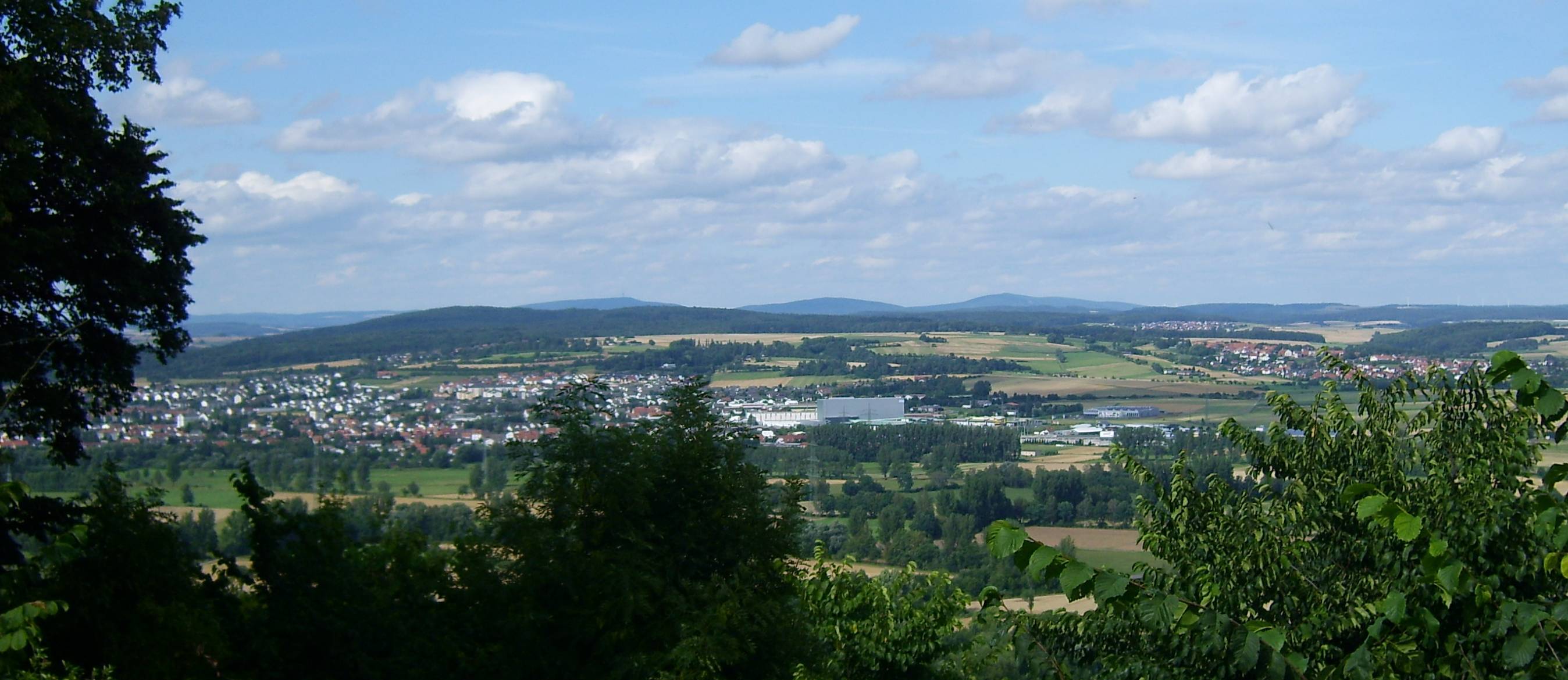
The Upper Hessian Ridge (german: Oberhessische Schwelle) or Upper Hesse Ridge is a hill chain in the West Hesse Highlands in North Hesse, North and Middle Hesse, which lies on the Rhine-Weser watershed and links the montane Central Upland ranges of the Kellerwald and the Vogelsberg in a north-south direction. The swell is divided into the Gilserberg Heights (''Gilserberger Höhen'') in the north, the central Neustadt Saddle (''Neustädter Sattel'') and the Northern Vogelsberg Foreland (''Nördliche Vogelsberg-Vorland'') in the south. Location In the north the Gilserberg Heights transition directly into the clearly much higher Kellerwald with its prominent hills, the Jeust and the Wüstegarten; to the northeast into the Löwenstein Bottom, which is part of the ''Ostwaldecker Randsenken''. Separated by the Wohra (Ohm), Wohra the ridge is adjoined in the northwest by the Burgwald at the Gilserberg Heights. In the southwest the Ohm (river), Ohm and the flat Amöneburg Basin follows ... [...More Info...] [...Related Items...] OR: [Wikipedia] [Google] [Baidu] |
West Hesse Highlands
The West Hesse Highlands (german: Westhessisches Bergland), also known as the West Hessian Lowlands and Highlands (''Westhessisches Berg- und Senkenland''), are a heavily forested region of the Central Uplands in Germany. These highlands lie mainly within the state of Hesse, between that part of the Rhenish Massif right of the Rhine in the west, the Weser Uplands to the north, the Hessian Central Uplands to the east and the Wetterau to the south. The West Hesse Highlands form one of the major natural regions of Germany (Natural Region No. 34 or D46) and are part of the Central European Uplands as well as being the watershed between the Rhine and the Weser. They comprise a line of hill ranges in the west, running north-northeast to south-southwest on the shoulder of the Rhenish Massif and include the Kellerwald, and a fault trough in the east, the West Hesse Depression. The West and East Hesse Highlands, together referred to as the ''Hesse Highlands'', combine to form the geolog ... [...More Info...] [...Related Items...] OR: [Wikipedia] [Google] [Baidu] |
West Hesse Depression
The West Hesse Depression (german: Westhessische Senke) is part of the West Hesse Highlands and Lowlands region in the north of the German state of Hesse. Like the East Hesse Depression, it is a series of separate depressions that form a natural corridor and have been an important historical trade route.Dickinson, Robert E (1964). ''Germany: A regional and economic geography'' (2nd ed.). London: Methuen, p. 512. . Geography and geology Geographical location The West Hesse Depression runs along the valleys of the Schwalm, Eder, Fulda, Esse and Diemel roughly from Alsfeld in the south to Bad Karlshafen in the north. It separates the East Hesse Highlands (major regional group 34 or D46), including the Knüll hills and Kaufungen Forest in the east, from the West Hesse Highlands (35 or D47), including the Kellerwald and Habichtswald in the west and is itself part of the West Hesse Highlands, within which it is included as geographical unit 343. Its southern boundary is fo ... [...More Info...] [...Related Items...] OR: [Wikipedia] [Google] [Baidu] |
Hohes Lohr
Hohes Lohr is a mountain of Landkreis Waldeck-Frankenberg, Hesse, Germany Germany,, officially the Federal Republic of Germany, is a country in Central Europe. It is the second most populous country in Europe after Russia, and the most populous member state of the European Union. Germany is situated betwe .... Mountains of Hesse Mountains and hills of the Kellerwald {{Hesse-geo-stub ... [...More Info...] [...Related Items...] OR: [Wikipedia] [Google] [Baidu] |
Ernsthausen (Rauschenberg)
Ernsthausen is a village ( ''Ortsteil'') of the municipality of Weilmünster in the district of Limburg-Weilburg in central Hesse. It has around 600 inhabitants (2021). Geography The village is located in the district of Limburg-Weilburg in central Hesse, north of Frankfurt am Main and close to Weilburg. As Ernsthausen was part of the former Oberlahnkreis until the creation of the district of Limburg-Weilburg in July 1974, it was also referred to as Ernsthausen (Oberlahnkreis). Located in the eastern Hintertaunus and thus in the Taunus Nature Park, Ernsthausen is crossed by the Weil, a tributary of the Lahn. History Ernsthausen was mentioned in surviving documents under the following place names (the year of mention in brackets): ''Ernistishusen'' (1308), ''Ernsthusen'' (1330), ''Erneshusen'' (1391) and ''Ernshusen'' (1540). The oldest known documentary reference dates back to 1308, but it can be assumed that the village of Ernsthausen existed already several centuries earlie ... [...More Info...] [...Related Items...] OR: [Wikipedia] [Google] [Baidu] |
Knüll
The Knüllgebirge or simply Knüll is a small mountain range in the northern part of Hesse, Germany, approximately south of Kassel Kassel (; in Germany, spelled Cassel until 1926) is a city on the Fulda River in northern Hesse, Germany. It is the administrative seat of the Regierungsbezirk Kassel and the district of the same name and had 201,048 inhabitants in December 2020 .... Its highest peak is the Eisenberg, with an altitude of . The area is heavily forested and has a low population density compared to neighbouring regions. The principal town of the region is Schwarzenborn, with a population of 1158 (2006), which is the site of German army Jägerregiment 1 headquarters. References *Kümmerly and Frey. ''The New International Atlas''. Rand McNally (1980) Knüllgebirgsverein Hiking and Nature Club Mountains of Hesse ! North Hesse {{Hesse-geo-stub ... [...More Info...] [...Related Items...] OR: [Wikipedia] [Google] [Baidu] |
Burgholz (Berg)
Burgholz is a hill in the Gilserberg Heights near the town of Kirchhain in Marburg-Biedenkopf, which is high. On the summit and the north-east slope is the district of Burgholz, which is part of the town of Kirchhain. The majority of the hill is covered by trees, with the exception of some housing on one slope. Geography The Burgholz is the southwestern-most mountain of the Gilserberger Heights and merges directly into the Amöneburg Basin in the northern part of Kirchhain, while the Wohra valley joins it to the west, beyond which the southern Burgwald begins (separated from the northern part by the B3). On its outer flanks are Emsdorf (in the east), higher parts of Langenstein and Kirchhain (in the south), the town of Rauschenberg (already in and behind the valley of the Wohra, in the west), Ernsthausen (in the north of the valley) and Wolferode (also in the valley, in the northeast). Despite its low height, the Burgholz is about 10 km taller than the Amöneburg, thoug ... [...More Info...] [...Related Items...] OR: [Wikipedia] [Google] [Baidu] |
Hundskopf (Hemberg)
Hundskopf is a hill in the county of Schwalm-Eder-Kreis, Hesse, Germany Germany,, officially the Federal Republic of Germany, is a country in Central Europe. It is the second most populous country in Europe after Russia, and the most populous member state of the European Union. Germany is situated betwe .... Hills of Hesse {{Hesse-geo-stub ... [...More Info...] [...Related Items...] OR: [Wikipedia] [Google] [Baidu] |
Kirchhain
Kirchhain () is a town in Marburg-Biedenkopf district in Hesse, Germany. Geography Kirchhain is located in the heart of the state of Hesse in Marburg-Biedenkopf district. Geographically, it is surrounded by the Amöneburg Basin on the southeast edge of the ''Burgwald'' (a low mountain range) about 15 km east of Marburg on the rivers Ohm River, Ohm and Wohra. Neighbouring communities In the north, Kirchhain borders on the town of Rauschenberg, Hesse, Rauschenberg, in the east on the town of Stadtallendorf, in the south on the town of Amöneburg and the community of Cölbe. Town divisions Besides the main centre of Kirchhain with about 8,300 inhabitants, 12 further constituent communities share another 8,900 people: History In prehistoric times a network of long-distance and connecting trails crossed back and forth over the area where the town of Kirchhain was later to be founded. Since the early New Stone Age, there is evidence of almost continuous settlement in the area ... [...More Info...] [...Related Items...] OR: [Wikipedia] [Google] [Baidu] |
Rauschenberg
Milton Ernest "Robert" Rauschenberg (October 22, 1925 – May 12, 2008) was an American painter and graphic artist whose early works anticipated the Pop art movement. Rauschenberg is well known for his Combine painting, Combines (1954–1964), a group of artworks which incorporated everyday objects as art materials and which blurred the distinctions between painting and sculpture. Rauschenberg was both a painter and a sculptor, but he also worked with photography, printmaking, papermaking and performance. Rauschenberg received numerous awards during his nearly 60-year artistic career. Among the most prominent were the International Grand Prize in Painting at the 32nd Venice Biennale in 1964 and the National Medal of Arts in 1993. Rauschenberg lived and worked in New York City and on Captiva Island, Florida, until his death on May 12, 2008. Life and career Rauschenberg was born Milton Ernest Rauschenberg in Port Arthur, Texas, the son of Dora Carolina (née Matson) and Ernest ... [...More Info...] [...Related Items...] OR: [Wikipedia] [Google] [Baidu] |
Burgholz (hill)
Burgholz is a hill in the Gilserberg Heights near the town of Kirchhain in Marburg-Biedenkopf, which is high. On the summit and the north-east slope is the district of Burgholz, which is part of the town of Kirchhain. The majority of the hill is covered by trees, with the exception of some housing on one slope. Geography The Burgholz is the southwestern-most mountain of the Gilserberger Heights and merges directly into the Amöneburg Basin in the northern part of Kirchhain, while the Wohra valley joins it to the west, beyond which the southern Burgwald begins (separated from the northern part by the B3). On its outer flanks are Emsdorf (in the east), higher parts of Langenstein and Kirchhain (in the south), the town of Rauschenberg (already in and behind the valley of the Wohra, in the west), Ernsthausen (in the north of the valley) and Wolferode (also in the valley, in the northeast). Despite its low height, the Burgholz is about 10 km taller than the Amöneburg, thoug ... [...More Info...] [...Related Items...] OR: [Wikipedia] [Google] [Baidu] |


