|
Uplawmoor (L
Uplawmoor is a village in East Renfrewshire, Scotland. Its population was 700 as of 2016. Historic Uplawmoor, associated for centuries with the Barony of Caldwell and the Mure family, is still a vibrant community today, although bereft of the shops once to be found there. It has a primary school, hotel (Uplawmoor Hotel), village hall (Mure Hall), sports ground for tennis and football (including a playpark) and a golf club (Caldwell Golf Club). Nearby is the extensive Caldwell, East Renfrewshire, Caldwell Estate with the roofless 18th century Caldwell, East Renfrewshire#Caldwell House and estate, Caldwell House, which was designed by Robert Adam. The separate Caldwell Tower, of probable 16th century origin, is visible from the village. Several farms surround the village, as agriculture has always been of importance locally. Historically the village was served by two railway lines - Uplawmoor (L&A) railway station, Lanarkshire and Ayrshire and Uplawmoor (GB&K) railway station, Gla ... [...More Info...] [...Related Items...] OR: [Wikipedia] [Google] [Baidu] |
East Renfrewshire
East Renfrewshire (; ) is one of 32 council areas of Scotland. It was formed in 1996, as a successor to the Eastwood (district), Eastwood district of the Strathclyde region. The northeastern part of the council area is close to Glasgow and many of the council area's northern settlements fall into the Greater Glasgow urban area. Clockwise, East Renfrewshire borders Glasgow City council area to the northeast, South Lanarkshire to the southeast, East Ayrshire to the southwest, North Ayrshire to the west and Renfrewshire to the northwest. Until 1975, the council area formed part of the counties of Scotland, county of Renfrewshire (historic), Renfrewshire for local government purposes along with the modern council areas of Renfrewshire and Inverclyde. These three council areas together still form a single lieutenancy areas of Scotland, lieutenancy area called Renfrewshire. History East Renfrewshire was created in 1996 under the Local Government etc. (Scotland) Act 1994, which r ... [...More Info...] [...Related Items...] OR: [Wikipedia] [Google] [Baidu] |
Loch Libo
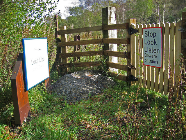
Loch Libo is a freshwater loch in East Renfrewshire, Parish of Neilston, Scotland. The Lugton Water has its source from the southern end of loch, running 14 miles before reaching its confluence with the River Garnock near Kilwinning. The village of Uplawmoor and the hamlet of Shillford lie nearby. away to the northeast is the town of Neilston. History The name is of great antiquity and 'Libo' may be pre-Gaelic in origin. The loch lies in a glen, with Caldwell Law to the north and Uplawmoor Wood to the south. In the 14th century was referred to as 'Loch le Bog Syde' in a charter, meaning the 'Bogside Loch'.Scottish Carper Retrieved : 2012-12-23 The loch is now owned by the |
Lanarkshire And Ayrshire Railway
The Lanarkshire and Ayrshire Railway (L&AR) was an independent railway company built to provide the Caledonian Railway with a shorter route for mineral traffic from the coalfields of Lanarkshire to Ardrossan Harbour, in Scotland. It opened in stages from 1888, being extended to Neilston and Newton, giving the Caledonian Railway a fully independent route by 1904. At the Ayrshire end the line duplicated the existing Glasgow and South Western Railway route at a time when bulk coal exports could be handled more economically in Clydebank, so that the primary purpose of the line was short-lived. The Caledonian Railway hoped to develop suburban traffic in south Glasgow where the new line passed through those districts, but street tramcars limited the success of this. The duplicate routes to Ardrossan were wasteful and, as traffic declined, closures took place from 1930. The eastern section from Neilston and Newton to the Cathcart circle lines developed as outer suburban railways, and ... [...More Info...] [...Related Items...] OR: [Wikipedia] [Google] [Baidu] |
Neilston
Neilston (, , ) is a village and List of civil parishes in Scotland, parish in East Renfrewshire in the west central Lowlands of Scotland. It is in the River Levern, Levern Valley, southwest of Barrhead, the last remaining town in greater Glasgow to operate trams, south of Paisley, Renfrewshire, Paisley, and south-southwest of Renfrew, at the southwestern fringe of the Greater Glasgow, Greater Glasgow conurbation. Neilston is a dormitory village with a resident population of just over 5,000 people. Neilston is mentioned in documents from the 12th century, when the feudal lord Robert de Croc, endowed a chapel to Paisley Abbey to the North. Neilston Parish Church—a Listed building, Category B listed building—is said to be on the site of this original chapel and has been at the centre of the community since 1163. Little remains of the original structure. Before industrialisation, Neilston was a scattered farming settlement composed of a series of single-storey houses, many o ... [...More Info...] [...Related Items...] OR: [Wikipedia] [Google] [Baidu] |
Shillford
Shillford or Shilford is a hamlet to the south-west of Barrhead on the Lochlibo Road in East Renfrewshire near Uplawmoor, Scotland in the parish of Neilston. It is located around south-west of Glasgow and north of Kilmarnock, and around south of Paisley. Meaning of place-name The name may derive from the word ''ford'' and the Scots word ''shill'', meaning cold or chilly; the word is also said to mean shallow. The old ford ceased to exist after the building of the railway that runs beside Loch Libo as the nearby cutting resulted in the Thorter Burn being diverted to run into the loch. History In 1910 the hamlet had a population of 46. The shallow ford at the hamlet was formed by the Thorter Burn that ran into a hollow on the old road.Pride, Page 83 Shillford Mill was a substantial grain and sawmill, still operating in the 1960s. It was located close to the present day Shillford Garage. (datum 2012) The site is now used as a lorry park. The old smithy is now a roofless ruin ... [...More Info...] [...Related Items...] OR: [Wikipedia] [Google] [Baidu] |
Site Of Special Scientific Interest
A Site of Special Scientific Interest (SSSI) in Great Britain, or an Area of Special Scientific Interest (ASSI) in the Isle of Man and Northern Ireland, is a conservation designation denoting a protected area in the United Kingdom and Isle of Man. SSSI/ASSIs are the basic building block of site-based nature conservation legislation and most other legal nature/geological conservation designations in the United Kingdom are based upon them, including national nature reserve (United Kingdom), national nature reserves, Ramsar Convention, Ramsar sites, Special Protection Areas, and Special Area of Conservation, Special Areas of Conservation. The acronym "SSSI" is often pronounced "triple-S I". Selection and conservation Sites notified for their Biology, biological interest are known as Biological SSSIs (or ASSIs), and those notified for geological or Physical geography, physiographic interest are Geological SSSIs (or ASSIs). Sites may be divided into management units, with some a ... [...More Info...] [...Related Items...] OR: [Wikipedia] [Google] [Baidu] |
Scottish Wildlife Trust
The Scottish Wildlife Trust () is a registered charity dedicated to conserving the wildlife and natural environment of Scotland. Description The Scottish Wildlife Trust has well over 46,000 members. The Scottish Wildlife Trust acquired its first wildlife reserve in 1966 and now has more than 120 reserves throughout Scotland with visitor centres at Loch of the Lowes (Perth and Kinross), Montrose Basin (Angus), and the Falls of Clyde (South Lanarkshire). As well as providing homes for wildlife these sites are valuable places for people to interact with and enjoy wildlife. The trust also seek to influence and challenge legislation for the benefit of wildlife. The Scottish Wildlife Trust was involved in a trial reintroduction of the Eurasian beaver to Scotland. Begun in 2009, the trial ran at Knapdale until 2014. The beaver was given native species status in 2016. Another of the Scottish Wildlife Trust's major projects is the protection of the red squirrel in Scotland. With pro ... [...More Info...] [...Related Items...] OR: [Wikipedia] [Google] [Baidu] |
Uplawmoor (GB&K) Railway Station
Uplawmoor is a village in East Renfrewshire, Scotland. Its population was 700 as of 2016. Historic Uplawmoor, associated for centuries with the Barony of Caldwell and the Mure family, is still a vibrant community today, although bereft of the shops once to be found there. It has a primary school, hotel (Uplawmoor Hotel), village hall (Mure Hall), sports ground for tennis and football (including a playpark) and a golf club (Caldwell Golf Club). Nearby is the extensive Caldwell Estate with the roofless 18th century Caldwell House, which was designed by Robert Adam. The separate Caldwell Tower, of probable 16th century origin, is visible from the village. Several farms surround the village, as agriculture has always been of importance locally. Historically the village was served by two railway lines - Lanarkshire and Ayrshire and Glasgow, Barrhead and Kilmarnock Joint Railway Uplawmoor has a rural setting, with farmland on one side and mainly beech woodland (Pollick Glen and S ... [...More Info...] [...Related Items...] OR: [Wikipedia] [Google] [Baidu] |
Renfrewshire (historic)
Renfrewshire or the County of Renfrew is a historic county, registration county and lieutenancy area in the west central Lowlands of Scotland. The lieutenancy area covers the three modern council areas of Inverclyde, Renfrewshire and East Renfrewshire, and this area is occasionally termed Greater Renfrewshire to distinguish it from the modern council area called Renfrewshire. The historic county additionally included territory on the south-western edge of Glasgow which was gradually transferred to the administrative area of the city as it grew. The county borders Glasgow and Lanarkshire to the east and Ayrshire to the south and west. The Firth of Clyde forms its northern boundary, with Dunbartonshire and Argyll on the opposing banks. Renfrewshire's early history is marked by ancient British and Roman settlement. Renfrewshire can trace its origin to the feudal lands at Strathgryfe granted to Walter FitzAlan, the first High Steward of Scotland. Renfrewshire was created as ... [...More Info...] [...Related Items...] OR: [Wikipedia] [Google] [Baidu] |
Uplawmoor (L&A) Railway Station
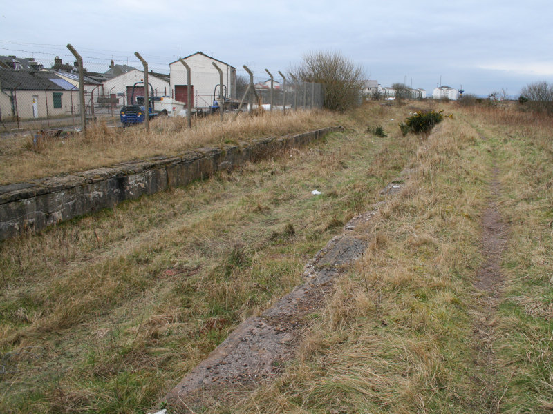
Uplawmoor railway station was a railway station serving the village of Uplawmoor, East Renfrewshire, Scotland as part of the Lanarkshire and Ayrshire Railway. History The station opened on 1 May 1903.Butt (1995), p. 237 It closed between 1 January 1917 and 2 March 1919 due to wartime economy, and closed permanently to passengers and freight on 2 April 1962. Upon closure, the nearby station took on the name 'Uplawmoor'. Although the station was closed to regular passengers, in 1964 the Royal Train was stabled here overnight during a visit to the area by the Queen Mother. Sidings ran to the Shillford Shillford or Shilford is a hamlet to the south-west of Barrhead on the Lochlibo Road in East Renfrewshire near Uplawmoor, Scotland in the parish of Neilston. It is located around south-west of Glasgow and north of Kilmarnock, and around south ... Quarry that was located to the east of the station within Uplawmoor Wood. Image:Uplawmoorstation10.JPG, Station site in 20 ... [...More Info...] [...Related Items...] OR: [Wikipedia] [Google] [Baidu] |


